
The Blue Ridge Parkway is a National Parkway and All-American Road in the United States, noted for its scenic beauty. The parkway, which is the longest linear park in the U.S., runs for 469 miles (755 km) through 29 counties in Virginia and North Carolina, linking Shenandoah National Park to Great Smoky Mountains National Park. It runs mostly along the spine of the Blue Ridge, a major mountain chain that is part of the Appalachian Mountains. Its southern terminus is at U.S. Route 441 (US 441) on the boundary between Great Smoky Mountains National Park and the Qualla Boundary of the Eastern Band of Cherokee Indians in North Carolina, from which it travels north to Shenandoah National Park in Virginia. The roadway continues through Shenandoah as Skyline Drive, a similar scenic road which is managed by a different National Park Service unit. Both Skyline Drive and the Virginia portion of the Blue Ridge Parkway are part of Virginia State Route 48 (SR 48), though this designation is not signed.
The Jones Mountains are an isolated group of mountains, trending generally east–west for 27 nautical miles, situated on the Eights Coast, Ellsworth Land, Antarctica, about 50 nautical miles south of Dustin Island.

Capitol Peak is a high and prominent mountain summit in the Elk Mountains range of the Rocky Mountains of North America. It is the 52nd highest mountain in North America. The 14,136.3-foot (4,309 m) fourteener is located in the Maroon Bells-Snowmass Wilderness of White River National Forest, 8.7 miles (14.0 km) east by south of the community of Redstone in Pitkin County, Colorado, United States.
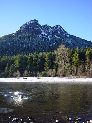
Rattlesnake Ridge, known as daʔšədabš to the Snoqualmie people, is the ridge of Rattlesnake Mountain located south of North Bend, Washington, United States. The western end is near the intersection of State Route 18 and I-90 in Snoqualmie, Washington, and runs southeast about 7 miles (11 km) or 11 miles (18 km) by trail. It is the highest and easternmost of the Issaquah Alps. A maze of abandoned logging roads and constructed trails have been strung together to provide a 10.5-mile (16.9 km) footpath from the Snoqualmie Point trailhead at Exit 27 on I-90 all the way to the Rattlesnake Lake trailhead near Exit 32.

Pisgah National Forest is a National Forest in the Appalachian Mountains of western North Carolina. It is administered by the United States Forest Service, part of the United States Department of Agriculture. The Pisgah National Forest is completely contained within the state of North Carolina. The forest is managed together with the other three North Carolina National Forests from common headquarters in Asheville, North Carolina. There are local ranger district offices located in Pisgah Forest, Mars Hill, and Nebo.
Schunemunk Mountain is the highest mountain in Orange County, New York. The 1,664-foot (507 m) summit is located in the town of Blooming Grove, with other portions in Cornwall and Woodbury. The community of Mountain Lodge Park is built up its western slope.

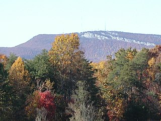
Tussey Mountain is a stratigraphic ridge in central Pennsylvania, United States, trending east of the Bald Eagle, Brush, Dunning and Evitts Mountain ridges. Its southern foot just crosses the Mason–Dixon line near Flintstone, Maryland, running north 130 km (80 mi) to the Seven Mountains of central Pennsylvania, near Tusseyville, making it one of the longest named ridges in this section of the Ridge-and-valley Appalachians.
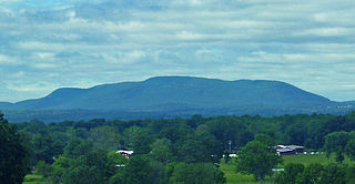
The Sauratown Mountains, which are sometimes called "the mountains away from the mountains", are an isolated mountain range located within Stokes and Surry counties in the U.S. state of North Carolina. The vast majority of the range is located in Stokes County. Although the range occupies only 5% of Stokes County's area, it dominates the county's scenery from almost every direction. The Sauras rise sharply 800 to 1,700 feet above the surrounding terrain.

The Great Balsam Mountains, or Balsam Mountains, are in the mountain region of western North Carolina, United States. The Great Balsams are a subrange of the Blue Ridge Mountains, which in turn are a part of the Appalachian Mountains. The most famous peak in the Great Balsam range is Cold Mountain, which is the centerpiece of author Charles Frazier's bestselling novel Cold Mountain. Other notable peaks include Richland Balsam, which is the highest peak in the range, Black Balsam Knob, and Mount Pisgah.

The Metacomet Ridge, Metacomet Ridge Mountains, or Metacomet Range of southern New England is a narrow and steep fault-block mountain ridge known for its extensive cliff faces, scenic vistas, microclimate ecosystems, and rare or endangered plants. The ridge is an important recreation resource located within 10 miles (16 km) of more than 1.5 million people, offering four long-distance hiking trails and over a dozen parks and recreation areas, including several historic sites. It has been the focus of ongoing conservation efforts because of its natural, historic, and recreational value, involving municipal, state, and national agencies and nearly two dozen non-profit organizations.
Peter's Rock, also known as Rabbit Rock, Rabbit Hill, Indian Rock and Great Rock, with a high point of (est.) 373 feet (114 m) above sea level, is a trap rock peak located 4 miles (6 km) northeast of downtown New Haven, Connecticut in the town of North Haven. It is part of the Metacomet Ridge that extends from Long Island Sound near New Haven, north through the Connecticut River Valley of Massachusetts to the Vermont border. Peter's Rock is known for its scenic views, unique microclimate ecosystems, rare plant communities, and columnar basalt rock formations. It is traversed by a number of hiking trails managed by the non-profit Peter's Rock Association.

Cimarron Ridge is a ridge in the San Juan Mountains in southwestern Colorado. The ridge runs north-south and occupies parts of Gunnison, Montrose, Ouray, and Hinsdale counties. The ridge parallels U.S. Highway 550, and parts of the ridge can be seen from points along the highway.
Buckskin Mountain is a 16-mile (26 km) mountain ridge that spans from Coconino County, Arizona to Kane County, Utah in the United States, that is divided almost equally between the two counties.

Possum Trot is an unincorporated community in Highland County, Virginia, United States. The community is located 4.7 miles (7.6 km) northeast of Monterey, Virginia and 2.1 miles (3.4 km) southeast of Blue Grass, Virginia on State Route 635. Possum Trot is cradled by the long ridge line of Monterey Mountain to the west and Ginseng Mountain to the north.

The Forest Heritage Scenic Byway is a 76.7-mile (123.4 km) National Forest Scenic Byway, National Scenic Byway and North Carolina Scenic Byway that traverses through the Pisgah National Forest, in Western North Carolina. It features the Cradle of Forestry, waterfalls, trails and scenic vistas.
Mongaup Mountain is a mountain located in the Catskill Mountains of New York west of Frost Valley. Cradle Rock Ridge is located north, and Beaver Kill Range is located east-northeast of Mongaup Mountain.
Beaver Kill Range is a mountain located in the Catskill Mountains of New York west-northwest of Frost Valley. Wildcat Mountain is located east-southeast, Cradle Rock Ridge is located north, and Mongaup Mountain is located west-southwest of Beaver Kill Range.

The Cradle is a prominent 7,472-foot (2,277-metre) double summit mountain located in Chelan County of Washington state. The mountain's name is derived from the depression between the two peaks of nearly identical elevation. The Cradle is situated within the Alpine Lakes Wilderness and is part of the Wenatchee Mountains, which is subset of the Cascade Range. Its nearest higher peak is Jack Ridge, 5.7 mi (9.2 km) to the east-southeast. Precipitation runoff from the mountain drains into tributaries of Icicle Creek, which in turn is a tributary of the Wenatchee River. The first ascent of the south peak was made in 1944 by Gene Paxton and Dwight Watson, whereas the north peak wasn't climbed until 1952 by Bill and Gene Prater.

The Anthracite Range is a mountain range in the West Elk Mountains, a sub-range of the Rocky Mountains of North America. The range is located in Gunnison County of western Colorado and lies within the West Elk Wilderness of the Gunnison National Forest. The Anthracite Range is one of several prominent laccoliths found in the West Elk Mountains.

