Dehu Dehugaon | |
|---|---|
Town | |
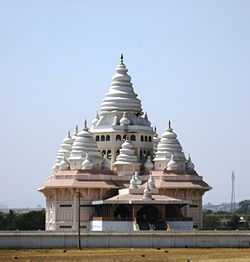 Gatha Temple | |
 Dehu Location in Maharashtra, India | |
| Coordinates: 18°43′N73°46′E / 18.72°N 73.77°E | |
| Country | |
| State | Maharashtra |
| District | Pune |
| Government | |
| • Type | Urban |
| • Body | Nagar Panchayat |
| Elevation | 594 m (1,949 ft) |
| Population (2015) | |
• Total | 50,308 |
| Demonym(s) | Punekar, Puneri, Puneite |
| Languages | |
| • Official | Marathi |
| Time zone | UTC+5:30 (IST) |
| Vehicle registration | MH 12, MH 14 |
Dehu is a town in the Pune district, India. It is known for being the abode of Sant Tukaram.
Contents
The Tukaram Palakhi heading towards the town of Pandharpur originates from Dehu in the month of Ashadh.
