Denver Formation Stratigraphic range: Late Cretaceous-Paleocene | |
---|---|
Type | Geological formation |
Unit of | D1 Sequence [1] |
Underlies | Dawson Arkose |
Overlies | Arapahoe Formation |
Thickness | up to 1,580 ft (480 m) |
Lithology | |
Primary | Claystone, siltstone, sandstone |
Other | Conglomerate, tuff, coal, lava |
Location | |
Region | Colorado |
Country | United States |
Type section | |
Named for | Denver, Colorado |
Named by | Emmons, Cross and Eldridge (1896) [2] |
The Denver Formation is a geological formation that is present within the central part of the Denver Basin that underlies the Denver, Colorado, area. It ranges in age from latest Cretaceous (Maastrichtian) to early Paleocene, and includes sediments that were deposited before, during and after the Cretaceous-Paleogene boundary event. [3] [4]
The formation is known for its paleontological resources, including dinosaur remains that are found in the Late Cretaceous part of the formation, [5] and it includes aquifers that are important sources of water for the area. [6] [7]
The Denver Formation rests on the Arapahoe Formation, and its base is marked by the first appearance of tuffaceous sediments. It is overlain by the Dawson Arkose. [4] [8]
In 2002 the Denver Formation was included as part of a larger unconformity-bounded unit named the D1 sequence, in order to facilitate basin-wide studies and avoid confusion arising from the lateral and vertical facies changes that occur within the Denver Basin. The base of the D1 is marked by the abrupt facies change at the top of the Laramie Formation, and its top is placed at the base of a regional paleosol series. The Arapahoe Formation and the Dawson Arkose are also included in the D1 Sequence. [1]
The Denver Formation consists of alluvial fan, fluvial, and paludal deposits that accumulated at the foot of the growing Rocky Mountain Front Ranges. [1] It ranges in thickness from 600 feet (180 m) to 1,580 feet (480 m) in the central part of the Denver Basin. [9] It is characterized by significant amounts of andesitic volcanic debris, [2] and is composed of primarily of light-grey to brown, lenticular bedded, loosely cemented silty claystone, mudstone, siltstone, tuffaceous sandstone and, in some areas, andesitic conglomerate. [4] [8] Beds of low-rank coal and carbonaceous shale occur in the upper 500 feet (150 m) in some areas. [10]
Several early Paleocene lava flows are present in the upper part of the Denver Formation at North and South Table Mountain near Golden, Colorado. The Ralston Dike, a body of intrusive monzonite located several miles to the northwest, probably represents the volcanic vent from which the flows erupted. [8] Generally referred to as basaltic, they are classified either as monzonite (the lowest flow) and latite (the upper two flows), [8] or as shoshonite. [11] They contain the minerals augite, plagioclase, and olivine altered to serpentine, with accessory sanidine and/or orthoclase, apatite, magnetite, and biotite. One of the flows hosts a wide variety of zeolite minerals, including analcime, thomsonite, mesolite, chabazite, and others. [11]
The Denver Formation spans the Cretaceous-Paleogene boundary. The lava flows in the upper part of the formation are about 62 to 64 million years old according to radiometric dating, [8] which places them in the early Paleocene Epoch. The Cretaceous-Paleogene boundary occurs in the lower part of the formation, and an exposure of the boundary layer has been identified and documented on South Table Mountain near the city of Golden. [12]
Plant fossils [13] and remains of vertebrates, including turtles [14] and mammals, [15] are found throughout the Denver Formation. [6] Dinosaur remains are restricted to the lower, Late Cretaceous, part. [5] [8] [16]
Ornithischians reported from the Denver Formation | ||||||
---|---|---|---|---|---|---|
Genus | Species | Location | Stratigraphic position | Material | Notes | Images |
C. arctatus [17] | "Fragmentary maxilla, vertebrae, fragmentary postcranial elements." [18] | Later found to be indeterminate hadrosaurid remains. [17] | ||||
Indeterminate [17] | ||||||
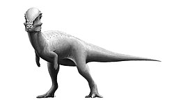
P. mortuarius [17] | "Horn fragments, vertebrae." [19] (type specimen) | A dubious ceratopsian | ||||
T. galeus [17] | "Nasal horn core." [19] | A dubious ceratopsian | ||||
Indeterminate [17] | ||||||
Saurischians of the Denver Formation | ||||||
---|---|---|---|---|---|---|
Genus | Species | Location | Stratigraphic position | Abundance | Notes | Images |
A. mirandus [17] | Later found to be indeterminate tyrannosauroid remains. [17] | |||||
O. velox [17] | ||||||
Indeterminate [17] | ||||||
The Late Cretaceous is the younger of two epochs into which the Cretaceous geological period is divided in the geologic time scale. Rock strata from this epoch form the Upper Cretaceous series. The Cretaceous is named after the white limestone known as chalk, which occurs widely in northern France and is seen in the white cliffs of south-eastern England, and which dates from this time.
The Denver Basin, variously referred to as the Julesburg Basin, Denver-Julesburg Basin, or the D-J Basin, is a geologic structural basin centered in eastern Colorado in the United States, but extending into southeast Wyoming, western Nebraska, and western Kansas. It underlies the Denver-Aurora Metropolitan Area on the eastern side of the Rocky Mountains.
The Maastrichtian is, in the ICS geologic timescale, the latest age of the Late Cretaceous epoch or Upper Cretaceous series, the Cretaceous period or system, and of the Mesozoic era or erathem. It spanned the interval from 72.1 to 66 million years ago. The Maastrichtian was preceded by the Campanian and succeeded by the Danian.
The Lance (Creek) Formation is a division of Late Cretaceous rocks in the western United States. Named after Lance Creek, Wyoming, the microvertebrate fossils and dinosaurs represent important components of the latest Mesozoic vertebrate faunas. The Lance Formation is Late Maastrichtian in age, and shares much fauna with the Hell Creek Formation of Montana and North Dakota, the Frenchman Formation of southwest Saskatchewan, and the lower part of the Scollard Formation of Alberta.
South Table Mountain is a mesa on the eastern flank of the Front Range of the Rocky Mountains of North America. Castle Rock, the 6,338-foot (1,932 m) summit of the mesa, is located on private property 0.56 miles (0.9 km) directly east of downtown Golden, Colorado, United States, in Jefferson County.
North Table Mountain is a mesa on the eastern flank of the Front Range of the Rocky Mountains of North America. The 6,555-foot (1,998 m) mesa summit is located in North Table Mountain Park, 3.4 miles (5.5 km) north by east of downtown Golden, Colorado, United States, in Jefferson County.
The Scollard Formation is an Upper Cretaceous to lower Palaeocene stratigraphic unit of the Western Canada Sedimentary Basin in southwestern Alberta. Its deposition spanned the time interval from latest Cretaceous to early Paleocene, and it includes sediments that were deposited before, during, and after the Cretaceous-Paleogene (K-Pg) extinction event. It is significant for its fossil record, and it includes the economically important coal deposits of the Ardley coal zone.
The Laramie Formation is a geologic formation of Late Cretaceous (Maastrichtian) age, named by Clarence King in 1876 for exposures in northeastern Colorado, in the United States. It was deposited on a coastal plain and in coastal swamps that flanked the Western Interior Seaway. It contains coal, clay and uranium deposits, as well as plant and animal fossils, including dinosaur remains.
The Frenchman Formation is stratigraphic unit of Late Cretaceous age in the Western Canada Sedimentary Basin. It is present in southern Saskatchewan and the Cypress Hills of southeastern Alberta. The formation was defined by G.M. Furnival in 1942 from observations of outcrops along the Frenchman River, between Ravenscrag and Highway 37. It contains the youngest of dinosaur genera, much like the Hell Creek Formation in the United States.
The Cedar Mountain Formation is the name given to a distinctive sedimentary geologic formation in eastern Utah. The formation was named for Cedar Mountain in northern Emery County, Utah, where William Lee Stokes first studied the exposures in 1944.
The Raton Basin is a geologic structural basin in southern Colorado and northern New Mexico. It takes its name from Raton Pass and the town of Raton, New Mexico. In extent, the basin is approximately 50 miles (80 km) east-west, and 90 miles (140 km) north-south, in Huerfano and Las Animas Counties, Colorado, and Colfax County, New Mexico.
The Fort Union Formation is a geologic unit containing sandstones, shales, and coal beds in Wyoming, Montana, and parts of adjacent states. In the Powder River Basin, it contains important economic deposits of coal, uranium, and coalbed methane.
The Raton Formation is a geological formation of Upper Cretaceous and Paleocene age which outcrops in the Raton Basin of northeast New Mexico and southeast Colorado.
The Willow Creek Formation is a stratigraphic unit of Late Cretaceous to Early Paleocene age in the Western Canada Sedimentary Basin of southwestern Alberta. It was first described by George Mercer Dawson in 1883 along the Willow Creek, a tributary of the Oldman River. Williams and Dyer defined the type section in 1930 at the mouth of Willow Creek, east of Fort Macleod.
The North Horn Formation is a widespread non-marine sedimentary unit with extensive outcrops exposed in central and eastern Utah. The formation locally exceeds 3,600 feet (1,100 m) in thickness and is characterized by fluvial, lacustrine, and floodplain dominated systems, representing a terrestrial, high energy, depositional environment. The sediments date from Late Cretaceous (Maastrichtian) to early Paleocene in age and include the K-Pg extinction event boundary; however, this boundary is extremely difficult to locate and there is no strong stratigraphic evidence available that indicates a specific marker bed such as an iridium rich clay layer. Thus far, the only visible evidence is represented in the form of faunal turnover from dinosaur to mammal-dominated fossil assemblages. Taxa from the Cretaceous part of the formation include squamates, testudines, choristoderes, crocodyliforms, sharks, bony fishes, amphibians, mammals, dinosaurs, eggshell fragments, trace fossils, mollusks, plant macrofossils, such as wood fragments, and palynomorphs.
The Maastricht Formation, named after the city of Maastricht, the Netherlands, is a geological formation in the Netherlands and Belgium whose strata date back to the Late Cretaceous, within 500,000 years of the Cretaceous–Paleogene boundary, now dated at 66 million years ago. The formation is part of the Chalk Group and is between 30 and 90 metres thick. It crops out in southern parts of Dutch and Belgian Limburg and adjacent areas in Germany. It can be found in the subsurface of northern Belgium and southeastern Netherlands, especially in the Campine Basin and Roer Valley Graben. Dinosaur remains are among the fossils that have been recovered from the formation.
The Arapahoe Formation is a geological formation of latest Cretaceous (Maastrichtian) age that is present within the Denver Basin that underlies the Denver, Colorado, area. The formation includes fossil leaves and dinosaur remains, although none of the latter have yet been referred to a specific genus. It also includes aquifers that are important sources of water for the area.
The Yacoraite Formation is a largely Mesozoic geologic formation. The deposits of this formation mainly date from the Maastrichtian of the Upper Cretaceous, but the Cretaceous–Paleogene boundary runs right through this formation near its top, and the uppermost parts are consequently from the Danian. It was probably deposited around the intertidal zone, as the sedimentary rocks of this formation alternate according to sea level changes between deposits of muddy beaches and of shallow ocean.
The Edmonton Group is a Late Cretaceous to early Paleocene stratigraphic unit of the Western Canada Sedimentary Basin in the central Alberta plains. It was first described as the Edmonton Formation by Joseph Burr Tyrrell in 1887 based on outcrops along the North Saskatchewan River in and near the city of Edmonton. E.J.W. Irish later elevated the formation to group status and it was subdivided into four separate formations. In ascending order, they are the Horseshoe Canyon, Whitemud, Battle and Scollard Formations. The Cretaceous-Paleogene boundary occurs within the Scollard Formation, based on dinosaurian and microfloral evidence, as well as the presence of the terminal Cretaceous iridium anomaly.
The Dawson Arkose is a geologic formation in the Denver Basin that underlies the Denver area in Colorado. It is characterized by alternating beds of arkosic sandstone and mudstone. The Dawson Arkose contains plant remains and other nonmarine fossils, and hosts aquifers that are important sources of water for the area.