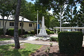
Diglum, Queensland

Last updated

Diglum
Queensland
Australia Queensland location map.svg
Red pog.svg
Diglum
Coordinates 24°15′25″S151°05′09″E / 24.2569°S 151.0858°E / -24.2569; 151.0858 (Diglum (centre of locality))
Population56 (2021 census) [1]
 • Density0.1489/km2 (0.386/sq mi)
Postcode(s) 4680
Area376.0 km2 (145.2 sq mi)
Time zone AEST (UTC+10:00)
Location
LGA(s) Gladstone Region
State electorate(s) Callide
Federal division(s) Flynn
Suburbs around Diglum:
Mount Alma Wooderson Taragoola
Tablelands Diglum Boynedale
Tablelands Boyne Valley Boyne Valley

Diglum is a rural locality in the Gladstone Region, Queensland, Australia. [2] In the 2021 census, Diglum had a population of 56 people. [1]

Contents

Geography

The Gladstone–Monto Road runs along the north-eastern boundary. [3]

Apart from Futter Conservation Park, a small protected area in the north-west of the locality, the land use is almost entirely grazing on native vegetation. [4]

History

Dan Dan State School opened on 1920 and closed on 1930. [5] Dan Dan Creek is located within Diglum. [6]

Demographics

In the 2016 census, Diglum had a population of 36 people. [7]

In the 2021 census, Diglum had a population of 56 people. [1]

Education

There are no schools in Diglum. The nearest government primary schools are Nagoorin State School in Boyne Valley to the south-east and Calliope State School in Calliope to the north. The nearest government secondary school is Calliope State High School in Calliope. [4]

Related Research Articles

<span class="mw-page-title-main">Calliope, Queensland</span> Town in Queensland, Australia

Calliope is a rural town and locality in the Gladstone Region, Queensland, Australia. In the 2021 census, the locality of Calliope had a population of 5,263 people.

<span class="mw-page-title-main">Raglan, Queensland</span> Town in Queensland, Australia

Raglan is a rural town and locality in the Gladstone Region, Queensland, Australia. In the 2021 census, the locality of Raglan had a population of 143 people.

<span class="mw-page-title-main">East End, Queensland</span> Suburb of Gladstone Region, Queensland, Australia

East End is a rural locality in the Gladstone Region, Queensland, Australia. In the 2021 census, East End had a population of 88 people.

Bracewell is a rural locality in the Gladstone Region, Queensland, Australia. In the 2021 census, Bracewell had a population of 178 people.

Machine Creek is a rural locality in the Gladstone Region, Queensland, Australia. In the 2021 census, Machine Creek had a population of 131 people.

New Auckland is an urban locality in Gladstone in the Gladstone Region, Queensland, Australia. In the 2021 census, New Auckland had a population of 5,266 people.

Boynedale is a rural locality in the Gladstone Region, Queensland, Australia. In the 2021 census, Boynedale had a population of 13 people.

Berajondo is a rural locality in the Gladstone Region, Queensland, Australia. In the 2021 census, Berajondo had a population of 112 people.

Bukali is a rural locality in the North Burnett Region, Queensland, Australia. In the 2021 census, Bukali had a population of 57 people.

Burua is a rural locality in the Gladstone Region, Queensland, Australia. In the 2021 census, Burua had a population of 849 people.

<span class="mw-page-title-main">Tablelands, Queensland (Gladstone Region)</span> Suburb of Gladstone Region, Queensland, Australia

Tablelands is a rural locality in the Gladstone Region, Queensland, Australia. In the 2021 census, Tablelands had "no people or a very low population".

Iveragh is a rural locality in the Gladstone Region, Queensland, Australia.

Beecher is a rural locality in the Gladstone Region, Queensland, Australia. In the 2021 census, Beecher had a population of 876 people.

West Stowe is a rural locality in the Gladstone Region, Queensland, Australia. It is immediately west of the Gladstone urban area and immediately south of the small town of Yarwun. In the 2021 census, West Stowe had a population of 391 people.

Deepwater is a coastal locality in the Gladstone Region, Queensland, Australia. In the 2021 census, Deepwater had a population of 287 people.

Byellee is an industrial suburb of Gladstone in the Gladstone Region, Queensland, Australia. In the 2021 census, Byellee had "no people or a very low population".

<span class="mw-page-title-main">Captain Creek, Queensland</span> Suburb of Gladstone Region, Queensland, Australia

Captain Creek is a rural locality in the Gladstone Region, Queensland, Australia. In the 2021 census, Captain Creek had a population of 452 people.

Darts Creek is a rural locality in the Gladstone Region, Queensland, Australia. In the 2021 census, Darts Creek had a population of 165 people.

<span class="mw-page-title-main">Mount Alma, Queensland</span> Suburb of Gladstone Region, Queensland, Australia

Mount Alma is a rural locality in the Gladstone Region, Queensland, Australia. In the 2021 census, Mount Alma had a population of 59 people.

Taunton is a rural locality in the Gladstone Region, Queensland, Australia. In the 2021 census, Taunton had a population of 57 people.

References

  1. 1 2 3 Australian Bureau of Statistics (28 June 2022). "Diglum (SAL)". 2021 Census QuickStats. Retrieved 28 February 2023. OOjs UI icon edit-ltr-progressive.svg
  2. "Diglum – locality in Gladstone Region (entry 46603)". Queensland Place Names. Queensland Government . Retrieved 26 October 2019.
  3. Diglum, Queensland (Map). Google Maps. Retrieved 29 October 2021.
  4. 1 2 "Queensland Globe". State of Queensland . Retrieved 2 September 2023.
  5. Queensland Family History Society (2010), Queensland schools past and present (Version 1.01 ed.), Queensland Family History Society, ISBN   978-1-921171-26-0
  6. "Dan Dan Creek – watercourse in the Gladstone Region (entry 9291)". Queensland Place Names. Queensland Government . Retrieved 26 January 2020.
  7. Australian Bureau of Statistics (27 June 2017). "Diglum (SSC)". 2016 Census QuickStats. Retrieved 20 October 2018. OOjs UI icon edit-ltr-progressive.svg