
Beacon Mountain, locally Mount Beacon, is the highest peak of Hudson Highlands, located south of City of Beacon, New York, in the Town of Fishkill. Its two summits rise above the Hudson River behind the city and can easily be seen from Newburgh across the river and many other places in the region. The more accessible northern peak, at 1,516 feet (462 m) above sea level, has a complex of radio antennas on its summit; the 1,595 feet (486 m) southern summit has a fire lookout tower, which was built in 1931.

Kinsman Mountain is a mountain located in Grafton County, New Hampshire. It is named after Nathan Kinsman, an early resident of Easton, New Hampshire, and is part of the Kinsman Range of the White Mountains. To the northeast, Kinsman is connected by The Cannon Balls ridge to Cannon Mountain.
Scar Ridge, also known as Scar Ridge , is a mountain located in Grafton County, New Hampshire. It is part of the White Mountains. It is officially trailless and several different routes are possible. Scar Ridge is flanked to the west by Loon Mountain, to the northwest by Black Mountain, and to the east by Mount Osceola.
Beacon Reservoir supplies water to the city of Beacon, in Dutchess County, New York, United States. It is located at 1,285 feet above sea level in a hollow between Beacon Mountain and Scofield Ridge, in the neighboring Town of Fishkill, very close to the Putnam County line. It was created in 1922 by damming Dry Brook, a tributary of Fishkill Creek.

Mount Toby, 1,269 feet (387 m), is the highest summit of a sprawling collection of mostly wooded hills and knolls that rise from a distinct plateau-like upland in the towns of Sunderland and Leverett, Massachusetts, just east of the Connecticut River. This mountain mass, part of the Metacomet Ridge geology, is oval shaped and roughly three miles by two miles wide. Although three of the subordinate peaks have names of their own, none of them are noteworthy on their own, and the designation “Mount Toby” is most often used to describe the entire geologic mass. This article, therefore, describes the entire Mount Toby upland.

Sawteeth is a mountain located in Essex County, New York. The mountain is part of the Great Range of the Adirondack Mountains. The mountain's name comes from the serrated appearance of its summit ridge. Sawteeth is on a spur ridge of the Great Range, which branches off to the southeast from Gothics.
Peak Mountain, also called Copper Mountain, est. 730 feet (220 m), is a traprock mountain located in East Granby, Connecticut, 6 miles (10 km) south of the Massachusetts border and 6 miles west of the Connecticut River. It is part of the narrow, linear Metacomet Ridge that extends from Long Island Sound near New Haven, Connecticut, north through the Connecticut River Valley of Massachusetts to the Vermont border. Peak Mountain is known for its expansive views from 200 feet (61 m) high cliffs overlooking the historic Old Newgate Prison, Congamond Lake, and the Salmon Brook Valley of north-central Connecticut. The mountain is also known for its microclimate ecosystems, rare plant communities, and as a seasonal raptor migration path. It is traversed by the 51-mile (82 km) Metacomet Trail.
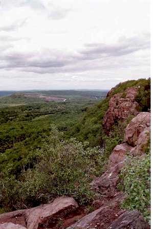
Higby Mountain or Mount Higby 892 feet (272 m), is a traprock mountain ridge located 3.75 miles (6.04 km) east of Meriden, Connecticut. It is part of the narrow, linear Metacomet Ridge that extends from Long Island Sound near New Haven, Connecticut, north through the Connecticut River Valley of Massachusetts to the Vermont border. Higby Mountain is known for its high cliff faces, unique microclimate ecosystems, and rare plant communities. It rises steeply 600 feet (180 m) above the Quinnipiac River valley and the city of Meriden to the west as a continuous 2-mile (3 km) long ledge. The mountain is traversed by the 50-mile (80 km) Mattabesett Trail.

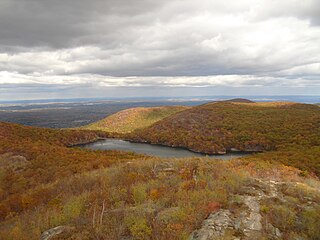
Saltonstall Mountain, also known as Saltonstall Ridge, with a high point of (est.) 320 feet (98 m) above sea level, is a traprock mountain ridge located 3 miles (5 km) east of New Haven, Connecticut and 1.75 miles (2.8 km) north of Long Island Sound. It is part of the Metacomet Ridge that extends from Long Island Sound near New Haven, Connecticut, north through the Connecticut River Valley of Massachusetts to the Vermont border. Saltonstall Mountain is known for its 100 foot (30 m) scenic cliff faces and sharp ridgeline, unique microclimate ecosystems, rare plant communities, and for Lake Saltonstall, a 3 miles (5 km) long by 0.3 miles (400 m) wide municipal reservoir nearly enclosed by the mountain. Saltonstall Mountain is traversed by a number of hiking trails managed by the South Central Connecticut Regional Water Authority (SCCRWA) and Branford Land Trust.
Bearpen Mountain is a mountain located in the Catskill Mountains of New York. The mountain's highest peak is in Greene County, but its northwest subpeak at 42°16.42′N74°29.05′W is the highest point in Delaware County at 3,520 ft. Bearpen Mountain is flanked to the north by Roundtop, and to the southeast by Vly Mountain.

Vly Mountain is a mountain located in the town of Halcott, New York, United States in Greene County. The mountain is part of the Catskill Mountains. Vly Mountain is flanked to the northwest by Bearpen Mountain, to the east by Vinegar Hill, to the northeast by Kipp Hill, and to the southeast by Beech Ridge.

Manitook Mountain, also called Manituck Mountain, 638 feet (194 m), is a 1.6-mile (2.6 km) long traprock mountain ridge located between the Berkshires and the Connecticut River Valley in north-central Connecticut. It is an outlying ridge belonging to the narrow, linear Metacomet Ridge that extends from Long Island Sound near New Haven, Connecticut, north through the Connecticut River Valley of Massachusetts to the Vermont border. Manitook Mountain is known for its ledges and microclimate ecosystems. The mountain has no official trail.

Balsam Lake Mountain is one of the Catskill Mountains, located in the Town of Hardenburgh, New York, United States. It is the westernmost of the range's 35 High Peaks. Its exact height has not been determined, but the highest contour line on topographic maps, 3,720 feet (1,130 m), is usually given as its elevation.
Big Indian Mountain is a mountain located in Ulster County, New York. The mountain is part of the Catskill Mountains. It is flanked to the northwest by Eagle Mountain, to the southeast by Fir Mountain, and to the southwest by Doubletop Mountain.
Doubletop Mountain is a mountain located in Ulster County, New York. The mountain is part of the Catskill Mountains. Doubletop Mountain is flanked to the northwest by Graham Mountain, to the east by Big Indian Mountain, and to the southwest by the Beaver Kill Range.

Graham Mountain is the seventh highest of the Catskill High Peaks and the highest privately owned mountain in the range. It is located in the town of Hardenburgh, New York, United States.
Dry Ridge Mountain (10,326 feet is located in the Teton Range in the U.S. state of Wyoming. The peak is on the border of Grand Teton National Park and the Jedediah Smith Wilderness of Caribou-Targhee National Forest. Dry Ridge Mountain is at the head of Moran Canyon and 1 mile NNE of Green Lakes Mountain.
Mount Crawford is a mountain located in Coos County, New Hampshire, in the United States. The mountain is on a spur of Montalban Ridge within the White Mountains and overlooks Crawford Notch. It is accessible via the Davis Path, which climbs from Crawford Notch near the Notchland Inn. The Davis Path continues north up Montalban Ridge to Mount Washington.
Pakatakan Mountain is a mountain located in the Catskill Mountains of New York southeast of Margaretville. Pakataghkan Mountain is the variant name. Kettle Hill is located north, Meade Hill is located east-northeast and Dry Brook Ridge is located southeast of Pakatakan Mountain.

