The term "United States," when used in the geographical sense, refers to the contiguous United States, Alaska, Hawaii, the five insular territories of Puerto Rico, Northern Mariana Islands, U.S. Virgin Islands, Guam, American Samoa, and minor outlying possessions. The United States shares land borders with Canada and Mexico and maritime borders with Russia, Cuba, The Bahamas, and many other countries, mainly in the Caribbeanin addition to Canada and Mexico. The northern border of the United States with Canada is the world's longest bi-national land border.

Ohio is a town in Herkimer County, New York, United States. The population was 1,002 at the 2010 census. The town is named after the state of Ohio. The town is in the northern part of the county and northeast of Utica. Part of Ohio is within the Adirondack Park.

Walton is a town in Delaware County, New York, United States. The population was 5,270 at the 2020 census. The town is in the west-central part of the county and contains the village of Walton. The town claims to be the "Scarecrow Capital of the World."

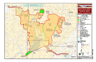
The Black Rock Desert is a semi-arid region of lava beds and playa, or alkali flats, situated in the Black Rock Desert–High Rock Canyon Emigrant Trails National Conservation Area, a silt playa 100 miles (160 km) north of Reno, Nevada, that encompasses more than 300,000 acres (120,000 ha) of land and contains more than 120 miles (200 km) of historic trails. It is in the northern Nevada section of the Great Basin with a lakebed that is a dry remnant of Pleistocene Lake Lahontan.

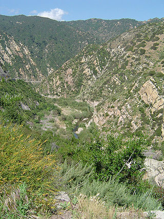
The Santa Monica Mountains are a coastal mountain range in Southern California, next to the Pacific Ocean. It is part of the Transverse Ranges. The Santa Monica Mountains National Recreation Area encompasses this mountain range. Because of its proximity to densely populated regions, it is one of the most visited natural areas in California.

The Blackhead Mountains range is located near the northern end of the Catskill Mountains, in Greene County, New York, United States, where it divides the towns of Windham and Jewett. The three named peaks in the range — Thomas Cole Mountain, Black Dome, and Blackhead Mountain — are the fourth-, third-, and fifth-highest peaks in the Catskills, respectively. The gap between Thomas Cole and Black Dome is, at 3,700 feet, the highest in the Catskills.

Vly Mountain is a mountain located in the town of Halcott, New York, United States in Greene County. The mountain is part of the Catskill Mountains. Vly Mountain is flanked to the northwest by Bearpen Mountain, to the east by Vinegar Hill, to the northeast by Kipp Hill, and to the southeast by Beech Ridge.

Berlin Mountain is a 2,818-foot-tall (859 m) prominent peak in the Taconic Mountains of western New England and is located adjacent to Massachusetts's border with New York State. It is the highest point in Rensselaer County. The summit and west side of the mountain are located in New York; the east side lies within Williamstown, Massachusetts. The mountain is a bald, notable for its grassy summit and expansive views of the Hudson River Valley to the west. The 37-mile (60 km) Taconic Crest Trail traverses the mountain. Several other hiking trails approach the summit from the east. Much of the upper slopes and summit are within protected conservation land. Historically the lower slopes of the mountain were farmed heavily throughout the 19th Century. In addition to agriculture, there are several remnants of charcoal kilns located on the mountain that produced fuel for iron smelting.

The Black Hills is an isolated mountain range rising from the Great Plains of North America in western South Dakota and extending into Wyoming, United States. Black Elk Peak, which rises to 7,242 feet (2,207 m), is the range's highest summit. The name of the range in Lakota is Pahá Sápa. It encompasses the Black Hills National Forest. It formed as a result of an upwarping of ancient rock, after which the removal of the higher portions of the mountain mass by stream erosion produced the present-day topography. The hills are so called because of their dark appearance from a distance, as they are covered in evergreen trees.
Crum Hill, 2,841 feet (866 m), located in northwest Massachusetts, United States, in the towns of Monroe and Florida, is the highest point in Franklin County. The mountain, part of the Hoosac Range, is crossed by a trail system maintained by a local snowmobile club, the Florida Mountaineers. They maintain a trail map on their website.

Badger Mountain is a mountain summit in the South Park Hills of the Rocky Mountains of North America. The 11,295-foot (3,443 m) peak is located in Pike National Forest, 9.6 miles (15.5 km) northwest by west of the community of Lake George in Park County, Colorado, United States.
Red House Hill is a mountain in the Central New York Region of the State of New York, United States. It is located south-southwest of the Hamlet of Springfield Center, New York, west of Hutter Point and Six Mile Point of Otsego Lake, and southeast of Rum Hill. Mohican Brook flows eastward along the southern edge of the hill.
Frost Hill is a mountain in the Finger Lakes Region of New York. It is located west of Bristol Springs in Ontario County. At an elevation of 2,284 feet (696 m), the mountain is the highest point in Ontario County. It is about 1.25 miles (2.01 km) southwest of the 2,150-foot (660 m) Worden Hill, where Bristol Mountain Ski Resort is.
Lumbert Hill is a mountain located in the Catskill Mountains of New York west of Delhi. Dunk Hill is located southwest, The Cobble is located south, and Johnson Hill is located west of Lumbert Hill.
Gallis Hill is a 794-foot-tall (242 m) mountain in the Catskill Mountains region of New York. It is located northwest of Kingston in Ulster County. Jockey Hill is located north-northeast, and Morgan Hill is located west of Gallis Hill. In 1927, the Conservation Department built a steel fire lookout tower on the mountain. In 1950, the tower was closed and disassembled then moved to Overlook Mountain, where it still remains today.
Petersburg Mountain is a mountain located in the Catskill Mountains of New York southeast of Cobleskill. Warnerville Hill is located northwest, and Donats Mountain is located northwest of Petersburg Mountain. In 1940, a 67-foot-6-inch-tall (20.57 m) steel fire lookout tower was built on the mountain. The tower was closed at the end of the 1971 season, and later transferred to Schoharie County for use as a radio tower. The tower site is closed to the public.
Van Loan Hill is a mountain in Greene County, New York. It is located in the Catskill Mountains southwest of Maplecrest. Round Hill is located west, Elm Ridge is located north-northeast, and East Jewett Range is located south of Van Loan Hill.

Cerro del Diablo is a mountain in the municipality of Ponce, Puerto Rico, located north-northwest of the city of Ponce. The 2,234-foot high hill sits at the foothills of the Cordillera Central and is located in Barrio Tibes.


