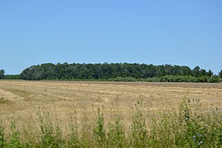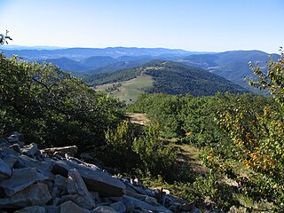
Webb is the northernmost town in Herkimer County, New York, United States. As of the 2020 Census it had a population of 1,797.

The Flatrock River, also known as Flatrock Creek and other variants of the two names, is a 98-mile-long (158 km) tributary of the East Fork of the White River in east-central Indiana in the United States. Via the White, Wabash and Ohio rivers, it is part of the watershed of the Mississippi River, draining an area of 532 square miles (1,380 km2).

Blood Mountain is the highest peak on the Georgia section of the Appalachian Trail and the sixth-tallest mountain in Georgia, with an elevation of 4,458 feet (1,359 m). It is located on the border of Lumpkin County with Union County and is within the boundaries of the Chattahoochee National Forest and the Blood Mountain Wilderness. There are several waterfalls, hiking trails and other recreational areas in the vicinity. This mountain marks the southernmost range limit for many Northern and Appalachian species, especially for plant species.

Flatrock Township is one of the thirteen townships of Henry County, Ohio, United States. As of the 2020 census the population was 1,248.

Pleasant Township is one of the thirteen townships of Henry County, Ohio, United States. As of the 2020 census the population was 1,882.
Eurybia avita, commonly called Alexander's rock aster, is a rare North American plant species, a herbaceous perennial in the family Asteraceae that was formerly considered part of the genus Aster. It is native to the southeastern United States. It is of conservation concern as it is found in less than 50 sites, typically only in sandy soils near granite flatrocks, and it is most likely already extirpated in North Carolina. Its habitat is threatened by development and the recreational use of the area where it grows. It is very similar to both E. surculosa and E. paludosa and more research needs to be done to determine the exact relationship between the three species.

Flat Rock is an unincorporated community in Jackson County, Alabama, United States. The Flat Rock post office was established in 1912.

Flatrock is a town in Newfoundland and Labrador. The town had a population of 1,722 in the Canada 2021 Census.

Plateau Mountain is located in the town of Hunter in Greene County, New York, United States. It is part of the Devil's Path range of the Catskill Mountains. Plateau has a two-mile-long (3.2 km) summit ridge above 3,500 feet (1,100 m). The highest point, at least 3,840 feet (1,170 m), is at the southeast end, facing Sugarloaf Mountain to the east across Mink Hollow Notch. It is the 12th-highest peak in the range Devils Tombstone is located west of Plateau Mountain. The northwest end faces Hunter Mountain to the west across 1,400-foot deep (430 m) Stony Clove Notch.

Berlin Mountain is a 2,818-foot-tall (859 m) prominent peak in the Taconic Mountains of western New England and is located adjacent to Massachusetts's border with New York State. It is the highest point in Rensselaer County. The summit and west side of the mountain are located in New York; the east side lies within Williamstown, Massachusetts. The mountain is a bald, notable for its grassy summit and expansive views of the Hudson River Valley to the west. The 37-mile (60 km) Taconic Crest Trail traverses the mountain. Several other hiking trails approach the summit from the east. Much of the upper slopes and summit are within protected conservation land. Historically the lower slopes of the mountain were farmed heavily throughout the 19th Century. In addition to agriculture, there are several remnants of charcoal kilns located on the mountain that produced fuel for iron smelting.

WNDH is a radio station broadcasting a classic hits format. Licensed to Napoleon, Ohio, United States, the station is currently owned by iHeartMedia, Inc.

The Roaring Plains West Wilderness is a U.S. Wilderness Area in the Allegheny Mountains of eastern West Virginia, USA. It is part of the Monongahela National Forest and includes Mount Porte Crayon, the sixth highest point in the state.
Pleasure Valley is an unincorporated community in Noble Township, Shelby County, in the U.S. state of Indiana.

Dun Brook Mountain is a mountain located in Adirondack Mountains of New York located in the town of Indian Lake east-northeast of Blue Mountain Lake. Tirrell Mountain is located west and Tirrel Pond is located west-southwest of Dun Brook Mountain.

Huntersfield Mountain is a mountain located in the Catskill Mountains of New York north-northwest of Ashland. Ashland Pinnacle is located east, and Tower Mountain is located south-southeast of Huntersfield Mountain. It is the highest point in Schoharie County and it is ranked 9 of 62 on the list of New York County High Points.
Faunces Mountain is a mountain in Barnstable County, Massachusetts. It is located on 1.5 miles (2.4 km) southeast of Sagamore in the Town of Bourne. Flatrock Hill is located west of Faunces Mountain.
Flatrock Hill is a mountain in Barnstable County, Massachusetts. It is located on 1.2 miles (1.9 km) southwest of Sagamore in the Town of Bourne. Discovery Hill is located northwest and Faunces Mountain is located east of Flatrock Hill.
Bare Mountain is a summit located in Herkimer County, New York in the Adirondack Mountains. It is located north-northwest of Minnehaha in the Town of Webb. Flatrock Mountain is located southeast of Bare Mountain.


