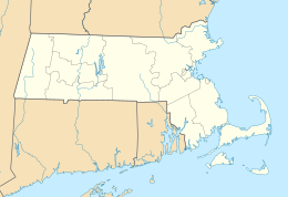
Waltham is a city in Middlesex County, Massachusetts, United States, and was an early center for the labor movement as well as a major contributor to the American Industrial Revolution. The original home of the Boston Manufacturing Company, the city was a prototype for 19th century industrial city planning, spawning what became known as the Waltham-Lowell system of labor and production. The city is now a center for research and higher education, home to Brandeis University and Bentley University. The population was 60,636 at the census in 2010.

Chingford is a district in East London, located in the London Borough of Waltham Forest and is situated 8.6 miles (13.8 km) northeast of Charing Cross. Historically a rural Essex parish, it gained urban district status in 1894, and between 1938 and 1965 formed the core of the Municipal Borough of Chingford. Chingford is close to the Essex border of Epping Forest District. Chingford has a population of 66,211 as of 2011, represented by six electoral wards, which includes its sub-neighbourhoods such as Chingford Mount, Friday Hill and Highams Park.

Leyton is a district in East London and part of the London Borough of Waltham Forest, located 6.2 miles (10 km) north-east of Charing Cross in the United Kingdom. It borders Walthamstow and Leytonstone in Waltham Forest, Stratford in the London Borough of Newham and Homerton and Lower Clapton in the London Borough of Hackney. The district includes part of the Queen Elizabeth Olympic Park, which hosted the 2012 Olympic Games, as well as Leyton Orient Football Club, although it is predominantly residential. It consists mainly of terraced houses built between 1870 and 1910, interspersed with some modern housing estates.

Walthamstow is a major district in the London Borough of Waltham Forest, located 7.5 miles (12.1 km) north-east of Charing Cross and immediately east of the Lee Valley Reservoir Chain and the Walthamstow Marshes. Historically an ancient parish in the county of Essex, its population increased as part of the suburban growth of London, becoming the Municipal Borough of Walthamstow in 1929. In 1965 the district merged with neighbouring Leyton and Chingford to form the new Borough of Waltham Forest, a component of the new Greater London area.

The London Borough of Waltham Forest is a London borough in East London, England.
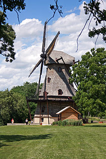
Kane County is a county in the U.S. state of Illinois. According to the 2010 census, it has a population of 515,269, making it the fifth-most populous county in Illinois. Its county seat is Geneva, and its largest city is Aurora.

Waltham Abbey is a suburban market town in the Epping Forest District of Essex. Located on the Greenwich Meridian, between the River Lea in the west and Epping Forest in the east, the town is 14 miles from central London and lies on the outskirts of North East London, with the Metropolitan Green Belt to the north, east and south of the town. For statistical purposes, Waltham Abbey is included in the metropolitan area of London and the Greater London Urban Area.

The Department of Conservation and Recreation (DCR) is a state agency of the Commonwealth of Massachusetts, situated in the Executive Office of Energy and Environmental Affairs. It is best known for its parks and parkways. The DCR's mission is "To protect, promote and enhance our common wealth of natural, cultural and recreational resources for the well-being of all." The agency is the largest landowner in Massachusetts.

The Mass Central Rail Trail is a partially-completed rail trail from Northampton, Massachusetts to Boston along the former right of way of the Massachusetts Central Railroad. When complete, it will run 104 miles (167 km) through Central Massachusetts and Greater Boston. Many segments of the trail, including the Norwottuck Branch Rail Trail and the Somerville Community Path, have been developed as separate projects but will serve as part of the complete Mass Central Rail Trail.

Highams Park is a district of Chingford in the London Borough of Waltham Forest, England. It is a suburban area adjacent to Epping Forest and situated 8.7 miles (14 km) north-east of Charing Cross.
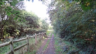
This is a list of Parks and open spaces in the London Borough of Waltham Forest, which contains the most parks of any government district north of the River Thames.

Illinois's 6th congressional district covers parts of Cook, DuPage, Lake, Kane and McHenry counties, as of the 2011 redistricting which followed the 2010 census. All or parts of Algonquin, Barrington, Barrington Hills, Bartlett, Burr Ridge, Carol Stream, Carpentersville, Cary, Clarendon Hills, Crystal Lake, Darien, Deer Park, Downers Grove, Elgin, East Dundee, Forest Lake, Fox River Grove, Gilberts, Glen Ellyn, Hawthorn Woods, Hinsdale, Hoffman Estates, Inverness, Kildeer, Lake Barrington, Lake in the Hills, Lake Zurich, Lakewood, Lisle, Lombard, Long Grove, Naperville, North Barrington, Oak Brook, Oakbrook Terrace, Oakwood Hills, Palatine, Port Barrington, Rolling Meadows, Sleepy Hollow, South Barrington, South Elgin, St. Charles, Tower Lakes, Trout Valley, Warrenville, Wayne, West Chicago, West Dundee, Westmont, Wheaton, Willowbrook and Winfield are included.

Connecticut River Greenway State Park is a protected environment with public recreation features that consists of separate state land holdings, including open spaces, parks, scenic vistas, and archaeological and historic sites, along the Connecticut River in the Pioneer Valley of western Massachusetts. The state park includes critical wildlife and plant habitat as well as areas providing public access to the river in its run across the state and is intertwined with other protected land including farmland under state-held agricultural preservation restrictions, municipal and conservation land trust holdings, and state and national wildlife refuges.
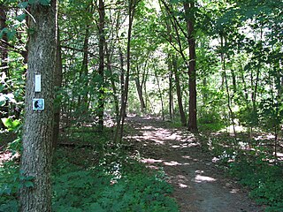
The Bay Circuit Trail and Greenway or Bay Circuit is a Massachusetts recreational trail and greenway connecting the outlying suburbs of Boston from Plum Island in Newburyport to Kingston Bay in Duxbury, a distance of 200 miles (320 km).
Berry Mountain, east peak 2,203 feet (671 m) and west peak 2,188 feet (667 m), is a prominent mountain in the Taconic Mountains of western Massachusetts. The mountain is located in Pittsfield State Forest. The west peak is traversed by the 35 mi (56 km) Taconic Crest hiking trail and the east peak is traversed by the 12.1 mi (19.5 km) multi-use Taconic Skyline Trail. The summits are mostly wooded with northern hardwood forest species, but also support a 65-acre (260,000 m2) field of wild azaleas. A microwave tower stands on the east peak. A park loop automobile road and a campground, maintained for summer use, are located just to the north of the summits. Berry Pond, 2,150 feet (660 m), presumed the highest natural pond in the state of Massachusetts, is located on the ridge between Berry Mountain and Berry Hill to the north.
Berry Hill, 2,200 feet (670 m), is a prominent mountain in the Taconic Mountains of western Massachusetts. The mountain is located in Pittsfield State Forest and is traversed by a short spur trail from a park automobile road. The Taconic Crest hiking trail and the multi-use Taconic Skyline Trail are located nearby. The mountain is known for its wild azalea fields. Its slopes are wooded with northern hardwood forest species. A park loop automobile road nearly encircles the summit, and a campground, maintained for summer use, is located just to the south of the summit. Berry Pond, 2,150 feet (660 m), presumed the highest natural pond in the state of Massachusetts, is located on the ridge between Berry Hill and Berry Mountain to the south.

The Charles River Bike Path is a mixed-use path in the Boston, Massachusetts area. It is named after the cardiologist Paul Dudley White, a prominent advocate of preventive medicine. His research led him to proclaim frequently "I'd like to put everybody on bicycles." In 1955 White served as president Eisenhower's cardiologist and prescribed his famous patient bicycle therapy after his 1955 heart attack.

The Charles River Reservation Parkways are parkways that run along either side of the Charles River in eastern Massachusetts. The roads are contained within the Charles River Reservation and the Upper Charles River Reservation, and fall within a number of communities in the greater Boston metropolitan area. The Charles River parks extend from the Charles River Dam, where the Charles empties into Boston Harbor, to Riverdale Park in the West Roxbury neighborhood of Boston. Most of the roadways within the parks are listed on the National Register of Historic Places as a unit, although Storrow Drive and Memorial Drive are listed as part of the Charles River Basin Historic District.
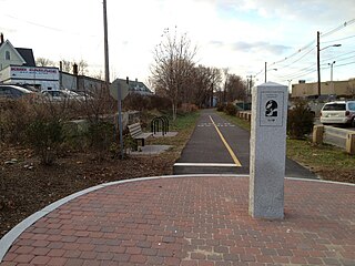
The Watertown Branch Railroad was a branch loop of the Fitchburg Railroad that was meant to serve the town of Watertown and the City of Waltham, Middlesex County, Massachusetts, as an independent short line railroad; it also serviced the Watertown Arsenal. The line has been formally abandoned and portions are being converted into a rail trail, the Watertown-Cambridge Greenway. A section from School Street to Arlington Street in Watertown has been completed. A small portion in Waltham has been converted into a park called Chemistry Station Park after the railroad station once located there. Construction of an extension to Fresh Pond Reservation in Cambridge began in the summer of 2018 and is expected to be completed in 2021.

The Metropolitan Park System of Greater Boston is a system of reservations, parks, parkways and roads under the control of the Massachusetts Department of Conservation and Recreation (DCR) in and around Boston that has been in existence for over a century. The title is used by the DCR to describe the areas collectively: "As a whole, the Metropolitan Park System is currently eligible for listing on the National Register of Historic Places", as outlined on the department's website. The DCR maintains a separate Urban Parks and Recreation division to oversee the system, one of five such divisions within the department—DCR's Bureau of State Parks and Recreation manages the remainder of Massachusetts state parks. Direct design and maintenance functions for the parkways and roads within the system are provided by the DCR Bureau of Engineering.

