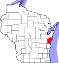
Francis Creek, Wisconsin

Last updated

Francis Creek, Wisconsin
Francis Creek Wisconsin Village Office.jpg
Nickname: 
French Crick
Manitowoc County Wisconsin Incorporated and Unincorporated areas Francis Creek Highlighted.svg
Location of Francis Creek in Manitowoc County, Wisconsin.
Coordinates: 44°12′10″N87°43′19″W / 44.20278°N 87.72194°W / 44.20278; -87.72194
Country Flag of the United States.svg  United States
State Flag of Wisconsin.svg  Wisconsin
County Manitowoc
Government
  Village President 2018-2020Matt Payette
Area
[1]
  Total1.14 sq mi (2.94 km2)
  Land1.14 sq mi (2.94 km2)
  Water0.00 sq mi (0.00 km2)
Elevation
[2]
732 ft (223 m)
Population
 (2020) [3]
  Total659
  Density563.38/sq mi (217.44/km2)
Time zone UTC-6 (Central (CST))
  Summer (DST) UTC-5 (CDT)
Area code 920
FIPS code 55-27125 [4]
GNIS feature ID1565246 [2]
Website www.franciscreek.org

Francis Creek is a village in Manitowoc County, Wisconsin, United States. The population was 659 at the 2020 census. The village is located within the town of Kossuth.

Contents

History

A post office called Francis Creek was first established in 1850. [5] The village took its name from nearby Francis Creek. [6]

Geography

Francis Creek is located at 44°12′10″N87°43′19″W / 44.202728°N 87.722047°W / 44.202728; -87.722047 (44.202728, -87.722047). [7]

According to the United States Census Bureau, the village has a total area of 1.18 square miles (3.06 km2), all of it land. [8]

The village is east of Interstate 43.

Demographics

Historical population
CensusPop.Note
1970 492
1980 58919.7%
1990 562−4.6%
2000 68121.2%
2010 669−1.8%
2020 659−1.5%
U.S. Decennial Census [9]

2010 census

As of the census [3] of 2010, there were 669 people, 277 households, and 189 families living in the village. The population density was 566.9 inhabitants per square mile (218.9/km2). There were 296 housing units at an average density of 250.8 per square mile (96.8/km2). The racial makeup of the village was 97.6% White, 0.1% African American, 0.6% Asian, 0.3% from other races, and 1.3% from two or more races. Hispanic or Latino people of any race were 0.4% of the population.

There were 277 households, of which 27.4% had children under the age of 18 living with them, 57.0% were married couples living together, 7.2% had a female householder with no husband present, 4.0% had a male householder with no wife present, and 31.8% were non-families. 27.1% of all households were made up of individuals, and 10.1% had someone living alone who was 65 years of age or older. The average household size was 2.42 and the average family size was 2.91.

The median age in the village was 39.3 years. 22.4% of residents were under the age of 18; 9.8% were between the ages of 18 and 24; 24.2% were from 25 to 44; 29.4% were from 45 to 64; and 14.3% were 65 years of age or older. The gender makeup of the village was 49.5% male and 50.5% female.

2000 census

As of the census [4] of 2000, there were 681 people, 266 households, and 186 families living in the village. The population density was 618.6 people per square mile (239.0/km2). There were 280 housing units at an average density of 254.3 per square mile (98.3/km2). The racial makeup of the village was 99.85% White, 0.15% from other races. Hispanic or Latino people of any race were 0.88% of the population.

There were 266 households, out of which 36.8% had children under the age of 18 living with them, 58.6% were married couples living together, 7.9% had a female householder with no husband present, and 29.7% were non-families. 25.9% of all households were made up of individuals, and 13.2% had someone living alone who was 65 years of age or older. The average household size was 2.56 and the average family size was 3.09.

In the village, the population was spread out, with 27.6% under the age of 18, 9.3% from 18 to 24, 29.4% from 25 to 44, 20.3% from 45 to 64, and 13.5% who were 65 years of age or older. The median age was 35 years. For every 100 females, there were 99.7 males. For every 100 females age 18 and over, there were 98.0 males.

The median income for a household in the village was $43,542, and the median income for a family was $53,542. Males had a median income of $33,750 versus $21,618 for females. The per capita income for the village was $18,441. About 6.2% of families and 5.1% of the population were below the poverty line, including 5.0% of those under age 18 and 14.4% of those age 65 or over.

Events

Every year, Francis Creek hosts a village-wide rummage sale on the first weekend of June. The Francis Creek Lions Club provides a food tent at Wagner's Restaurant, on the corner of South Packer Drive and Forest Home Drive. [10]

Every year, Francis Creek holds French Creek Days on the second weekend in July. People gather from many of the neighboring cities to see the tractor and truck pulls. It is one of the biggest festivals in the area.

Images

Related Research Articles

<span class="mw-page-title-main">Athens, Michigan</span> Village in Michigan, United States

Athens is a village in Calhoun County in the U.S. state of Michigan. The population was 936 at the 2020 census. The village is located in southern Athens Township, and is part of the Battle Creek, Michigan Metropolitan Statistical Area. It was settled in 1831.

<span class="mw-page-title-main">Deer Creek, Minnesota</span> City in Minnesota, United States

Deer Creek is a city in Otter Tail County, Minnesota, United States. The population was 330 at the 2020 census.

<span class="mw-page-title-main">Gravois Mills, Missouri</span> Town in Missouri, United States

Gravois Mills is a town in Morgan County, Missouri, United States. The population was 129 at the 2020 census.

<span class="mw-page-title-main">Shoal Creek Drive, Missouri</span> Village in Missouri, United States

Shoal Creek Drive is a village in Newton County, Missouri, United States. The population was 337 at the 2010 census. It is part of the Joplin, Missouri Metropolitan Statistical Area.

<span class="mw-page-title-main">Shoal Creek Estates, Missouri</span> Village in Missouri, United States

Shoal Creek Estates is a village in Newton County, Missouri, United States. The population was 76 at the 2010 census. It is part of the Joplin, Missouri Metropolitan Statistical Area.

<span class="mw-page-title-main">Bull Creek, Missouri</span> Village in Missouri, United States

Bull Creek is a village in northwest Taney County, Missouri, United States. The population was 426 at the 2020 census. It is part of the Branson, Missouri Micropolitan Statistical Area.

<span class="mw-page-title-main">Cedar Creek, Nebraska</span> Village in Nebraska, United States

Cedar Creek is a village in Cass County, Nebraska, United States. The population was 465 at the 2020 census.

<span class="mw-page-title-main">Silver Creek, Missouri</span> Neighborhood in Newton, Missouri, United States

Silver Creek was a village in Newton County, Missouri, United States. The population was 623 at the 2010 census. It is part of the Joplin, Missouri Metropolitan Statistical Area. On August 7, 2012, residents of the Village of Silver Creek and the City of Joplin voted to consolidate and become part of the city of Joplin.

<span class="mw-page-title-main">Rock Creek, Ohio</span> Village in Ohio, United States

Rock Creek is a village in Ashtabula County, Ohio, United States. The population was 667 at the 2020 census. It is part of the Ashtabula micropolitan area, 45 miles (72 km) northeast of Cleveland.

<span class="mw-page-title-main">Killbuck, Ohio</span> Village in Ohio, United States

Killbuck is a village in Holmes County, Ohio, United States, along Killbuck Creek. It is named for the famous Lenape chief Bemino, also known as John Killbuck Sr.. The population was 810 at the 2020 census.

<span class="mw-page-title-main">Darbyville, Ohio</span> Village in Ohio, United States

Darbyville is a village in Pickaway County, Ohio, United States. The population was 186 at the 2020 census.

<span class="mw-page-title-main">Macksburg, Ohio</span> Village in Ohio, United States

Macksburg is a village in Washington County, Ohio, United States, along the West Fork of Duck Creek. The population was 120 at the 2020 census. The village is about 28 miles (45 km) south of Cambridge, Ohio.

<span class="mw-page-title-main">Apple Creek, Ohio</span> Village in Ohio, United States

Apple Creek is a village in East Union Township, Wayne County, Ohio, United States. The population was 1,188 at the 2020 census.

<span class="mw-page-title-main">Shreve, Ohio</span> Village in Ohio, United States

Shreve is a village in Clinton Township, Wayne County, Ohio, United States. The population was 1,497 at the 2020 census. Shreve is served by a branch of the Wayne County Public Library.

<span class="mw-page-title-main">Valley Grove, West Virginia</span> Village in West Virginia, United States

Valley Grove is a village in Ohio County, West Virginia, United States. It is part of the Wheeling, West Virginia Metropolitan Statistical Area. The population was 275 at the 2020 census. The village was named from a nearby recreational area at a grove in a valley.

<span class="mw-page-title-main">Boyceville, Wisconsin</span> Village in Wisconsin, United States

Boyceville is a village in Dunn County, Wisconsin, United States. The population was 1,100 at the 2020 census.

<span class="mw-page-title-main">Fall Creek, Wisconsin</span> Village in Wisconsin, United States

Fall Creek is a village in Eau Claire County, Wisconsin, United States. The population was 1,315 at the 2010 census. The village is bordered by the Town of Lincoln.

<span class="mw-page-title-main">Conrath, Wisconsin</span> Village in Wisconsin, United States

Conrath is a village in Rusk County, Wisconsin, United States. The population was 95 at the 2010 census.

<span class="mw-page-title-main">Pigeon Falls, Wisconsin</span> Village in Wisconsin, United States

Pigeon Falls is a village in Trempealeau County, Wisconsin, United States. The population was 411 at the 2010 census.

<span class="mw-page-title-main">Ogdensburg, Wisconsin</span> Village in Wisconsin, United States

Ogdensburg is a village in Waupaca County, Wisconsin, United States. The population was 185 at the 2010 census.

References

  1. "2019 U.S. Gazetteer Files". United States Census Bureau. Retrieved August 7, 2020.
  2. 1 2 "US Board on Geographic Names". United States Geological Survey. October 25, 2007. Retrieved January 31, 2008.
  3. 1 2 "U.S. Census website". United States Census Bureau . Retrieved November 18, 2012.
  4. 1 2 "U.S. Census website". United States Census Bureau . Retrieved January 31, 2008.
  5. "Manitowoc County". Jim Forte Postal History. Retrieved March 18, 2015.
  6. Chicago and North Western Railway Company (1908). A History of the Origin of the Place Names Connected with the Chicago & North Western and Chicago, St. Paul, Minneapolis & Omaha Railways. p. 73.
  7. "US Gazetteer files: 2010, 2000, and 1990". United States Census Bureau. February 12, 2011. Retrieved April 23, 2011.
  8. "US Gazetteer files 2010". United States Census Bureau. Archived from the original on July 2, 2012. Retrieved November 18, 2012.
  9. "Census of Population and Housing". Census.gov. Retrieved June 4, 2015.
  10. "Village of Francis Creek, Francis Creek, WI". www.franciscreek.org. Retrieved July 16, 2019.