Related Research Articles

Polk County is located in the central portion of the U.S. state of Florida. The county population was 725,046, as of the 2020 census. Its county seat is Bartow, and its largest city is Lakeland.

Tulare County is a county located in the U.S. state of California. As of the 2020 census, the population was 473,117. The county seat is Visalia. The county is named for Tulare Lake, once the largest freshwater lake west of the Great Lakes. Drained for agricultural development, the site is now in Kings County, which was created in 1893 from the western portion of the formerly larger Tulare County.

Cooke County is a county in the U.S. state of Texas. At the 2020 census, its population was 41,668. The county seat is Gainesville. The county was founded in 1848 and organized the next year. It is named for William Gordon Cooke, a soldier during the Texas Revolution. It is a part of the Texoma region.

Hall County is a county located in the north central portion of the U.S. state of Georgia. As of the 2020 census, the population was 203,136, up from 179,684 at the 2010 census. The county seat is Gainesville. The entirety of Hall County comprises the Gainesville, Georgia, Metropolitan Statistical Area, which is also part of the Atlanta-Athens-Clarke County-Sandy Springs, Combined Statistical Area.

Gainesville is the county seat of Alachua County, Florida, and the largest city in North Central Florida, with a population of 141,085 in 2020. It is the principal city of the Gainesville metropolitan area, which had a population of 339,247 in 2020.

The Chicago metropolitan area, also colloquially referred to as Chicagoland, is a metropolitan area in the Midwestern United States. Encompassing 10,286 sq mi, the metropolitan area includes the city of Chicago, its suburbs and hinterland, spanning 14 counties in northeast Illinois, northwest Indiana, and southeast Wisconsin. The MSA had a 2020 census population of 9,618,502 and the combined statistical area which spans up to 19 counties had a population of nearly 10 million people. The Chicago area is the fourth largest metropolitan area in North America, the third-largest metropolitan area in the United States, the largest within the entire Midwest, and the largest in the Great Lakes megalopolis. Its urban area is one of the forty largest in the world.

The Dallas–Fort Worth metroplex, officially designated Dallas–Fort Worth–Arlington by the U.S. Office of Management and Budget, is a conurbated metropolitan statistical area in the U.S. state of Texas encompassing 11 counties and anchored by the major cities of Dallas and Fort Worth. It is the economic and cultural hub of North Texas. Residents of the area also refer to it as DFW, or the Metroplex. The Dallas–Fort Worth–Arlington metropolitan statistical area's population was 7,637,387 according to the U.S. Census Bureau's 2020 census, making it the most populous metropolitan area in both Texas and the Southern United States, the fourth-largest in the U.S., and the tenth-largest in the Americas. In 2016, the Dallas–Fort Worth metroplex had the highest annual population growth in the United States.

The New Orleans metropolitan area, designated the New Orleans–Metairie metropolitan statistical area by the U.S. Office of Management and Budget, or simply Greater New Orleans, is a metropolitan statistical area designated by the United States Census Bureau encompassing eight Louisiana parishes—the equivalent of counties in other U.S. states—centered on the city of New Orleans. The population of Greater New Orleans was 1,271,845 in 2020, up from 1,189,166 at the 2010 United States census. According to 2017 census estimates, the broader New Orleans–Metairie–Hammond combined statistical area (CSA) had a population of 1,510,562.

The Portland metropolitan area is a metro area in the U.S. states of Oregon and Washington centered on the principal city of Portland, Oregon. The U.S. Office of Management and Budget (OMB) identifies it as the Portland–Vancouver–Hillsboro, OR–WA Metropolitan Statistical Area, a metropolitan statistical area used by the United States Census Bureau (USCB) and other entities. The OMB defines the area as comprising Clackamas, Columbia, Multnomah, Washington, and Yamhill Counties in Oregon, and Clark and Skamania Counties in Washington. The area had a population of 2,512,859 at the 2020 census.
The Milwaukee metropolitan area is a major metropolitan area located in Southeastern Wisconsin, consisting of the city of Milwaukee and the surrounding area. There are several definitions of the area, including the Milwaukee–Waukesha–West Allis metropolitan area and the Milwaukee–Racine–Waukesha combined statistical area. It is the largest metropolitan area in Wisconsin, and the 39th largest metropolitan area in the United States.
The Memphis–City Combined Statistical Area, TN–MS–AR (CSA) is the commercial and cultural hub of The Mid-South or Ark-Miss-Tenn. The census-defined combined statistical area covers ten counties in three states – Tennessee, Mississippi, and Arkansas. As of census 2010 the MSA had a population of 1,324,108. The Forrest City Micropolitan area was added to the Memphis area in 2012 to form the Memphis–Forrest City Combined Statistical area and had a population of 1,369,548 according to census estimates. The greater Mid-South area as a whole has a population of 2.4 million according to 2013 census estimates. This area is covered by Memphis local news channels and includes the Missouri Bootheel, Northeast Arkansas, West Tennessee, and North Mississippi.
Pennsylvania has fourteen metropolitan statistical areas (MSAs) and four combined statistical areas (CSAs), as defined by the United States Census Bureau. A map of the Pennsylvania MSAs is available from the Census Bureau. As of 2020 Philadelphia is the seventh-largest United States metropolitan area.

The Sarasota metropolitan area is a metropolitan area located in Southwest Florida. The metropolitan area is defined by the Office of Management and Budget as the North Port–Sarasota–Bradenton metropolitan statistical area as a metropolitan statistical area (MSA) consisting of Manatee County and Sarasota County. The largest cities in the MSA are North Port, Sarasota, and Bradenton. At the 2020 census, the MSA had a population of 833,716.

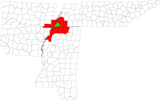
The Gainesville metropolitan area is the metropolitan area in North Central Florida that includes Alachua, Levy, and Gilchrist counties, centered around Gainesville, Florida. The metropolitan area had a population of 339,247 in 2020.

The Colorado Springs, CO, Metropolitan Statistical Area is a United States Office of Management and Budget defined Metropolitan Statistical Area (MSA) located in the Colorado Springs region of the State of Colorado. The 2020 United States census counted a population of 755,105, an increase of 17.0% since the 2010 United States Census. The Colorado Springs MSA is the 79th-most populous MSA in the United States. The Colorado Springs MSA encompasses El Paso County and Teller County, Colorado. Approximately 88.40% percent of the MSA's population live in cities or CDPs. The Colorado Springs Metropolitan Statistical Area is the second-most populous component of the Front Range Urban Corridor.

The Peoria Metropolitan Statistical Area, as defined by the United States Census Bureau, is an area consisting of six counties in Central Illinois, anchored by the city of Peoria. As of the 2020 census, the area had a population of 402,391. The City of Peoria, according to the 2020 US Census Bureau, has 113,150 people.
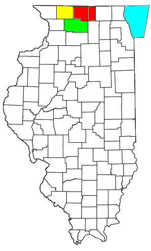
The Rockford Metropolitan Statistical Area, as defined by the United States Census Bureau, is an area consisting of four counties in north-central Illinois, anchored by the city of Rockford. As of the 2010 census, the MSA had a population of 349,431. The Rockford MSA abuts the southern portions of the Janesville-Beloit MSA and the Chicago MSA. It forms the main part of the larger Rockford–Freeport–Rochelle Combined Statistical Area.
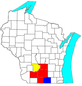
The Madison, Wisconsin, metropolitan area, also known as Greater Madison, is the metropolitan area surrounding the city of Madison, Wisconsin. Madison is the state capital of Wisconsin and is Wisconsin's second largest city, and the metropolitan area is also the state's second largest.

The Savannah metropolitan area is centered on the principal city of Savannah, Georgia. The official name given by the U.S. Office of Management and Budget (OMB) is the Savannah, GA Metropolitan Statistical Area, which is used for statistical purposes by the United States Census Bureau and other entities. The OMB defines this area as consisting of Bryan, Chatham, and Effingham counties in Georgia; its total population was 404,798 in the official 2020 U.S. Census, compared to 347,611 in the 2010 census. Savannah is the third most populous of fourteen Georgia metropolitan areas. It was the fastest-growing metro area in the state for the period 2010–2020.
The Gainesville Metropolitan Statistical Area, as defined by the United States Census Bureau, is an area consisting of one county – Hall – in the state of Georgia. As of the 2010 census, the MSA had a population of 179,684.
References
- ↑ "Gainesville-Lake City, FL Combined Statistical Area" (PDF). U.S. Department of Commerce. 2012. Retrieved April 18, 2019.
- ↑ "Combined Estimates of Resident Population - Combined Statistical Area". United States Census Bureau . March 2018. Retrieved April 18, 2019.