Gilman Square station

Last updated

Gilman Square
Gilman MBTA Station, Inbound, December 2022.jpg
A Heath Street-bound train at Gilman Square station in December 2022
General information
LocationMedford Street at Pearl Street
Somerville, Massachusetts
Coordinates 42°23′17″N71°05′48″W / 42.38792°N 71.09677°W / 42.38792; -71.09677
Line(s) Medford Branch
Platforms1 island platform
Tracks2
ConnectionsAiga bus trans.svg MBTA bus: 80
Construction
Bicycle facilities100-space "Pedal and Park" bicycle cage
40 spaces on racks
AccessibleYes
History
OpenedDecember 12, 2022
Passengers
2030 (projected)4,410 daily boardings [1] :48
Services
Preceding station MBTA.svg MBTA Following station
Magoun Square Green Line East Somerville
toward Heath Street
Former services (Winter Hill station)
Preceding station Boston and Maine Railroad Following station
Somerville Junction
toward Concord, NH
Boston – Concord, NH Prospect Hill
toward Boston
Somerville Junction
toward Lowell or Reformatory
Lexington Branch
Somerville Junction
toward Northampton
Central Mass Branch
Location
Gilman Square station

Gilman Square station is a light rail station on the Massachusetts Bay Transportation Authority (MBTA) Green Line located at Gilman Square in Somerville, Massachusetts. The accessible station has a single island platform serving the two tracks of the Medford Branch. It opened on December 12, 2022, as part of the Green Line Extension (GLX), which added two northern branches to the Green Line, and is served by the E branch.

Contents

The location was previously served by railroad stations. The Boston and Lowell Railroad (B&L) opened a station at Winter Hill in 1863; it was rebuilt in 1886–1888. The station was served by the Boston and Maine Railroad, successor to the B&L, until 1937. Extensions to the Green Line were proposed throughout the 20th century, most with Winter Hill as one of the intermediate stations. A Gilman Square station at the Winter Hill site was officially chosen for the GLX in 2008. Cost increases triggered a wholesale reevaluation of the GLX project in 2015, and a scaled-down station design was released in 2016. A design and construction contract was issued in 2017. Construction of Gilman Square station began in early 2020 and was largely completed by late 2021.

Station design

The School Street entrance and the Community Path under construction in 2022 Gilman Square station and Community Path construction, March 2022.JPG
The School Street entrance and the Community Path under construction in 2022

Gilman Square station is located between School Street and Medford Street in the eponymous neighborhood in central Somerville, adjacent to Somerville City Hall and Somerville High School. The Lowell Line runs roughly northwest–southeast through the station area, with the two-track Medford Branch of the Green Line on the south side of the Lowell Line tracks. The station has a single island platform, 225 feet (69 m) long and 20 feet (6.1 m) wide, between the Green Line tracks. A canopy covers the full length of the platform. [2]

The platform is 8 inches (200 mm) high for accessible boarding on current light rail vehicles (LRVs), and can be raised to 14 inches (360 mm) for future level boarding with Type 9 and Type 10 LRVs. It is also provisioned for future extension to 300-foot (91 m) length. [3] :12.1-5 The tracks and platform are located below street level. [2]

The Somerville Community Path runs at street level along the south side of the rail lines. There are two entrances: from the School Street bridge at the west end of the platform, and from the Community Path at the east end. Both entrances have stairs and a single elevator for accessibility. A 100-space "Pedal and Park" bike cage and 40 bike racks are located along the Community Path next to the entrance. The Pearl Street Traction Power Substation is located northeast of the station along Medford Street. [2]

History

Railroad station

The Boston and Lowell Railroad opened between its namesake cities in 1835; local stops were added after several years. Medford Street crossed over the railroad on a bridge by 1852, while a bridge was added in 1856 to extend School Street over the railroad. [4] [5] Winter Hill opened as a stop at Gilman Square in Somerville on January 1, 1863, with a station building added soon after. [6] (Winter Hill Steps had previously been a flag stop on Woburn Branch local trains by 1846. [7] ) The original station building was a long wooden structure north of the tracks just west of Medford Street. [8] [9]

Postcard of the second Winter Hill station Winter Hill station 1908 postcard.JPG
Postcard of the second Winter Hill station

In 1870, the Lexington Branch was routed over the B&L east of Somerville Junction, increasing service to Somerville Junction, Winter Hill, Milk Row, and East Cambridge stations. The Central Massachusetts Railroad began operations in 1881 with the Lexington Branch and B&L as its Boston entry. [10] [11] Gilman Square was named after Charles E. Gilman, Somerville's first town and city clerk. [12] Before becoming town clerk, Gilman worked for the B&L and sold the first ticket between its two terminal destinations. [13]

A foundation was laid in 1886 for a new stone station on the south side of the tracks. [14] The Boston and Maine Railroad (B&M) acquired the B&L in 1887. [11] The new station opened in 1888; the old wooden station was split into two sections which were reused as houses, which are still standing near Magoun Square. [9] [13] [15] The new station was made of red marble ashlar with rough marble trim; the waiting room featured a marble fireplace. [15] On February 3, 1898, a Lexington Branch express collided with a Stoneham Branch local at the station, injuring about 40 passengers. [16]

The inner suburban stations lost much of their ridership to streetcars, especially after the Lechmere Viaduct sped travel times to downtown beginning in 1912. The ticket office at Winter Hill was closed in 1926. [17] [18] On April 25, 1927, the Lexington Branch was reconnected to the Fitchburg Line; the 1870-built line west of Somerville Junction became the Fitchburg Cutoff used only by freight trains. Three stations on the cutoff plus Prospect Hill and East Cambridge stations east of Winter Hill were closed entirely. [9] [19] [20] The railroad unsuccessfully attempted to sell the Winter Hill station building for reuse. [21] The abandoned station building was demolished in July and August 1934, as it had become a target for vandalism. [17] [18] A small number of trains continued to stop until February 19, 1937. [22] The stone base of the former station was used to house electric equipment until Green Line Extension construction began in 2018. [9]

During the late 1960s and early 1970s, the newly formed MBTA reopened several inner-suburb commuter rail stations in response to community desire for service that was faster if less frequent than buses. In 1976, Winter Hill station was considered for reactivation, but ridership was expected to be negligible due to the nearby route 80, 88, 90, and 94 buses. [23]

Green Line Extension

Previous plans

Map of 1926 proposals for Boston rapid transit extensions.jpg
Map showing the 1926-proposed extensions northwest from Lechmere (at left)

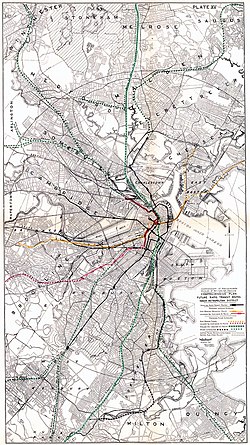
The Boston Elevated Railway (BERy) opened Lechmere station in 1922 as a terminal for streetcar service in the Tremont Street subway. [24] That year, with the downtown subway network and several radial lines in service, the BERy indicated plans to build three additional radial subways: one paralleling the Midland Branch through Dorchester, a second branching from the Boylston Street subway to run under Huntington Avenue, and a third extending from Lechmere Square northwest through Somerville. [25] The Report on Improved Transportation Facilities, published by the Boston Division of Metropolitan Planning in 1926, proposed extension from Lechmere to North Cambridge and beyond via the Southern Division and the 1870-built cutoff. [26] [27] Winter Hill was to be the site of an intermediate station in this and subsequent plans. [28] [29]

In 1945, a preliminary report from the state Coolidge Commission recommended nine suburban rapid transit extensions – most similar to the 1926 plan – along existing railroad lines. These included an extension from Lechmere to Woburn over the Southern Division, again with Winter Hill as an intermediate stop. [30] :16 [31] [32] The 1962 North Terminal Area Study recommended that the elevated Lechmere–North Station segment be abandoned. The Main Line (now the Orange Line) was to be relocated along the B&M Western Route; it would have a branch following the Southern Division to Arlington or Woburn. [33]

The Massachusetts Bay Transportation Authority (MBTA) was formed in 1964 as an expansion of the Metropolitan Transit Authority to subsidize suburban commuter rail service, as well as to construct rapid transit extensions to replace some commuter rail lines. [10] :15 In 1965, as part of systemwide rebranding, the Tremont Street subway and its connecting lines became the Green Line. [34] The 1966 Program for Mass Transportation, the MBTA's first long-range plan, listed a short extension from Lechmere to Washington Street as an immediate priority, with a second phase reaching to Mystic Valley Parkway (Route 16) or West Medford. [35] [26]

The 1972 final report of the Boston Transportation Planning Review listed a Green Line extension from Lechmere to Ball Square as a lower priority, as did several subsequent planning documents. [26] [36] In 1980, the MBTA began a study of the "Green Line Northwest Corridor" (from Haymarket to Medford), with extension past Lechmere one of its three topic areas. Extensions to Tufts University or Union Square were considered. [37] :308 [38]

Station planning

A 1991 agreement between the state and the Conservation Law Foundation, which settled a lawsuit over auto emissions from the Big Dig, committed to the construction of a "Green Line Extension To Ball Square/Tufts University". [39] No progress was made until an updated agreement was signed in 2005. [40] The Beyond Lechmere Northwest Corridor Study, a Major Investment Study/alternatives analysis, was published in 2005. The analysis studied a variety of light rail, bus rapid transit, and commuter rail extensions, all of which included a Gilman Square station at the former Winter Hill station site. The highest-rated alternatives all included an extension to West Medford with Gilman Square as one of the intermediate stations. [41]

The Massachusetts Executive Office of Transportation and Public Works submitted an Expanded Environmental Notification Form (EENF) to the Massachusetts Executive Office of Environmental Affairs in October 2006. The EENF identified a Green Line extension with Medford and Union Square branches as the preferred alternative. [42] That December, the Secretary of Environmental Affairs issued a certificate that required analysis of Lowell Line stations at Tufts University and Gilman Square in the draft environmental impact report (DEIR) for the Green Line Extension (GLX). [43] Plans shown in early 2008 called for a Green Line platform between School Street and Medford Street, with no commuter rail platform. [44]

Planned station sites were announced in May 2008. Unlike the other four stations on the Medford Branch, only one site – between School Street and Medford Street – was considered for Gilman Square station. [45] [46] [47] The DEIR, released in October 2009, did not recommend the construction of a commuter rail platform at Gilman Square or Tufts University. The width of a platform and a gauntlet track for freight would require additional right-of-way width, which would have substantial impacts on adjacent properties. [48] Preliminary plans in the DEIR called for the main station entrance to be on Medford Street at Gilman Square near Pearl Street, with an additional entrance from the Community Path on the south side. (The Community Path was to be at track level under the bridges, but would rise to street level between them for station access.) An emergency exit would connect to the School Street bridge. [1] :47 [49]

Updated plans shown in May 2011 removed the direct entrance from the Community Path, replacing it with a footbridge from the path to the entrance plaza, and added a kiss and ride loop next to the headhouse. [50] Plans presented in February 2012 added a second level to the headhouse, with the footbridge replaced by a direct entrance from the Community Path. The bike cage was relocated to the southwest side of the tracks, and a traction power substation was added near School Street. [51] [52] A further update in June 2013, with design 60% complete, reduced the size of the Medford Street headhouse and enlarged the Community Path entrance. The substation was moved below ground level. [53] [54] Design was then paused while Phase 2/2A stations (Lechmere, Union Square, and East Somerville) were prioritized, as they were scheduled to open sooner than the rest of the GLX. Design resumed in fall 2014 and reached 90% by June 2015. [55]

By 2012, the portion of the Medford Branch from Gilman Square station to College Avenue was expected to be completed by June 2019. [56] A Gilman Square commuter rail station to supplement the Green Line station was again listed as a possibility in 2012 as an interim air quality mitigation measure in response to delays in building the Green Line Extension. However, such a station would have been costly to build and could not have been completed by the 2015 deadline, and was thus not supported by MassDOT. [57]

Redesign

In August 2015, the MBTA disclosed that project costs had increased substantially, triggered a wholesale re-evaluation of the GLX project. [58] In December 2015, the MBTA ended its contracts with four firms. Construction work in progress continued, but no new contracts were awarded. [59] At that time, cancellation of the project was considered possible, as were elimination of the Union Square Branch and other cost reduction measures. [60] [61] In May 2016, the MassDOT and MBTA boards approved a modified project that had undergone value engineering to reduce its cost. Stations were simplified to resemble D branch surface stations rather than full rapid transit stations, with canopies, faregates, escalators, and some elevators removed. Gilman Square station, previously planned to have two elevators, was reduced to one. [62] [63]

In December 2016, the MBTA announced a new planned opening date of 2021 for the extension. [64] A design-build contract for the GLX was awarded in November 2017. [65] The winning proposal included six additive options – elements removed during value engineering – including full-length canopies at all stations and a second elevator at Gilman Square. [66] [67] [68] Station design advanced from 30% in March 2018 to 80% that December and to 100% in October 2019. [69] [2]

Construction

Demolition of the Homans Building

Both road bridges adjacent to the station site were rebuilt in the decades prior to the GLX: the 1910-built Medford Street bridge was reconstructed in 1983, [70] [71] [72] and the circa-1900 School Street bridge in 2001. [73] [74] [75] However, the bridges required further modification to accommodate the GLX. The Medford Street bridge was reduced to one sidewalk and a single vehicle lane from February 24, 2015, to September 6, 2016, for construction of a temporary utility bridge; the School Street bridge was similarly partially closed from April 8 to late August 2015. [55] [76] [77] [78]

Both bridges were subsequently modified to add an additional span behind the existing south abutment to provide space for the southbound Green Line track. [3] :8.4-1 The Medford Street bridge closed for renovations on May 17, 2019, with MBTA bus route 80 detoured, followed by the School Street bridge in April 2020. [79] [80] (Original plans called for sequential closures, but delays forced the closures to overlap. [81] ) Steel was placed for the new School Street span on February 25, 2021, followed by Medford Street on March 18. [82] A temporary footbridge was in place next to the School Street bridge until May 8, 2021; the main bridge reopened for pedestrians and bikes on August 24. [83] [84]

Station construction in July 2021 Gilman Square station under construction, July 2021.JPG
Station construction in July 2021
The station as seen from the School Street bridge in March 2024; the tracks of the MBTA Commuter Rail's Lowell Line can be seen to the left. Gilman Square MBTA Green Line Station, March 2024.jpg
The station as seen from the School Street bridge in March 2024; the tracks of the MBTA Commuter Rail's Lowell Line can be seen to the left.

The "structurally compromised" Homans Building, a former food distribution facility on the north side of the station site, was demolished to make room for the traction power substation and construction access. A concrete carving of a lion's head – the logo of grocery merchandiser Monarch Foods, for whom the art deco building was constructed in 1929 – was selected for preservation and display near the new station. In September 2018, a silicone cast of the sculpture was made; it was then carefully removed from the building and stored. [85] [86] Demolition began on March 18, 2019, and was completed on April 6. [87] [88]

Work on the substation and a retaining wall for the station was underway by February 2020. [89] Construction on the station itself began in June 2020; by August, the platform foundation and south headhouse were underway. [90] [91] The concrete platform was poured in November and December 2020. [92] [93] [94] The east elevator shaft was erected on March 30, 2021, by which time the platform canopy was under construction, followed by the west elevator shaft on June 19. [82] [95]

Original plans called for the D Branch to be extended to Medford/Tufts. [96] [97] However, in April 2021, the MBTA indicated that the Medford Branch would instead be served by the E Branch. [98] By March 2021, the station was expected to open in December 2021. [99] In June 2021, the MBTA indicated an additional delay, under which the station was expected to open in May 2022. [100] In February 2022, the MBTA announced that the Medford Branch would open in "late summer". [101] Train testing on the Medford Branch began in May 2022. [102] The Medford Street bridge reopened on July 1, 2022, followed by the School Street bridge on December 8. [103] [104] In August 2022, the planned station opening was delayed to November 2022. [105] The Medford Branch, including Gilman Square station, opened on December 12, 2022. [106]

Related Research Articles

<span class="mw-page-title-main">Green Line (MBTA)</span> Light rail system

The Green Line is a semi-metro system run by the Massachusetts Bay Transportation Authority (MBTA) in the Boston, Massachusetts, metropolitan area. It is the oldest MBTA subway line, and with tunnel sections dating from 1897, the oldest subway in North America. It runs underground through downtown Boston, and on the surface into inner suburbs via six branches on radial boulevards and grade-separated alignments. With an average daily weekday ridership of 137,700 in 2019, it is the third most heavily used light rail system in the country. The line was assigned the green color in 1967 during a systemwide rebranding because several branches pass through sections of the Emerald Necklace of Boston.

<span class="mw-page-title-main">Porter station</span> Transit station in Cambridge, Massachusetts, US

Porter station is a Massachusetts Bay Transportation Authority (MBTA) transit station in Cambridge, Massachusetts. It serves the Red Line rapid transit line, the MBTA Commuter Rail Fitchburg Line, and several MBTA bus lines. Located at Porter Square at the intersection of Massachusetts and Somerville Avenues, the station provides rapid transit access to northern Cambridge and the western portions of Somerville. Porter is 14 minutes from Park Street on the Red Line, and about 10 minutes from North Station on commuter rail trains. Several local MBTA bus routes also stop at the station.

<span class="mw-page-title-main">Davis station (MBTA)</span> Rapid transit station in Somerville, Massachusetts, US

Davis station is an underground Massachusetts Bay Transportation Authority (MBTA) Red Line rapid transit station located at Davis Square in Somerville, Massachusetts. The accessible station has a single island platform for the Red Line, as well as a dedicated busway on the surface. It opened in 1984 as part of the Red Line Northwest Extension project.

<span class="mw-page-title-main">Somerville Community Path</span> Rail trail in Somerville, Massachusetts

The Somerville Community Path is a paved rail trail in Somerville, Massachusetts, running 3.2 miles (5.1 km) from Massachusetts Avenue to East Cambridge via Davis Square. The first portion opened in 1985 along part of the former Fitchburg Cutoff rail line. Extensions opened in 1994 and 2015. A further 1.9-mile (3.1 km) extension to East Cambridge opened in June 2023 as part of the Green Line Extension project. It is a section of the partially completed Mass Central Rail Trail.

<span class="mw-page-title-main">Science Park station (MBTA)</span> Light rail station in Boston, Massachusetts, US

Science Park station is an elevated light rail station on the Massachusetts Bay Transportation Authority (MBTA) Green Line in Boston, Massachusetts, United States. The station is located at the Boston end of the Charles River Dam Bridge at Leverett Circle. It is at the southeast end of the Lechmere Viaduct, which carries the Green Line over the Charles River. The station is named for the nearby Boston Museum of Science. With 873 daily boardings by a FY 2019 count, Science Park is the least-used fare-controlled station on the Green Line, and the second-lowest on the MBTA subway system after Suffolk Downs.

<span class="mw-page-title-main">Lechmere station</span> Light rail station in Cambridge, Massachusetts, US

Lechmere station is a Massachusetts Bay Transportation Authority (MBTA) Green Line light rail station in Lechmere Square in East Cambridge, Massachusetts. It is located on the east side of Monsignor O'Brien Highway near First Street, adjacent to the NorthPoint development. The accessible elevated station has a single island platform, with headhouses at both ends. It opened on March 21, 2022, as part of the Green Line Extension (GLX). Lechmere station is served by Green Line D branch and E branch service.

<span class="mw-page-title-main">Green Line E branch</span> Light rail line

The E branch is a light rail line in Boston, Cambridge, Medford, and Somerville, Massachusetts, operating as part of the Massachusetts Bay Transportation Authority (MBTA) Green Line. The line runs in mixed traffic on South Huntington Avenue and Huntington Avenue between Heath Street and Brigham Circle, in the median of Huntington Avenue to Northeastern University, then into the Huntington Avenue subway. The line merges into the Boylston Street subway just west of Copley, running to North Station via the Tremont Street subway. It then follows the Lechmere Viaduct to Lechmere, then the Medford Branch to Medford/​Tufts. As of February 2023, service operates on eight-minute headways at weekday peak hours and eight to nine-minute headways at other times, using 13 to 17 trains.

<span class="mw-page-title-main">Green Line B branch</span> Light rail line in Boston, Massachusetts

The B branch, also called the Commonwealth Avenue branch or Boston College branch, is a branch of the MBTA Green Line light rail system which operates on Commonwealth Avenue west of downtown Boston, Massachusetts. One of four branches of the Green Line, the B branch runs from Boston College station down the median of Commonwealth Avenue to Blandford Street. There, it enters Blandford Street portal into Kenmore station, where it merges with the C and D branches. The combined services run into the Boylston Street subway and Tremont Street subway to downtown Boston. B branch service has terminated at Government Center since October 2021. Unlike the other branches, the B branch runs solely through the city limits of Boston. The Green Line Rivalry between Boston College and Boston University is named in reference to the B branch, which runs to both universities.

<span class="mw-page-title-main">Green Line D branch</span> Light rail line

The Green Line D branch is a light rail line in Boston, Brookline, Cambridge, Newton, and Somerville, Massachusetts, operating as part of the Massachusetts Bay Transportation Authority (MBTA) Green Line. The line runs on a grade separated surface right-of-way for 9 miles (14 km) from Riverside station to Fenway station. The line merges into the C branch tunnel west of Kenmore, then follows the Boylston Street subway and Tremont Street subway to North Station. It is the longest and busiest of the four Green Line branches. As of February 2023, service operates on 8 to 9-minute headways at weekday peak hours and 8 to 11-minute headways at other times, using 13 to 19 trains.

The Urban Ring was a proposed project of the Massachusetts Bay Transportation Authority and the Massachusetts Department of Transportation, to develop new public transportation routes that would provide improved circumferential connections among many existing transit lines that project radially from downtown Boston. The Urban Ring Corridor is located roughly one to two miles from downtown Boston, passing through the Massachusetts cities of Boston, Chelsea, Everett, Medford, Somerville, Cambridge, and Brookline. The project was expected to convert 41,500 car trips to transit trips daily.

<span class="mw-page-title-main">MBTA subway</span> Boston region transit service

The Massachusetts Bay Transportation Authority (MBTA) operates rapid transit, light rail, and bus rapid transit services in the Boston metropolitan area, collectively referred to as the rapid transit, subway, or the T system.

<span class="mw-page-title-main">Lechmere Viaduct</span> Bridge over the Charles River in Boston

The Lechmere Viaduct is a concrete arch bridge connecting the West End neighborhood of Boston to East Cambridge, Massachusetts. Opened in 1912, the viaduct carries the MBTA's Green Line over the Charles River. It is adjacent to the Charles River Dam Bridge, but structurally separate.

<span class="mw-page-title-main">Green Line Extension</span> Light rail system in greater Boston, US

The Green Line Extension (GLX) was a construction project to extend the Massachusetts Bay Transportation Authority (MBTA) Green Line light rail system northwest into Somerville and Medford, two inner suburbs of Boston, Massachusetts. The project opened in two phases in 2022 at a total cost of $2.28 billion. Total ridership on the 4.3-mile (6.9 km) extension is estimated to reach 45,000 one-way trips per day in 2030.

<span class="mw-page-title-main">Medford/Tufts station</span> Light rail station in Medford, Massachusetts, US

Medford/Tufts station is a light rail station on the Massachusetts Bay Transportation Authority (MBTA) Green Line located off Boston Avenue near College Avenue in Medford, Massachusetts, adjacent to Tufts University. The accessible station has a single island platform serving the two tracks of the Medford Branch. It opened on December 12, 2022, as part of the Green Line Extension (GLX), which added two northern branches to the Green Line, and is the northern terminus of the E branch.

<span class="mw-page-title-main">Ball Square station</span> Light rail station in Massachusetts, US

Ball Square station is a light rail station on the Massachusetts Bay Transportation Authority (MBTA) Green Line located at Ball Square in Somerville and Medford, Massachusetts. The accessible station has a single island platform serving the two tracks of the Medford Branch. It opened on December 12, 2022, as part of the Green Line Extension (GLX), which added two northern branches to the Green Line, and is served by the E branch.

<span class="mw-page-title-main">Magoun Square station</span> Light rail station in Somerville, Massachusetts, US

Magoun Square station is a light rail station on the Massachusetts Bay Transportation Authority (MBTA) Green Line located at Lowell Street south of Magoun Square in Somerville, Massachusetts. The accessible station has a single island platform serving the two tracks of the Medford Branch. It opened on December 12, 2022, as part of the Green Line Extension (GLX), which added two northern branches to the Green Line, and is served by the E branch.

<span class="mw-page-title-main">East Somerville station</span> Light rail station in Somerville, Massachusetts, US

East Somerville station is a light rail station on the Massachusetts Bay Transportation Authority (MBTA) Green Line located in southeastern Somerville, Massachusetts. The accessible station has a single island platform serving the two tracks of the Medford Branch. It opened on December 12, 2022, as part of the Green Line Extension (GLX), which added two northern branches to the Green Line, and is served by the E branch.

<span class="mw-page-title-main">Union Square station (Somerville)</span> Light rail station in Somerville, Massachusetts, US

Union Square station is a light rail station on the Massachusetts Bay Transportation Authority (MBTA) Green Line located in the Union Square neighborhood of southeastern Somerville, Massachusetts. The accessible terminal station has a single island platform serving the two tracks of the Union Square Branch, which parallels the Fitchburg Line. It opened on March 21, 2022, as part of the Green Line Extension (GLX), which added two northern branches to the Green Line.

The Massachusetts Bay Transportation Authority operates subway, bus, commuter rail, and ferry service in the Greater Boston region. Boston has some of the highest rates of non-motorized commuting in the United States, including high bicycle usage. The MBTA offers certain provisions for riders wishing to make part of their trips by bicycle. The agency allows bicycles to be carried on all fixed-route services except the Green Line and the Ashmont-Mattapan High Speed Line light rail lines, although they are restricted on the commuter rail and heavy rail subway services at peak hours. Bicycle storage areas are offered at many stations, with "Pedal and Park" locking bicycle cages at certain high-usage stations.

<span class="mw-page-title-main">North Station (subway)</span> Rapid transit station in Boston, Massachusetts, US

North Station is an underground MBTA subway station in Boston, Massachusetts. Served by the Massachusetts Bay Transportation Authority (MBTA) Green Line and Orange Line, it is connected to the North Station surface terminal used by MBTA Commuter Rail and Amtrak. The station is fully accessible.

References

  1. 1 2 "Chapter 3: Alternatives" (PDF). Green Line Extension Project Draft Environmental Impact Report / Environmental Assessment and Section 4(f) Statement. Massachusetts Executive Office of Transportation and Public Works; Federal Transit Administration. October 2009. Archived from the original (PDF) on July 5, 2016.
  2. 1 2 3 4 "Public meeting boards". Massachusetts Bay Transportation Authority. November 19, 2019. pp. 15–18.
  3. 1 2 "Execution Version: Volume 2: Technical Provisions" (PDF). MBTA Contract No. E22CN07: Green Line Extension Design Build Project. Massachusetts Bay Transportation Authority. December 11, 2017.
  4. Annual Report of the Selectmen of the Town of Somerville. Town of Somerville. 1856. p. 5.
  5. Draper, Martin Jr. (1852). "Map of Somerville, Mass". J.T. Powers & Co.
  6. "New Depot in Somerville". Boston Evening Transcript. January 3, 1863. p. 2 via Newspapers.com.
  7. Knight, Ellen (2021). "The Evolution of Winchester's Four Railroad Depots". Town of Winchester.
  8. "Plate H". Atlas of the city of Somerville, Massachusetts : from actual surveys and official records. G.M. Hopkins & Co. 1874. pp. 30–31 via Norman B. Leventhal Map Center.
  9. 1 2 3 4 Somerville Bicycle Committee and Somerville Historic Preservation Commission (May 31, 2008). "Rails of the Past Guiding the Green Line of the Future" (PDF). City of Somerville. Archived from the original (PDF) on December 15, 2013.
  10. 1 2 Humphrey, Thomas J.; Clark, Norton D. (1985). Boston's Commuter Rail: The First 150 Years. Boston Street Railway Association. p. 55. ISBN   9780685412947.
  11. 1 2 Karr, Ronald Dale (2017). The Rail Lines of Southern New England (2 ed.). Branch Line Press. p. 278. ISBN   9780942147124.
  12. Sammarco, Anthony Mitchell (2003). Somerville (Images of America: Massachusetts). Arcadia Publishing. p. 45. ISBN   0738512907.
  13. 1 2 Samuels, Edward Augustus; Kimball, Henry Hatsings (1897). Somerville, past and present : an illustrated historical souvenir commemorative of the twenty-fifth anniversary of the establishment of the city government of Somerville, Massachusetts. Samuels and Kimball. pp. 464–468, 543 via Internet Archive.
  14. "Somerville". Boston Globe. November 4, 1886. p. 6 via Newspapers.com.
  15. 1 2 "Somerville and New England History Collection: In the Spotlight". Somerville Public Library. February 2009. Archived from the original on March 21, 2009.
  16. "Cars Telescoped". Boston Globe. February 3, 1898. pp. 1, 7 via Newspapers.com.
  17. 1 2 "Somerville". Boston Globe. July 28, 1934. p. 4 via Newspapers.com. Open Access logo PLoS transparent.svg
  18. 1 2 "Winter Hill station being razed - once pride of the B. & M." Boston Globe. August 4, 1934. p. 10 via Newspapers.com. Open Access logo PLoS transparent.svg
  19. "Five B. & M. Stations Will Be Abandoned". Boston Daily Globe. March 16, 1927 via Newspapers.com. (second page) Open Access logo PLoS transparent.svg
  20. "Lexington Branch back on Fitchburg". Boston Daily Globe. April 25, 1927. p. 13 via Newspapers.com. Open Access logo PLoS transparent.svg
  21. "How would you like to live in a railroad station". Boston Globe. July 15, 1933. p. 3 via Newspapers.com. Open Access logo PLoS transparent.svg
  22. "B. & M. Would End Winter Hill Service". Boston Globe. February 13, 1937. p. 20 via Newspapers.com.
  23. Massachusetts Executive Office of Transportation and Construction (April 22, 1976). Capital needs developed at the corridor level: core and west (Report). Massachusetts Executive Office of Transportation and Construction. pp. 101–103.
  24. "New Lechmere Sq Transfer Station, Open for L Traffic". Boston Globe. July 10, 1922. p. 9 via Newspapers.com.
  25. "Three New Subways Planned". Boston Globe. June 25, 1922. p. 71 via Newspapers.com.
  26. 1 2 3 Central Transportation Planning Staff (November 15, 1993). "The Transportation Plan for the Boston Region - Volume 2". National Transportation Library. Archived from the original on May 5, 2001.
  27. Report on Improved Transportation Facilities in Boston. Division of Metropolitan Planning. December 1926. pp. 6, 7, 34, 35. hdl:2027/mdp.39015049422689.
  28. "Planning Division Asks Extension of Boylston-St Subway Under Governor Sq". Boston Globe. February 12, 1925. p. 28 via Newspapers.com.
  29. "Proposes $50,000,000 Grant for Rapid Transit Development". Boston Globe. January 23, 1929. p. 24 via Newspapers.com.
  30. Clarke, Bradley H. (2003). Streetcar Lines of the Hub - The 1940s. Boston Street Railway Association. ISBN   0938315056.
  31. Boston Elevated Railway; Massachusetts Department of Public Utilities (April 1945), Air View: Present Rapid Transit System – Boston Elevated Railway and Proposed Extensions of Rapid Transit into Suburban Boston via Wikimedia Commons
  32. Lyons, Louis M. (April 29, 1945). "El on Railroad Lines Unified Transit Plan". Boston Globe. pp. 1, 14 via Newspapers.com.
  33. Barton-Aschman Associates (August 1962). North Terminal Area Study. pp. iv, 51, 59–61 via Internet Archive.
  34. Belcher, Jonathan. "Changes to Transit Service in the MBTA district" (PDF). Boston Street Railway Association.
  35. A Comprehensive Development Program for Public Transportation in the Massachusetts Bay Area. Massachusetts Bay Transportation Authority. 1966. pp. V-20–V-23 via Internet Archive.
  36. Boston Transportation Planning Review Final Study Summary Report. Massachusetts Executive Office of Transportation and Construction. February 1973. pp. 15, 17 via Internet Archive.
  37. McCarthy, James D. "Boston's Light Rail Transit Prepares for the Next Hundred Years" (PDF). Special Report 221: Light Rail Transit: New System Successes at Affordable Prices. Transportation Research Board: 286–308. ISSN   0360-859X.
  38. "Beyond Lechmere Northwest Corridor Project Project History" (PDF). Somerville Transportation Equity Partnership. June 3, 2004.
  39. United States Environmental Protection Agency (October 4, 1994). "Approval and Promulgation of Air Quality Implementation Plans; Massachusetts—Amendment to Massachusetts' SIP (for Ozone and for Carbon Monoxide) for Transit Systems Improvements and High Occupancy Vehicle Facilities in the Metropolitan Boston Air Pollution Control District)". Federal Register. 59 FR 50498.
  40. Daniel, Mac (May 19, 2005). "$770m transit plans announced". Boston Globe. pp. B1, B4 via Newspapers.com.
  41. Vanasse Hangen Brustlin, Inc (August 2005). "Chapter 4: Identification and Evaluation of Alternatives – Tier 1" (PDF). Beyond Lechmere Northwest Corridor Study: Major Investment Study/Alternatives Analysis. Massachusetts Bay Transportation Authority. Archived from the original (PDF) on July 5, 2016.
  42. TranSystems (October 2006). "Green Line Extension Expanded Environmental Notification Form" (PDF). Massachusetts Executive Office of Transportation and Public Works. pp. 4–6. Archived from the original (PDF) on July 5, 2016.
  43. Golledge, Robert W. Jr. (December 1, 2006). "Certificate of the Secretary of Environmental Affairs on the Expanded Environmental Notification Form" (PDF). Massachusetts Executive Office of Environmental Affairs. Archived from the original (PDF) on July 5, 2016.
  44. "Station Workshop – Summary Minutes" (PDF). Massachusetts Executive Office of Transportation and Public Works. January 28, 2008. Archived from the original (PDF) on July 5, 2016.
  45. Ryan, Andrew (May 7, 2008). "Potential Green Line stops announced in Somerville, Medford". The Boston Globe . Archived from the original on May 10, 2008.
  46. Vanasse Hangen Brustlin, Inc (May 1, 2008). "Green Line Extension Project" (PDF). Massachusetts Executive Office of Transportation and Public Works. Archived from the original (PDF) on July 5, 2016.
  47. Vanasse Hangen Brustlin, Inc (May 2, 2008). "Green Line Extension Project: Summary of Station Evaluations/Site Selections" (PDF). Massachusetts Executive Office of Transportation and Public Works. Archived from the original (PDF) on July 5, 2016.
  48. "Appendix B: Station and Alignment Selection Analysis" (PDF). Green Line Extension Project Draft Environmental Impact Report / Environmental Assessment and Section 4(f) Statement. Massachusetts Executive Office of Transportation and Public Works; Federal Transit Administration. October 2009. pp. 16, 25–27. Archived from the original (PDF) on July 5, 2016.
  49. "Chapter 3: Alternatives" (PDF). Green Line Extension Project Draft Environmental Impact Report / Environmental Assessment and Section 4(f) Statement. Massachusetts Executive Office of Transportation and Public Works; Federal Transit Administration. October 2009. Archived from the original (PDF) on July 5, 2016. Figures 3.7-10, 3.7-11, 3.7-12, and 3.7-13.
  50. "Site Boards" (PDF). Massachusetts Department of Transportation. May 2011. Archived from the original (PDF) on July 5, 2016.
  51. "'Station Design Meeting': Gilman Square and Lowell Street Stations" (PDF). Massachusetts Department of Transportation. March 7, 2012. Archived from the original (PDF) on July 5, 2016.
  52. "Gilman Square and Lowell Street Station Design Meeting" (PDF). Massachusetts Department of Transportation. March 7, 2012. Archived from the original (PDF) on July 5, 2016.
  53. "Gilman Square and Lowell Street Station Design Meeting" (PDF). Massachusetts Department of Transportation. June 4, 2013. pp. 20–31. Archived from the original (PDF) on July 5, 2016.
  54. "Public Meeting – Summary Minutes" (PDF). Massachusetts Department of Transportation. June 4, 2013. p. 2. Archived from the original (PDF) on July 5, 2016.
  55. 1 2 "Gilman Square & Lowell Street Stations" (PDF). Massachusetts Department of Transportation. June 16, 2015. Archived from the original (PDF) on July 5, 2016.
  56. "Green Line Extension Project: Fall 2012 Fact Sheet" (PDF). Massachusetts Department of Transportation. November 5, 2012. Archived from the original (PDF) on June 7, 2016. Retrieved February 9, 2018.
  57. Central Transportation Planning Staff (January 23, 2012). "Green Line Extension SIP Mitigation Inventory" (PDF). Massachusetts Department of Transportation. Archived from the original (PDF) on October 30, 2014.
  58. Metzger, Andy (August 24, 2015). "Ballooning Cost Throws Future Of Green Line Extension Into Question". WBUR.
  59. Conway, Abby Elizabeth (December 10, 2015). "MBTA Ending Several Contracts Associated With Green Line Extension Project". WBUR.
  60. Conway, Abby Elizabeth (December 9, 2015). "Axing Green Line Extension Still On The Table, Pollack Says". WBUR.
  61. Arup (December 9, 2015). "Cost Reduction Opportunities" (PDF). Massachusetts Bay Transportation Agency.
  62. Interim Project Management Team Report: Green Line Extension Project (PDF). MBTA Fiscal and Management Control Board and the MassDOT Board of Directors. May 9, 2016. pp. 5, 6, 45.
  63. Dungca, Nicole (May 10, 2016). "State OK's a cut-down Green Line extension". Boston Globe. pp. A1, A9 via Newspapers.com.
  64. Dungca, Nicole (December 7, 2016). "New Green Line stations are delayed until 2021". Boston Globe. Archived from the original on December 9, 2016.
  65. Vaccaro, Adam (November 20, 2017). "Green Line extension contract officially approved". Boston Globe. Archived from the original on January 24, 2018.
  66. Jessen, Klark (November 17, 2017). "Green Line Extension Project Design-Build Team Firm Selected" (Press release). Massachusetts Department of Transportation. Archived from the original on January 28, 2022.
  67. "GLX Program Update" (PDF). Massachusetts Bay Transportation Authority. November 20, 2017.
  68. Response to the Request for Proposal for the Green Line Extension Design Build Project (PDF). GLX Constructors. September 2017. (Volume 2)
  69. "GLX Project Open House". Massachusetts Department of Transportation. January 30, 2019. p. 14.
  70. Janigian, Warren C. (April 11, 1980). "Medford Street Bridge over B and M Railroad". Historic Bridge Inventory and Evaluation via Massachusetts Cultural Resource Information System.
  71. "Traffic Watch". Boston Globe. August 22, 1983. p. 40 via Newspapers.com.
  72. "Commonwealth of Massachusetts Department of Public Works: Proposals". Boston Globe. July 30, 1983. p. 41 via Newspapers.com.
  73. Janigian, Warren C. (January 22, 1982). "School Street Bridge over B and M Railroad". Historic Bridge Inventory and Evaluation via Massachusetts Cultural Resource Information System.
  74. "Somerville Notes". Boston Globe. April 15, 2001. p. 187 via Newspapers.com.
  75. Palmer, Thomas C. Jr. (December 23, 2001). "Officials mull compromise on Cambridge truck limits". Boston Globe. p. 32 via Newspapers.com.
  76. "School St. Bridge Sidewalk & Street Closure". Massachusetts Department of Transportation. August 2015. Archived from the original on October 8, 2015.
  77. "Medford St. Bridge Sidewalk & Street Closure". Massachusetts Department of Transportation. 2015. Archived from the original on June 7, 2016.
  78. Newman, Alex (September 6, 2016). "Somerville's Medford Street Bridge Reopens". Somerville Patch. Archived from the original on October 27, 2016.
  79. "Green Line Extension: Medford Street Bridge to Close Friday, May 17, through Spring 2020" (Press release). Massachusetts Department of Transportation. April 22, 2019.
  80. "GLX Community Working Group Monthly Meeting". Massachusetts Bay Transportation Authority. May 5, 2020. p. 18.
  81. "GLX Announces New Schedule for Bridge Closures; Somerville Seeks Resources for Public Safety, Local Businesses" (Press release). City of Somerville. January 27, 2020.
  82. 1 2 "GLX Community Working Group Monthly Meeting #41". Massachusetts Bay Transportation Authority. April 6, 2021. pp. 13–15.
  83. "GLX Community Working Group: Monthly Meeting #43". Massachusetts Bay Transportation Authority. June 1, 2021. pp. 24, 26.
  84. "GLX Community Working Group: Monthly Meeting #46". Massachusetts Bay Transportation Authority. September 7, 2021. p. 29.
  85. Buell, Spencer (September 20, 2018). "As the Green Line Extension Rolls Through Somerville, a Lion's Head Will Live On". Boston Magazine. Retrieved May 4, 2022.
  86. "GLX Community Working Group Monthly Meeting". Massachusetts Bay Transportation Authority. October 2, 2018. pp. 21, 22.
  87. "GLX Community Working Group: Monthly Meeting". Massachusetts Bay Transportation Authority. April 2, 2019. p. 17.
  88. "GLX Community Working Group: Monthly Meeting". Massachusetts Bay Transportation Authority. May 7, 2019. p. 15.
  89. "GLX Community Working Group: Monthly Meeting". Massachusetts Bay Transportation Authority. February 4, 2020. p. 28.
  90. "GLX Community Working Group Monthly Meeting". Massachusetts Bay Transportation Authority. June 2, 2020. p. 28.
  91. "GLX Community Working Group Monthly Meeting: August 4, 2020". Massachusetts Bay Transportation Authority. August 4, 2020. p. 8.
  92. "GLX Community Working Group: Monthly Meeting #36". Massachusetts Bay Transportation Authority. November 3, 2020. p. 18.
  93. "GLX Community Working Group: Monthly Meeting #36". Massachusetts Bay Transportation Authority. December 1, 2020. p. 29.
  94. "Community Working Group (CWG) Meeting Minutes". Massachusetts Bay Transportation Authority. January 5, 2021. p. 3.
  95. "Gilman Square Station Elevator Shaft Set in Place. 06-19-2021". GLX Constructors. June 19, 2021 via Flickr.
  96. "MBTA Light Rail Transit System OPERATIONS AND MAINTENANCE PLAN" (PDF). Massachusetts Bay Transportation Authority. January 6, 2011. Archived from the original (PDF) on March 7, 2017.
  97. "Travel Forecasts: Systemwide Stats and SUMMIT Results" (PDF). Green Line Extension Project: FY 2012 New Starts Submittal. Massachusetts Department of Transportation. January 2012. Archived from the original (PDF) on March 7, 2017.
  98. DeCosta-Klipa, Nik (April 9, 2021). "The MBTA is planning to open part of the Green Line Extension this October". Boston Globe. Retrieved April 9, 2021.
  99. "Report from the General Manager" (PDF). Massachusetts Bay Transportation Authority. March 29, 2021. p. 20.
  100. Dalton, John (June 21, 2021). "Green Line Extension Update" (PDF). Massachusetts Bay Transportation Authority. p. 19.
  101. Lisinski, Chris (February 24, 2022). "Green Line Extension service to begin March 21". WBUR. Retrieved February 25, 2022.
  102. "Train Testing Begins on New Green Line Medford Branch" (Press release). Massachusetts Bay Transportation Authority. July 5, 2022.
  103. "The Timing and Schedule of GLX Bridge Work". Massachusetts Department of Transportation. November 1, 2022.
  104. "School Street Bridge Reopens Saturday, December 10" (Press release). City of Somerville. December 8, 2022.
  105. "Building A Better T: GLX Medford Branch to Open in Late November 2022; Shuttle Buses to Replace Green Line Service for Four Weeks between Government Center and Union Square beginning August 22" (Press release). Massachusetts Bay Transportation Authority. August 5, 2022.
  106. "MBTA Celebrates Opening of the Green Line Extension Medford Branch" (Press release). Massachusetts Bay Transportation Authority. December 12, 2022.

Commons-logo.svg Media related to Gilman Square station at Wikimedia Commons