Groveville, New Jersey

Last updated

Groveville, New Jersey
Groveville, NJ.jpg
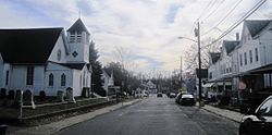
Along Church Street (CR 609)
Mercer County New Jersey incorporated and unincorporated areas Groveville highlighted.svg
Location in Mercer County and the state of New Jersey
Location map of Mercer County, New Jersey.svg
Red pog.svg
Groveville
Location in Mercer County
USA New Jersey relief location map.svg
Red pog.svg
Groveville
Location in New Jersey
Usa edcp relief location map.png
Red pog.svg
Groveville
Location in the United States
Coordinates: 40°10′12″N74°39′05″W / 40.170048°N 74.651278°W / 40.170048; -74.651278
Country Flag of the United States.svg  United States
State Flag of New Jersey.svg  New Jersey
County Mercer
Township Hamilton
Area
[1]
  Total2.25 sq mi (5.83 km2)
  Land2.21 sq mi (5.73 km2)
  Water0.04 sq mi (0.10 km2)  1.71%
Elevation
[2]
49 ft (15 m)
Population
 (2020) [3]
  Total3,106
  Density1,404.16/sq mi (542.24/km2)
Time zone UTC−05:00 (Eastern (EST))
  Summer (DST) UTC−04:00 (Eastern (EDT))
ZIP Code
08620 - Trenton [4]
FIPS code 34-28620 [5] [6] [7]
GNIS feature ID02583996 [5] [8]

Groveville is an unincorporated community and census-designated place (CDP) [9] located within Hamilton Township, in Mercer County, in the U.S. state of New Jersey. [10] As of the 2020 census, the CDP's population was 3,106. [1] Before the 2010 Census, the area was part of the Yardville-Groveville CDP. [11]

Contents

Geography

Groveville is in southern Mercer County, bordered to the south by Crosswicks Creek, which forms the Burlington County line. The hamlet of Groveville is in the western part of the CDP, centered on the junction of Main Street and Church Street, while North Crosswicks is in the southeastern part of the CDP, at the intersection of South Broad Street and a separate Church Street. Groveville is bordered to the north by the community of Yardville. The New Jersey Turnpike (Interstate 95) crosses the eastern part of the CDP between Exits 7 and 7A, with no direct access.

According to the U.S. Census Bureau, the CDP had a total area of 2.160 square miles (5.593 km2), including 2.123 square miles (5.498 km2) of land and 0.037 square miles (0.096 km2) of water (1.71%). [1] The southern part of the CDP is drained by Crosswicks Creek, while Doctors Creek, a tributary of Crosswicks, flows through the northern part. The CDP is part of the Delaware River watershed.

Demographics

Historical population
CensusPop.Note
2010 2,945
2020 3,1065.5%
U.S. Decennial Census [12]
2010 [3] 2020 [3]

2010 census

The 2010 United States census counted 2,945 people, 1,046 households, and 810 families in the CDP. The population density was 1,387.4 per square mile (535.7/km2). There were 1,093 housing units at an average density of 514.9 per square mile (198.8/km2). The racial makeup was 84.58% (2,491) White, 8.59% (253) Black or African American, 0.10% (3) Native American, 3.29% (97) Asian, 0.00% (0) Pacific Islander, 1.73% (51) from other races, and 1.70% (50) from two or more races. Hispanic or Latino of any race were 7.13% (210) of the population. [13]

Of the 1,046 households, 38.6% had children under the age of 18; 59.3% were married couples living together; 12.9% had a female householder with no husband present and 22.6% were non-families. Of all households, 18.2% were made up of individuals and 6.1% had someone living alone who was 65 years of age or older. The average household size was 2.81 and the average family size was 3.21. [13]

25.1% of the population were under the age of 18, 9.7% from 18 to 24, 24.1% from 25 to 44, 30.7% from 45 to 64, and 10.4% who were 65 years of age or older. The median age was 39.6 years. For every 100 females, the population had 94.6 males. For every 100 females ages 18 and older there were 92.7 males. [13]

Related Research Articles

<span class="mw-page-title-main">Hamilton Township, Mercer County, New Jersey</span> Township in Mercer County, New Jersey, US

Hamilton Township is a township and the most populous municipality in Mercer County, in the U.S. state of New Jersey. It is the largest suburb of Trenton, the state's capital, which is located to the township's west. The township is situated within the New York metropolitan area as defined by the United States Census Bureau but directly borders the Philadelphia metropolitan area and is part of the Federal Communications Commission's Philadelphia Designated Market Area. As of the 2020 United States census, the township's population was 92,297, its highest decennial count ever and an increase of 3,833 (+4.3%) from the 2010 census count of 88,464, which in turn reflected an increase of 1,355 (+1.6%) from the 2000 census count of 87,109. The township was the state's ninth-largest municipality in 2010 and 2020, after having been ranked 10th in 2000.

<span class="mw-page-title-main">Mercerville-Hamilton Square, New Jersey</span> Populated place in Mercer County, New Jersey, US

Mercerville-Hamilton Square is a census-designated place and unincorporated community located within Hamilton Township, in Mercer County, in the U.S. state of New Jersey. As of the 2000 United States Census, the CDP's population was 26,419. As part of the 2010 census, the area was split into two CDPs, Mercerville and Hamilton Square.

<span class="mw-page-title-main">Princeton Township, New Jersey</span> Populated place in Mercer County, New Jersey, US

Princeton Township was a township in Mercer County, in the U.S. state of New Jersey, that existed from 1838 until the end of 2012. On January 1, 2013, it merged with the Borough of Princeton to form Princeton, New Jersey; both Princeton Township and the Borough of Princeton were dissolved in the merger.

<span class="mw-page-title-main">Princeton North, New Jersey</span> Populated place in Mercer County, New Jersey, US

Princeton North, also known as North Princeton, is an unincorporated community that is located in Princeton, in Mercer County, in the U.S. state of New Jersey. As of the 2000 census, the CDP population was 4,528. While the area was categorized as a census-designated place in the 2000 Census, the CDP status was eliminated by the United States Census Bureau as of the 2010 census. The community is located in what was formerly Princeton Township.

<span class="mw-page-title-main">Robbinsville Township, New Jersey</span> Township in Mercer County, New Jersey, US

Robbinsville Township is a township in Mercer County, in the U.S. state of New Jersey. It is located on the border of the New York metropolitan area and the Philadelphia metropolitan area. As of the 2020 United States census, the township's population was 15,476, its highest decennial count ever. Inspired by its central geographical location within New Jersey, Robbinsville's motto is Be at the Center of it All.

<span class="mw-page-title-main">White Horse, New Jersey</span> Populated place in Mercer County, New Jersey, US

White Horse is an unincorporated community and census-designated place (CDP) located within Hamilton Township, in Mercer County, in the U.S. state of New Jersey. As of the 2010 United States Census, the CDP's population was 9,494.

<span class="mw-page-title-main">Yardville-Groveville, New Jersey</span> Populated place in Mercer County, New Jersey, US

Yardville-Groveville was an unincorporated community and former census-designated place (CDP) located within Hamilton Township, in Mercer County, in the U.S. state of New Jersey. As of the 2000 United States Census, the CDP's population was 9,208.

Columbia is an unincorporated community and census-designated place (CDP) located within Knowlton Township in Warren County, in the U.S. state of New Jersey. While the community has existed for over a century, the CDP was created as part of the 2010 United States Census. As of the 2010 Census, the CDP's population was 229. The area is served as United States Postal Service ZIP Code 07832.

<span class="mw-page-title-main">Robbinsville (CDP), New Jersey</span> Populated place in Mercer County, New Jersey, US

Robbinsville is a census-designated place (CDP) located within Robbinsville Township in Mercer County, in the U.S. state of New Jersey. The area is served as United States Postal Service ZIP Code 08691. As of the 2010 United States Census, the population for the CDP was 3,041.

<span class="mw-page-title-main">Yardville, New Jersey</span> Populated place in Camden County, New Jersey, US

Yardville is an unincorporated community and census-designated place (CDP) located within Hamilton Township, in Mercer County, in the U.S. state of New Jersey. As of the 2010 United States Census, the CDP's population was 2,945. Before the 2010 Census, the area was part of the Yardville-Groveville CDP.

<span class="mw-page-title-main">Mercerville, New Jersey</span> Populated place in Mercer County, New Jersey, US

Mercerville is an unincorporated community and census-designated place (CDP) located within Hamilton Township, in Mercer County, in the U.S. state of New Jersey. As of the 2010 United States Census, the CDP's population was 13,230. Until after the 2000 census, the area was part of the Mercerville-Hamilton Square CDP. For the 2010 Census it was split into two CDPs, Mercerville and Hamilton Square.

<span class="mw-page-title-main">Hamilton Square, New Jersey</span> Populated place in Mercer County, New Jersey, US

Hamilton Square is an unincorporated community and census-designated place (CDP) located within Hamilton Township, in Mercer County, in the U.S. state of New Jersey, that is the site of a historic colonial village. Until the 2000 census the area was part of the Mercerville-Hamilton Square CDP, which was split into two CDPs as of 2010: Mercerville and Hamilton Square.

<span class="mw-page-title-main">Port Colden, New Jersey</span> Populated place in Warren County, New Jersey, US

Port Colden is an unincorporated community and census-designated place (CDP) located within Washington Township, in Warren County, in the U.S. state of New Jersey, that was created as part of the 2010 United States Census. As of the 2010 Census, the CDP's population was 122.

<span class="mw-page-title-main">Oxford (CDP), New Jersey</span> Populated place in Warren County, New Jersey, US

Oxford is an unincorporated community and census-designated place (CDP) located within Oxford Township in Warren County, New Jersey, United States, that was created as part of the 2010 United States Census. As of the 2010 Census, the CDP's population was 1,090.

<span class="mw-page-title-main">Florence (CDP), New Jersey</span> Populated place in Burlington County, New Jersey, US

Florence is an unincorporated community and census-designated place (CDP) located within Florence Township, in Burlington County, in the U.S. state of New Jersey, that was established as part of the 2010 United States Census. As of the 2000 United States Census, the CDP was combined as Florence-Roebling, which had a total population of 8,200. As of the 2010 Census, the Florence-Roebling CDP was split into its components, Roebling and Florence. As of the 2010 Census, the population of the Florence CDP was 4,426.

Upper Stewartsville is an unincorporated community and census-designated place (CDP) located within Greenwich Township in Warren County, in the U.S. state of New Jersey, that was defined as part of the 2010 United States Census. As of the 2010 Census, the CDP's population was 212.

<span class="mw-page-title-main">Hope (CDP), New Jersey</span> Populated place in Warren County, New Jersey, US

Hope is an unincorporated community and census-designated place (CDP) located within Hope Township in Warren County, in the U.S. state of New Jersey, that was defined as part of the 2010 United States Census. As of the 2010 Census, the CDP's population was 195.

Silver Lake is an unincorporated community and census-designated place (CDP) located within Hope Township in Warren County, in the U.S. state of New Jersey, that was defined as part of the 2010 United States Census. As of the 2010 Census, the CDP's population was 368.

Mountain Lake is an unincorporated community and census-designated place (CDP) located within Liberty Township in Warren County, in the U.S. state of New Jersey, that was created as part of the 2010 United States Census. As of the 2020 United States census, the CDP's population was 494 a decrease of 81 (−14.1%) from the 575 recorded at the 2010 census.

Upper Pohatcong is an unincorporated community and census-designated place (CDP) located within Pohatcong Township in Warren County, in the U.S. state of New Jersey, that was defined as part of the 2010 United States Census. As of the 2010 Census, the CDP's population was 1,781.

References

  1. 1 2 3 "2023 U.S. Gazetteer Files: New Jersey". United States Census Bureau. Retrieved June 25, 2024.
  2. U.S. Geological Survey Geographic Names Information System: Groveville Census Designated Place, Geographic Names Information System. Accessed November 20, 2012.
  3. 1 2 3 Census Data Explorer: Groveville CDP, New Jersey, United States Census Bureau. Accessed June 15, 2023.
  4. Look Up a ZIP Code for Groveville, NJ, United States Postal Service. Accessed November 20, 2012.
  5. 1 2 Gazetteer of New Jersey Places, United States Census Bureau. Accessed July 21, 2016.
  6. U.S. Census website, United States Census Bureau. Accessed September 4, 2014.
  7. Geographic Codes Lookup for New Jersey, Missouri Census Data Center. Accessed June 9, 2023.
  8. US Board on Geographic Names, United States Geological Survey. Accessed September 4, 2014.
  9. State of New Jersey Census Designated Places - BVP20 - Data as of January 1, 2020, United States Census Bureau. Accessed December 1, 2022.
  10. Locality Search, State of New Jersey. Accessed April 18, 2015.
  11. New Jersey: 2010 - Population and Housing Unit Counts - 2010 Census of Population and Housing (CPH-2-32), P. III-4. United States Census Bureau, August 2012. Accessed November 20, 2012. "Mercer County—Name Changes: Robbinsville township name changed from Washington; New CDPs: Groveville (formed from part of deleted Yardville-Groveville CDP and additional area), Hamilton Square (formed from part of deleted Mercerville-Hamilton Square CDP and additional area), Mercerville (formed from part of deleted Mercerville-Hamilton Square CDP), Robbinsville, and Yardville (formed from part of deleted Yardville-Groveville CDP and additional area)"
  12. "Census of Population and Housing". Census.gov. Retrieved June 4, 2016.
  13. 1 2 3 DP-1 - Profile of General Population and Housing Characteristics: 2010 Demographic Profile Data for Groveville CDP, New Jersey Archived 2020-02-12 at archive.today , United States Census Bureau. Accessed November 20, 2012.