Related Research Articles
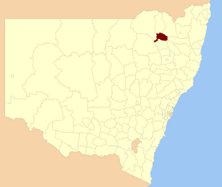
Bingara Shire was a local government area located in the New England region of New South Wales, Australia, about 150 kilometres (93 mi) north of Tamworth via Fossickers Way. The Shire, administered from the town of Bingara covered an area of 2,853.7 square kilometres (1,101.8 sq mi), and existed as a local government entity from 1906 until 2004, when it was amalgamated with Yallaroi Shire and part of Barraba to form the Gwydir Shire.
Coolah Shire was a former local government area in New South Wales, Australia from 1906 to 1994.
Boree Shire was a local government area in the Central West region of New South Wales, Australia.
Amaroo Shire was a local government area in the Central West region of New South Wales, Australia.
Jindalee Shire was a local government area in the Riverina region of New South Wales, Australia.
Liverpool Plains Shire was a local government area in the North West Slopes region of New South Wales, Australia.
Mandowa Shire was a local government area in the New England region of New South Wales, Australia.
Ashford Shire was a local government area in the North West Slopes region of New South Wales, Australia.
Macintyre Shire was a local government area in the North West Slopes region of New South Wales, Australia.
Bannockburn Shire was a local government area in the North West Slopes region of New South Wales, Australia.
Culcairn Shire was a local government area in the eastern Riverina region of New South Wales, Australia.
Holbrook Shire was a local government area in the eastern Riverina region of New South Wales, Australia.
Gundurimba Shire was a local government area in the Northern Rivers region of New South Wales, Australia.
Terania Shire was a local government area in the Northern Rivers region of New South Wales, Australia.
Kyeamba Shire was a local government area in the Riverina region of New South Wales, Australia.
Imlay Shire was a local government area in the South Coast region of New South Wales, Australia.
Mumbulla Shire was a local government area in the South Coast region of New South Wales, Australia.
Upper Hunter Shire was a local government area in the Hunter region of New South Wales, Australia.
Warrah Shire was a local government area in the Hunter region of New South Wales, Australia.
Patrick Plains Shire was a local government area in the Hunter region of New South Wales, Australia.
References
- ↑ "Proclamation (121)". Government Gazette of the State of New South Wales . 7 March 1906. p. 1593. Retrieved 10 January 2020– via National Library of Australia.
- ↑ "Gwydir Shire Council: Proposed special loan ₤3,500 (73)". Government Gazette of the State of New South Wales . 13 May 1938. p. 1977. Retrieved 10 January 2020– via National Library of Australia.
- ↑ "Local Government Act 1919. Proclamation (143)". Government Gazette of the State of New South Wales . 17 December 1943. p. 2190. Retrieved 10 January 2020– via National Library of Australia.
| This New South Wales geography article is a stub. You can help Wikipedia by expanding it. |