Ohio is a town in Herkimer County, New York, United States. The population was 1,002 at the 2010 census. The town is named after the state of Ohio. The town is in the northern part of the county and northeast of Utica. Part of Ohio is within the Adirondack Park.

Walton is a town in Delaware County, New York, United States. The population was 5,270 at the 2020 census. The town is in the west-central part of the county and contains the village of Walton. The town claims to be the "Scarecrow Capital of the World."

Northeast is the northeastern quadrant of Washington, D.C., the capital of the United States. It encompasses the area located north of East Capitol Street and east of North Capitol Street.
Northeast Glacier is a steep, heavily crevassed glacier, 13 nautical miles long and 5 nautical miles wide at its mouth, which flows from McLeod Hill westward and then south-westwards into Marguerite Bay between the Debenham Islands and Roman Four Promontory, on the west coast of Graham Land, Antarctica.

Ardsley is an unincorporated community located in Abington Township, as well as Upper Dublin Township, Montgomery County, Pennsylvania, United States. It is a neighbor of Glenside. A large portion of this neighborhood is composed of the historic cemeteries Hillside Cemetery and Ardsley Burial Park. It is the location of the Ardsley SEPTA station.

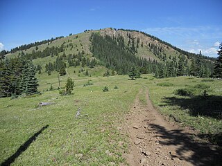
The Cochetopa Hills are a mountain range on the Continental Divide in Saguache County, Colorado, United States. The Cochetopa Hills are a sub-range of the San Juan Mountains and are located in the Gunnison National Forest and Rio Grande National Forest. The range extends from Marshall Pass southwest 50 miles (80 km) along the winding crest of the divide to Saguache Park. The high point of the Cochetopa Hills is Long Branch Baldy at an elevation of 11,974 feet (3,650 m).
Woodside Hills is an unincorporated community in New Castle County, Delaware, United States. Woodside Hills is located northwest of the intersection of Silverside Road and Carr Road to the northeast of Wilmington.
Pennyhill is an unincorporated community in New Castle County, Delaware, United States. Pennyhill is located north of U.S. Route 13 Business and west of Delaware Route 3, northeast of Wilmington. Delaware State Police Troop 1 is located in Pennyhill.

Kingston is a town in Ulster County, New York, United States. The Town of Kingston is in the northeastern part of Ulster County, north of the City of Kingston. Kingston is inside the Catskill Park. The population was 933 at the 2020 census.
Fort Hill is an unincorporated community in Somerset County, Pennsylvania, United States. The community is located along the Casselman River, 4.6 miles (7.4 km) east-northeast of Confluence. Fort Hill has a post office, with ZIP code 15540, which opened on December 23, 1885.
Gifford Hill is a small mountain chain in the Central New York Region of New York. It is located northeast of Oneonta, New York. It is made of three main peaks the highest being 1928 feet. Gifford Hill is named for the Gifford Family who moved to the area in 1803 and settled along the Oneonta Creek on what is now called Gifford Hill.
Jersey Hill is a 2,251-foot-long (686 m) mountain in the Southern Tier of New York. It is located Wells northeast of the hamlet of Allegany County. In 1935, a 79-foot-6-inch-long (24.23 m) steel fire lookout tower was built on the mountain. The Jersey Hill tower was only staffed on an as-needed basis by the Division of Lands and Forests. Due to increased use of aerial fire detection, the tower ceased fire lookout operations and was removed in August 1987.
Red Hill is a mountain located in the Catskill Mountains of New York east-south of Frost Valley. Woodhull Mountain is located northeast of Red Hill.
Morgan Hill is a mountain in the central part of the state of New York. It is located north-northeast of Truxton in Cortland County with a small portion in Onondaga County. The portion of the mountain within Onondaga County is the highest point in the county.
Gallis Hill is a 794-foot-tall (242 m) mountain in the Catskill Mountains region of New York. It is located northwest of Kingston in Ulster County. Jockey Hill is located north-northeast, and Morgan Hill is located west of Gallis Hill. In 1927, the Conservation Department built a steel fire lookout tower on the mountain. In 1950, the tower was closed and disassembled then moved to Overlook Mountain, where it still remains today.
Jockey Hill is a ridge located in the Catskill Mountains of New York northeast of Stony Hollow. Gallis Hill is located south-southwest, and Halihan Hill is located east of Jockey Hill.
Mount Marion is a mountain located in the Catskill Mountains of New York north of Kingston. Mount Airy is located north-northeast, Overlook Mountain is located west-northwest, and Halihan Hill is located south-southwest of Mount Marion.
Van Loan Hill is a mountain in Greene County, New York. It is located in the Catskill Mountains southwest of Maplecrest. Round Hill is located west, Elm Ridge is located north-northeast, and East Jewett Range is located south of Van Loan Hill.

The Pennsylvania State Game Lands Number 49 are Pennsylvania State Game Lands in Bedford and Fulton Counties in Pennsylvania in the United States providing hunting, bird watching, and other activities.
The following is a list of neighborhoods in Wichita, Kansas, United States.


