This article needs additional citations for verification .(January 2016) |
Hamirpur | |
---|---|
Town | |
Coordinates: 25°57′N80°09′E / 25.95°N 80.15°E | |
Country | India |
State | Uttar Pradesh |
Division | Chitrakoot |
District | Hamirpur |
Incorporated | 1937 |
Government | |
• Type | Municipal Council |
• Body | Hamirpur Municipal Council |
• Municipal Chairperson | Kuldeep Nishad (BJP) [1] [2] |
• Lok Sabha MP | Ajendra Singh Lodhi (SP) |
• MLA | Manoj Prajapati (BJP) |
Elevation | 80 m (260 ft) |
Population (2011) | |
• Total | 35,475 |
Language | |
• Official | Hindi [3] |
• Additional official | Urdu [3] |
Time zone | UTC+5:30 (IST) |
Vehicle registration | UP-91 |
Website | www |
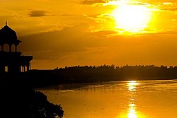
Hamirpur is a town and a municipal board in Hamirpur district in the Indian state of Uttar Pradesh. Located just above the confluence of the Yamuna and Betwa rivers, it is the administrative headquarters of Hamirpur district.
Hamirpur is located at 25°57′N80°09′E / 25.95°N 80.15°E , [4] 68 km from Kanpur and 140 km from Lucknow. [5] : 267 It is wedged snugly between the Yamuna and Betwa rivers, just west of their confluence. [6] : 170 It has an average elevation of 80 metres (262 feet).
Climate data for Hamirpur, Uttar Pradesh (1981–2010) | |||||||||||||
---|---|---|---|---|---|---|---|---|---|---|---|---|---|
Month | Jan | Feb | Mar | Apr | May | Jun | Jul | Aug | Sep | Oct | Nov | Dec | Year |
Record high °C (°F) | 30.2 (86.4) | 35.2 (95.4) | 41.2 (106.2) | 45.2 (113.4) | 48.2 (118.8) | 48.2 (118.8) | 46.0 (114.8) | 41.0 (105.8) | 40.2 (104.4) | 39.2 (102.6) | 38.2 (100.8) | 31.0 (87.8) | 48.2 (118.8) |
Mean daily maximum °C (°F) | 21.4 (70.5) | 26.5 (79.7) | 33.5 (92.3) | 39.7 (103.5) | 42.2 (108.0) | 40.5 (104.9) | 35.0 (95.0) | 33.6 (92.5) | 33.8 (92.8) | 33.2 (91.8) | 29.5 (85.1) | 25.0 (77.0) | 32.8 (91.0) |
Mean daily minimum °C (°F) | 7.5 (45.5) | 11.1 (52.0) | 17.0 (62.6) | 22.4 (72.3) | 25.0 (77.0) | 26.3 (79.3) | 24.6 (76.3) | 23.9 (75.0) | 23.2 (73.8) | 19.3 (66.7) | 13.3 (55.9) | 8.7 (47.7) | 18.5 (65.3) |
Record low °C (°F) | −0.9 (30.4) | −0.9 (30.4) | 7.4 (45.3) | 11.0 (51.8) | 9.4 (48.9) | 15.0 (59.0) | 16.0 (60.8) | 15.0 (59.0) | 14.0 (57.2) | 9.0 (48.2) | 2.0 (35.6) | −1.0 (30.2) | −1.0 (30.2) |
Average rainfall mm (inches) | 11.0 (0.43) | 5.7 (0.22) | 4.9 (0.19) | 4.0 (0.16) | 7.3 (0.29) | 59.8 (2.35) | 194.8 (7.67) | 183.8 (7.24) | 137.8 (5.43) | 22.7 (0.89) | 3.2 (0.13) | 3.3 (0.13) | 638.1 (25.12) |
Average rainy days | 0.7 | 0.6 | 0.6 | 0.4 | 0.8 | 3.2 | 9.5 | 9.5 | 6.1 | 1.1 | 0.3 | 0.4 | 33.2 |
Average relative humidity (%) (at 17:30 IST) | 64 | 52 | 37 | 29 | 33 | 49 | 72 | 77 | 73 | 57 | 57 | 62 | 55 |
Source: India Meteorological Department [7] |
According to tradition, Hamirpur was founded by one Hamira Deva in the 11th century. The town's old fort, which was still standing in the early 1900s, is also attributed to Hamira Deva. Hamirpur was important enough in the late 1500s to be the seat of a mahal , which the Ain-i-Akbari lists as part of sarkar Kalpi. [6] : 171–2
In 1823, the British moved their collectorate headquarters for northern Bundelkhand from Kalpi to Hamirpur. The town's main market, Sophiganj, was founded by a British officer in 1830 and named after his daughter. The town grew somewhat after its promotion to district headquarters, but it plateaued in the late 1800s and in 1909 was described as "a town of no considerable size". [6] : 171–2
Hamirpur was promoted to a municipality in 1949. [5] : 267
As of the 2011 Census of India, Hamirpur NPP had a population of 35,475, of which 19,027 were males and 16,448 were females. The population in the age range of 0–6 years was 3,940 constituting 11.1% of the total population. The total number of literates were 26,121, which constituted 73.6% of the population with male literacy of 78.7% and female literacy of 67.6%. The effective literacy rate (of 7+ population) of Hamirpur NPP was 82.8%%, of which male literacy rate was 88.5% and female literacy rate was 76.3%. Hamirpur had 6,802 households in 2011. [8]
As of the 2001 Census of India, [9] Hamirpur had a population of 32,035, of which 17,349 were males and 14,686 were females. The population in the age range of 0–6 years was 4,230, constituting 13.2% of the total population. The total number of literates were 22,592, which constituted 70.5% of the total population, with male literacy of 77.5% and female literacy of 62.3%. The effective literacy (of 7+ population) was 81.3%, of which male literacy rate was 89.1% and female literacy rate was 72.0%.
Majority of the population of Hamirpur are Hindus with 82.5% adherents, followed by Muslims at 17.2%. [10]
Jalaun is a city and a municipal board in Jalaun district in the Indian state of Uttar Pradesh.
Baberu is a town and a nagar panchayat in Banda district in the state of Uttar Pradesh, India. It is one of four tehsils (subdistricts) of the Banda district.
Guna is a city and a municipality in Guna district in the Indian state of Madhya Pradesh. It is the administrative headquarters of Guna District and is located on the banks of Parbati river.
Ayodhya district is one of the 75 districts in the northern Indian state of Uttar Pradesh. The city of Ayodhya is its administrative headquarters. The district occupies an area of 2,522 square kilometres (974 sq mi), and had a population of 2,470,996 in the 2011 census. Ayodhya district shares its borders with 6 districts of Uttar Pradesh. It is bordered by Gonda and Basti districts on the northern side, Amethi and Sultanpur districts on the south, and Ambedkar Nagar and Barabanki districts share the border on the east and west.
Jalaun district is a district of Uttar Pradesh, India. The district is named after the town of Jalaun, which was the former headquarters of a Maratha governor, but the administrative headquarters of the district is at Orai.
Hamirpur district is one of the 75 districts of Uttar Pradesh state of India and Hamirpur town is the district headquarters. Hamirpur district is a part of Chitrakoot Division. The district occupies an area of 4,121.9 km2. The district has a population of 1,104,285. As of 2011 it is the third least populous district of Uttar Pradesh, after Mahoba and Chitrakoot. Two major rivers Yamuna and Betwa meet here. On the banks of river Betwa lies the "Coarse sand" which is exported to many parts in U.P.
Lalitpur is one of the 75 districts in the northern Indian state of Uttar Pradesh. Lalitpur district is a part of Jhansi Division. Lalitpur is the main town and administrative headquarters. The district occupies an area of 5,039 km2.
Baraut is a city and municipal board in Baghpat district, Uttar Pradesh, India.
Bah is a Block and sub-division in Agra district of Uttar Pradesh in India. The township is on the State Highway 62 of Uttar Pradesh. The place is surrounded by three rivers giving it its name.
Bela Pratapgarh is a town and a municipal board in Pratapgarh district in the state of Uttar Pradesh, India.
Chharra Rafatpur is a town and a nagar panchayat in Aligarh district in the state of Uttar Pradesh, India.
Dostpur is a town and a nagar panchayat in Sultanpur district in the state of Uttar Pradesh, India. The town borders Sultanpur and Ambedkarnagar. Purvanchal Expressway passes near the town.
Jewar is a town and a nagar panchayat in Gautam Buddha Nagar district in the Indian state of Uttar Pradesh. Noida, Dadri and Jewar are the 3 sub-divisions of GB Nagar district, each headed by a SDM.
Kadipur is a town, tehsil and a nagar panchayat in Sultanpur district in the Indian state of Uttar Pradesh. It is located a short distance from the bank of the Gomti River, at a crossroads between two roads heading from Sultanpur to Surapur and from Pratapgarh to Dostpur and then on to Akbarpur. On the north side of town is a stream with a steep ravine that drains the surrounding area. The road to Sultanpur crosses over this stream on a bridge. The lands surrounding Kadipur are average quality for agricultural purposes. As of 2011, Kadipur has a population of 8,010 people, in 1,216 households.
Kairana is a city and a municipal board in Shamli district of the Indian state of Uttar Pradesh. It is approximately 14 km (8.7 mi) from Shamli city.
Maudaha is a city and a Municipal Board in Hamirpur district, Uttar Pradesh, India.
Sarsawa is a town at the border of Haryana and a municipal board in Saharanpur district in the Indian state of Uttar Pradesh.
Shankargarh is a town and a nagar panchayat in Prayagraj district in the Indian state of Uttar Pradesh.It Is Also Known As Kasauta Shankargarh.
Siyana is a city and a municipal board with 25 wards, situated in Siyana Tehsil in the district of Bulandshahr in the Indian state of Uttar Pradesh.
Fatehabad is a town in Agra district in the state of Uttar Pradesh, India. It is nearly 35 km south-east of Agra in the direction of Etawah. The historical name of the town is Samugarh.