Hubbard, Dodge County, Wisconsin

Last updated

See also Hubbard, Rusk County, Wisconsin.
Hubbard, Wisconsin
Hubbard (1).jpg
WIMap-doton-Hubbard.png
Location of Hubbard, Wisconsin
Coordinates: 43°24′47″N88°34′51″W / 43.41306°N 88.58083°W / 43.41306; -88.58083
Country Flag of the United States.svg  United States
State Flag of Wisconsin.svg  Wisconsin
County Dodge
Area
  Total33.4 sq mi (86.5 km2)
  Land31.7 sq mi (82.2 km2)
  Water1.7 sq mi (4.3 km2)
Elevation
[1]
869 ft (265 m)
Population
 (2000)
  Total1,643
  Density51.8/sq mi (20.0/km2)
Time zone UTC-6 (Central (CST))
  Summer (DST) UTC-5 (CDT)
FIPS code 55-36100 [2]
GNIS feature ID1583415 [1]
Website http://www.townofhubbard.com

Hubbard is a town in Dodge County, Wisconsin, United States. The population was 1,643 at the 2000 census. The unincorporated community of Neda is located in the town. The town is named for Henry Hubbard, the governor of New Hampshire from 1842 to 1844. [3]

Contents

Geography

According to the United States Census Bureau, the town has a total area of 33.4 square miles (86.5 km2), of which, 31.7 square miles (82.2 km2) of it is land and 1.7 square miles (4.3 km2) of it (4.97%) is water.

Demographics

As of the census [2] of 2000, there were 1,643 people, 620 households, and 479 families residing in the town. The population density was 51.8 people per square mile (20.0/km2). There were 745 housing units at an average density of 23.5 per square mile (9.1/km2). The racial makeup of the town was 98.78% White, 0.06% African American, 0.37% Native American, 0.43% Asian, 0.18% from other races, and 0.18% from two or more races. Hispanic or Latino of any race were 0.43% of the population.

There were 620 households, out of which 29.5% had children under the age of 18 living with them, 68.2% were married couples living together, 5.6% had a female householder with no husband present, and 22.6% were non-families. 17.9% of all households were made up of individuals, and 6.8% had someone living alone who was 65 years of age or older. The average household size was 2.65 and the average family size was 2.99.

In the town, the population was spread out, with 23.9% under the age of 18, 6.6% from 18 to 24, 28.7% from 25 to 44, 28.0% from 45 to 64, and 12.9% who were 65 years of age or older. The median age was 40 years. For every 100 females, there were 108.0 males. For every 100 females age 18 and over, there were 108.2 males.

The median income for a household in the town was $51,250, and the median income for a family was $56,667. Males had a median income of $40,164 versus $27,083 for females. The per capita income for the town was $23,142. About 3.9% of families and 5.9% of the population were below the poverty line, including 7.9% of those under age 18 and 9.6% of those age 65 or over.

Notable people

Related Research Articles

<span class="mw-page-title-main">Pike Bay Township, Cass County, Minnesota</span> Township in Minnesota, United States

Pike Bay Township is a township in Cass County, Minnesota, United States. The population was 1,643 as of the 2000 census. Pike Bay Township was named for Pike Bay of Cass Lake, and indirectly for Zebulon Pike, an explorer.

<span class="mw-page-title-main">West Salem, Ohio</span> Village in Ohio, United States

West Salem is a village in Wayne County, Ohio. The population was 1,430 at the time of the 2020 census. West Salem is served by a branch of the Wayne County Public Library.

<span class="mw-page-title-main">Fairfield, Vermont</span> Town in Vermont, United States

Fairfield is a town in Franklin County, Vermont, United States, chartered in 1763. The population was 2,044 at the 2020 census. President Chester A. Arthur was born in Fairfield in 1829, and lived there for the first three years of his life. A replica of his home, the Chester Alan Arthur State Historic Site, is open seasonally.

<span class="mw-page-title-main">Chesapeake, West Virginia</span> Town in West Virginia, United States

Chesapeake is a town in Kanawha County, West Virginia, United States. The population was 1,336 at the 2020 census. The town is situated on the Kanawha River.

<span class="mw-page-title-main">Montrose, Wisconsin</span> Town in Wisconsin, United States

The Town of Montrose is located in Dane County, Wisconsin, United States. The population was 1,134 at the 2000 census. The unincorporated communities of Basco and Paoli are located within the town.

<span class="mw-page-title-main">Lebanon, Dodge County, Wisconsin</span> Town in Wisconsin, United States

Lebanon is a town in Dodge County, Wisconsin, United States. The population was 1,664 at the 2000 census. The census-designated place of Lebanon is located in the town, as are the unincorporated communities of Old Lebanon and Sugar Island.

<span class="mw-page-title-main">Waterloo, Grant County, Wisconsin</span> Town in Wisconsin, United States

Waterloo is a town in Grant County in the U.S. state of Wisconsin. The population was 557 at the 2000 census. The unincorporated communities of Burton and McCartney are located in the town.

<span class="mw-page-title-main">Lisbon, Juneau County, Wisconsin</span> Town in Wisconsin, United States

Lisbon is a town in Juneau County, Wisconsin, United States. The population was 1,020 at the 2000 census.

<span class="mw-page-title-main">Brighton, Marathon County, Wisconsin</span> Town in Wisconsin, United States

Brighton is a town in Marathon County, Wisconsin, United States. It is part of the Wausau, Wisconsin Metropolitan Statistical Area. The population was 620 at the 2020 census.

<span class="mw-page-title-main">Day, Wisconsin</span> Town in Wisconsin, United States

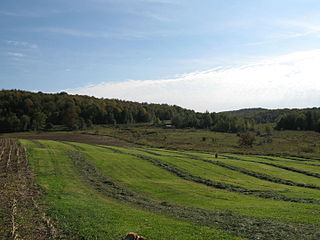
Day is a town in southwest Marathon County, Wisconsin, United States. It is part of the Wausau, Wisconsin Metropolitan Statistical Area. The population was 1,085 at the 2010 census. The unincorporated community of Rozellville is located in the town. The unincorporated community of Rangeline is also located partially in the town.

<span class="mw-page-title-main">Stiles, Wisconsin</span> Town in Wisconsin, United States

Stiles is a town in Oconto County, Wisconsin, United States. The population was 1,465 at the 2000 census. The unincorporated communities of Stiles and Stiles Junction are located in the town. Situated within ancestral Menominee territory that was ceded to the United States in the 1836 Treaty of the Cedars, its Menominee name is Pæhkuahkiw which means "pointed hillock".

<span class="mw-page-title-main">Union, Rock County, Wisconsin</span> Town in Wisconsin, United States

The Town of Union is located in Rock County, Wisconsin, United States. The population was 1,860 at the 2000 census. The town surrounds the city of Evansville.

<span class="mw-page-title-main">Hubbard, Rusk County, Wisconsin</span> Town in Wisconsin, United States

Hubbard is a town in Rusk County, Wisconsin, United States. The population was 168 at the 2000 census. The town was likely named for Arthur O. Hubbard, a manufacturer based in Minnesota.

<span class="mw-page-title-main">Strickland, Wisconsin</span> Town in Wisconsin, United States

The Town of Strickland is located in Rusk County, Wisconsin, United States. The population was 300 at the 2000 census.

<span class="mw-page-title-main">Linn, Wisconsin</span> Town in Wisconsin, United States

Linn is a town in Walworth County, Wisconsin, United States. The population was 2,687 at the 2020 census. The unincorporated communities of Linton and Zenda are located within the town.

<span class="mw-page-title-main">Mukwonago (town), Wisconsin</span> Town in Wisconsin, United States

Mukwonago is a town in Waukesha County, Wisconsin, United States. The population was 7,781 at the 2020 census. The Village of Mukwonago is located mostly within the town. The unincorporated community of Jericho is also located in the town.

<span class="mw-page-title-main">Winchester, Winnebago County, Wisconsin</span> Town in Wisconsin, United States

Winchester is a town in Winnebago County, Wisconsin, United States. The population was 1,763 at the 2010 census. The census-designated place of Winchester and the unincorporated communities of Clarks Point, Indian Shores, Lasleys Point, and Piacenza are located in the town.

<span class="mw-page-title-main">Albany, Pepin County, Wisconsin</span> Town in Wisconsin, United States

Albany is a town in Pepin County, Wisconsin, United States. The population was 716 at the 2020 census.

<span class="mw-page-title-main">Wynnedale, Indiana</span> Town in Indiana, United States

Wynnedale is a town in Washington Township, Marion County, Indiana, United States. The population was 215 at the 2020 census. It has existed as an "included town" since 1970, when it was incorporated into Indianapolis as part of Unigov. It is part of Indianapolis, but retains a functioning town government under IC 36-3-1-11.

<span class="mw-page-title-main">Dane (town), Wisconsin</span>

Dane is a town in Dane County, Wisconsin, United States. The population was 968 at the 2000 census. The unincorporated community of Lutheran Hill is located partially in the town.

References

  1. 1 2 "US Board on Geographic Names". United States Geological Survey. October 25, 2007. Retrieved January 31, 2008.
  2. 1 2 "U.S. Census website". United States Census Bureau . Retrieved January 31, 2008.
  3. Callary, Edward (November 12, 2023). Place Names of Wisconsin. Madison, WI: University of Wisconsin Press. p. 125. ISBN   978-0-299-30964-0.