
Mining is the extraction of valuable minerals or other geological materials from the Earth, usually from an ore body, lode, vein, seam, reef, or placer deposit. These deposits form a mineralized commodity that is of economic interest to the miner.

Kennecott, also known as Kennicott and Kennecott Mines, is an abandoned mining camp in the Valdez-Cordova Census Area in the U.S. state of Alaska that was the center of activity for several copper mines. It is located beside the Kennicott Glacier, northeast of Valdez, inside Wrangell-St. Elias National Park and Preserve. The camp and mines are now a National Historic Landmark District administered by the National Park Service.

Empire Mine State Historic Park is a state-protected mine and park in the Sierra Nevada mountains in Grass Valley, California, U.S. The Empire Mine is on the National Register of Historic Places, a federal Historic District, and a California Historical Landmark. Since 1975 California State Parks has administered and maintained the mine as a historic site. The Empire Mine is "one of the oldest, largest, deepest, longest and richest gold mines in California". Between 1850 and its closure in 1956, the Empire Mine produced 5.8 million ounces of gold, extracted from 367 miles (591 km) of underground passages.

Hatcher Pass is a mountain pass through the southwest part of the Talkeetna Mountains, Alaska. It is named after Robert Hatcher, a prospector and miner. The nearest cities are Palmer and Wasilla approximately 12 miles (19 km) to the south, and Willow approximately 26 mi (42 km) to the west. The communities are at an elevation of approximately 250 ft (76 m) in the Mat-Su valley.

The Monte Cristo Gold Mine is a gold mine in the San Gabriel Mountains near Los Angeles, California, USA.

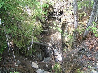
Kentucky Camp is a ghost town and former mining camp along the Arizona Trail in Pima County, Arizona, United States, near the community of Sonoita. The Kentucky Camp Historic District is listed on the National Register of Historic Places and has been since 1995. As it is located within Coronado National Forest, the United States Forest Service is responsible for the upkeep of the remaining buildings within the Kentucky Camp Historic District.

The Treadwell gold mine was on the south side of Douglas Island, .5-mile (0.80 km) east of downtown Douglas and southeast of downtown Juneau, owned and operated by John Treadwell. Composed of four sub-sites, Treadwell was in its time the largest hard rock gold mine in the world, employing over 2,000 people. Between 1881 and 1922, over 3 million troy ounces of gold were extracted. Not much remains today except for a few crumbling buildings and a "glory hole". Although John Treadwell had twelve years of experience in both placer and lode mines, he was a carpenter and builder by trade who had come to Alaska prior to the Klondike Gold Rush.

Silver mining in Nevada, a state of the United States, began in 1858 with the discovery of the Comstock Lode, the first major silver-mining district in the United States. Nevada calls itself the "Silver State." Nevada is the nation's second-largest producer of silver, after Alaska. In 2014 Nevada produced 10.93 million troy ounces of silver, of which 6,74 million ounces were as a byproduct of the mining of gold. The largest byproducers were the Hycroft Mine, the Phoenix Mine, the Midas Mine and Round Mountain.
Gold mining in Alaska, a state of the United States, has been a major industry and impetus for exploration and settlement since a few years after the United States acquired the territory in 1867 from the Russian Empire. Russian explorers discovered placer gold in the Kenai River in 1848, but no gold was produced. Gold mining started in 1870 from placers southeast of Juneau, Alaska.

Gold was discovered in the Yentna Cache-Creek Mining District in the US state of Alaska of the upper Susitna Valley in 1898, soon followed by claim staking. Placer mining was reported in the Cache Creek drainage of the Dutch Hills by 1906. Quaternary glaciofluvial deposits, alluvial deposits, and Cenozoic conglomeratic white quartz-breccia units have been mined in the Dutch Hills. About 200,000 oz of gold has been produced from these placer deposits.
The Willow Creek mining district, also known as the Independence Mine/Hatcher Pass district, is a gold-mining area in the U.S. state of Alaska. Underground hard-rock mining of gold from quartz veins accounts for most of the mineral wealth extracted from the Hatcher Pass area. The first mining efforts were placer mining of stream gravels, and placer mining in the area has continued sporadically to this day. Robert Hatcher discovered gold and staked the first claim in the Willow Creek valley in September 1906. The first lode mill in the area started operating in 1908. Underground mining continued at a variety of locations around the pass until 1951. In the 1980s one of the area's hard-rock mines was briefly re-opened. At least one mining company is actively exploring for gold in the area now. Through 2006 the district produced 667-thousand ounces of hard rock gold and 60-thousand ounces of placer gold.
The Juneau mining district is a gold mining area in the U.S. state of Alaska.
The Admiralty mining district is a mining area in the U.S. state of Alaska which consists of Admiralty Island. Silver and base metals are mined, with gold recovered as a by-product.

Shafter is a ghost town in Presidio County, Texas. The Texas Attorney General's Office gives a population of 11 as of the 2000 Census. It was named in honor of General William R. Shafter, who at one point commanded the nearby Fort Davis. In the early 1900s, six silver mines were in operation near Shafter. When the mines closed, the town died. It was later the location for several scenes in the 1971 movie The Andromeda Strain. As of 2012, at least one silver mine, La Mina Grande, has been reopened by Aurcana Corporation. Shafter, as well as the ruins of the mining houses, was the location for scenes in The Three Burials of Melquiades Estrada.
Coeur Mining, Inc. is a precious metals mining company listed on the New York Stock exchange. It operates five mines located in North America. Coeur employs 2,200 people and in 2012 it was the world's 9th largest silver producer. In 2013 the company changed its name to Coeur Mining, Inc. from Coeur d'Alene Mines and moved its head office to Chicago, Illinois from Coeur d'Alene, Idaho.

The Bremner Historic Mining District is a historic district in Wrangell-St. Elias National Park and Preserve in Alaska. It is named after John Bremner, who in 1884-1885 was the first non-native person to live in the area and who prospected for gold along the Bremner River. Located just to the north of the Bremner River, it was the scene of an important placer gold discovery in 1902, and played a key role in the history of the Copper River Basin. Only a few miners struck it rich, but the resulting demand for materials and supplies helped establish regional transportation networks, encouraged supporting industries, and hastened the exploration and settlement of the entire region. While small-scale placer mining continued for over forty years, lode development was largely confined to the period between 1934 and 1941, the district's most significant era.
Beanland Mine, also known as Clenor Mine, is an abandoned surface and underground mine in Northeastern Ontario, Canada. It is located about 1 km (0.62 mi) west of Arsenic Lake and 4 km (2.5 mi) northwest of the town of Temagami in central Strathy Township. It is named after Sydney Beanland, who first claimed the mine site in the 1920s and was a director for the mine from 1937 to 1938.

The Alaska-Juneau Gold Mining Company (AJGMC) was incorporated under the laws of West Virginia, USA in 1897. Its lode mining claims covered approximately 402.37 acres (162.83 ha) on the wide vein called the Juneau gold belt of which it owned one mile on the outcrop.
The Fort Knox Gold Mine is an open pit gold mine, 9 mi (14 km) east of Fox in the Fairbanks mining district of Alaska. It is owned and operated by Toronto-based Kinross Gold. Originally staked in 1913, after very minor mining at the location the property sat idle until being restaked in 1980. Following the initial exploration discovery in 1987, in 1992 the project was purchased by Amax Gold, which brought the mine to production. Amax Gold merged with Kinross Gold in 1998.
The Sumdum mine is one of the largest lead and zinc mines in United States. The mine is located in north-western United States in Alaska. The mine has reserves amounting to 24 million tonnes of ore grading 0.37% zinc and 79.1 million oz of silver.
Alaska Division of Geological and Geophysical Surveys Alaska Office of Mineral Development, Special Report #33


