WikiMili
Index of Palau-related articles
Last updated
November 20, 2025
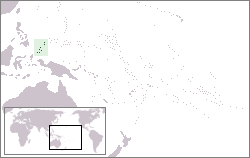
The location of the
Republic of Palau
Main article:
Palau
The following is an alphabetical list of
topics related to the
Republic of Palau
.
Contents
0–9
A
B
C
D
E
F
G
H
I
J
K
L
M
N
O
P
R
S
T
U
W
See also
External links
Contents
A
B
C
D
E
F
G
H
I
J
K
L
M
N
O
P
Q
R
S
T
U
V
W
X
Y
Z
0–9
A map of the
Republic of Palau
.pw
–
Internet
country code top-level domain
for Palau
A
Aimeliik
Air Force of Palau
Airai
Airports in Palau
Angaur
Army of Palau
Atlas of Palau
B
Babeldaob
Baseball in Palau
BentProp Project
Birds of Palau
Bkulangriil
C
Capital of Palau
:
Ngerulmud
Caroline Islands
Categories:
Category:Palau
Category:Buildings and structures in Palau
Category:Communications in Palau
Category:Culture of Palau
Category:Economy of Palau
Category:Education in Palau
Category:Environment of Palau
Category:Geography of Palau
Category:Government of Palau
Category:History of Palau
Category:Military of Palau
Category:Palauan people
Category:Palau-related lists
Category:Politics of Palau
Category:Society of Palau
Category:Sport in Palau
Category:Transport in Palau
commons:Category:Palau
Chelbacheb
Cities in Palau
Climate of Palau
Coat of arms of Palau
Communications in Palau
Compact of Free Association
with the
United States of America
Cuisine of Palau
D
Demographics of Palau
Yukiwo P. Dengokl
Diplomatic missions in Palau
Diplomatic missions of Palau
E
Eastern Hemisphere
Economy of Palau
Education in Palau
Elections in Palau
English language
Environment of Palau
F
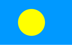
The
Flag of Palau
Flag of Koror
Flag of Palau
Foreign relations of Palau
G
Geography of Palau
Government of Palau
Gross domestic product
H
Hatohobei
History of Palau
I
Imeong Conservation Area
Imetang
International Organization for Standardization
(
ISO
)
ISO 3166-1 alpha-2
country code for the Republic of Palau:
PW
ISO 3166-1 alpha-3
country code for the Republic of Palau:
PLW
ISO 3166-2:PW
region codes for the Republic of Palau
Internet in Palau
Island countries
J
Jellyfish Lake
K
Kayangel
Koror
L
Law enforcement in Palau
Lists:
Diplomatic missions of Palau
List of airports in Palau
List of archipelagos
List of birds of Palau
List of cities in Palau
List of countries by GDP (nominal)
List of diplomatic missions in Palau
List of island countries
List of island countries by area
List of island countries by population density
List of Palau-related topics
List of Palauans
List of political parties in Palau
List of radio stations in Palau
List of wettest tropical cyclones to affect Palau
M
Melanesia
Melekeok
, capital
Micronesia
Micronesia challenge
Military of Palau
Music of Palau
N
Nesopupa eapensis
Ngaraard
Ngarchelong
Ngardmau
Ngaremlengui
Ngatpang
Ngchesar
Ngetbong
Ngiwal
Ngkeklau
North Pacific Ocean
Northern Hemisphere
O
Oceania
Ollei
P
Pacific Ocean
Palau
Palau at the Olympics
Palau Community College
Palau International Airport
Palau Islands
Palauan language
Peleliu
PLW
–
ISO 3166-1 alpha-3
country code for the Republic of Palau
Political parties in Palau
Politics of Palau
President of Palau
Prominent Palauans
Public holidays in Palau
PW
–
ISO 3166-1 alpha-2
and
USPS
country code for the Republic of Palau
R
Radio stations in Palau
Leilani Reklai
Religion in Palau
Republic of Palau
Rock Islands (Palau)
S
Scouting in Palau
Senate of Palau
Small Island Developing States
Sonsorol
Southwest Islands (Palau)
States of Palau
:
Aimeliik
Airai
Angaur
Hatohobei
Kayangel
Koror
Melekeok
Ngaraard
Ngarchelong
Ngardmau
Ngaremlengui
Ngatpang
Ngchesar
Ngiwal
Peleliu
Sonsorol
Supreme Court of Palau
T
Topic outline of Palau
Transport in Palau
Tropical cyclones in Palau
Trust Territory of the Pacific Islands
U
United States-Palau relations
W
Wikimedia Atlas of Palau
Wikipedia:WikiProject Topic outline/Drafts/Topic outline of Palau
Contents
0–9
A
B
C
D
E
F
G
H
I
J
K
L
M
N
O
P
Q
R
S
T
U
V
W
X
Y
Z
See also
Main article:
Palau
All pages with titles beginning with
Palau
All pages with titles containing
Palau
List of international rankings
Lists of country-related topics
Topic outline of geography
Topic outline of Palau
External links
Wikimedia Atlas of Palau
Palau
at Wikipedia's
sister projects
:
Media
from Commons
News
from Wikinews
Travel guides
from Wikivoyage
English edition
of Wikipedia
v
t
e
Countries and territories
of
Oceania
List of Oceanian countries by area
List of Oceanian countries by population
Sovereign states
Entire
Australia
Fiji
Kiribati
Marshall Islands
Micronesia
Nauru
New Zealand
Palau
Papua New Guinea
Samoa
Solomon Islands
Tonga
Tuvalu
Vanuatu
In part
Chile
Easter Island
Juan Fernández Islands
Ecuador
Galápagos Islands
Indonesia
Central Papua
Highland Papua
Papua
South Papua
Southwest Papua
West Papua
United States
Hawaii
Palmyra Atoll
Associated states
Cook Islands
Niue
Dependencies
and
other
territories
Australia
Ashmore and Cartier Islands
Christmas Island
Cocos (Keeling) Islands
Coral Sea Islands
Norfolk Island
France
Clipperton Island
French Polynesia
New Caledonia
Wallis and Futuna
New Zealand
Tokelau
United Kingdom
Pitcairn Islands
United States
American Samoa
Baker Island
Guam
Howland Island
Jarvis Island
Johnston Atoll
Kingman Reef
Midway Atoll
Northern Mariana Islands
Wake Island
British Overseas Territories
Overseas France
Overseas collectivity
Overseas country of France
Realm of New Zealand
Political status of the Cook Islands and Niue
States and territories of Australia
Australian Indian Ocean Territories
Territories of the United States
Commonwealth (U.S. insular area)
Insular area
United States Minor Outlying Islands
Oceania
portal
v
t
e
Indices
General reference
Culture and the arts
Geography and places
Health and fitness
History and events
Law
Mathematics and logic
Natural and physical sciences
People and self
Philosophy and thinking
Religion and belief systems
Society and social sciences
Technology and applied sciences
This page is based on this
Wikipedia article
Text is available under the
CC BY-SA 4.0
license; additional terms may apply.
Images, videos and audio are available under their respective licenses.