List of sovereign states and dependent territories in Oceania

Last updated

Exclusive economic zones of Oceania and neighboring areas Map of the Territorial Waters of the Pacific Ocean.png
Exclusive economic zones of Oceania and neighboring areas

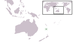
This is a list of sovereign states and dependent territories in the geographical region of Oceania. Although it is mostly ocean and spans many tectonic plates, Oceania is occasionally listed as one of the continents.

Contents

Most of this list follows the boundaries of geopolitical Oceania, which includes Australasia, Melanesia, Micronesia, and Polynesia. The main continental landmass of Oceania is Australia. [1]

Boundaries of Oceania

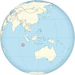
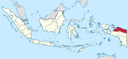
The boundary between Southeast Asia and Oceania is not clearly defined. For political reasons, the United Nations considers the boundary between the two regions to be the IndonesianPapua New Guinean border. [2] Papua New Guinea is occasionally considered Asian as it neighbours Indonesia, [3] [4] [5] but this is rare, and it is generally accepted to be part of Oceania. Biogeographically and geologically, Papua and West Papua provinces are parts of Oceania.

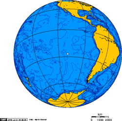
Likewise, there is also no clearly defined boundary between Latin America and Oceania; the mostly uninhabited oceanic Pacific islands near Latin America have been considered by some as part of Oceania, both historically and in present-day times. [6] [7] [8] [9] [10] Nearly all of these islands have become politically associated with the Americas, but none lie on the respective tectonic plates of those continents, nor were any inhabited by Indigenous peoples of the Americas during the pre-Columbian era. [11] Some share strong biogeographical affinities to geopolitical Oceania. [12] The Malay Archipelago has historically been associated with Oceania, [13] [9] [14] [15] however, very few present-day definitions include it as part of Oceania. [16] [17] The Malay Archipelago lies on the continental shelf of Asia; Christmas Island and Cocos (Keeling) Islands (both adjacent to the Malay Archipelago) lie on the Australian tectonic plate, and are not politically associated with Asia. The Bonin Islands, which have been politically integrated into Japan, are not geologically associated with the Asian continent, and are biogeographically within Micronesia.

Sovereign states

United Nations member states

This section includes all sovereign states located predominantly in Oceania that are member states of the United Nations. [18] All 14 states are full members of the Pacific Islands Forum. [19]

FlagCoat of Arms / National EmblemMapEnglish short, formal names, and ISO
[20] [21] [22] [23]
Domestic short and formal name(s) [20] [21] Capital
[22] [24] [25]
Population 2021
[26] [27]
Area
[28]
Flag of Australia.svg
Coat of Arms of Australia.svg Australia (orthographic projection).svg Australia [note 1]

Commonwealth of Australia

AUS
English: Australia — Commonwealth of Australia Canberra 25,921,0897,741,220 km2 (2,988,902 sq mi)
Flag of the Federated States of Micronesia.svg
Seal of the Federated States of Micronesia.svg LocationMicronesia.png Federated States of Micronesia

FSM
English: Federated States of Micronesia Palikir 113,131702 km2 (271 sq mi)
Flag of Fiji.svg
Coat of arms of Fiji.svg LocationFiji.png Fiji

Republic of Fiji

FJI
English: Fiji — Republic of Fiji

Fijian : Viti — Matanitu ko Viti

Fiji Hindi फीजी/Fiji - रिपब्लिक ऑफ फीजी/ Ripablik ăph Phījī
Suva 924,61018,274 km2 (7,056 sq mi)
Flag of Kiribati.svg
Coat of arms of Kiribati.svg LocationKiribati.png Kiribati

Republic of Kiribati

KIR
English: Kiribati — Republic of Kiribati

Gilbertese : Kiribati — Ribaberiki Kiribati
South Tarawa
Bairiki
128,874811 km2 (313 sq mi)
Flag of the Marshall Islands.svg
Seal of the Marshall Islands.svg LocationMarshallIslands.png Marshall Islands

Republic of the Marshall Islands

MHL
English: Marshall Islands — Republic of the Marshall Islands

Marshallese : Aelōn̄ in M̧ajeļ - Aolepān Aorōkin M̧ajeļ
Majuro 42,050181 km2 (70 sq mi)
Flag of Nauru.svg
Coat of arms of Nauru.svg NRU orthographic.svg Nauru

Republic of Nauru

NRU
English: Nauru — Republic of Nauru

Nauruan : Naoero - Repubrikin Naoero
No official Capital
Government offices are in Yaren
10,83421 km2 (8 sq mi)
Flag of New Zealand.svg
Coat of arms of New Zealand.svg New Zealand (orthographic projection).svg New Zealand [note 2]

NZL
English: New Zealand

Māori : Aotearoa
Wellington 5,129,727267,710 km2 (103,363 sq mi)
Flag of Palau.svg
Seal of Palau.svg
LocationPalau.png Palau

Republic of Palau

PLW
English: Palau — Republic of Palau

Palauan : Belau — Beluu er a Belau
Ngerulmud 18,024459 km2 (177 sq mi)
Flag of Papua New Guinea.svg
National emblem of Papua New Guinea.svg Papua New Guinea (orthographic projection).svg Papua New Guinea

Independent State of Papua New Guinea

PNG
English: Papua New Guinea — Independent State of Papua New Guinea

Tok Pisin : Papua Niugini — Independen Stet bilong Papua Niugini
Port Moresby 9,949,437462,840 km2 (178,704 sq mi)
Flag of Samoa.svg
Coat of arms of Samoa.svg LocationSamoa.png Samoa

Independent State of Samoa

WSM
English: Samoa — Independent State of Samoa

Samoan : Samoa — Malo Sa‘oloto Tuto'atasi o Samoa
Apia 218,7642,831 km2 (1,093 sq mi)
Flag of the Solomon Islands.svg
Coat of arms of the Solomon Islands.svg LocationSolomonIslands.png Solomon Islands

SLB
English: Solomon Islands

Pijin : Solomon Aelan
Honiara 707,85128,896 km2 (11,157 sq mi)
Flag of Tonga.svg
Coat of arms of Tonga.svg LocationTonga.png Tonga

Kingdom of Tonga

TON
English: Tonga — Kingdom of Tonga

Tongan : Tonga — Pule'anga Tonga
Nukuʻalofa 106,017747 km2 (288 sq mi)
Flag of Tuvalu.svg
Coat of arms of Tuvalu.svg LocationTuvalu.png Tuvalu

TUV
English: Tuvalu

Tuvaluan : Tuvalu
Funafuti 11,20426 km2 (10 sq mi)
Flag of Vanuatu.svg
Coat of arms of Vanuatu.svg LocationVanuatu.png Vanuatu

Republic of Vanuatu

VUT
Bislama : Vanuatu — Ripablik blong Vanuatu

English: Vanuatu — Republic of Vanuatu

French : Vanuatu — République de Vanuatu
Port Vila 319,13712,189 km2 (4,706 sq mi)

Associated states

Two states, the Cook Islands and Niue, are in free association with New Zealand. While maintaining a close constitutional and political relationship with New Zealand, both states have full treaty-making capacity and are members of several United Nations specialized agencies. Both independently engage in diplomatic relations with sovereign states under their own name, and are full members of the Pacific Islands Forum. Because of these features, both act in many ways as fully independent states. [29]

FlagCoat of Arms / National EmblemMapEnglish short and formal names [20] StatusDomestic short and formal namesCapitalPopulationArea [28]
Flag of the Cook Islands.svg
Coat of arms of the Cook Islands.svg LocationCookIslands.png Cook Islands [22] Self-governing in free association with New Zealand. It shares a head of state with New Zealand as well as having shared citizenship, but is independent in its internal affairs.English: Cook Islands
Cook Islands Māori : Kūki 'Āirani
Avarua [22] [24] 11,124 [30] 236 km2 (91 sq mi)
Flag of Niue.svg
Public Seal of Niue.svg LocationNiue.png Niue [22] Self-governing in free association with New Zealand. It shares a head of state with New Zealand as well as having shared citizenship, but is independent in its internal affairs.English: Niue

Niuean : Niuē
Alofi [22] [24] 1,311 [30] 260 km2 (100 sq mi)

Non-sovereign territories

The following are entities considered to be within Oceania that fall into one of these categories:

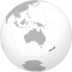
1. Federal territories of sovereign states located outside these states' mainland.

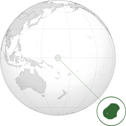
2. Territories that constitute integral parts of sovereign states in some form other than as federal territories, where a significant part of the sovereign state's landmass is located outside Oceania or the territory is located outside the sovereign state's mainland. Many of these territories are often described as dependencies or autonomous areas.

3. Dependent territories of sovereign states.

Two of these territories (French Polynesia and New Caledonia) are associate members of the Pacific Islands Forum, while five others (American Samoa, Guam, Northern Mariana Islands, Tokelau, and Wallis and Futuna) hold observer status within the organization.

FlagCoat of Arms / National EmblemMapEnglish short and formal names [20] StatusDomestic short and formal namesCapitalPopulationArea [28]
Flag of American Samoa.svg
Seal of American Samoa.svg LocationAmericanSamoa.png American Samoa

Territory of American Samoa [22]
Unincorporated territory of the United States English: American Samoa — Territory of American Samoa

Samoan : Amerika Sāmoa
Pago Pago [22] [24] 67,242 [30] 199 km2 (77 sq mi)
Flag of Australia (converted).svg
AshmoreandCartierIslands.png Ashmore and Cartier Islands

Territory of Ashmore and Cartier Islands
External territory of Australia English: Ashmore and Cartier IslandsNoneUninhabited5 km2 (2 sq mi)
Flag of the United States.svg
LocationBakerIsland.png Baker Island Unincorporated territory of the United States English: Baker Island [31] NoneUninhabited [31] 129.1 km2 (49.8 sq mi)
Flag of Central Papua Province.svg
Lambang Papua Tengah.png
Papua Tengah in Indonesia.svg Central Papua

Central Papua Province
Province of Indonesia Indonesian : Papua Tengah Nabire Regency 1,408,981 [32] 66,130.49 km2 (25,533 sq mi)
Flag of Christmas Island.svg
Christmas Island on globe (Southeast Asia centered) with borders.svg Christmas Island External territory of Australia English: Christmas Island – Territory of Christmas Island Flying Fish Cove [22] / The Settlement [24] 1,843 [33] 135 km2 (52 sq mi)
Flag of France.svg
Clipperton Island in its region.svg Clipperton Island Overseas state private property French : Île de ClippertonNoneUninhabited6 km2 (2 sq mi)
Flag of the Cocos (Keeling) Islands.svg
Cocos (Keeling) Islands on the globe (Southeast Asia centered).svg Cocos (Keeling) Islands External territory of Australia English: Cocos (Keeling) Islands – Territory of the Cocos (Keeling) Islands West Island [24] / Bantam [22] 544 [33] 14 km2 (5 sq mi)
Flag of Australia (converted).svg
Wyspy Morza Koralowego.png Coral Sea Islands

Coral Sea Islands Territory
External territory of Australia English: Coral Sea Islands — Coral Sea Islands Territory Willis Island Uninhabited3 km2 (1 sq mi)
Flag of Rapa Nui, Chile.svg
Emblem of Easter Island.svg
Orthographic projection centred over Easter Island.png Easter Island Special territory of Chile Spanish : Isla de Pascua

Rapa Nui : Rapa Nui
Hanga Roa 6,148 [34] 163.6 km2 (63 sq mi)
Flag of French Polynesia.svg
Coat of arms of French Polynesia.svg Location French Polynesia.png French Polynesia

Overseas Country of French Polynesia [22]
Overseas country of France French : Polynésie française — Pays d'outre-mer de la Polynésie française [20] Papeete [22] [24] 294,935 [30] 4,167 km2 (1,609 sq mi)
Bandera Provincia Galapagos.svg
Galapagos Islands topographic map-fi.svg
Galápagos Islands Special territory of Ecuador Spanish : Islas Galápagos Puerto Baquerizo Moreno 35,0007,880 km2 (3,042 sq mi)
Flag of Guam.svg
Seal of Guam.svg LocationGuam.png Guam

Territory of Guam
Unincorporated territory of the United States English: Guam — Territory of Guam

Chamorro : Guahan [20]
Hagåtña / Agaña [22] [24] 183,286 [35] 544 km2 (210 sq mi)
Flag of Hawaii.svg
Seal of the State of Hawaii.svg LocationHawaii.png Hawaii

State of Hawaii
State of the United States English: Hawaii — State of Hawaii

Hawaiian : Hawaiʻi — Mokuʻāina o Hawaiʻi
Honolulu 1,404,054 [30] 28,311 km2 (10,931 sq mi)
Flag of Highland Papua.svg
Lambang Papua Pegunungan.svg
Papua Pegunungan in Indonesia.svg Highland Papua

Highland Papua Province
Province of Indonesia Indonesian : Papua Pegunungan Jayawijaya Regency 1,408,641 [32] 108,476 km2 (41,883 sq mi)
Flag of the United States.svg
LocationHowlandIsland.png Howland Island Unincorporated territory of the United States English: Howland Island [31] NoneUninhabited [31] 138.6 km2 (53.5 sq mi)
Flag of the United States.svg
LocationJarvisIsland.png Jarvis Island Unincorporated territory of the United States English: Jarvis Island [31] NoneUninhabited [31] 152 km2 (59 sq mi)
Flag of the United States.svg
LocationJohnstonAtoll.png Johnston Atoll Unincorporated territory of the United States English: Johnston Atoll [31] NoneUninhabited [31] 276.6 km2 (106.8 sq mi)
Bandera Juan Fernandez.svg
Escudo de Juan Fernandez.svg
Orthographic projection centred over Juan Fernandez.png Juan Fernández Islands Special territory of Chile [36] Spanish : Archipiélago Juan Fernández San Juan Bautista 90099.06 km2 (38.25 sq mi)
Flag of the United States.svg
Orthographic projection over Kingman Reef.png Kingman Reef Unincorporated territory of the United States English: Kingman Reef [31] NoneUninhabited [31] 1,958.01 km2 (755.99 sq mi)
Flag of the United States.svg
Orthographic projection centred over midway.png Midway Atoll Unincorporated territory of the United States English: Midway Islands [31] NoneUninhabited [31] 2,355.2 km2 (909.3 sq mi)
Flag of France.svg

Flag of FLNKS.svg
Emblem of New Caledonia.svg
LocationNewCaledonia.png New Caledonia

Territory of New Caledonia and Dependencies
Overseas sui generis collectivity of France [22] French : Nouvelle-Calédonie — Territoire des Nouvelle-Calédonie et Dépendances [20] Nouméa [22] [24] 256,275 [30] 18,575 km2 (7,172 sq mi)
Flag of Norfolk Island.svg
Coat of arms of Norfolk Island.svg LocationNorfolkIsland.png Norfolk Island

Territory of Norfolk Island [22]
External territory of Australia English: Norfolk Island — Territory of Norfolk Island

Norfuk: Teratri of Norf'k Ailen
Kingston [22] [24] 2,169 [30] 36 km2 (14 sq mi)
Flag of the Northern Mariana Islands.svg
Seal of the Northern Mariana Islands.svg LocationNorthernMarianas.png Northern Mariana Islands

Commonwealth of the Northern Mariana Islands [22]
Unincorporated territory and commonwealth of the United States English: Northern Mariana Islands — Commonwealth of the Northern Mariana Islands

Chamorro : Sankattan Siha Na Islas Mariånas

Carolinian: Téél Falúw kka Efáng Ilól Marianas

Saipan [22] [24] 46,050 [30] 464 km2 (179 sq mi)
Flag of Ogasawara, Tokyo.svg
Emblem of Ogasawara, Tokyo.svg
Map of ogasawara islands ja.png Ogasawara Village Part of Ogasawara Village in Tokyo, Japan Bonin Islands: Japanese : 小笠原群島(Ogasawara Guntō)

Marcus Island: Japanese : 南鳥島(Minamitori Shima)

Parece Vela Reef: Japanese : 沖ノ鳥島(Okinotori Shima)

Rosario Island: Japanese : 西之島(Nishino Shima)

Volcano Islands: Japanese : 火山列島(Kazan Rettō)
Ōmura (大村)2,871 [37] 104.35 km2 (40 sq mi) [37]
Flag of the United States.svg
Orthographic projection over Palmyra Atoll.png Palmyra Atoll [20] Incorporated territory of the United States English: Palmyra Atoll [31] NoneUninhabited [31] 12 km2 (5 sq mi)
Flag of Papua 2.svg
Coat of arms of Papua 2.svg
Province of Papua in Indonesia.svg Papua

Papua Province
Province of Indonesia Indonesian : Papua Jayapura 1,020,190 [32] 81,049.30 km2 (31,293 sq mi)
Flag of the Pitcairn Islands.svg
Coat of arms of the Pitcairn Islands.svg Pitcairn Islands on the globe (French Polynesia centered).svg Pitcairn Islands

Pitcairn Group of Islands
British overseas territory English: Pitcairn Islands — Pitcairn, Henderson, Ducie and Oeno Islands

Pitkern: Pitkern Ailen
Adamstown [22] [24] 48 [30] 47 km2 (18 sq mi)
Flag of South Papua Province.svg
Lambang Papua Selatan.png
Papua Selatan in Indonesia.svg South Papua

South Papua Province
Province of Indonesia Indonesian : Papua Selatan Merauke Regency 517,623 [32] 127,280.69 km2 (49,143 sq mi)
Flag of Southwest Papua.svg
Logo Papua Barat Daya1.png
Southwest Papua in Indonesia.svg Southwest Papua

Southwest Papua Province
Province of Indonesia Indonesian : Papua Barat Daya Sorong 603,054 [32] 39,167 km2 (15,122 sq mi)
Flag of Tokelau.svg
Badge of Tokelau.svg LocationTokelau.png Tokelau [22] Dependent territory of New Zealand Tokelauan : Tokelau

English: Tokelau
Each Atoll has its own administrative centre. [22] [24] 1,384 [30] 12 km2 (5 sq mi)
Flag of the United States.svg
LocationWakeIsland.png Wake Island Unincorporated territory of the United States English: Wake Island [31] NoneUninhabited [31] 6.5 km2 (2.5 sq mi)
Flag of Wallis and Futuna.svg
Seal of Wallis and Futuna.png LocationWallisAndFutuna.png Wallis and Futuna

Territory of the Wallis and Futuna Islands
Overseas collectivity of France French : Wallis et Futuna — Territoire des Iles Wallis et Futuna [20] Mata-Utu [22] [24] 15,398 [30] 142 km2 (55 sq mi)
Flag of West Papua (vectorised).svg
Coat of arms of West Papua.svg
West Papua in Indonesia.svg West Papua

West Papua Province
Province of Indonesia Indonesian : Papua Barat Manokwari 551,791 [30] 64,125.66 km2 (24,759 sq mi)

See also

Island countries

Notes

  1. Australia has two external territory in the Antarctic, the Heard Island and McDonald Islands and the claimed Australian Antarctic Territory.
  2. New Zealand has five island groups in the Subantarctic. New Zealand claims territory in the Antarctic as the Ross Dependency.

Related Research Articles

<span class="mw-page-title-main">Oceania</span> Geographical region in the Pacific Ocean

Oceania is a geographical region comprising Australasia, Melanesia, Micronesia, and Polynesia. Spanning the Eastern and Western Hemispheres, at the centre of the water hemisphere, Oceania is estimated to have a land area of about 9,000,000 square kilometres (3,500,000 sq mi) and a population of around 44.4 million as of 2022. When compared to the other continents, Oceania is the smallest in land area and the second-least populated after Antarctica.

<span class="mw-page-title-main">Melanesia</span> Subregion of Oceania

Melanesia is a subregion of Oceania in the southwestern Pacific Ocean. It extends from New Guinea in the west to the Fiji Islands in the east, and includes the Arafura Sea.

<span class="mw-page-title-main">Pacific Islander</span> Person from the Pacific Islands

Pacific Islanders, Pasifika, Pasefika, Pacificans or rarely Pacificers are the peoples of the Pacific Islands. As an ethnic/racial term, it is used to describe the original peoples—inhabitants and diasporas—of any of the three major subregions of Oceania.

<span class="mw-page-title-main">Subregion</span> Part of a larger geographic region or continent

A subregion is a part of a larger region or continent. Cardinal directions are commonly used to define subregions. There are many criteria for creating systems of subregions; this article is focusing on the UN statistical geoscheme, which is a changing, constantly updated, UN tool based on specific political geography considerations relevant in UN statistics.

<span class="mw-page-title-main">Pacific coast</span> Part of a nations coast bordering the Pacific Ocean

Pacific coast may be used to reference any coastline that borders the Pacific Ocean.

<span class="mw-page-title-main">Asia–Pacific</span> Geopolitical region

The Asia–Pacific (APAC) is the region of the world adjoining the western Pacific Ocean. The region's precise boundaries vary depending on context, but countries and territories in Australasia, East Asia, and Southeast Asia are often included. In a wider context, Central Asia, North Asia, the Pacific Islands, South Asia, West Asia, and even Pacific-adjoining countries in the Americas can be included. For example, the Asia-Pacific Economic Cooperation (APEC) includes five countries in the New World. The term has become popular since the late 1980s in commerce, finance, and politics. Despite the heterogeneity of the regions' economies, most individual nations within the zone are emerging markets experiencing rapid growth. Sometimes, the notion of "Asia–Pacific excluding Japan" (APEJ) is considered useful.

European exploration and settlement of Oceania began in the 16th century, starting with the Spanish (Castilian) landings and shipwrecks in the Mariana Islands, east of the Philippines. This was followed by the Portuguese landing and settling temporarily in some of the Caroline Islands and Papua New Guinea. Several Spanish landings in the Caroline Islands and New Guinea came after. Subsequent rivalry between European colonial powers, trade opportunities and Christian missions drove further European exploration and eventual settlement. After the 17th century Dutch landings in New Zealand and Australia, with no settlement in these lands, the British became the dominant colonial power in the region, establishing settler colonies in what would become Australia and New Zealand, both of which now have majority European-descended populations. States including New Caledonia (Caldoche), Hawaii, French Polynesia, and Norfolk Island also have considerable European populations. Europeans remain a primary ethnic group in much of Oceania, both numerically and economically.

The indigenous peoples of Oceania are Aboriginal Australians, Papuans, and Austronesians. These indigenous peoples have a historical continuity with pre-colonial societies that developed on their territories. With the notable exceptions of Australia, New Zealand, Hawaii, New Caledonia, Guam, and Northern Mariana Islands, indigenous peoples make up the majority of the populations of Oceania.

<span class="mw-page-title-main">Boundaries between the continents</span>

Determining the boundaries between the continents is generally a matter of geographical convention. Several slightly different conventions are in use. The number of continents is most commonly considered seven but may range as low as four when Afro-Eurasia and the Americas are both considered as single continents. An island can be considered to be associated with a given continent by either lying on the continent's adjacent continental shelf or being a part of a microcontinent on the same principal tectonic plate. An island can also be entirely oceanic while still being associated with a continent by geology or by common geopolitical convention. Another example is the grouping into Oceania of the Pacific Islands with Australia and Zealandia.

<span class="mw-page-title-main">Central Indo-Pacific</span> Biogeographic sea region

The Central Indo-Pacific is a biogeographic region of Earth's seas, comprising the tropical waters of the western Pacific Ocean, the eastern Indian Ocean, and the connecting seas.

<span class="mw-page-title-main">Australia (continent)</span> One of Earths seven main divisions of land

The continent of Australia, sometimes known in technical contexts by the names Sahul, Australia-New Guinea, Australinea, or Meganesia to distinguish it from the country of Australia, is located within the Southern and Eastern hemispheres. The continent includes mainland Australia, Tasmania, the island of New Guinea, the Aru Islands, the Ashmore and Cartier Islands, most of the Coral Sea Islands, and some other nearby islands. Situated in the geographical region of Oceania, Australia is the smallest of the seven traditional continents.

<span class="mw-page-title-main">Outline of Oceania</span> Overview of and topical guide to Oceania

The following outline is provided as an overview and topical guide to Oceania.

The decolonisation of Oceania occurred after World War II when nations in Oceania achieved independence by transitioning from European colonial rule to full independence.

<span class="mw-page-title-main">Demographics of Oceania</span>

Oceania is a region centered on the islands of the tropical Pacific Ocean. Conceptions of what constitutes Oceania vary, with it being defined in various ways, often geopolitically or geographically. In the geopolitical conception used by the United Nations, International Olympic Committee, and many atlases, the Oceanic region includes Australia and the nations of the Pacific from Papua New Guinea east, but not the Malay Archipelago or Indonesian New Guinea. The term is sometimes used more specifically to denote Australasia as a geographic continent, or biogeographically as a synonym for either the Australasian realm or the Oceanian realm.

<span class="mw-page-title-main">Insular Chile</span> Islands owned by Chile

Insular Chile, also called Las islas Esporádicas, or "the Sporadic Islands", is a scattered group of oceanic islands of volcanic origin located in the South Pacific, and which are under the sovereignty of Chile. The islands lie on the Nazca Plate, separate from the South American continental plate.

<span class="mw-page-title-main">Flags of country subdivisions (Oceania)</span>

This article is a gallery of the flags of the principal subdivisions of the countries and territories of Oceania. For purposes of this article, Oceania is taken to comprise Australasia, Melanesia, Micronesia and Polynesia.

References

  1. "Fast facts about Australia - Australia in Brief - Australian Department of Foreign Affairs and Trade". Archived from the original on 2003-08-20. Retrieved 2010-08-30.
  2. "Marcos Diaz Crosses Oceania-Asia Border to Raise Awareness of MDGS | End Poverty 2015". Archived from the original on 2010-07-24. Retrieved 2010-08-27.
  3. Frank Barton, Thomas (1978). "Papua New Guinea: Tenth country of Southeast Asia?". Journal of Geography. 77 (7): 269–272. doi:10.1080/00221347808980139 . Retrieved 26 January 2022.
  4. Quan, Jinqiang; Cai, Yuan; Yang, Tianliang; Ge, Qianyun; Jiao, Ting; Zhao, Shengguo (2020). "Phylogeny and conservation priority assessment of Asian domestic chicken genetic resources". Global Ecology and Conservation. 22: e00944. doi: 10.1016/j.gecco.2020.e00944 . S2CID   213962014.
  5. "First night-flowering orchid found in Asia". 22 November 2011.
  6. "Oceania Bibliography" (PDF). Helictite: Journal of Australasian Cave Research. 25 (1). 1987. Retrieved 16 March 2022. This paper covers the region from Irian Jaya (Western New Guinea, a province of New Guinea) in the west to Galapagos Islands (Equador) and Easter Island (Chile) in the east.
  7. Review of the Protected Areas System in Oceania (PDF). International Union for Conservation of Nature and Natural Resources. 1986. Retrieved 17 January 2022. Easter Island on the east has been included on the basis of its Polynesian and biogeographic affinities even though it is politically apart. The other islands of the eastern Pacific (Galapagos, Juan Fernandez, etc.) have sometimes been included in Oceania.
  8. Todd, Ian (1974). Island Realm: A Pacific Panorama. Angus & Robertson. p. 190. ISBN   9780207127618 . Retrieved 2 February 2022. [we] can further define the word culture to mean language. Thus we have the French language part of Oceania, the Spanish part and the Japanese part. The Japanese culture groups of Oceania are the Bonin Islands, the Marcus Islands and the Volcano Islands. These three clusters, lying south and south-east of Japan, are inhabited either by Japanese or by people who have now completely fused with the Japanese race. Therefore they will not be taken into account in the proposed comparison of the policies of non - Oceanic cultures towards Oceanic peoples. On the eastern side of the Pacific are a number of Spanish language culture groups of islands. Two of them, the Galapagos and Easter Island, have been dealt with as separate chapters in this volume. Only one of the dozen or so Spanish culture island groups of Oceania has an Oceanic population — the Polynesians of Easter Island. The rest are either uninhabited or have a Spanish - Latin - American population consisting of people who migrated from the mainland. Therefore, the comparisons which follow refer almost exclusively to the English and French language cultures.
  9. 1 2 Brown, Robert (1876). "Oceania: General Characteristics". The countries of the world. Oxford University. Retrieved 1 February 2022.
  10. "Oceania Military Guide". GlobalSecurity.org. Retrieved 6 January 2022.
  11. Flett, Iona; Haberle, Simon (2008). "East of Easter: Traces of human impact in the far-eastern Pacific" (PDF). In Clark, Geoffrey; Leach, Foss; O'Connor, Sue (eds.). Islands of Inquiry. ANU Press. pp. 281–300. CiteSeerX   10.1.1.593.8988 . hdl:1885/38139. ISBN   978-1-921313-89-9. JSTOR   j.ctt24h8gp.20.
  12. Udvardy, Miklos D.F. "A Classification of the Biogeographical Provinces of the World" (PDF). UNESCO. Retrieved 7 March 2022.
  13. Parley, Peter (1866). Tales about Europe, Asia, Africa, America, & Oceania. Oxford University. p. 2. Retrieved 12 March 2022. Oceania consists of Australasia, Polynesia and Malaysia. Australasia means South Asia. It comprises New Holland or Australia, Van Diemen's Land or Tasmania, Papua or New Guinea, Norfolk Island, New Zealand and some smaller islands. Polynesia is the term given to the various islands in the Pacific Ocean, which, as you may see on the map, are situated to the eastward of Australia, including the Philippine Islands. Malaysia is the name given to the islands of the Malay Archipelago, which are principally inhabited by the Malay race, comprising Borneo, the Sunday Isles, Celebes, Moluccas [...]
  14. Cornell, Sophia S. (1859). Cornell's First Steps in Geography. The University of Michigan. Retrieved 11 March 2022.
  15. Chambers's New Handy Volume American Encyclopædia: Volume 9. The University of Virginia. 1885. p. 657. Retrieved 13 March 2022. the whole region has sometimes been called Oceania, and sometimes Australasia—generally, however, in modern times, to the exclusion of the islands in the Indian archipelago, to which certain writers have given the name of Malaysia [...] we have the three geographical divisions of Malaysia, Australasia and Polynesia, the last mentioned of which embraces all the groups and single islands not included under the other two. Accepting this arrangement, still the limits between Australasia and Polynesia have not been very accurately defined; indeed, scarcely any two geographers appear to be quite agreed upon the subject; neither shall we pretend to decide in the matter. The following list, however, comprises all the principal groups and single island not previously named as coming under the division of Australasia: 1. North of the equator—The Ladrone or Marian islands. the Pelew islands, the Caroline islands, the Radack and Ralick chains, the Sandwich islands, Gilbert's or Kingstnill's archipelago. and the Galapagos. 2. South of the equator—The Ellice group, the Phoenix and Union groups. the Fiji islands, the Friendly islands, the Navigator's islands. Cook's or Harvey islands, the Society islands. the Dangerous archipelago, the Marquesas islands, Pitcairn island, and Easter island.
  16. Henderson, John William (1971). Area Handbook for Oceania. U.S. Government Printing Office. p. 5. Retrieved 11 March 2022.
  17. "Oceania | Definition, Population, & Facts | Britannica". www.britannica.com.
  18. "United Nations Member States". United Nations. Retrieved 15 February 2012.
  19. "Member Countries". Pacific Islands Forum Secretariat. Archived from the original on 11 May 2012. Retrieved 15 February 2012.
  20. 1 2 3 4 5 6 7 8 9 "Field Listing :: Names". CIA. Archived from the original on June 13, 2007. Retrieved 15 August 2011.
  21. 1 2 "UNGEGN List of Country Names" (PDF). United Nations Group of Experts on Geographical Names. 2007. Retrieved 15 August 2011.
  22. 1 2 3 4 5 6 7 8 9 10 11 12 13 14 15 16 17 18 19 20 21 22 23 "List of countries, territories and currencies". Europa. 9 August 2011. Retrieved 23 August 2011.
  23. "ISO 3166". International Organization for Standardization. 1974. Retrieved 2022-07-24.
  24. 1 2 3 4 5 6 7 8 9 10 11 12 13 14 "Field Listing :: Capital". CIA. Archived from the original on June 13, 2007. Retrieved 23 August 2011.
  25. "UNGEGN World Geographical Names". United Nations Group of Experts on Geographical Names. 29 July 2011. Retrieved 23 August 2011.
  26. "World Population Prospects 2022". United Nations Department of Economic and Social Affairs, Population Division. Retrieved July 17, 2022.
  27. "World Population Prospects 2022: Demographic indicators by region, subregion and country, annually for 1950-2100" (XSLX) ("Total Population, as of 1 July (thousands)"). United Nations Department of Economic and Social Affairs, Population Division. Retrieved July 17, 2022.
  28. 1 2 3 "Field Listing :: Area". CIA. Archived from the original on June 13, 2007. Retrieved 23 August 2011.
  29. Gillard, Charles Andrew (2012). "Sovereignty, Self-Determination and the South-West Pacific" (PDF). University of Waikato . Retrieved 27 January 2014.
  30. 1 2 3 4 5 6 7 8 9 10 11 12 "Country Comparison :: Population". CIA. July 2012. Archived from the original on June 13, 2007. Retrieved 2 September 2012.
  31. 1 2 3 4 5 6 7 8 9 10 11 12 13 14 15 16 "How are U.S. states, territories, and commonwealths designated in the Geographic Names Information System?". U.S. Geological Survey. Retrieved 24 November 2020.
  32. 1 2 3 4 5 Badan Pusat Statistik, Jakarta, 2022.
  33. 1 2 Australian Government – Department of Infrastructure and Regional Development. "2016 Census: Christmas Island" (PDF). Retrieved 10 January 2018.
  34. "COMUNAS: ACTUALIZACIÓN POBLACIÓN 2002-2012 Y PROYECCIONES 2013-2020". National Statistics Institute (in Spanish). Retrieved 20 April 2015.
  35. "Guam". CIA. Retrieved 23 August 2011.
  36. "Weekly Analysis: Chile's Pacific Presence. | 36th Parallel Assessments (NZ)".
  37. 1 2 管内概要|小笠原支庁 Archived 2017-07-24 at the Wayback Machine (in Japanese).