List of sovereign states and dependent territories in Africa

Last updated

Africa (orthographic projection).svg

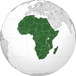
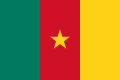
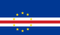
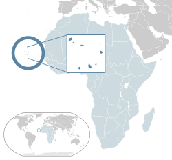
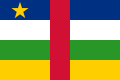
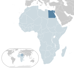
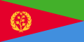
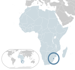
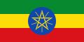
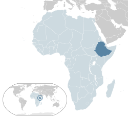
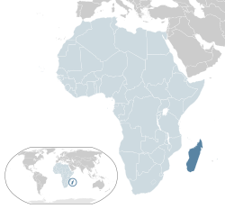
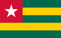
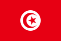
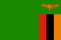
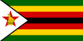
This is a list of sovereign states and dependent territories in Africa. It includes fully recognised states, states with limited or zero recognition, and dependent territories of both African and non-African states. It lists 56 sovereign states (54 of which are member states of the United Nations), two non-sovereign (dependent) territories of non-African sovereign states, and nine sub-national regions of non-African sovereign states. Malta and parts of France, Italy, Portugal, and Spain are located on the African continental plate, some considerably closer to the African mainland than the European mainland but, politically, are generally considered to be European by convention. Egypt, although extending into Asia through the Sinai Peninsula, is considered an African state.

Contents

Sovereign states

Recognised sovereign states

The following 54 fully recognised states are all members of the United Nations [1] and the African Union. [2] [3] [4] [5]

FlagMapEnglish short, formal names, and ISO
[6] [7] [8] [9]
Domestic short and formal name(s)
[6] [7]
Capital
[8] [10] [11]
Population 2021
[12] [13]
Area [a] [b]
[14]
Currency
[8]
Flag of Algeria.svg
Location Algeria AU Africa.svg Algeria

People's Democratic Republic of Algeria

DZA
Arabic : الجزائر—الجمهورية الجزائرية الديمقراطية الشعبية
(Al Jazāʼir — Al Jumhūriyyah al Jazāʾiriyyah ad Dimuqrāṭiyyah ash Shaʾbiyyah)
Algiers

Arabic : الجزائر
(Al Jazā’ir)
44,177,9692,381,740 km2 (919,595 sq mi) Algerian dinar
Flag of Angola.svg
Location Angola AU Africa.svg Angola

Republic of Angola

AGO
Portuguese: Angola—República de Angola Luanda

Portuguese: Luanda
34,503,7741,246,700 km2 (481,354 sq mi) kwanza
Flag of Benin.svg
Location Benin AU Africa.svg Benin

Republic of Benin

BEN
French: Bénin—République du Bénin Porto-Novo

French: Porto-Novo
12,996,895112,622 km2 (43,484 sq mi) CFA franc
Flag of Botswana.svg
Location Botswana AU Africa.svg Botswana

Republic of Botswana

BWA
English: Botswana—Republic of Botswana

Tswana: Botswana—Lefatshe la Botswana
Gaborone

English: Gaborone

Tswana: Gaborone
2,588,423581,726 km2 (224,606 sq mi) pula
Flag of Burkina Faso.svg
Location Burkina Faso AU Africa.svg Burkina Faso

BFA
French: Burkina Faso Ouagadougou

French: Ouagadougou
22,100,683274,000 km2 (105,792 sq mi) CFA franc
Flag of Burundi.svg
Location Burundi AU Africa.svg Burundi

Republic of Burundi

BDI
French: Burundi—République du Burundi

Kirundi: Burundi—Republika y'u Burundi
Gitega

French: Gitega

Kirundi: Gitega

12,551,21327,830 km2 (10,745 sq mi) Burundi franc
Flag of Cameroon.svg
Location Cameroon AU Africa.svg Cameroon

Republic of Cameroon

CMR
English: Cameroon—Republic of Cameroon

French: Cameroun—République du Cameroun
Yaoundé

English: Yaoundé

French: Yaoundé
27,198,628475,442 km2 (183,569 sq mi) includes the Cameroonian-administered parts of Southern Cameroons, which is claimed by the Southern Cameroons Peoples Organisation as the Republic of Ambazonia CFA franc
Flag of Cape Verde.svg
Location Cape Verde AU Africa.svg Cape Verde

Republic of Cabo Verde

CPV
Portuguese: Cabo Verde—República de Cabo Verde Praia

Portuguese: Praia
587,9254,033 km2 (1,557 sq mi) Cape Verdean escudo
Flag of the Central African Republic.svg
Location Central African Republic AU Africa.svg Central African Republic

CAF
Sango: Ködörösêse tî Bêafrîka

French: République centrafricaine
Bangui

Sango: Bangî

French: Bangui
5,457,154622,984 km2 (240,535 sq mi) CFA franc
Flag of Chad.svg
Location Chad AU Africa.svg Chad

Republic of Chad

TCD
Arabic : تشاد—جمهورية تشاد
(Tshād—Jumhūriyyat Tshād)

French: Tchad—République du Tchad
N'Djamena

Arabic : نجامينا (Nijāmīnā)

French: N'Djaména
17,179,7401,284,000 km2 (495,755 sq mi) CFA franc
Flag of the Comoros.svg
Location Comoros AU Africa.svg Comoros

Union of the Comoros

COM
Arabic : جزرالقمر—جمهورية القمرالمتحدة
(Juzur al Qamar—Jumhūriyyat al Qamar al Muttaḥidah)

Comorian: Komori—Udzima wa

Komori

French: Comores—Union des Comores

Moroni

Arabic : موروني (Mūrūnī)

French: Moroni
821,6252,235 km2 (863 sq mi) Comorian franc
Flag of the Democratic Republic of the Congo.svg
Location DR Congo AU Africa.svg Democratic Republic of the Congo [n 1]

COD
French: République démocratique du Congo Kinshasa

French: Kinshasa
95,894,1182,344,858 km2 (905,355 sq mi) Congolese franc
Flag of the Republic of the Congo.svg
Location Republic of the Congo AU Africa.svg Republic of the Congo [n 2]

COG
French: République du Congo Brazzaville

French: Brazzaville
5,835,806342,000 km2 (132,047 sq mi) CFA franc
Flag of Djibouti.svg
Location Djibouti AU Africa.svg Djibouti

Republic of Djibouti

DJI
Arabic : جيبوتي—جمهورية جيبوتي
(Jibūti—Jumhūrīyat Jibūti)

French: Djibouti—République de Djibouti
Djibouti

Arabic: مدينة جيبوتي (Jibūti Madīna)

French: Ville de Djibouti
1,105,55723,200 km2 (8,958 sq mi) Djibouti franc
Flag of Egypt.svg
Location Egypt AU Africa.svg Egypt

Arab Republic of Egypt [n 3]

EGY
Arabic : مصر—جمهورية مصر العربية(Miṣr—Jumhūrīyat Miṣr al ʿArabiyyah) Cairo

Arabic: القاهرة (al Qāhirah)
109,262,1781,001,449 km2 (386,662 sq mi) Egyptian pound
Flag of Equatorial Guinea.svg
Location Equatorial Guinea AU Africa.svg Equatorial Guinea

Republic of Equatorial Guinea

GNQ
Spanish: Guinea Ecuatorial—República de Guinea Ecuatorial

French: Guinée équatoriale—République de Guinée équatoriale

Portuguese: Guiné Equatorial—República da Guiné Equatorial

Malabo [n 4]

Spanish: Malabo

French: Malabo

Portuguese: Malabo

1,634,46628,051 km2 (10,831 sq mi) CFA franc
Flag of Eritrea.svg
Location Eritrea AU Africa.svg Eritrea

State of Eritrea

ERI
Arabic : إرتريا—دولة إرتريا
(ʾIritriyā—Dawlat ʾIritriyā)

English: Eritrea—State of Eritrea

Tigrinya: ኤርትራ — ሃገረ ኤርትራ
(ʾErtra—Hagere ʾErtra)
Asmara

Arabic: أسمرة (ʾAsmara)

English: Asmara

Tigrinya: ኣስመራ
(Asmera)
3,620,312117,600 km2 (45,406 sq mi) nakfa
Flag of Eswatini.svg
Location Swaziland AU Africa.svg Eswatini

Kingdom of Eswatini

SWZ
English: Eswatini—Kingdom of Eswatini

Swazi: eSwatini—Umbuso weSwatini
Lobamba (royal and legislative)
Mbabane (administrative)

English: Lobamba, Mbabane

Swazi: Lobamba, ÉMbábáne
1,192,27117,364 km2 (6,704 sq mi) lilangeni
Flag of Ethiopia.svg
Location Ethiopia AU Africa.svg Ethiopia

Federal Democratic Republic of Ethiopia

ETH
Amharic: Iትዮጵያ — የIትዮጵያ ፈደራላዊ ዲሞክራሲያዊ ሪፐብሊክ
(Ītyōṗṗyā—Ītyōṗṗyā Fēdēralāwī Dēmōkrāsīyāwī Rīpeblīk)
Addis Ababa

Amharic: አዲስ አበባ (Addis Abäba)
120,283,0261,104,300 km2 (426,373 sq mi) Ethiopian birr
Flag of Gabon.svg
Location Gabon AU Africa.svg Gabon

Gabonese Republic

GAB
French: Gabon—République gabonaise Libreville

French: Libreville
2,341,179267,668 km2 (103,347 sq mi) CFA franc
Flag of The Gambia.svg
Location Gambia AU Africa.svg The Gambia

Republic of the Gambia

GMB
English: The Gambia—Republic of the Gambia Banjul

English: Banjul
2,639,91610,380 km2 (4,008 sq mi) dalasi
Flag of Ghana.svg
Location Ghana AU Africa.svg Ghana

Republic of Ghana

GHA
English: Ghana—Republic of Ghana Accra

English: Accra
32,833,031238,534 km2 (92,098 sq mi) Ghana cedi
Flag of Guinea.svg
Location Guinea AU Africa.svg Guinea [n 5]

Republic of Guinea

GIN
French: Guinée—République de Guinée Conakry

French: Conakry
13,531,906245,857 km2 (94,926 sq mi) Guinean franc
Flag of Guinea-Bissau.svg
Location Guinea Bissau AU Africa.svg Guinea-Bissau

Republic of Guinea-Bissau

GNB
Portuguese: Guiné-Bissau—República da Guiné-Bissau Bissau

Portuguese: Bissau
2,060,72136,125 km2 (13,948 sq mi) CFA franc
Flag of Cote d'Ivoire.svg
Location Cote d'Ivoire AU Africa.svg Ivory Coast

Republic of Côte d'Ivoire

CIV
French: Côte d'Ivoire—République de Côte d'Ivoire Yamoussoukro

French: Yamoussoukro
27,478,249322,460 km2 (124,503 sq mi) CFA franc
Flag of Kenya.svg
Location Kenya AU Africa.svg Kenya

Republic of Kenya

KEN
English: Kenya—Republic of Kenya

Swahili: Kenya—Jamhuri ya Kenya
Nairobi

English: Nairobi

Swahili: Nairobi
53,005,614580,367 km2 (224,081 sq mi) Kenyan shilling
Flag of Lesotho.svg
Location Lesotho AU Africa.svg Lesotho

Kingdom of Lesotho

LSO
English: Lesotho—Kingdom of Lesotho

Sotho: Lesotho—Muso oa Lesotho
Maseru

English: Maseru

Sotho: Maseru
2,281,45430,355 km2 (11,720 sq mi) loti
Flag of Liberia.svg
Location Liberia AU Africa.svg Liberia

Republic of Liberia

LBR
English: Liberia—Republic of Liberia Monrovia

English: Monrovia
5,193,416111,369 km2 (43,000 sq mi) Liberian dollar
Flag of Libya.svg
Location Libya AU Africa.svg Libya

State of Libya

LBY
Arabic : ليبيا—دولة ليبيا(Lībīyā)

Berber: ⵍⵉⴱⵢⴰ (Libya)
Tripoli

Arabic: طرابلس (Ṭarābulus)

Berber: ⵟⵔⴰⴱⵍⴻⵙ (Ṭrables)
6,735,2771,759,540 km2 (679,362 sq mi) Libyan dinar
Flag of Madagascar.svg
Location Madagascar AU Africa.svg Madagascar

Republic of Madagascar

MDG
French: Madagascar—République de Madagascar

Malagasy : Repoblikan'i Madagasikara
Antananarivo

French: Antananarivo

Malagasy: Antananarivo
28,915,653587,041 km2 (226,658 sq mi) ariary
Flag of Malawi.svg
Location Malawi AU Africa.svg Malawi

Republic of Malawi

MWI
Chichewa: Malaŵi—Dziko la Malaŵi

English: Malawi—Republic of Malawi
Lilongwe

Chichewa: Lilongwe

English: Lilongwe
19,889,742118,484 km2 (45,747 sq mi) Malawian kwacha
Flag of Mali.svg
Location Mali AU Africa.svg Mali

Republic of Mali

MLI
French: Mali—République du Mali Bamako

French: Bamako
21,904,9831,240,192 km2 (478,841 sq mi) CFA franc
Flag of Mauritania.svg
Location Mauritania AU Africa.svg Mauritania

Islamic Republic of Mauritania

MRT
Arabic : موريتانيا—الجمهورية الإسلامية الموريتانية
(Mūrītānīyyā

—Al Jumhūriyyah alʾIslāmiyyah al Mūrītānīyyah
)
Nouakchott

Arabic: نواكشوط (Nuwākshūṭ)
4,614,9741,030,700 km2 (397,955 sq mi) ouguiya
Flag of Mauritius.svg
Location Mauritius AU Africa.svg Mauritius

Republic of Mauritius

MUS
English: Mauritius—Republic of Mauritius

French: Maurice—République de Maurice

Mauritian Creole Moris—Repiblik Moris
Port Louis

English: Port Louis

French: Port-Louis

Mauritian Creole: Porlwi
1,298,9152,040 km2 (788 sq mi) Mauritian rupee
Flag of Morocco.svg
Location Morocco AU Africa.svg Morocco

Kingdom of Morocco

MAR
Arabic : المغرب—المملكة المغربية
(Al Maḡrib—Al Mamlakah al Maḡribiyyah)

Berber: ⵜⴰⴳⵍⴷⵉⵜ ⵏ ⵍⵎⴰⵖⵔⵉⴱ (Tageldit n-Elmaġrib)
Rabat

Arabic: الرباط (ar-Ribaaṭ)

Berber: ⴰⵕⴱⴰⵟ (Aṛbaṭ)
37,076,584446,550 km2 (172,414 sq mi) excludes all disputed territories

710,850 km2 (274,461 sq mi) includes the Moroccan-administered parts of Western Sahara, which is claimed by the Polisario Front as the Sahrawi Arab Democratic Republic
Moroccan dirham
Flag of Mozambique.svg
Location Mozambique AU Africa.svg Mozambique

Republic of Mozambique

MOZ
Portuguese: Moçambique—República de Moçambique Maputo

Portuguese: Maputo
32,077,072801,590 km2 (309,496 sq mi) metical
Flag of Namibia.svg
Location Namibia AU Africa.svg Namibia

Republic of Namibia

NAM
English: Namibia—Republic of Namibia Windhoek

English: Windhoek
2,530,151825,418 km2 (318,696 sq mi) Namibian dollar
Flag of Niger.svg
Location Niger AU Africa.svg Niger

Republic of the Niger

NER
French: Niger—République du Niger Niamey

French: Niamey
25,252,7221,267,000 km2 (489,191 sq mi) CFA franc
Flag of Nigeria.svg
Location Nigeria AU Africa.svg Nigeria

Federal Republic of Nigeria

NGA
English: Nigeria—Federal Republic of Nigeria Abuja

English: Abuja
213,401,323923,768 km2 (356,669 sq mi) naira
Flag of Rwanda.svg
Location Rwanda AU Africa.svg Rwanda

Republic of Rwanda

RWA
English: Rwanda—Republic of Rwanda

French: Rwanda—République du Rwanda

Kinyarwanda Rwanda—Repubulika y'u Rwanda
Kigali

English: Kigali

French: Kigali

Kinyarwanda Kigali
13,461,88826,798 km2 (10,347 sq mi) Rwandese franc
Flag of Sao Tome and Principe.svg
Location Sao Tome and Principe AU Africa.svg São Tomé and Príncipe

Democratic Republic of São Tomé and Príncipe

STP
Portuguese: São Tomé e Príncipe—República Democrática de São Tomé e Príncipe São Tomé

Portuguese: São Tomé
223,107964 km2 (372 sq mi) Dobra
Flag of Senegal.svg
Location Senegal AU Africa.svg Senegal

Republic of Senegal

SEN
French: Sénégal—République du Sénégal Dakar

French: Dakar
16,876,720196,723 km2 (75,955 sq mi) CFA franc
Flag of Seychelles.svg
Location Seychelles AU Africa.svg Seychelles

Republic of Seychelles

SYC
English: Seychelles—Republic of Seychelles

French: Seychelles—République des Seychelles

Seychellois Creole: Sesel— Repiblik Sesel
Victoria

English: Victoria

French: Victoria

Seychellois Creole: Victoria
106,471451 km2 (174 sq mi) Seychelles rupee
Flag of Sierra Leone.svg
Location Sierra Leone AU Africa.svg Sierra Leone

Republic of Sierra Leone

SLE
English: Sierra Leone—Republic of Sierra Leone Freetown

English: Freetown
8,420,64171,740 km2 (27,699 sq mi) leone
Flag of Somalia.svg
Location Somalia AU Africa.svg Somalia

Federal Republic of Somalia

SOM
Arabic : الصومال—جمهورية الصومال الفيدرالية
(Aṣ Ṣūmāl—Jumhūriyyah aṣ Ṣūmāl al Fīdrāliyyah)

Somali: Jamhuuriyadda Federaalka Soomaaliya
Mogadishu

Arabic: مقديشو (Maqadīshū)

Somali: Muqdisho
17,065,581637,657 km2 (246,201 sq mi) Somali shilling
Flag of South Africa.svg
Location South Africa AU Africa.svg South Africa

Republic of South Africa

ZAF
Afrikaans: Suid-Afrika—Republiek van Suid-Afrika
10 other official names
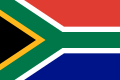
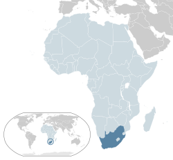
  • English: South Africa—Republic of South Africa
    Tsonga: Afrika Dzonga—Riphabliki ra Afrika Dzonga
    Tswana: Aforika Borwa—Rephaboliki ya Aforika Borwa
    Southern Ndebele: Sewula Afrika—iRiphabliki yeSewula Afrika
    Northern Sotho: Afrika-Borwa—Repabliki ya Afrika-Borwa
    (Southern) Sotho: Afrika Borwa—Rephaboliki ya Afrika Borwa
    Swati: Ningizimu Afrika—iRiphabhulikhi yeNingizimu Afrika
    Venda: Afurika Tshipembe—Riphabuḽiki ya Afurika Tshipembe
    Xhosa: uMzantsi Afrika—iRiphabliki yomZantsi Afrika
    Zulu: Ningizimu Afrika—iRiphabhuliki yaseNingizimu Afrika
Bloemfontein (judicial),
Cape Town (legislative),
and Pretoria (executive)
59,392,2551,221,037 km2 (471,445 sq mi) rand
Flag of South Sudan.svg
Location South Sudan AU Africa.svg South Sudan

Republic of South Sudan

SSD
English: South Sudan—Republic of South Sudan Juba

English: Juba
10,748,272644,329 km2 (248,777 sq mi) South Sudanese pound
Flag of Sudan.svg
Location Sudan AU Africa.svg Sudan

Republic of the Sudan

SDN
Arabic : السودان—جمهورية السودان
(As Sūdān—Jumhūriyyah as Sūdān)

English: Republic of the Sudan
Khartoum

Arabic: الخرطوم (Al Khurṭūm)

English: Khartoum
45,657,2021,861,484 km2 (718,723 sq mi) Sudanese pound
Flag of Tanzania.svg
Location Tanzania AU Africa.svg Tanzania

United Republic of Tanzania

TZA
English: Tanzania—United Republic of Tanzania

Swahili: Tanzania—Jamhuri ya Muungano wa Tanzania
Dodoma (official)
Dar es Salaam (seat of government)

English: Dodoma

Swahili: Dodoma
63,588,334945,203 km2 (364,945 sq mi) Tanzanian shilling
Flag of Togo.svg
Location Togo AU Africa.svg Togo

Togolese Republic

TGO
French: Togo—République Togolaise Lomé

French: Lomé
8,644,82956,785 km2 (21,925 sq mi) CFA franc
Flag of Tunisia.svg
Location Tunisia AU Africa.svg Tunisia

Republic of Tunisia

TUN
Arabic : تونس—الجمهورية التونسية
(Tūnis—Al Jumhūriyyah at Tūnisīyyah)
Tunis

Arabic: تونس (Tūnis)
12,262,946163,610 km2 (63,170 sq mi) Tunisian dinar
Flag of Uganda.svg
Location Uganda AU Africa.svg Uganda

Republic of Uganda

UGA
English: Uganda—Republic of Uganda

Swahili: Uganda—Jamhuri ya Uganda
Kampala

English: Kampala

Swahili: Kampala
45,853,778236,040 km2 (91,136 sq mi) Ugandan shilling
Flag of Zambia.svg
Location Zambia AU Africa.svg Zambia

Republic of Zambia

ZMB
English: Zambia—Republic of Zambia Lusaka

English: Lusaka
19,473,125752,614 km2 (290,586 sq mi) Zambian kwacha
Flag of Zimbabwe.svg
Location Zimbabwe AU Africa.svg Zimbabwe

Republic of Zimbabwe

ZWE
English: Zimbabwe—Republic of Zimbabwe Harare

English: Harare
15,993,524390,757 km2 (150,872 sq mi) Zimbabwe dollar

Sovereign states with limited or no international recognition

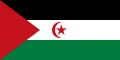
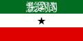
The following two entities have declared themselves to be sovereign states and are in control of some territory but have limited or no recognition from other states. Neither entity is a member state of the United Nations, although the Sahrawi Arab Democratic Republic is a member of the African Union.

FlagMapEnglish short, formal names, and ISO StatusDomestic short name(s)
and
formal name(s)
CapitalPopulationAreaCurrency
Flag of the Sahrawi Arab Democratic Republic.svg
Location Western Sahara AU Africa.svg Sahrawi Arab Democratic Republic [n 6] Claimed by Morocco as its southernmost provinces

Recognized by the African Union and 46 UN members and South Ossetia as the representative government of Western Sahara
Arabic : الجمهورية العربية الصحراوية الديمقراطية
(Al Jumhūrīyah al ‘Arabīyah aṣ Ṣaḥrāwīyah ad Dīmuqrāṭīyah)

Spanish: República Árabe Saharaui Democrática
El Aaiún (proclaimed) [n 7]

Arabic: العيون (AlʿUyūn)

Spanish: El Aaiún
582,478267,405 km2 (103,246 sq mi) Sahrawi peseta
Flag of Somaliland.svg
Location Somaliland AU Africa.svg Somaliland

Republic of Somaliland [15] [16]
State not controlled by Somalia [17]

Recognized by no UN member [18] [19] , only by Taiwan
Arabic : أرض الصومال—جمهورية أرض الصومال
(Arḍ aṣ Ṣūmāl—Jumhūrīyat Arḍ aṣ Ṣūmāl)

Somali: Jamhuuriyadda Somaliland
Hargeisa

Arabic: هرجيسا (Harjaysā)

Somali: Hargeysa
4,000,000176,120 km2 (68,000 sq mi) Somaliland shilling

Non-sovereign territories

There are currently 11 non-sovereign territories in Africa. Except two Spanish autonomous cities and Peñón de Vélez de la Gomera, all the remaining territories are islands off the continent's coast.

Dependent territories

FlagMapEnglish short, formal names, and ISO Ruling powerStatus [20] Domestic short name
and
formal name
CapitalPopulationArea [14] Currency
Flag of the United Kingdom.svg
Saint Helena, Ascension and Tristan da Cunha in United Kingdom.svg Saint Helena, Ascension and Tristan da Cunha

SH
Flag of the United Kingdom.svg  United Kingdom British Overseas Territory English: Saint Helena, Ascension and Tristan da Cunha Jamestown 5,633420 km2 (162 sq mi) Saint Helena pound (Saint Helena & Ascension)
Pound sterling (Tristan da Cunha)
Flag of the French Southern and Antarctic Lands.svg
TAAF-fr.png French Southern and Antarctic Lands [n 8]

FR-TF
Flag of France.svg  France Overseas territory of France French: Terres australes et antarctiques françaises Saint Pierre [n 9] No permanent population [21] 38.60 km2 (15 sq mi) euro

Other territories

This list contains 9 territories that are administered as incorporated areas of a primarily non-African country.

FlagMapEnglish short, formal names, and ISO Ruling powerStatus [20] Domestic short name(s)
and
formal name(s)
CapitalPopulationArea [14] Currency
Flag of the Canary Islands.svg
Location Canary Islands Africa.svg Canary Islands

Autonomous Region of the Canary Islands

ES-CN
Flag of Spain.svg  Spain Autonomous community of Spain Spanish: Islas Canarias Santa Cruz and Las Palmas [22]

Spanish: Santa Cruz de Tenerife and Las Palmas de Gran Canaria
2,207,2257,447 km2 (2,875 sq mi) euro
Flag Ceuta.svg
Ceuta-melilla.png Ceuta

Autonomous City of Ceuta

ES-CE
Autonomous city of Spain Spanish: Ceuta—Ciudad autónoma de CeutaCeuta

Spanish: Ceuta
84,84328 km2 (11 sq mi) euro
Flag of Madeira.svg
Location Madeira Africa.svg Madeira

Autonomous Region of Madeira

PT-30
Flag of Portugal.svg  Portugal Autonomous Region of Portugal Portuguese: Madeira—Região Autónoma da Madeira Funchal

Portuguese: Funchal
267,785828 km2 (320 sq mi) euro
Flag of France.svg
Location Mayotte Africa.svg Mayotte

Mayotte Region

YT
Flag of France.svg  France Overseas region and constituent part of the French Republic French: Mayotte—Région Mayotte Dzaoudzi (official)
Mamoudzou (seat of prefect and departmental council)

French: Mamoudzou
266,380374 km2 (144 sq mi) euro
Flag of Melilla.svg
Ceuta-melilla.png Melilla

Autonomous City of Melilla

ES-ML
Flag of Spain.svg  Spain Autonomous city of Spain Spanish: Melilla—Ciudad autónoma de MelillaMelilla

Spanish: Melilla
84,71420 km2 (8 sq mi) euro
Flag of Italy.svg
Pelagie Islands map.png Pelagie Islands

Flag of Italy.svg  Italy Archipelago of Italy Italian: Isole Pelagie

Sicilian: Ìsuli Pilaggî
Lampedusa e Linosa [n 10]

Italian: Lampedusa e Linosa

Sicilian: Lampidusa e Linusa
6,30421.4 km2 (8 sq mi) euro
Flag of Spain.svg
Mapa del sur de Espana neutral.png Plazas de soberanía

Flag of Spain.svg  Spain Overseas territory of Spain Spanish: Plazas de soberaníaN/A740.59 km2 (0.23 sq mi) euro
Flag of France.svg Location Reunion Africa.svg Reunion

Reunion Region

RE
Flag of France.svg  France Overseas region and constituent part of the French Republic French: Réunion—Région Réunion Saint-Denis

French: Saint-Denis
889,9182,512 km2 (970 sq mi) euro
Flag of Yemen.svg
Socotra Archipelago.PNG Socotra Archipelago

Flag of Yemen.svg  Yemen Governorate of Yemen Arabic : أرخبيل سقطرى
(ʾArḫabīl Suquṭrā)
Hadibu

Arabic: اديبو (Ḥādībū)
60,5503,974.64 km2 (1,535 sq mi) Yemeni rial

See also

Notes

  1. Also known as Congo-Kinshasa and formerly as Zaire.
  2. Also known as Congo-Brazzaville.
  3. Some territory could be argued to be a part of Asia or Africa.
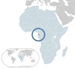
  4. Ciudad de la Paz is to be the future capital of Equatorial Guinea; currently under construction.
  5. Also known as Guinea-Conakry to distinguish it from neighboring Guinea-Bissau.
  6. Occupies part of the territory of Western Sahara, disputed with Morocco.
  7. Currently under Moroccan administration. Tifariti is the factual temporary capital, but Tindouf located in Algeria is the place of some government and military facilities.
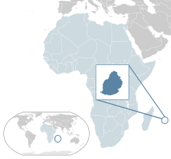
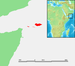
  8. Only the Îles Éparses are considered part of the African continent. The remaining four districts lie outside the continental shelf in the Indian Ocean or Antarctica.
  9. The main station on the Îles Éparses is on Tromelin. The headquarters of the district chief, however, is Saint Pierre, in Réunion.
  10. Geographically part of the archipelago (Lampedusa and Lampione) belongs to the African continent; politically and administratively, the islands fall within the Province of Agrigento in Sicily

Related Research Articles

<span class="mw-page-title-main">Country</span> Distinct territorial body or political entity

A country is a distinct part of the world, such as a state, nation, or other political entity. When referring to a specific polity, the term "country" may refer to a sovereign state, states with limited recognition, constituent country, or a dependent territory. Most sovereign states, but not all countries, are members of the United Nations. There is no universal agreement on the number of "countries" in the world since several states have disputed sovereignty status, limited recognition and a number of non-sovereign entities are commonly called countries.

<span class="mw-page-title-main">Somalia</span> Country in the Horn of Africa

Somalia, officially the Federal Republic of Somalia, is the easternmost country in continental Africa. The country is on the Horn of Africa and is bordered by Ethiopia to the west, Djibouti to the northwest, the Gulf of Aden to the north, the Indian Ocean to the east, and Kenya to the southwest. Somalia has the longest coastline on Africa's mainland. In antiquity, Somalia was an important commercial center. During the Middle Ages, several powerful Somali empires dominated the regional trade, including the Imamate of Awsame, Ajuran Sultanate, the Adal Sultanate, and the Sultanate of the Geledi. In the late 19th century, Somali sultanates were colonized by the Italian and British Empires, who merged all of these tribal territories into two colonies: Italian Somaliland and British Somaliland. In 1960, the two territories united to form the independent Somali Republic under a civilian government. Siad Barre of the Supreme Revolutionary Council (SRC) seized power in 1969 and established the Somali Democratic Republic, brutally attempting to squash the Somaliland War of Independence in the north of the country. The SRC collapsed in 1991 with the onset of the Somali Civil War. The Transitional National Government of Somalia (TNG) was established in 2000, followed by the formation of the Transitional Federal Government of Somalia (TFG) in 2004, which reestablished the Somali Armed Forces.

<span class="mw-page-title-main">Somaliland</span> Unrecognised state in the Horn of Africa

Somaliland, officially the Republic of Somaliland, is an unrecognised country in the Horn of Africa, recognised internationally as de jure part of Somalia. It is located in the southern coast of the Gulf of Aden and bordered by Djibouti to the northwest, Ethiopia to the south and west, and Somalia to the east. Its claimed territory has an area of 176,120 square kilometres (68,000 sq mi), with approximately 5.7 million residents as of 2021. The capital and largest city is Hargeisa. The Government of Somaliland regards itself as the successor state to British Somaliland, which, as the briefly independent State of Somaliland, united from 1960 to 1991 with the Trust Territory of Somaliland to form the Somali Republic.

A dependent territory, dependent area, or dependency is a territory that does not possess full political independence or sovereignty as a sovereign state and remains politically outside the controlling state's integral area. As such a dependent territory includes a range of non-integrated not fully to non-independent territory types, from associated states to non-self-governing territories.

<span class="mw-page-title-main">Foreign relations of Somaliland</span>

Foreign relations of the Republic of Somaliland are the responsibility of the Ministry of Foreign Affairs of the Republic of Somaliland. The region's self-declaration of independence remains unrecognised by the international community.

<span class="mw-page-title-main">State of Somaliland</span> 1960 short-lived state in the Horn of Africa

Somaliland, officially the State of Somaliland, was a short-lived independent country in the territory of the present-day unilaterally declared Republic of Somaliland, which regards itself as its legal successor. It existed on the territory of former British Somaliland for five days between 26 June 1960 and 1 July 1960, when it merged with the formerly Italian administered Trust Territory of Somaliland to form the Somali Republic.

<span class="mw-page-title-main">Somaliland nationality law</span> Laws governing Somaliland nationality and citizenship

Somaliland a self-declared independent country in the Horn of Africa in which inhabitants were initially governed by various kinship networks. Upon contact with Europeans, treaties were signed in the area to secure rights to trade in the territory in exchange for protection of clans from rivals. Britain formally extended a protectorate over British Somaliland in 1898. Inhabitants of Somaliland were British Protected Persons from that date until they gained their independence in 1960 and joined in the union of their state with Italian Somaliland to form the Somali Republic. Inhabitants derive their nationality from Somali law. The legal means to acquire nationality, formal legal membership in a sovereign nation, differ from the domestic relationship of rights and obligations between a citizen within its nation, known as citizenship. Nationality describes the relationship of an individual to the nation under international law, whereas citizenship is the domestic relationship of an individual within the state. As the African Union, United Nations, and no independent nation has recognized its national sovereignty, Somaliland's inhabitants are Somali nationals, but since declaring its independence in 1991, it has de facto authority to control internal affairs and citizenship within its territory.

<span class="mw-page-title-main">Somaliland Declaration of Independence</span>

The Somaliland Declaration of Independence was made on 18 May 1991 by Somali sultans from the Isaaq, Dhulbahante, Issa, Gadabursi, Warsangali clans, as well as the Somali National Movement.

References

  1. "Member States". United Nations. Archived from the original on 7 February 2011. Retrieved 28 July 2011.
  2. "Member States". African Union. Archived from the original on 9 January 2015. Retrieved 15 July 2013.
  3. "African Union Welcomes South Sudan as the 54th Member State of the Union". StarAfrica.com. 27 July 2011. Archived from the original on 23 December 2011. Retrieved 28 July 2011.
  4. "African Union suspends Central African Republic after coup". Los Angeles Times. 25 March 2013. Archived from the original on 31 December 2014. Retrieved 14 March 2015.
  5. "Africa Population (LIVE)". www.worldometers.info. Retrieved 31 July 2019.
  6. 1 2 "Field Listing :: Names". CIA. Archived from the original on 1 July 2017. Retrieved 28 July 2017.
  7. 1 2 "UNGEGN List of Country Names" (PDF). United Nations Group of Experts on Geographical Names. 2007. Archived (PDF) from the original on 28 July 2011. Retrieved 28 July 2011.
  8. 1 2 3 "List of countries, territories and currencies". Europa. 9 August 2011. Archived from the original on 5 August 2013. Retrieved 10 August 2011.
  9. "ISO 3166". International Organization for Standardization. 1974. Retrieved 24 July 2022.
  10. "Field Listing :: Capital". CIA. Archived from the original on 29 June 2011. Retrieved 3 August 2011.
  11. "UNGEGN World Geographical Names". United Nations Group of Experts on Geographical Names. 29 July 2011. Archived from the original on 1 August 2011. Retrieved 3 August 2011.
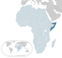
  12. "World Population Prospects 2022". United Nations Department of Economic and Social Affairs, Population Division. Retrieved 17 July 2022.
  13. "World Population Prospects 2022: Demographic indicators by region, subregion and country, annually for 1950-2100" (XSLX) ("Total Population, as of 1 July (thousands)"). United Nations Department of Economic and Social Affairs, Population Division. Retrieved 17 July 2022.
  14. 1 2 3 "Field Listing :: Area". CIA. Archived from the original on 16 September 2012. Retrieved 7 August 2011.
  15. Name used in The Constitution of the Republic of Somaliland Archived 2015-09-24 at the Wayback Machine
  16. Susan M. Hassig, Zawiah Abdul Latif, Somalia, (Marshall Cavendish: 2007), p.10.
  17. "The Transitional Federal Charter of the Somali Republic" (PDF). University of Pretoria. 1 February 2004. Archived from the original on 18 December 2008. Retrieved 2 February 2010.{{cite web}}: CS1 maint: unfit URL (link) "The Somali Republic shall have the following boundaries. (a) North; Gulf of Aden. (b) North West; Djibouti. (c) West; Ethiopia. (d) South south-west; Kenya. (e) East; Indian Ocean."
  18. Lacey, Marc (5 June 2006). The Signs Say Somaliland, but the World Says Somalia Archived 2011-06-27 at the Wayback Machine . The New York Times. Retrieved 2010-05-25.
  19. "UN in Action: Reforming Somaliland's Judiciary" (PDF). Archived (PDF) from the original on 21 January 2012. Retrieved 29 May 2012.
  20. 1 2 "Field Listing :: Dependency Status". CIA. Archived from the original on 29 June 2011. Retrieved 8 August 2011.
  21. "French Southern and Antarctic Lands" . Retrieved 5 October 2014.
  22. "Estatuto de Autonomía de Canarias en la Página Web Oficial del Gobierno de Canarias". .gobiernodecanarias.org. Archived from the original on 20 January 2011. Retrieved 20 September 2010.