List of transcontinental countries

Last updated

This is a list of countries with territory that straddles more than one continent, known as transcontinental states or intercontinental states. [1]

Contents

Contiguous transcontinental countries are states that have one continuous or immediately-adjacent piece of territory that spans a continental boundary, most commonly the line that separates Asia and Europe. By contrast, non-contiguous transcontinental countries are those states that have portions of territory that are separated from one another either by a body of water or by other countries (such as in the case of France). Most non-contiguous transcontinental countries are countries with dependent territories like Denmark with Greenland, but can be countries that have fully integrated former dependent territories in their central states like France with its overseas regions. [1]

For the purposes of this article, a seven-continent model is assumed based on common terms of reference by English language geographers. [2] Combined continents like "the Americas" and "Eurasia" are not acknowledged or referenced. The boundary between Asia and Europe is largely conventional (much of it over land), and several conventions remained in use well into the 20th century. However, the now-prevalent convention—which has been in use by some cartographers since about 1850—follows the Caucasus northern chain, the Ural River and the Ural Mountains, is used for the purposes of this list. [3] This convention results in several countries such as in the case of Azerbaijan, Kazakhstan, and Turkey finding themselves almost entirely in 'Asia', with a few small enclaves or districts technically in 'Europe'. Notwithstanding these anomalies, this list of transcontinental or intercontinental states respects the convention that Europe and Asia are full continents rather than subcontinents or component landmasses of a larger Eurasian continent.

Listed further below, separately, are countries with distant non-contiguous parts (overseas territories) on separate continents.

Definition

The lists within this article include entries that meet the following criteria:

The boundaries between the continents can be vague and subject to interpretation, making it difficult to conclusively define what counts as a 'transcontinental state'.

Contiguous boundary

Contiguous transcontinental states are those countries that have one continuous or immediately adjacent piece of territory that spans a continental boundary. More specifically, they contain a portion of their territory on one continent and a portion of their territory on another continent, while having these two portions connected via a natural geological land connection (e.g. Russia) or the two portions being immediately adjacent to one another (e.g. Turkey). [6] [7] In other words, someone can travel to another continent without changing the country (without crossing a border).

Africa and Asia

.mw-parser-output .legend{page-break-inside:avoid;break-inside:avoid-column}.mw-parser-output .legend-color{display:inline-block;min-width:1.25em;height:1.25em;line-height:1.25;margin:1px 0;text-align:center;border:1px solid black;background-color:transparent;color:black}.mw-parser-output .legend-text{}
African land part of Egypt
Asian land part of Egypt
The rest of Africa
The rest of Asia TransAfrica.PNG
  African land part of Egypt
  Asian land part of Egypt
  The rest of Africa
  The rest of Asia

The modern convention for the land boundary between Asia and Africa runs along the Isthmus of Suez and the Suez Canal in Egypt. The border continues through the Gulf of Suez, Red Sea, and Gulf of Aden. In antiquity, Egypt had been considered part of Asia,[ citation needed ] with the Catabathmus Magnus escarpment taken as the boundary with Africa (Libya).

Asia and Europe

Conventions used for the boundary between Asia and Europe during the 18th and 19th centuries. The red line shows the most common modern convention, in use since c. 1850.
Asia
Europe
historically placed in either continent Historical Europe-Asia boundaries 1700 to 1900.png
Conventions used for the boundary between Asia and Europe during the 18th and 19th centuries. The red line shows the most common modern convention, in use since c.1850.
  Asia
  Europe
  historically placed in either continent

The conventional Asia-Europe boundary was subject to considerable variation during the 18th and 19th centuries, indicated anywhere between the Don River and the Caucasus to the south or the Ural Mountains to the east. Since the late 19th century, the Caucasus–Urals boundary has become almost universally accepted. According to this now-standard convention, the boundary follows the Aegean Sea, the Turkish Straits, the Black Sea, along the watershed of the Greater Caucasus, the northwestern portion of the Caspian Sea and along the Ural River and Ural Mountains to the Arctic Ocean. [8] [9]

According to this convention, the following countries have territory in both Asia and Europe.

North America and South America

Map of the Darien Gap at the border between Colombia and Panama Map of Darien Gap-en.svg
Map of the Darién Gap at the border between Colombia and Panama

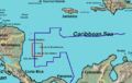
The conventional boundary between North America and South America is at some point on the Colombia–Panama border, with the most common demarcation in atlases and other sources following the Darién Mountains watershed where the Isthmus of Panama meets the South American continent (see Darién Gap). This area encompasses a large watershed, forest and mountains in the northern portion of Colombia's Chocó Department and Panama's Darién province.

Some geographers prefer to use the Panama Canal [22] as the physical boundary between North and South America instead. [23] [ full citation needed ] Under this convention, its capital Panama City is classified as a South American city. Given the competing claims, the Panamanian sports governing bodies affiliate to differing continental/regional confederations: its athletics federation to South America's, its soccer federation to North, Central America and Caribbean's; its Olympic committee to both South America's and Central America's.

Non-contiguous

North America and South America

The special case of Caribbean islands adjacent to the South American coastline:

Caribbean Island locations

North American Caribbean islands administered by South American states:

Caribbean islands considered North American or South American:

South America and Oceania

Europe and North America

Comparison map: Greenland, the Faroe Islands (enlarged) and Denmark differ significantly in size. The Danish Realm is spread across the North Atlantic Ocean and North Sea. Kingdom of Denmark, administrative divisions - en - colored (zoom).svg
Comparison map: Greenland, the Faroe Islands (enlarged) and Denmark differ significantly in size. The Danish Realm is spread across the North Atlantic Ocean and North Sea.

Europe, North America, and South America

North America, Oceania, and Asia

Europe, North America, South America, Oceania, Africa, and Antarctica

Europe, North America, South America, Oceania, Africa, Asia, and Antarctica

Africa and Europe

Asia and Africa

Asia and Europe

Asia and Oceania

Antarctica and other continents

Sub-Antarctic region

  • Argentina, Australia, Chile, France, New Zealand, Norway, South Africa, and the United Kingdom: These eight states have overseas island possessions in the Subantarctic region between 46°S and 60°S latitude. Subantarctic islands that are north of 60°S latitude but south of the Antarctic Convergence and that are recognized by international law as being full sovereign possessions of an administering state are: Bouvet Island (Norway), Heard Island and McDonald Islands (Australia), the Kerguelen Islands (France), and South Georgia and the South Sandwich Islands (United Kingdom). The United Nations categorize Bouvet Island and South Georgia and the South Sandwich Islands as part of South America, and Heard Island and McDonald Islands as part of Oceania. [30] South Georgia and the South Sandwich Islands is sometimes considered to be geographically within the bounds of South America; [59] [60] however, the other islands are among the most isolated locations in the world. Human activity is very limited on Bouvet Island and Heard Island and McDonald Islands; for example, the McDonald Islands have only ever been visited twice throughout their entire recorded history, with the last visit being in 1980. [61] The World Factbook categorize Bouvet Island and Heard Island and McDonald Islands as part of Antarctica rather than South America/Oceania. [62] [63]

Antarctic region

Countries formerly and/or never widely or officially considered as transcontinental countries

Asia and Oceania

North America and Oceania

South America and Oceania

Europe and North America

Notes

    1. Anguilla, Bermuda, the British Virgin Islands, the Cayman Islands, Montserrat, and the Turks and Caicos Islands.
    2. The Antarctic claims of Argentina, Chile, and the United Kingdom overlap to some degree.
    3. Australia, France, New Zealand, Norway, and the United Kingdom recognize each other's Antarctic claims (which do not overlap). [64]

    See also

    Related Research Articles

    <span class="mw-page-title-main">Asia</span> Continent

    Asia is the largest continent in the world by both land area and population. It covers an area of more than 44 million square kilometers, about 30% of Earth's total land area and 8% of Earth's total surface area. The continent, which has long been home to the majority of the human population, was the site of many of the first civilizations. Its 4.7 billion people constitute roughly 60% of the world's population.

    <span class="mw-page-title-main">Far East</span> Geographical term for eastern Asia

    The Far East is the geographical region that encompasses the easternmost portion of the Asian continent, including East, North and Southeast Asia. South Asia is sometimes also included in the definition of the term.

    <span class="mw-page-title-main">Island</span> Piece of subcontinental land completely surrounded by water

    An island or isle is a piece of subcontinental land completely surrounded by water. Very small islands such as emergent land features on atolls can be called islets, skerries, cays or keys. An island in a river or a lake island may be called an eyot or ait, and a small island off the coast may be called a holm. Sedimentary islands in the Ganges Delta are called chars. A grouping of geographically or geologically related islands, such as the Philippines, is referred to as an archipelago.

    <span class="mw-page-title-main">North America</span> Continent in the Northern Hemisphere

    North America is a continent in the Northern and Western Hemispheres. North America is bordered to the north by the Arctic Ocean, to the east by the Atlantic Ocean, to the southeast by South America and the Caribbean Sea, and to the west and south by the Pacific Ocean. Greater North America includes the Bahamas, Bermuda, Canada, the Caribbean, Central America, Clipperton Island, Greenland, Mexico, Saint Pierre and Miquelon, Turks and Caicos Islands, and the United States.

    <span class="mw-page-title-main">Oceania</span> Geographical region in the Pacific Ocean

    Oceania is a geographical region comprising Australasia, Melanesia, Micronesia, and Polynesia. Spanning the Eastern and Western Hemispheres, at the centre of the water hemisphere, Oceania is estimated to have a land area of about 9,000,000 square kilometres (3,500,000 sq mi) and a population of around 44.4 million as of 2022. When compared to the other continents, Oceania is the smallest in land area and the second-least populated after Antarctica.

    <span class="mw-page-title-main">Southern Hemisphere</span> Half of Earth that is south of the Equator

    The Southern Hemisphere is the half (hemisphere) of Earth that is south of the Equator. It contains all or parts of five continents and four oceans, as well as New Zealand and most of the Pacific Islands in Oceania. Its surface is 80.9% water, compared with 60.7% water in the Northern Hemisphere, and it contains 32.7% of Earth's land.

    Mainland is defined as "relating to or forming the main part of a country or continent, not including the islands around it [regardless of status under territorial jurisdiction by an entity]." The term is often politically, economically and/or demographically more significant than politically associated remote territories, such as exclaves or oceanic islands situated outside the continental shelf.

    <span class="mw-page-title-main">Subregion</span> Part of a larger geographic region or continent

    A subregion is a part of a larger region or continent. Cardinal directions are commonly used to define subregions. There are many criteria for creating systems of subregions; this article is focusing on the UN statistical geoscheme, which is a changing, constantly updated, UN tool based on specific political geography considerations relevant in UN statistics.

    <span class="mw-page-title-main">Geography of Asia</span>

    Geography of Asia reviews geographical concepts of classifying Asia, the central and eastern part of Eurasia, comprising 58 countries and territories.

    The World Geographical Scheme for Recording Plant Distributions (WGSRPD) is a biogeographical system developed by the international Biodiversity Information Standards (TDWG) organization, formerly the International Working Group on Taxonomic Databases. The WGSRPD standards, like other standards for data fields in botanical databases, were developed to promote "the wider and more effective dissemination of information about the world's heritage of biological organisms for the benefit of the world at large". The system provides clear definitions and codes for recording plant distributions at four scales or levels, from "botanical continents" down to parts of large countries. The codes may be referred to as TDWG geographical codes. Current users of the system include the International Union for Conservation of Nature (IUCN), the Germplasm Resources Information Network (GRIN), and Plants of the World Online (POWO).

    <span class="mw-page-title-main">Boundaries between the continents</span>

    Determining the boundaries between the continents is generally a matter of geographical convention. Several slightly different conventions are in use. The number of continents is most commonly considered seven but may range as low as four when Afro-Eurasia and the Americas are both considered as single continents. An island can be considered to be associated with a given continent by either lying on the continent's adjacent continental shelf or being a part of a microcontinent on the same principal tectonic plate. An island can also be entirely oceanic while still being associated with a continent by geology or by common geopolitical convention. Another example is the grouping into Oceania of the Pacific Islands with Australia and Zealandia.

    <span class="mw-page-title-main">Continent</span> Large geographical region identified by convention

    A continent is any of several large geographical regions. Continents are generally identified by convention rather than any strict criteria. A continent could be a single landmass or a part of a very large landmass, as in the case of Asia or Europe. Due to this, the number of continents varies; up to seven or as few as four geographical regions are commonly regarded as continents. Most English-speaking countries recognize seven regions as continents. In order from largest to smallest in area, these seven regions are Asia, Africa, North America, South America, Antarctica, Europe, and Australia. Different variations with fewer continents merge some of these regions; examples of this are merging North America and South America into America, Asia and Europe into Eurasia, and Africa, Asia, and Europe into Afro-Eurasia.

    <span class="mw-page-title-main">Australia (continent)</span> One of Earths seven main divisions of land

    The continent of Australia, sometimes known in technical contexts by the names Sahul, Australia-New Guinea, Australinea, or Meganesia to distinguish it from the country of Australia, is located within the Southern and Eastern hemispheres. The continent includes mainland Australia, Tasmania, the island of New Guinea, the Aru Islands, the Ashmore and Cartier Islands, most of the Coral Sea Islands, and some other nearby islands. Situated in the geographical region of Oceania, Australia is the smallest of the seven traditional continents.

    <span class="mw-page-title-main">Indian subcontinent</span> Physiographical region in South Asia

    The Indian subcontinent is a physiographical region in Southern Asia, mostly situated on the Indian Plate, projecting southwards into the Indian Ocean from the Himalayas. Geopolitically, it spans major landmasses from the countries of Bangladesh, Bhutan, India, the Maldives, Nepal, Pakistan, and Sri Lanka. Although the terms "Indian subcontinent" and "South Asia" are often used interchangeably to denote the region, the geopolitical term of South Asia frequently includes Afghanistan, which is not considered part of the subcontinent.

    <span class="mw-page-title-main">Insular Chile</span> Islands owned by Chile

    Insular Chile, also called Las islas Esporádicas, or "the Sporadic Islands", is a scattered group of oceanic islands of volcanic origin located in the South Pacific, and which are under the sovereignty of Chile. The islands lie on the Nazca Plate, separate from the South American continental plate.

    References

    1. 1 2 3 4 "Transcontinental Countries Of The World". WorldAtlas. 7 May 2021. Archived from the original on 2021-05-14. Retrieved 2021-05-31.
    2. 1 2 "Continent". NationalGeographic.org . National Geographic. Archived from the original on 16 July 2019. Retrieved 5 February 2019.
    3. The question was treated as a "controversy" in British geographical literature until at least the 1860s, with Douglas Freshfield advocating the Caucasus crest boundary as the "best possible", citing support from various "modern geographers" (Journey in the Caucasus Archived 2023-07-03 at the Wayback Machine , Proceedings of the Royal Geographical Society, Volumes 13–14, 1869). In 1958, the Soviet Geographical Society formally recommended that the boundary between Europe and Asia be drawn in textbooks from Baydaratskaya Bay, on the Kara Sea, along the eastern foot of the Ural Mountains, then the Ural River to the Mugodzhar Hills, the Emba River, and the Kuma–Manych Depression (i.e. passing well north of the Caucasus); "Do we live in Europe or in Asia?" (in Russian). Archived from the original on 2018-02-18. Retrieved 2015-11-26.; Orlenok V. (1998). "Physical Geography" (in Russian). Archived from the original on 2011-10-16.. Nevertheless, most Soviet-era geographers continued to favour the boundary along the Caucasus crest. (E. M. Moores, R. W. Fairbridge, Encyclopedia of European and Asian regional geology, Springer, 1997, ISBN   978-0-412-74040-4, p. 34: "most Soviet geographers took the watershed of the Main Range of the Greater Caucasus as the boundary between Europe and Asia.")
    4. "transcontinental". OxfordDictionaries.com . Archived from the original on April 5, 2019. Retrieved 5 February 2019.
    5. "contiguous". Dictionary.Cambridge.org . Archived from the original on 5 April 2019. Retrieved 5 February 2019.
    6. 1 2 3 Misachi, John (25 April 2017). "Which Countries Span More Than One Continent?". WorldAtlas.com. Archived from the original on 30 January 2019. Retrieved 5 February 2019.
    7. 1 2 3 Ramos, Juan (19 March 2018). "What Continent Is Egypt Officially In?". ScienceTrends.com. Archived from the original on 3 July 2023. Retrieved 5 February 2019.
    8. National Geographic Atlas of the World (9th ed.). Washington, D.C.: National Geographic. 2011. "Europe" (plate 59); "Asia" (plate 74). ISBN   978-1-4262-0634-4. A commonly accepted division between Asia and Europe ... is formed by the Ural Mountains, Ural River, Caspian Sea, Caucasus Mountains, and the Black Sea with its outlets, the Bosporus and Dardanelles.
    9. World Factbook. Washington, D.C.: Central Intelligence Agency. 22 March 2022. Archived from the original on 27 January 2021. Retrieved 24 January 2021.
    10. "Country profiles". Archived from the original on 2019-09-13. Retrieved 2021-09-12.
    11. Kelly, Ian; Kramer, David J. (March 2021). "A Country on the Verge: The Case for Supporting Georgia" (PDF). Preface by Alina Inayeh. The German Marshall Fund of the United States. Archived (PDF) from the original on 26 December 2021.
    12. "10 things you might not know about Georgia – BBC News". BBC News. 4 July 2013. Archived from the original on 29 December 2019. Retrieved 12 September 2021.
    13. "EU relations with Georgia". Consilium. Archived from the original on 2021-09-12. Retrieved 2021-09-12.
    14. "BBC – Religions – Christianity: Eastern Orthodox Church". Archived from the original on 2020-05-10. Retrieved 2021-09-12.
    15. "Kazakhstan – Local Travel Information and City Guide". www.kazakhstan.com. Archived from the original on 2022-04-09. Retrieved 2022-03-20.
    16. "Kazakhstan" Archived 2015-06-17 at the Wayback Machine . Encyclopædia Britannica . Retrieved 8 May 2016.
    17. Schmid, Konrad (February 2004). "In the Name of God? The Problem of Religious or Non-religious Preambles of State Constitutions in Post-atheistic Contexts". Occasional Papers on Religion in Eastern Europe. 24 (1). George Fox University: 26. Archived from the original on 1 November 2018.
    18. World Factbook. Washington, D.C.: Central Intelligence Agency. 17 March 2022. Archived from the original on 9 January 2021. Retrieved 24 January 2021. Kazakhstan: Geography
    19. Borneman, Elizabeth (2016-03-02). "Transcontinental Cities". Geography Realm. Archived from the original on 2022-12-07. Retrieved 2022-12-10.
    20. Pashentsev, Evgeny, ed. (2019). Strategic Communication in EU-Russia Relations: Tensions, Challenges and Opportunities. Springer Nature. ISBN   9783030272531. Archived from the original on 12 March 2023. Retrieved 20 March 2022. Russia is culturally part of Europe and this will still be the case in the future.
    21. "Istanbul, Turkey – Image of the Week". Earth Watching. European Space Agency. Archived from the original on 2022-04-09. Retrieved 2022-03-20.
    22. "Panama Canal". Encyclopædia Britannica. Archived from the original on 2019-07-10. Retrieved 2019-09-13.
    23. "North America". Archived from the original on 2021-12-05. Retrieved 2020-08-14.
    24. 1 2 3 Sebeok, Thomas Albert (1971). Current Trends in Linguistics: Linguistics in Oceania. the University of Michigan. p. 950. Archived from the original on 30 July 2022. Retrieved 2 February 2022. Most of this account of the influence of the Hispanic languages in Oceania has dealt with the Western Pacific, but the Eastern Pacific has not been without some share of the presence of the Portuguese and Spanish. The Eastern Pacific does not have the multitude of islands so characteristic of the Western regions of this great ocean, but there are some: Easter Island, 2000 miles off the Chilean coast, where a Polynesian tongue, Rapanui, is still spoken; the Juan Fernandez group, 400 miles west of Valparaíso; the Galápagos archipelago, 650 miles west of Ecuador; Malpelo and Cocos, 300 miles off the Colombian and Costa Rican coasts respectively; and others. Not many of these islands have extensive populations — some have been used effectively as prisons — but the official language on each is Spanish.
    25. 1 2 3 4 5 R. Zug, George (2013). Reptiles and Amphibians of the Pacific Islands: A Comprehensive Guide. University of California Press.
    26. S. Ridgely, Robert; Guy, Tudor (1989). The Birds of South America: Volume 1: The Oscine Passerines. University of Texas Press. p. 14. ISBN   9780292707566. Archived from the original on 3 July 2023. Retrieved 12 March 2022. Finally, a few comments on the area we consider to be part of "South America" are in order. Essentially we have followed the limits established by Meyer de Schauensee (1970: xii) with a few minor modifications. Thus, all the continental inshore islands are included (e.g., Trinidad and Tobago; various small islands off the northern coast of Venezuela, the Netherlands Antilles [Aruba, Bonaire and Curaçao]; and Fernando de Noronha, off the northeastern coast of Brazil), but islands more properly considered part of the West Indies (e.g. Grenada) are not. To the south, we have opted to include the Falkland Islands (or Islas Malvinas — in referring to them as the Falklands we are not making any political statement but merely recognizing that this book is being written in the English language), as their avifauna is really very similar to that of Patagonia and Tierra del Fuego. However, various other islands farther out in the South Atlantic (e.g., South Georgia) are not included except incidentally (e.g., endemic South Georgia Pipit have been incorporated). Likewise, the Juan Fernández Islands far off the Chilean coast have not been included (except for incidental comments), nor have the Galápagos Islands, situated even further off the Ecuadorian coast.
    27. 1 2 3 "Oceania Military Guide". GlobalSecurity.org. Archived from the original on 6 January 2022. Retrieved 6 January 2022.
    28. 1 2 3 Brown, Robert (1876). "Oceania: General Characteristics". The countries of the world. Oxford University. Archived from the original on 4 April 2023. Retrieved 1 February 2022.
    29. Coffey, Luke. "Broadening U.S. Ties With Greenland Is a Smart Move". The Heritage Foundation. Archived from the original on 2022-04-09. Retrieved 2022-03-12.
    30. 1 2 "Composition of macro geographical (continental) regions, geographical sub-regions, and selected economic and other groupings". United Nations Statistics Division. Archived from the original on 2018-12-25. Retrieved 2022-03-12.
    31. "Greenland: the only country to have left the EU". ABC News. November 8, 2016. Archived from the original on 2022-03-12. Retrieved 2022-03-12 via www.abc.net.au.
    32. Todd, Ian (1974). Island Realm: A Pacific Panorama. Angus & Robertson. ISBN   9780207127618. Archived from the original on 3 July 2023. Retrieved 12 February 2022.
    33. Wallace, Alfred Russel (1879). Australasia. The University of Michigan. p. 2. Archived from the original on 4 April 2023. Retrieved 12 March 2022. Oceania is the word often used by continental geographers to describe the great world of islands we are now entering upon [...] This boundless watery domain, which extends northwards of Behring Straits and southward to the Antarctic barrier of ice, is studded with many island groups, which are, however, very irregularly distributed over its surface. The more northerly section, lying between Japan and California and between the Aleutian and Hawaiian Archipelagos is relived by nothing but a few solitary reefs and rocks at enormously distant intervals.
    34. Kohlhoff, Dean (2002). Amchitka and the Bomb: Nuclear Testing in Alaska. University of Washington Press. p. 6. ISBN   9780295800509. Archived from the original on 17 May 2023. Retrieved 12 March 2022. The regional name of the Pacific Islands is appropriate: Oceania, a sea of islands, including those of Alaska and Hawaii. The Pacific Basin is not insignificant or remote. It covers one third of the globe's surface. Its northern boundary is the Aleutian Islands chain. Oceania virtually touches all of the Western Hemisphere.
    35. The Stockholm Journal of East Asian Studies: Volumes 6-8. Center for Pacific Asia Studies, University of Stockholm. 1996. p. 3. Archived from the original on 4 April 2023. Retrieved 31 March 2022.
    36. The World and Its Peoples: Australia, New Zealand, Oceania. Greystone Press. 1966. p. 6. Archived from the original on 4 April 2023. Retrieved 29 March 2022.
    37. 1 2 3 Henderson, John William (1971). Area Handbook for Oceania. U.S. Government Printing Office. p. 5. Archived from the original on 6 April 2023. Retrieved 11 March 2022.
    38. Mears, Eliot Grinnell (1945). Pacific Ocean Handbook. J. L. Delkin. p. 45. Archived from the original on 3 July 2023. Retrieved 19 April 2022.
    39. "Clipperton Island Country data, links and map by administrative structure". Archived from the original on 2022-04-26. Retrieved 2022-04-26.
    40. "Country selection – North America". Archived from the original on 2022-04-26. Retrieved 2022-04-26.
    41. Bosque, Maria Mut (May 2022). "Questioning the current status of the British Crown Dependencies". Small States & Territories. Archived from the original on 2023-01-09. Retrieved 2023-01-17.
    42. Hutt, Graham (2010). North Africa. Imray, Laurie, Norie and Wilson Limited. p. 265. ISBN   9781846238833. Archived from the original on 2023-05-17. Retrieved 2023-03-19.
    43. Ryan, Peter (2017). Guide to Seabirds of Southern Africa. Penguin Random House South Africa. ISBN   9781775845201. Archived from the original on 26 March 2023. Retrieved 12 March 2022.
    44. Abram, Simone; Macleod, Don; Waldren, Jackie (2021). Tourists and Tourism: Identifying with People and Places. Taylor & Francis. ISBN   9781000324143. Archived from the original on 3 July 2023. Retrieved 12 March 2022. The Canary Islands are politically part of Spain, but geographically part of Africa, being islands of volcanic origin situated around one hundred miles off the coast of North-West Africa.
    45. Birmingham, David (1995). The Decolonization Of Africa. Taylor & Francis. p. 16. ISBN   9781135363673. Archived from the original on 3 July 2023. Retrieved 12 March 2022. The offshore Canary Islands, although historically and geographically part of Africa, remained culturally, economically and politically part of Spain.
    46. "Socotra". Britannica.com . 6 May 2014. Archived from the original on 7 February 2019. Retrieved 5 February 2019.
    47. Evans, Mike. "Islands east of the Horn of Africa and south of Yemen". WorldWildlife.org . Archived from the original on 5 February 2019. Retrieved 5 February 2019.
    48. "2016 Census: Christmas Island" (PDF). Department of Infrastructure and Regional Development. Australian Government. Archived (PDF) from the original on 11 January 2018. Retrieved 3 May 2020.
    49. Egan, Colleen (11 December 1999). "Bad tidings on Christmas". The Weekend Australian. Archived from the original on 8 June 2021. Retrieved 7 March 2022.
    50. 1 2 3 Todd, Ian (1974). Island Realm: A Pacific Panorama. Angus & Robertson. p. 190. ISBN   9780207127618. Archived from the original on 4 April 2023. Retrieved 2 February 2022. [we] can further define the word culture to mean language. Thus we have the French language part of Oceania, the Spanish part and the Japanese part. The Japanese culture groups of Oceania are the Bonin Islands, the Marcus Islands and the Volcano Islands. These three clusters, lying south and south-east of Japan, are inhabited either by Japanese or by people who have now completely fused with the Japanese race. Therefore they will not be taken into account in the proposed comparison of the policies of non – Oceanic cultures towards Oceanic peoples. On the eastern side of the Pacific are a number of Spanish language culture groups of islands. Two of them, the Galápagos and Easter Island, have been dealt with as separate chapters in this volume. Only one of the dozen or so Spanish culture island groups of Oceania has an Oceanic population — the Polynesians of Easter Island. The rest are either uninhabited or have a Spanish – Latin – American population consisting of people who migrated from the mainland. Therefore, the comparisons which follow refer almost exclusively to the English and French language cultures.
    51. "Prehistoric Marine Resource Use in the Indo-Pacific Regions – ANU". Press-files.anu.edu.au. 2019-04-11. Archived from the original on 2022-01-18. Retrieved 2022-01-18.
    52. Thomson, Lex; Doran, John; Clarke, Bronwyn (2018). Trees for life in Oceania: Conservation and utilisation of genetic diversity (PDF). Canberra, Australia: Australian Center for International Agricultural Research. p. 16. Archived (PDF) from the original on 24 January 2022. Retrieved 24 January 2022. In a number of cases, human exploitation of certain high-value tree species, including sandalwoods and other highly prized timbers, has led to their extinction—such as the sandalwood species Santalum fernandezianum, in Juan Fernández Islands; and others to the brink of extinction, such S. boninensis in Ogasawara Islands, Japan; or is an ongoing threatening factor in the examples of S. yasi in Fiji and Tonga, Gyrinops spp. in Papua New Guinea (PNG) and Intsia bijuga throughout the Pacific Islands.
    53. "小笠原諸島の歴史". www.iwojima.jp. Archived from the original on 2019-09-09. Retrieved 2022-03-07.
    54. Oceania in the 21st Century – Color. St. John's School, Guam, USA. 2010. ISBN   9780557445059. Archived from the original on 17 May 2023. Retrieved 12 March 2022. The Bonin Islands, now known as the Ogasawara Islands, are a group of subtropical islands located roughly equidistant between the Tokyo, Japan and the Northern Mariana Islands. This group of islands is nowhere near Tokyo, but it is still considered to be a part of Tokyo! The Ogasawara Islands consist of 30 subtropical islands made The Bonin Islands were said to be discovered first by Bernardo de la Torre, a Spanish explorer, who originally called the islands "Islas del Arzobispo" [,,,]
    55. "Spatial Data Infrastructure Work in Japan 2000 − 2003" (PDF). Bulletin of the Geographical Survey Institute. 50: 9–25. March 2004. Archived (PDF) from the original on 2022-03-02. Retrieved 2022-04-26.
    56. 1 2 "Oceania Bibliography" (PDF). Helictite: Journal of Australasian Cave Research. 25 (1). 1987. Archived (PDF) from the original on 22 March 2022. Retrieved 16 March 2022. This paper covers the region from Irian Jaya (Western New Guinea, a province of New Guinea) in the west to Galápagos Islands (Equador) and Easter Island (Chile) in the east.
    57. Ernst, Manfred; Anisi, Anna (1 February 2016). "The Historical Development of Christianity in Oceania". Sanneh/Wiley: 588–604. Archived from the original on 12 April 2022. Retrieved 10 March 2022 via www.academia.edu.
    58. "The Australian Continent". www.virtualoceania.net. Archived from the original on 2022-03-10. Retrieved 2022-03-10.
    59. "South Georgia and South Sandwich Islands". Central Intelligence Agency. March 3, 2022. Archived from the original on January 15, 2021. Retrieved March 12, 2022 via CIA.gov.
    60. West, Jacqueline (2002). South America, Central America and the Caribbean. Taylor & Francis Group. ISBN   9781857431384. Archived from the original on 3 July 2023. Retrieved 12 March 2022.
    61. Whitley, David (14 January 2015). "Advance Australia far: Our most remote outposts". Traveller. Archived from the original on 26 January 2022. Retrieved 12 March 2022.
    62. "Bouvet Island". Central Intelligence Agency. July 27, 2022. Archived from the original on August 14, 2022. Retrieved August 14, 2022 via CIA.gov.
    63. "Heard Island and McDonald Islands". Central Intelligence Agency. July 18, 2022. Archived from the original on August 24, 2022. Retrieved August 14, 2022 via CIA.gov.
    64. "Did you know that seven countries have claims in Antarctica?". Norwegian Polar Institute. Archived from the original on 2020-08-07. Retrieved 30 August 2020.
    65. Parley, Peter (1866). Tales about Europe, Asia, Africa, America, & Oceania. Oxford University. p. 2. Archived from the original on 3 July 2023. Retrieved 12 March 2022. Oceania consists of Australasia, Polynesia and Malaysia. Australasia means South Asia. It comprises New Holland or Australia, Van Diemen's Land or Tasmania, Papua or New Guinea, Norfolk Island, New Zealand and some smaller islands. Polynesia is the term given to the various islands in the Pacific Ocean, which, as you may see on the map, are situated to the eastward of Australia, including the Philippine Islands. Malaysia is the name given to the islands of the Malay Archipelago, which are principally inhabited by the Malay race, comprising Borneo, the Sunday Isles, Celebes, Moluccas [...]
    66. Cornell, Sophia S. (1859). Cornell's First Steps in Geography. The University of Michigan. Archived from the original on 17 May 2023. Retrieved 11 March 2022.
    67. Chambers's New Handy Volume American Encyclopædia: Volume 9. The University of Virginia. 1885. p. 657. Archived from the original on 4 April 2023. Retrieved 13 March 2022. the whole region has sometimes been called Oceania, and sometimes Australasia—generally, however, in modern times, to the exclusion of the islands in the Indian archipelago, to which certain writers have given the name of Malaysia [...] we have the three geographical divisions of Malaysia, Australasia and Polynesia, the last mentioned of which embraces all the groups and single islands not included under the other two. Accepting this arrangement, still the limits between Australasia and Polynesia have not been very accurately defined; indeed, scarcely any two geographers appear to be quite agreed upon the subject; neither shall we pretend to decide in the matter. The following list, however, comprises all the principal groups and single island not previously named as coming under the division of Australasia: 1. North of the equator—The Ladrone or Marian islands. the Pelew islands, the Caroline islands, the Radack and Ralick chains, the Sandwich islands, Gilbert's or Kingstnill's archipelago. and the Galápagos. 2. South of the equator—The Ellice group, the Phoenix and Union groups. the Fiji islands, the Friendly islands, the Navigator's islands. Cook's or Harvey islands, the Society islands. the Dangerous archipelago, the Marquesas islands, Pitcairn island, and Easter island.
    68. "Papua New Guinea asks RP support for Asean membership bid". GMA News. Archived from the original on 1 November 2014. Retrieved 15 July 2014.
    69. "The Pacific Islands Forum (PIF) | Coopération Régionale et Relations Extérieures de la Nouvelle-Calédonie". Cooperation-regionale.gouv.nc. Archived from the original on 2022-03-02. Retrieved 2022-03-02.
    70. "Japan, U.S. Increase cooperation to enhance Pacific islands' security | Indo-Pacific Defense Forum". Archived from the original on 2023-02-07. Retrieved 2022-04-25.
    71. 1 2 Todd, Ian (1974). Island Realm: A Pacific Panorama. Angus & Robertson. p. 197. ISBN   9780207127618. Archived from the original on 4 April 2023. Retrieved 2 February 2022. Mexico controls two small groups of Pacific Ocean islands — Islas Revilla Cigedo and Guadalupe — both less than 500 miles ... They have no indigenous population and are geographically part of Oceania
    72. Mueller-Dombois, Dieter; Fosberg, Frederic R. (1998). Vegetation of the Tropical Pacific Islands. Springer. Retrieved 11 March 2022.
    73. 1 2 Terry, James P. (1998). Climate and Environmental Change in the Pacific. The University of Michigan. p. 5. ISBN   9789820103580. Archived from the original on 5 April 2023. Retrieved 11 March 2022. The British added the Ellice, Pitcairn and portions of the Phoenix Islands; the Australians consolidated their claims to Papua; and the French consolidated their claims to Clipperton islands; Easter and adjacent islands were claimed by Chile, Cocos Island was claimed by Costa Rica, and the Galápagos claimed by Ecuador. By 1900 there were virtually no remaining islands in Oceania unclaimed by foreign powers.
    74. Romero-Torres, Mauricio; Treml, Eric A.; Acosta, Alberto; Paz-García, David A. (19 June 2018). "The Eastern Tropical Pacific coral population connectivity and the role of the Eastern Pacific Barrier". Scientific Reports. 8 (1): 9354. Bibcode:2018NatSR...8.9354R. doi:10.1038/s41598-018-27644-2. PMC   6008413 . PMID   29921956.
    75. Review of the Protected Areas System in Oceania (PDF). International Union for Conservation of Nature and Natural Resources. 1986. Archived (PDF) from the original on 20 January 2022. Retrieved 17 January 2022. Easter Island on the east has been included on the basis of its Polynesian and biogeographic affinities even though it is politically apart. The other islands of the eastern Pacific (Galápagos, Juan Fernandez, etc.) have sometimes been included in Oceania.
    76. Hull, Frank M. (1937). A Check List of the Syrphidae of Oceania (PDF). Department of Biology, University of Missouri. Archived (PDF) from the original on 26 January 2022. Retrieved 17 January 2022. Oceania is primarily considered as the restricted region treated in this paper, but for comparative purposes, in the table only, it is also considered in a broad sense as including New Guinea, Australia, New Caledonia, New Zealand, the Antipodes, and Galápagos.
    77. Steadman, David W. (2006). Extinction and Biogeography of Tropical Pacific Birds. University of Chicago Press. p. 7. ISBN   9780226771427. Archived from the original on 4 April 2023. Retrieved 4 February 2022.
    78. Sues, Hans-Diete; MacPhee, Ross D.E (1999). Extinctions in Near Time: Causes, Contexts, and Consequences. Springer US. p. 29. ISBN   9780306460920. Archived from the original on 13 May 2023. Retrieved 1 February 2022. The human colonization of remote Oceania occurred in the late Holocene. Prehistoric human explorers missed only the Galápagos and a very few out-of-the-way places as they surged east out of the Solomons, island-hopping thousands of kilometers through the Polynesian heartland to reach Hawaii to the far north, Easter Island over 7500km to the east and, New Zealand to the south
    79. 1 2 Flett, Iona; Haberle, Simon (2008). "East of Easter: Traces of human impact in the far-eastern Pacific" (PDF). In Clark, Geoffrey; Leach, Foss; O'Connor, Sue (eds.). Islands of Inquiry. ANU Press. pp. 281–300. CiteSeerX   10.1.1.593.8988 . hdl:1885/38139. ISBN   978-1-921313-89-9. JSTOR   j.ctt24h8gp.20. Archived (PDF) from the original on 2021-12-31. Retrieved 2022-01-17.
    80. Janick, Jules (2010). Horticultural Reviews, Volume 36. Wiley. p. 146. ISBN   9780470527221. Archived from the original on 4 April 2023. Retrieved 1 February 2022. Oceania is a broadly applied term for the thousands of islands in the Pacific Ocean. They range from extremely small, uninhabited islands, to large ones, including Australia, New Zealand and New Guinea. Oceania is further grouped into three regions, Melanesia, Micronesia and Polynesia. There a few other Pacific island groups that do not fit into these groupings, such as Galápagos.
    81. This Strange Iceland Shopping Center Straddles Europe and North America