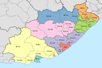
Mossel Bay Municipality is a municipality located in the Western Cape Province of South Africa. As of 2011 the population was 89,430.
Bitou Local Municipality is a municipality part of Garden Route District Municipality located in the Western Cape Province of South Africa. Its municipality code is WC047.

Overstrand Municipality is a local municipality in the Western Cape province of South Africa. It is located along the Atlantic coast between Cape Town and Cape Agulhas, within the Overberg District Municipality. The principal towns in the municipality are Hermanus, Gansbaai and Kleinmond. As of 2011 it had a population of 80,432.

Kannaland Municipality is a local municipality located within the Garden Route District Municipality in the Western Cape province of South Africa. The municipal area is situated in the western part of the Little Karoo and includes the towns of Ladismith, Calitzdorp and Zoar. As of 2011 it has a population of 24,767. Its municipality code is WC041.
The Mbhashe Municipality is a remote outpost of the Eastern Cape of South Africa.
Winnie Madikizela-Mandela Local Municipality is a local municipality in Alfred Nzo District Municipality in the Wild Coast Region of the Eastern Cape Province in South Africa.
Emthanjeni Local Municipality is a local municipality in the Pixley ka Seme District Municipality district of the Northern Cape province of South Africa. Emthanjeni is a Xhosa name meaning a "vein", symbolising the importance of an underground water supply system to the area. It is also a translation of the name of the municipality's seat, De Aar.
Thembelihle Local Municipality is a local municipality in the Pixley ka Seme District Municipality district of the Northern Cape province of South Africa. Thembelihle is a Xhosa name meaning "good hope".

//Khara Hais Local Municipality was a local municipality in the Northern Cape province of South Africa. It fell within the ZF Mgcawu District Municipality and governed the town of Upington and surrounding rural areas. As of 2011 the municipality had a population of approximately 93,500 people, and covered an area of 21,780 square kilometres (8,410 sq mi). The unusual spelling of the name comes from the original transcription of the Khwe language name, where the click consonant became "//".

Matjhabeng Local Municipality is a local government serving an administrative area in the Lejweleputswa District of the Free State in South Africa. The municipality services Welkom, Virginia, Odendaalsrus and Allanridge. The name is a Sesotho word meaning "where nations meet". It is derived from the migrant labour system where people from various countries like Lesotho, Mozambique, etc. meet to work in the mines of the Goldfields.

Camdeboo Local Municipality was a local municipality in the Sarah Baartman District Municipality of the Eastern Cape in South Africa. After municipal elections on 3 August 2016 it was merged into the larger Dr Beyers Naudé Local Municipality.

Makana Local Municipality is the local municipality which governs the town of Makhanda/Grahamstown and surrounding areas in the Eastern Cape province of South Africa. It forms part of the Sarah Baartman District Municipality. The municipality is named after a Xhosa prophet, Makana.

Ikwezi Local Municipality was a local municipality in the Sarah Baartman District Municipality of the Eastern Cape in South Africa. Ikwezi is an isiXhosa name that means "morning star". After municipal elections on 3 August 2016 it was merged into the larger Dr Beyers Naudé Local Municipality.

Umzimvubu Local Municipality is an administrative area in the Alfred Nzo District of Eastern Cape in South Africa.
Nkonkobe Local Municipality was an administrative area in the Amatole District of the Eastern Cape in South Africa. The municipality is named after the Winterberg mountain range, Nkonkobe in isiXhosa. The seat, as well as most offices, of the Municipality are in Fort Beaufort, but the Council's chambers in Alice are generally used for council meetings, being better equipped. Other towns served by the municipality are Seymour, Balfour, Hogsback and Middledrift. After municipal elections on 3 August 2016 it was merged into the larger Raymond Mhlaba Local Municipality.

Sakhisizwe Local Municipality is an administrative area in the Chris Hani District of the Eastern Cape in South Africa. Sakhisizwe is an isiXhosa name meaning "we are building the nation".

Tsolwana Local Municipality was an administrative area in the Chris Hani District of the Eastern Cape in South Africa. Tsolwana is an isiXhosa name which means "something with a sharp ending or a tip", referring the mountains around the whole area. After municipal elections on 3 August 2016 it was merged into the larger Enoch Mgijima Local Municipality.

Lukhanji Local Municipality was an administrative area in the Chris Hani District of the Eastern Cape in South Africa. Lukhanji is a Xhosa name for the mountain that runs from the eastern side of Queenstown to the western side. After municipal elections on 3 August 2016 it was merged into the larger Enoch Mgijima Local Municipality.

Ntambanana Local Municipality was a local municipality within the uThungulu District of KwaZulu-Natal in South Africa. In 2016 the municipality was dissolved and its territory divided between Mthonjaneni Local Municipality, uMhlathuze Local Municipality and uMfolozi Local Municipality.

Walter Sisulu Local Municipality is an administrative area in the Joe Gqabi District of the Eastern Cape in South Africa. The municipality was formed by the merging of Maletswai and Gariep Local Municipality immediately after the August 2016 Local Municipal Elections.


