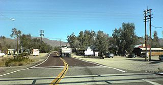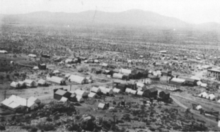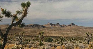
Nipton is an unincorporated community with a population of about 15 – 20, in San Bernardino County, California, on the northeastern border of Mojave National Preserve, approximately 12 miles southeast of Primm, Nevada and the Ivanpah Solar Power Facility. It is accessible via Nevada State Route 164.

Goffs, an unincorporated community in San Bernardino County, California, is a nearly empty one-time railroad town at the route's high point in the Mojave Desert. Goffs was a stop on famous U.S. Route 66 until 1931 when a more direct road opened between Needles and Essex. Goffs was also home to workers of the nearby Santa Fe Railroad, with Homer east, Fenner south, and Blackburn and Purdy north.

Oro Grande is an unincorporated community in the Mojave Desert of San Bernardino County, California, United States. It lies on the city boundary of Victorville and Adelanto. It is at 3,000 feet (910 m) elevation in Victor Valley north of the San Bernardino mountain range. It is located on old Route 66 near Interstate 15 between Victorville and Barstow. The ZIP code is 92368 and the community is inside area codes 442 and 760. Less than 1,000 residents live in the unincorporated area.

The Ivanpah Mountains are located in the southeastern Mojave Desert of California in the United States. The range lies to the south and east of the Mescal Range and Clark Mountain Range. Paute Valley lies between the Ivanpahs and the Mescal Range and Wheaton Wash lies between the Ivanpahs and the Clark Mountains to the north. Interstate 15 traverses the Wheaton Wash to the north of the Ivanpahs. The Ivanpah Valley lies to the southeast with the New York Mountains beyond. The mountains lie in a general southwest-northeasterly direction, however Mineral Hill in the northeast part of the range lies at right angles to this trend.

The Castle Mountains are located in the Eastern Mojave Desert, in northeastern San Bernardino County, California and Clark County, Nevada. The range lies south and east of the New York Mountains, southwest of Searchlight and west of Cal-Nev-Ari, Nevada.

The Piute Range is located in the Mojave Desert, primarily in northeast San Bernardino County, California, United States, with a north portion in Nevada. Most of the range is the eastern border of the Mojave National Preserve, a National Park Service natural area and park.

Lanfair Valley is located in the Mojave Desert in southeastern California near the Nevada state line. It is bounded on the north by the New York Mountains and Castle Mountains, on the east by the Piute Range, and on the south by the Woods Mountains and Vontrigger Hills. Joshua Trees can be found in most of the valley. Elevation is 4,045 feet.

Ivanpah Lake is a dry lake bed in the Mojave Desert of San Bernardino County, California on the border of California and Nevada. Nestled in the Ivanpah Valley near Primm on Interstate 15, the 13-square-mile (34 km2) lake is almost entirely within California. At the north edge of the lake lie the Nevada Welcome Center (closed) and a California Lottery retailer. It is a popular place for land sailing and kite buggying.

Ludlow is an unincorporated community in the Mojave Desert on Interstate 40, located in San Bernardino County, California, United States. The older remains of the ghost town are along historic Route 66.

Vanderbilt was a short-lived gold mining town located in San Bernardino County, California, United States. It existed between 1893 and 1895. At its peak it may have had a population of about 400 people.

Hart was a short-lived gold mining town located in the Mojave desert, in San Bernardino County, California. It existed between 1908 and 1915, and was located on the northeastern edge of Lanfair Valley near the New York Mountains. The area is now in the Mojave National Preserve, directed by the National Park Service.

Providence was a short-lived silver mining town located in San Bernardino County, California, United States. It existed between 1880 and 1886.

Ragtown was a mining town, now a ghost town, in the Mojave Desert, San Bernardino County, California, United States. John Sutter found gold in the Bagdad-Chase area in about 1898.

Bright Star Wilderness is a 8,190-acre (3,314 ha) wilderness area in Kern County in the U.S. state of California.

Jawbone Canyon is a geographic feature in the Mojave Desert and a Bureau of Land Management area located in Kern County, California, 20 miles (32 km) north of Mojave on CA 14. The area is a popular destination for hikers and off road vehicle enthusiasts.

Treasure Hill is an east-jutting spur of the White Pine Range of White Pine County in the easte central of the U.S. states of Nevada. Hamilton is situated at the northern base of the hill while Treasure City is situated on the hill, 2.5 miles (4.0 km) from Hamilton. It lies to the east of Mount Hamilton and to the northwest of Mokomoke Hill. It was noted for its silver mining from 1867 until the late 1880s. Between 1867 and 1880, the total production from the mines of the Treasure Hill was valued at $20 million. By early 1881 the mining activity had collapsed as the mining of the hill was dependent on the deposits and not on the lasting silver bearing geological veins. As a result, by 1888 there were only 24 people living there with the principal towns of Hamilton at the base of the hill, the Treasure City on the hill side and the Shermantown went into oblivion.

Barnwell, originally a rail camp named Summit, then Manvel, was a former railhead serving local mining camps, now a ghost town, in San Bernardino County, California. It lies at an elevation 4806 feet in the New York Mountains.

California Eastern Railway, is a defunct 45-mile (72 km) short-line railroad that operated from 1902 - 1911. The railroad ran from Goffs, California, to Ivanpah. It was first a private line operated by a mining company, that was acquired by the Atchison, Topeka and Santa Fe Railway.

The Mohave Trail was a Native American trade route between Mohave Indian villages on the Colorado River and settlements in coastal Southern California.

Castle Mountains National Monument is a U.S. National Monument located in the eastern Mojave Desert and northeastern San Bernardino County, in the state of California.


