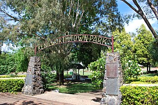
Kandanga, Queensland

Last updated

Kandanga
Queensland
KandangaHotel.JPG
Kandanga Hotel
Australia Queensland location map.svg
Red pog.svg
Kandanga
Coordinates 26°23′15″S152°40′40″E / 26.3875°S 152.6777°E / -26.3875; 152.6777 (Kandanga (town centre)) Coordinates: 26°23′15″S152°40′40″E / 26.3875°S 152.6777°E / -26.3875; 152.6777 (Kandanga (town centre))
Population665 (2016 census) [1]
 • Density14.089/km2 (36.49/sq mi)
Postcode(s) 4570
Area47.2 km2 (18.2 sq mi)
Time zone AEST (UTC+10:00)
Location
LGA(s) Gympie Region
State electorate(s) Gympie
Federal division(s) Wide Bay
Localities around Kandanga:
Amamoor Amamoor Coles Creek
Kandanga Creek Kandanga Tuchekoi
Melawondi Imbil Bollier

Kandanga is a town and a locality in the Gympie Region, Queensland, Australia. [2] [3] In the 2016 census, the locality of Kandanga had a population of 665 people. [1]

Contents

Geography

The town is located on the Mary Valley Road (State Route 51) 160 kilometres (99 mi) north of the state capital, Brisbane and 28 kilometres (17 mi) south west of Gympie, on the banks of Kandanga Creek, a tributary of the Mary River. This river forms the eastern and north-eastern boundaries of the locality. [4]

Kandanga is one of a chain of towns in the Mary Valley also including Imbil, Amamoor and Dagun.

Kandanga suffered a further blow when its popular hotel burnt down. Just like the valley itself, it is being rebuilt with the determination of locals.

History

The name "Kandanga" may be derived from the local Kabi Aboriginal language, meaning a fork or sharp bend of the creek [5] [6] or it may refer to the cabbage tree. [7]

Kandanga War Memorial, 2008 KandangaWarMemorial.JPG
Kandanga War Memorial, 2008

Kandanga Post Office opened by June 1914 (a receiving office had been open from 1895). [8]

Kandanga State School opened in September 1915. [9] [10]

The Kandanga War Memorial was unveiled on 11 November 1920 by the Member of the Queensland Legislative Assembly for the Cooroora Harry Walker. [11]

In 2006, the Beattie state government announced plans to construct the Traveston Crossing Dam at Traveston Crossing on the upper Mary River. The proposed dam, designed to provide water to the growing Sunshine Coast, was to have flooded fertile farmland, including Kandanga. However, the dam did not proceed on environmental grounds, but not before much of the land required was bought up and the original owners moved on. [12] A reconstruction plan was implemented following the decision to not build the dam, with farm land subdivided and offered to new owners who have introduced new crops to the Mary Valley.[ citation needed ]

At the 2006 census, the locality of Kandanga had a population of 596 people. [13]

On 12 December 2015, the 101-year-old Kandanga Hotel burned down following a fire which started in the kitchen. [14] Local people rallied to establish a temporary hotel next door until the hotel could be rebuilt. [15] The hotel reopened on 12 July 2017. [16] [17]

In the 2016 census, the locality of Kandanga had a population of 665 people. [1]

Heritage listings

Kadanga has a number of heritage-listed sites, including:

Education

Kandanga State School is a government primary (Prep-6) school for boys and girls at 84 Main Street ( 26°23′15″S152°40′48″E / 26.3874°S 152.6801°E / -26.3874; 152.6801 (Kandanga State School) ). [24] [25] In 2018, the school had an enrolment of 44 students with 4 teachers (3 full-time equivalent) and 6 non-teaching staff (3 full-time equivalent). [26]

There are no secondary schools in Kandanga. The nearest government secondary schools are Mary Valley State College (to Year 10) in neighbouring Imbil to the south and Gympie State High School (to Year 12) in Gympie to the north. [27]

Related Research Articles

Gympie City in Queensland, Australia

Gympie is a city and a locality in the Gympie Region, Queensland, Australia. In the Wide Bay-Burnett District, Gympie is about 170.7 kilometres (110 mi) north of the state capital, Brisbane. The city lies on the Mary River, which floods Gympie occasionally. Gympie is the administrative centre for the Gympie Region area. As of June 2018 Gympie had a population of 51,578.

Mary River (Queensland)

The Mary River is a major river system located in the South East and Wide Bay–Burnett regions of Queensland, Australia.

Mary Valley Rattler

The Mary Valley Rattler is a heritage railway line that conducts steam train trips and tours from Gympie through the Mary Valley using the former Mary Valley railway line in the Gympie Region, Queensland, Australia. It is now one of the region's biggest tourist attractions and is managed by a not-for-profit organisation. It has been described as Australia's third biggest heritage railway. It was shut down for safety reasons in 2012. In 2016, the Gympie Regional Council provided funding to make the railway operational again as it is a major tourist attraction for the area. Journeys recommenced between Gympie and Amamoor on 6 October 2018.

Kandanga Creek is a rural locality in the Gympie Region, Queensland, Australia. In the 2016 census, Kandanga Creek had a population of 118 people.

Cooran, Queensland Town in Queensland, Australia

Cooran is a rural hinterland town and locality in the Shire of Noosa, Queensland, Australia. In the 2016 census the locality of Cooran had a population of 1,624 people.

Carters Ridge is a rural locality in the Gympie Region, Queensland, Australia. In the 2016 census, Carters Ridge had a population of 469 people.

Traveston Crossing Dam was a proposed water project that was initiated by the state government of Queensland, Australia, in 2006 as a result of a prolonged drought which saw South-East Queensland's dam catchment area receive record-low rain. The project was cancelled in November 2009, after being refused approval by federal Environment Minister Peter Garrett.

Monkland, Queensland Suburb of Gympie, Queensland, Australia

Monkland is a rural locality in the Gympie Region, Queensland, Australia. In the 2016 census Monkland had a population of 1,125 people.

Brooloo, Queensland Town in Queensland, Australia

Brooloo is a rural town and locality in the Gympie Region, Queensland, Australia. In the 2016 census, the locality of Brooloo had a population of 348 people.

Imbil Town in Queensland, Australia

Imbil is a rural town and locality in the Gympie Region, Queensland, Australia. In the 2016 census, Imbil had a population of 924 people.

Amamoor Town in Queensland, Australia

Amamoor is a rural town and locality in the Gympie Region, Queensland, Australia. In the 2016 census the locality of Amamoor had a population of 636 people.

Dagun is a rural town and locality in the Gympie Region, Queensland, Australia. In the 2016 census, Dagun had a population of 150 people.

Traveston Suburb of Gympie Region, Queensland, Australia

Traveston is a rural town and locality in the Gympie Region, Queensland, Australia. In the 2016 census the locality of Traveston had a population of 480 people.

Melawondi is a rural locality in the Gympie Region, Queensland, Australia. It is located 20 kilometres (12 mi) south of Gympie. In the 2016 census Melawondi had a population of 30 people.

Imbil Railway Bridge Railway bridge over Yabba Creek in Queensland, Australia

Imbil Railway Bridge is a heritage-listed railway bridge over Yabba Creek, Imbil, Gympie Region, Queensland, Australia. It was built circa 1915 by Queensland Railways to facilitate settlement in the Mary River Valley. It was added to the Queensland Heritage Register on 14 October 2011.

Lake Borumba is a rural locality in the Gympie Region, Queensland, Australia. In the 2016 census Lake Borumba had a population of 6 people.

Bollier is a rural locality in the Gympie Region, Queensland, Australia. In the 2016 census Bollier had a population of 200 people.

The Gympie Local Heritage Register is a list of heritage sites within the Gympie Region, Queensland, Australia. It is maintained by the Gympie Regional Council.

Gympie–Brooloo–Kenilworth Road is a continuous 51.6 kilometres (32.1 mi) road route in the Gympie and Sunshine Coast regions of Queensland, Australia. It has two official names, Gympie–Brooloo Road and Kenilworth–Brooloo Road. The entire route is signed as State Route 51.

References

  1. 1 2 3 Australian Bureau of Statistics (27 June 2017). "Kandanga (SSC)". 2016 Census QuickStats. Retrieved 20 October 2018. OOjs UI icon edit-ltr-progressive.svg
  2. "Kandanga – town in Gympie Region (entry 17640)". Queensland Place Names. Queensland Government . Retrieved 20 April 2019.
  3. "Kandanga – locality in Gympie Region (entry 46344)". Queensland Place Names. Queensland Government . Retrieved 20 April 2019.
  4. Google (26 August 2019). "Kandanga, Queensland" (Map). Google Maps . Google. Retrieved 26 August 2019.
  5. Mary Valley tourist site Archived 19 September 2006 at the Wayback Machine - Retrieved 31 October 2006
  6. "Kandanga". Queensland Places. Centre for the Government of Queensland, University of Queensland. Archived from the original on 19 March 2019. Retrieved 20 April 2019.
  7. "ETYMOLOGICAL". Gympie Times And Mary River Mining Gazette . Vol. XLIV, no. 5761. Queensland, Australia. 2 December 1911. p. 7. Archived from the original on 18 January 2021. Retrieved 21 October 2019 via National Library of Australia.
  8. Premier Postal History. "Post Office List". Premier Postal Auctions. Archived from the original on 15 May 2014. Retrieved 10 May 2014.
  9. "Kandanga SS". Archived from the original on 4 February 2017. Retrieved 30 January 2017.
  10. "Opening and closing dates of Queensland Schools". Queensland Government . Retrieved 18 April 2019.
  11. "Kandanga War Memorial". Monument Australia. Archived from the original on 7 April 2014. Retrieved 3 April 2014.
  12. Queensland Government Ministerial Statement Archived 18 August 2007 at the Wayback Machine 5 July 2006 - Retrieved 31 October 2006
  13. Australian Bureau of Statistics (25 October 2007). "Kandanga (Cooloola Shire) (State Suburb)". 2006 Census QuickStats. Retrieved 5 July 2008.
  14. Burke, Gail; Williams, Patrick (12 December 2015). "Owners of 101-year-old pub destroyed in fire plan to rebuild". ABC News. Archived from the original on 8 May 2018. Retrieved 5 June 2022.
  15. "Locals keep Kandanga Hotel going with pop-up bar after fire". ABC News. 3 March 2017. Archived from the original on 26 November 2017. Retrieved 5 June 2022.
  16. "All-new Kandanga Hotel to auction". PubTIC. 8 August 2018. Archived from the original on 6 June 2022. Retrieved 6 June 2022.
  17. "Kandanga Hotel". Facebook. 12 December 2017. Retrieved 6 June 2022.
  18. "Mary Valley Railway Cream Sheds (entry 602792)". Queensland Heritage Register . Queensland Heritage Council. Retrieved 8 July 2013.
  19. "Kandanga Railway Station" (PDF). Local Heritage Register. Gympie Regional Council. Archived (PDF) from the original on 17 January 2021. Retrieved 17 January 2021.
  20. "Kandanga Cottage" (PDF). Local Heritage Register. Gympie Regional Council. Archived (PDF) from the original on 17 January 2021. Retrieved 17 January 2021.
  21. "Kandanga Memorial Hall" (PDF). Local Heritage Register. Gympie Regional Council. Archived (PDF) from the original on 17 January 2021. Retrieved 17 January 2021.
  22. "Kandanga State School" (PDF). Local Heritage Register. Gympie Regional Council. Archived (PDF) from the original on 18 January 2021. Retrieved 18 January 2021.
  23. "Sacred Heart Catholic Church" (PDF). Local Heritage Register. Gympie Regional Council. Archived (PDF) from the original on 17 January 2021. Retrieved 17 January 2021.
  24. "State and non-state school details". Queensland Government. 9 July 2018. Archived from the original on 21 November 2018. Retrieved 21 November 2018.
  25. "Kandanga State School". Kandanga State School. 15 January 2020. Archived from the original on 25 March 2020. Retrieved 5 June 2022.
  26. "ACARA School Profile 2018". Australian Curriculum, Assessment and Reporting Authority. Archived from the original on 27 August 2020. Retrieved 28 January 2020.
  27. "Queensland Globe". State of Queensland . Retrieved 5 June 2022.

Further reading