Kannur is one of the 14 districts along the west coast in the state of Kerala, India. The city of Kannur is the district headquarters and gives the district its name. The old name, Cannanore, is the anglicized form of the Malayalam name "Kannur". Kannur district is bounded by Kasaragod District to the north, Kozhikode district to the south, Mahé district to the southwest and Wayanad District to the southeast. To the east, the district is bounded by the Western Ghats, which forms the border with the state of Karnataka. The Arabian Sea lies to the west. Paithalmala is the highest point in Kannur District (1,372m). Enclosed within the southern part of the district is the Mahé district of the Union Territory of Puducherry. The district was established in 1957.
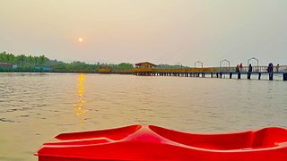
Thottada is a census town and suburb of Kannur city situated on NH 66 of about 8 km (5.0 mi) south of Kannur railway station in Kerala State, India.
Kannur South or Chovva or Thottada is a residential suburb in Kannur District of Kerala, India, which mainly consists of two areas. The National Highway 66 runs through both Thazhechovva and Melechovva. The name Chovva is believed to be derived from the Malayalam word "Chovvu" meaning propriety. Mele and Thazhe are Upper and Lower respectively, indicating that Mele Chovva is relatively at higher altitude compared with Thazhe chovva
Edacheri is a small panchayath in the district of Kozhikode in the South Indian state of Kerala.

Chelora is a village in Kannur district in the state of Kerala, India 8 km from Kannur town and on the Kannur-Mysore Highway. The Kannur International Airport is 15 km from Chelora. Kadakkara Sri Dharmasastha Temple and Valannur Sri Risheishwara Temple are the two temples that attract people to the village. Chelora Govt Higher Secondary School is a local educational institution. Kappad, Valannur, Mathukoth, Peringalayi and Konganamkott Para are among the major localities in Chelora.

Kalliasseri is a census town in Kannur district in the Indian state of Kerala. Kalliaseri Panchayat comprises two villages: Kalliasseri and Irinave.
Kanhirode is a census town in Kannur district of Kerala state, India. Kanhirode is located 13 km east of Kannur city on Kannur-Mattanur road.

Pappinisseri is a census town and a suburb of Kannur city in Kannur district in the Indian state of Kerala. Pappinissery have consistently won the Swaraj Trophy for best Grama Panchayat from 2017-2018 to 2021. Pappinisseri Panchayat also bagged the third position in the Swaraj Trophy during 2015-2016. Also, Pappinissery has been declared as the best Grama Panchayat in Kerala by Kerala government. Pappinisseri Panchayat comprises two villages, viz Pappinisseri and Aroli. Pappinisseri better known for visha chikitsa kendram
Pinarayi is a census town in Kannur district in the Indian state of Kerala.

Kottiyoor is a Township, Village and Grama Panchayat situated in eastern hilly area of Kannur district in Kerala state. Kottiyoor is the 23rd Wildlife Sanctuary of Kerala, located in the serene hills of Western Ghats. The ancient pilgrimage conducted here yearly, called 'Kottiyoor Vysakha Mahotsavam' attracts around 50,000 devotees every year. The Vavali river flows through Kottiyoor.
Vengad is a gram panchayat situated in Thalassery taluk, Kannur district, Kerala, India, on the banks of the Anjarakandi River. Vengad is famous for its black pepper and handloom. One state seed farm is located in Vengad. Vengad gram panchayat consists of 21 wards; viz Pattathari (1), Kallayi (2), Vengad Angadi (3), Vengad Metta (4), Vengad Theru (5), Oorppalli (6), Kaitheripoyil (7), Valankichal (8), Pathiriyad (9), Pachapoika (10), Parambayi (11), Kelalur (12), Mambaram (13), Poyanad (14), Keezhathur Balavadi (15), Keezhathur Vayanasala (16), Kuzhiyil Peedika (17), Mailulli (18), Kunnirikka (19), Paduvilayi (20) and Thattari (21).

Pulpally is a mid-sized town in Wayanad District of Kerala, India.Pulpally also known as 'The land of black gold'. Pulpally is also renowned for its pure wild Wayanad honey. The famous Seetha devi temple in Kerala is situated on Pulpally. Geographically a small town in Sultan Bathery Taluk and a "Grama Panchayath" under the local self governance system. It is about 24 km from Sultan Bathery, and is almost surrounded by forest. The main source of income is agriculture.
Koodali is a census town and grama panchayat in Thalassery taluk of Kannur district in Kerala state, India. Koodali is located 15.5 km (9.6 mi) east of Kannur city on Kannur-Mattanur road.

Punnakkulangara is a significant part as well as a Municipal Ward of Anthoor Municipality in Kannur district of Kerala, India.

Koyyam (കൊയ്യം) is the part of Chengalai Panchayat, Kannur district, in the state of Kerala on the southwestern coast of India. Koyyam LP school is situated in "Koyyam". Koyyam Govt High School situated in Perinthaleri, Koyyam. The new bridge is constructing from koyyam to Velam, Mayyil. The transportation is very much easier to Kannur Town after completing the Koyyam Bridge(23 km). The bridge made koyyam is a very accessible place to the new Kannur International Airport, Mattannur. Main Airport Road will be passing through Koyyam from chempanthotti & Valakkai. This will be parallel route for existing Parassinikkadavu from Taliparamba to Mattannur. Also it will be a major road connectivity for the people from high range areas like alakkode/ Karuvanchal/ Naduvil to the airport
Vallikunnam is a village in Mavelikara taluk of Alappuzha district in the Indian state of Kerala.
Mavichery is a village which is the part of Pariyaram Gramapanchayath in the Kannur district of Kerala, India.

Morazha is a village of Anthoor Municipality in Kannur district in the Indian state of Kerala. Before formation of Anthoor Municipality this village was part of Thaliparamba Municipality. Though part of a Municipal Town, Morazha remains like a village.

Kannur district is politically organized into a complex web of taluks, blocks, panchayaths and villages. In addition, there are also parliamentary divisions called Assembly constituencies and Lok Sabha constituencies.


![Munderikkadavu Bird Sanctuary munntteerikttv tnnnnii[?]ttttN.jpg](http://upload.wikimedia.org/wikipedia/commons/thumb/4/44/%E0%B4%AE%E0%B5%81%E0%B4%A3%E0%B5%8D%E0%B4%9F%E0%B5%87%E0%B4%B0%E0%B4%BF%E0%B4%95%E0%B4%9F%E0%B4%B5%E0%B5%8D_%E0%B4%A4%E0%B4%A3%E0%B5%8D%E0%B4%A3%E0%B5%80%E0%B5%BC%E0%B4%A4%E0%B5%8D%E0%B4%A4%E0%B4%9F%E0%B4%82.jpg/220px-%E0%B4%AE%E0%B5%81%E0%B4%A3%E0%B5%8D%E0%B4%9F%E0%B5%87%E0%B4%B0%E0%B4%BF%E0%B4%95%E0%B4%9F%E0%B4%B5%E0%B5%8D_%E0%B4%A4%E0%B4%A3%E0%B5%8D%E0%B4%A3%E0%B5%80%E0%B5%BC%E0%B4%A4%E0%B5%8D%E0%B4%A4%E0%B4%9F%E0%B4%82.jpg)
