
Kathmandu, officially Kathmandu Metropolitan City, is the capital and the most populous city of Nepal with 845,767 inhabitants living in 105,649 households in 2021 and 2.9 million people in its urban agglomeration. It is located in the Kathmandu Valley, a large valley in the high plateaus in central Nepal, at an altitude of 1,400 metres.

Dhangadhi is a sub-metropolitan city and the district headquarters of Kailali District in Sudurpashchim Province of Nepal.Dhangadhi is also the temporary capital of Sudurpashchim Province. It shares a border with Uttar Pradesh, India in the south, Godawari and Gauriganga Municipality in the North, Kailari Rural Municipality in the east and Kanchanpur District in the west. Dhangadhi is a sub-metropolis divided into 19 wards. It has a population of about 147,181 and thus is the 10th biggest city of Nepal. It has an area of 261.75 km2 (101.06 sq mi). It is one of the major cities of Far - West Province of Nepal along with Bhimdatta.
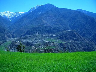
Bajura District, a part of Sudurpashchim Province, is one of the seventy-seven districts of Nepal. The district, with Martadi as its district headquarters, covers an area of 2,188 km2 (845 sq mi) and had a population of 108,781 in 2001 and 134,912 in 2011.

Bhaktapur district (Nepali: भक्तपुर जिल्लाListen ; Nepal Bhasa : ख्वप देश located in the eastern part of Kathmandu valley, is the smallest district among the seventy-seven districts of Nepal. It is part of Bagmati Province. The district, with Bhaktapur as its district headquarters, covers an area of 119 km2 and in 2011 had a population of 304,651 of whom 9,701 people were absent.

Chitwan District is one of 77 districts of Nepal, and takes up the southwestern corner of Bagmati Province. Bharatpur, largest city of Nepal after Kathmandu, is its administrative centre. It covers 2,238.39 km2 (864.25 sq mi), and in 2011 had a population of 579,984 people. Bharatpur is the commercial and service centre of South Central Nepal and a major destination for higher education, health care and transportation in the region. Chitwan lies in the Terai region of Nepal. It is in the drainage basin of the Gandaki River and is roughly triangular, taking that river as its meandering northwestern border, and a modest watershed border, with India, as the basis of its southern limit. Local government: Bharatpur Metropolitan,Rapti Municipality,Ratnanagar Municipality, Kalika Municipality, Madi Municipality, Ikshyakamana Gaupalika

Kathmandu District is a district located in Kathmandu Valley, Bagmati Province of Nepal. It is one of the 77 districts of Nepal, covers an area of 413.69 km2 (159.73 sq mi), and is the most densely populated district of Nepal with 1,081,845 inhabitants in 2001, 1,744,240 in 2011 and 2,017,532 in 2021. The administrative headquarters of Kathmandu district is located in Kathmandu.

Lalitpur District (Nepali: ललितपुर जिल्लाListen , a part of Bagmati Province, is one of the seventy-seven districts of Nepal. The district, with Lalitpur as its district headquarters, covers an area of 396.92 km2 and has a population of 337,785. It is one of the three districts in the Kathmandu Valley, along with Kathmandu and Bhaktapur. Its population was 466,784 in the initial 2011 census tabulation. It is surrounded by Makwanpur, Bhaktapur, Kathmandu and Kavre.

Pyuthan District (Nepali: प्युठान जिल्ला[piu̯ʈʰan], is a "hill" district some 250 km west of Kathmandu in Lumbini Province in midwestern Nepal. Pyuthan covers an area of 1,309 km2 with population of 212,484 in 2001 and 226,796 in 2011. Pyuthan Khalanga is the district's administrative center.
Bharatpur is a city in southern central Nepal. It is the third most populous city of Nepal after Kathmandu and Pokhara with 369,377 inhabitants in 2021. It is also the second largest metropolitan city in Nepal by area. It is the district headquarter of the Chitwan District.

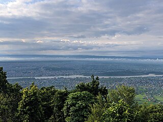
Nagarkot is a former Village Development Committee located 32 km west of Kathmandu, Nepal in Bhaktapur District in Bagmati Province and as of 2015 part of Nagarkot Municipality. At the time of the 2011 census it had a population of 4,571 and had 973 houses in it. At an elevation of 2,195 meters, it is considered one of the most scenic spots in Bhaktapur District. It is known for a sunrise view of the Himalayas including Mount Everest as well as other peaks of the Himalayan range of eastern Nepal. Nagarkot also offers a panoramic view of the Kathmandu Valley. The scenic beauty of the place makes it a very popular hiking route for tourists. It is located approximately 7000 ft above sea level and 28 km from Kathmandu International Airport.
Siraha is the headquarters and municipality of Siraha District, a part of Madhesh Province, Nepal. Siraha had a population of 28,442 according to the census of 2011. and a population of 82,531 as of 2015.The current population of Siraha municipality as of census 2022, is 96,543.It has a male population of 47,306 and female population of 49,237. The present mayor of Siraha Municipality is Dr. Nabin Kumar Yadav and Deputy Mayor is Babita Kumari Sah.Both assumed office on 25 May 2022. His predecessor mayor was Asheswor Yadav and the deputy mayor was Dr. Namita Yadav. Both assumed office on 25 September 2017 and their last working day was on 24 May 2022. The town is at 80 metres (260 ft) altitude, 29 kilometres (18 mi) ESE of Janakpur.
Baluwa is a village and former Village Development Committee that is now part of Gokarneshwar Municipality in Kathmandu District in Bagmati Province of central Nepal. At the time of the 2011 Nepal census it had a population of 5,467 and had 1,204 houses in it. It is located at north-east side from the capital city of Nepal. It touch Nuwakot District to the north and Gorkna VDC to the south. In east side, there is Nayapati VDC and in west Kapan VDC.
Bhadrabas is a village and former Village Development Committee that is now part of Kageshwari-Manohara Municipality in Kathmandu District in Province No. 3 of central Nepal, located approximately 15 kilometres (9 mi) northeast of Kathmandu. At the time of the 2011 Nepal census it had a population of 2,388 and had 503 houses in it. The oldest high school in the eastern Kathmandu Valley, Adarsh Madhayamik Vidhalaya is located in Bhadrabas. The Nepal Red Cross Society is active in Bhadrabas and it has notable health centre. In 1984, a tobacco smoking World Health Organization questionnaire was given to the inhabitants of Bhadrabas to survey smoking trends in the country.

Budhanilkantha is a city in Kathmandu district of Bagmati province of Nepal. It is the 3rd largest city in the Kathmandu Valley after Kathmandu and Lalitpur. As per 2021 Nepal census, the city population was 179,688 and 26,678 households. It was established on 2 December 2014 by merging the former Village development committees Hattigauda, Khadka Bhadrakali, Chapali Bhadrakali, Mahankal, Bishnu, Chunikhel and Kapan. The city is situated at the foot of Shivapuri hill. At the time of the 2011 Nepal census, it had a population of 15,421.
Kavresthali is a town and former Village Development Committee that is now part of Tarakeshwar Municipality in Kathmandu District in Province No. 3 of central Nepal. At the time of the 1991 Nepal census it had a population of 3,034 and had 581 households in it.

Ramkot is a village of the Nagarjun Municipality, Bagmati Province, Nepal. The 2011 Nepal census recorded that Ramkot had a population of 6,303 people in 1,427 independent households.
Tokha Chandeshwari is a village and former Village Development Committee that is now part of Tokha Municipality in Kathmandu District in Province No. 3 of central Nepal. At the time of the 2011 Nepal census it had a population of 3,961. Tokha Chandeshwari now is part of Tokha municipality.
Kshetrapa (Nepali:क्षेत्रपा) is a village development committee in north-eastern Nepal. As per the 2011 National Population and Housing Census, Kshetrapa had 2,447 people living in 580 individual households. Kshetrapa has one high school, Shree Kshetrawati Higher Secondary School, which is located at Peepal Daada, Majhgaun. Namdu Jugu Road, which runs through the village, is under construction as of 2020.

Gokarneshwar is a municipality in Kathmandu District in the Bagmati Province of Nepal that was established on 2 December 2014 by merging the former Village development committees Sundarijal, Nayapati, Baluwa, Jorpati and Gokarna. The office of the municipality is that of the former Jorpati village development committee. The river Bagmati has its origin as the name Bagh Dwar situated in the middle of the Shivapuri jungle in this municipality. In the village on the banks of the Bagmati River stands the Gokarna Mahadev temple, built in 1582. In late August or early September people go to this temple to bathe and make offerings in honor of their fathers, living or dead, on a day called Gokarna Aunsi.


