Related Research Articles

Electronic City is an information technology hub in Bangalore, India, located in Anekal taluk. Spread over 800 acres (3.2 km²) near Konappana Agrahara and Doddathogur it houses a large number of electronic/IT industrial parks.

Whitefield is a neighbourhood of Bangalore in the state of Karnataka, India. Established in 1882 as a settlement for the Eurasians and Anglo Indians of Bangalore, Whitefield remained a quaint little settlement at the eastern periphery of Bangalore city till the late 1990s when the local IT boom turned it into a major suburb. It is now a major part of Greater Bangalore. Whitefield is Bengaluru's first tech corridor to be connected by Namma Metro.

Domlur is a small township located in the eastern part of Bangalore city in India. Domlur was included in the erstwhile Bangalore Civil and Military Station under the British Madras Presidency till it was transferred to the Mysore State in 1949.

Indiranagar, is an affluent, medium-sized neighbourhood in east Bangalore, Karnataka, India. Indiranagar is one of the most expensive cosmopolitan neighbourhoods in Bangalore.

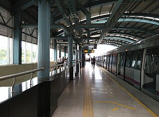
Namma Metro, also known as Bengaluru Metro, is a rapid transit system serving the city of Bengaluru, the capital city of the state of Karnataka, India. It is the second longest operational metro network in India with an operational length of 73.75 kilometers, just behind Delhi Metro. Upon its inauguration, it became the first underground metro system in South India. Namma Metro has a mix of underground, at grade, and elevated stations. Out of the 66 operational metro stations of Namma Metro as of October 2023, there are 57 elevated stations, eight underground stations and one at-grade station. The system runs on standard-gauge tracks.
The Bangalore Development Authority (BDA) of Bangalore, India, is a governmental organization and the principal planning authority for Bangalore. Its function, under the Karnataka Town and Country Planning Act of 1961, is as a regulatory body required "to prepare in the prescribed manner a Comprehensive Development Plan" for the Bangalore Metropolitan Region. It also oversees planning and development of infrastructure, provision of development-related sites and services, the housing needs of underprivileged citizens in Bangalore and is currently the city's largest land developer. No other authority or person may undertake development within the Bangalore Metropolitan Region without the permission of the BDA.

Mattanur, also spelled Mattannur, is a town, municipality, and an aerotropolis in Kannur district, Kerala, India. Mattanur is about 27 km east of Kannur and Thalassery, two major towns of the district.

Halasuru, previously known as Ulsoor, is one of the oldest neighbourhoods in the city of Bangalore. It is located in central Bangalore, and begins roughly near the eastern terminus of Mahatma Gandhi Raste. It is renowned for its numerous temples and market.

Dr S. K. Karim Khan Road, commonly known as 100 Feet Road Indira Nagar. It is a road in the Indian city of Bangalore that links Old Madras Road with Old Airport Road.

Old Airport Road is a major road in Bangalore, India. It was renamed from Airport Road after the new Bengaluru International Airport was opened at Devanahalli. Madivala Machideva Road is a 17 km stretch road which begins from the junction of Trinity Church Road and Victoria Road and goes to HAL Bangalore International Airport, Marathahalli, Varthur. Beyond that, the road officially becomes Varthur Road, but since the real estate boom started around 2003, builders have started calling the stretch between the Airport and the Marathahalli Outer Ring Road as Old Airport Road. Even so, due to the high significance of this road it has achieved due to its high accessibility for reaching Whitefield.
Bangalore BRTS was a proposed bus rapid transit system in Bangalore, Karnataka. Beginning with a comprehensive report in 2007, and even earlier, several proposals were made to implement a BRTS in Bangalore.

Kaggadasapura, also known as Upper Indiranagar is a relatively new area located near DRDO township in CV Raman Nagar, Bangalore, India. Kaggadasapura is an area in Bangalore, and has many apartment complexes. It is located at the coordinates: 12°59'0"N, 77°40'32"E. It is about 4 km from Indiranagar and old (HAL) Airport Road in Bangalore. Defence Avionics Research Establishment (DARE), Center for Artificial Intelligence Research (CAIR) and DRDO Phase II are located at Kaggadasapura.

Baiyappanahalli is an At-Grade metro station on the East-West corridor of the Purple Line of Namma Metro in the Baiyyappanahalli neighbourhood, Bangalore, India.
Indiranagar is an elevated metro station on the East-West corridor of the Purple Line of Namma Metro which is located on CMH Road in the Indiranagar locality in Bangalore, India. It was opened to the public on 20 October 2011.

Cubbon Park is an underground metro station on the East-West corridor of the Purple Line of Namma Metro in Bangalore, India. It was opened to the public on 30 April 2016. The station is located a few metres away from one of the entrances to Cubbon Park.

The Inner Ring Road is an arterial road in Bangalore, India. It is a six-lane link road connecting Indiranagar and Koramangala. The northern end of the road, beyond Old Airport Road from Domlur junction is called 100 Feet Road.

CV Raman Nagar is a neighbourhood located in the eastern part of the city of Bangalore. It is at a distance of 13 km from Majestic. It is bounded by Indiranagar, Kaggadasapura and Baiyappanahalli. It is an upmarket area and also known as Greater Indiranagar.

NAL Wind Tunnel Road, expanded as National Aerospace Laboratories Wind Tunnel Road, is a road in the Murugeshpalya locality of Bangalore. It was called Challaghatta Road, a name that still persists in local use, before it was renamed. It links HAL Airport Road with Bellandur. HAL Airport Road branches into Wind Tunnel Road at a traffic light junction.

Baiyyappanahalli railway station is an Indian Railways train station located in Baiyyappanahalli, Bangalore in the Indian state of Karnataka which is located about 13 km away from the Bangalore City railway station and serves Baiyyappanahalli, Indiranagar, Krishnarajapuram and HAL areas.
Baiyyappanahalli or New Baiyyappanahalli Extension is one of the neighbourhoods in Bengaluru. It is part of C. V. Raman Nagar in East Bengaluru. The area is a transport hub and popular for Baiyappanahalli metro station and Baiyyappanahalli railway station.
References
- ↑ "Kodihalli Bangalore Map". Archived from the original on 9 October 2011. Retrieved 17 June 2011.