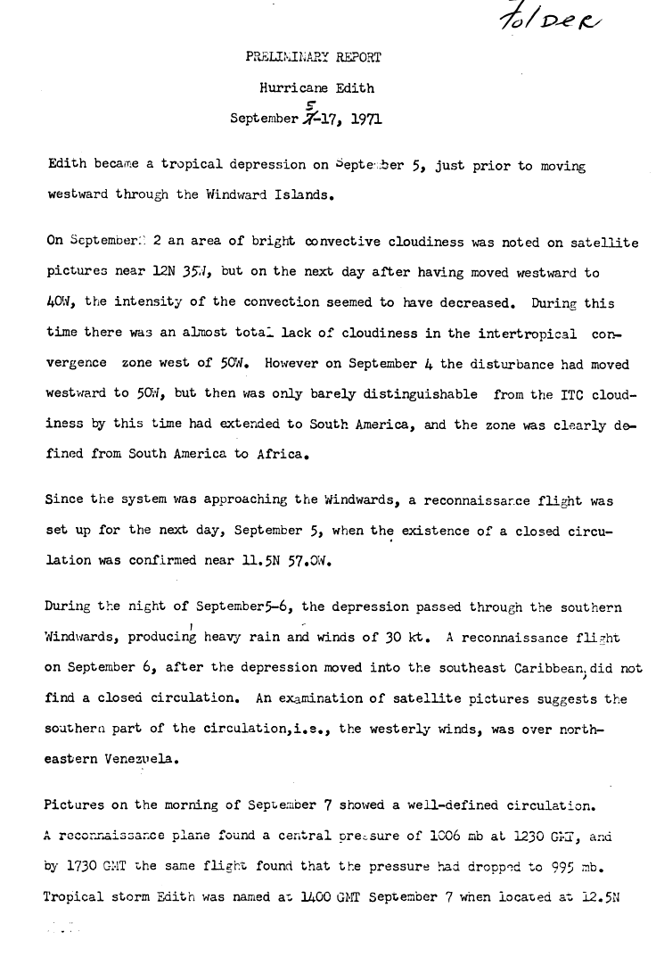
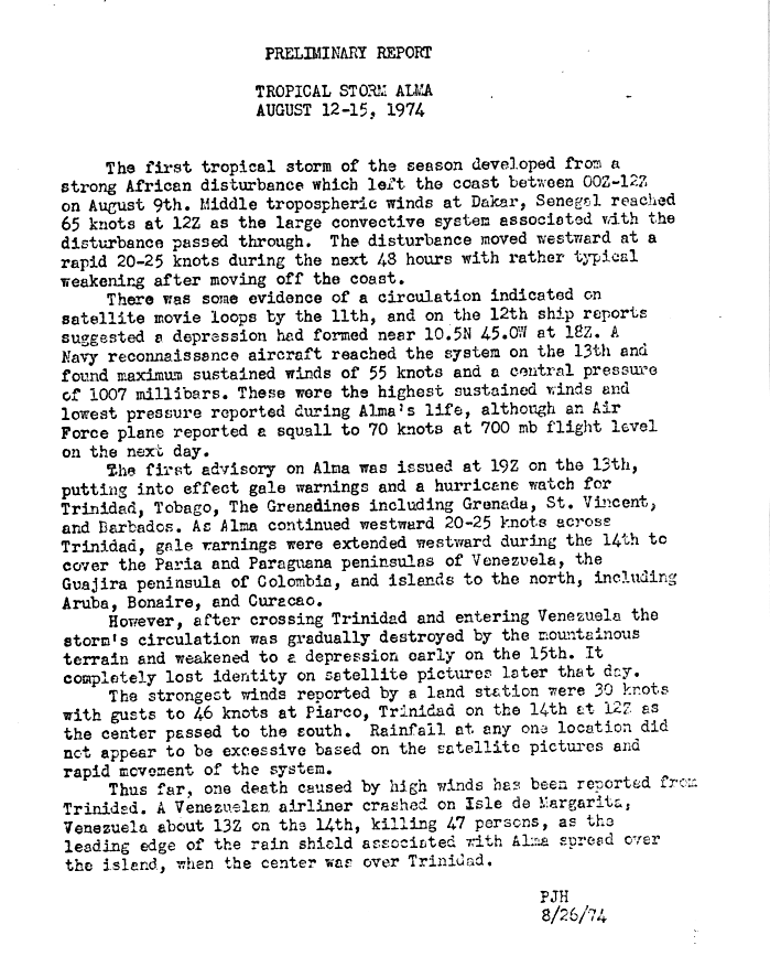
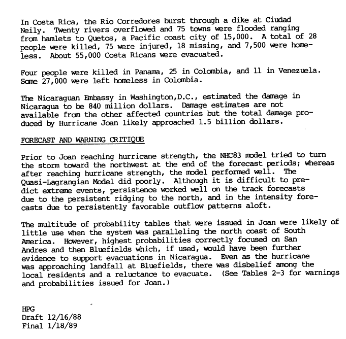
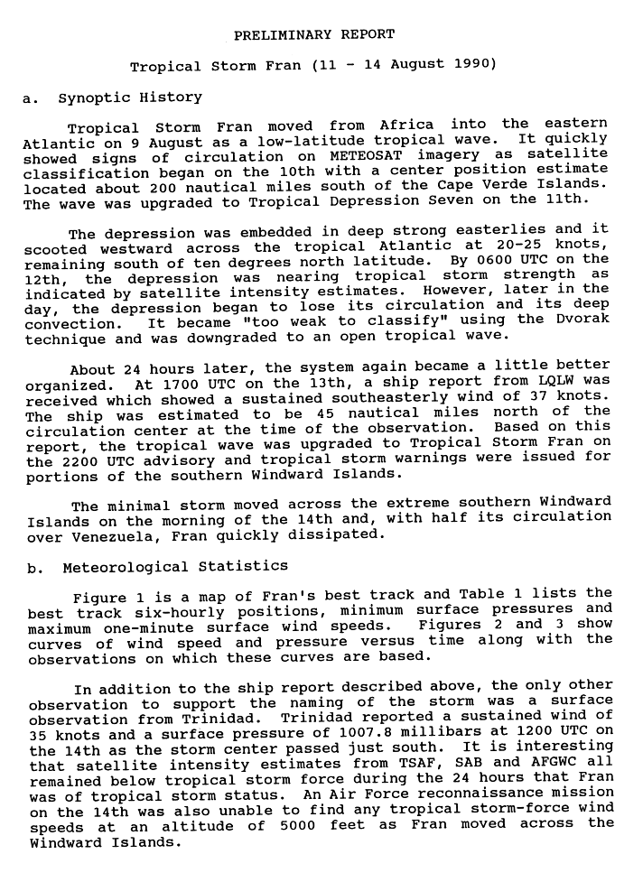
![]() | This article's factual accuracy may be compromised due to out-of-date information.(October 2022) |
A South American hurricane is a tropical cyclone that affects the continent of South America or its countries. The continent is rarely affected by tropical cyclones, though most storms to hit the area are formed in the North Atlantic Ocean. Typically, strong upper-level winds and its proximity to the equator prevents North Atlantic impacts. [1] Cyclone Yaku is the only known tropical cyclone to have ever affected the Pacific side of South America on record, albeit its status as a tropical cyclone is unofficial.[ citation needed ] Although conditions are typically too hostile for many storms to hit the area from the South Atlantic Ocean, there have been a few tropical cyclones to affect land. Based on climatology, northern Venezuela and Colombia have a 1 to 5% chance of a hurricane strike in any given year, while all locations south of 10° N have less than a 1% chance of a direct hit. [2]
44 tropical cyclones have affected South America in most months of the year.
| ![]() |
Data from South American tropical cyclones is sparse and incomplete, though most tropical cyclones that struck the continent caused multiple deaths. Bret, Julia, Joan, and Cesar all caused their deaths through rainfall or flash flooding.
Name | Year | Number of deaths |
---|---|---|
Bret | 1993 | 174 |
Joan | 1988 | 36 |
Cesar | 1996 | 17 |
Ubá | 2021 | 15 |
Unnamed | 2009 | 14 |
Matthew | 2010 | 8 |
Yaku | 2023 | 8 |
Iota | 2020 | 7 |
Gilbert | 1988 | 5 |
Catarina | 2004 | 3 |
Ivan | 2004 | 3 |
Kurumí | 2020 | 3 |
Lenny | 1999 | 2 |
Bret | 2017 | 2 |
Yakecan | 2022 | 2 |
Hattie | 1961 | 1 |
Matthew | 2016 | 1 |
"Trinidad" | 1933 | "Several" |
"Martinique–Venezuela" | 1822 | "Several" |
Alma | 1974 | 0 (47 indirect) |
Julia | 2022 | 0 (54 indirect) |
In the event an Atlantic hurricane threatens the northern coast of South America, the National Hurricane Center defines nine locations as tropical cyclone warning breakpoints. The westernmost is the border between Panama and Colombia, and the easternmost is Georgetown, Guyana, located at 6.82° N. In the eastern Pacific Ocean, tropical cyclone warning breakpoints extend eastward to the border of Panama and Colombia at 7.23° N. [74] No Atlantic hurricane has existed south of 6.82° N, [75] and no Pacific hurricane has existed east of 80° W, [76] though in the event a tropical cyclone threatens a region of South America without warnings, additional warning sites can be selected. In addition to warnings on the mainland of South America, the National Hurricane Center defines the entire island of San Andres as a tropical cyclone warning breakpoint. [74]
Intense Hurricane Flora in 1963 prompted officials to declare gale warnings for two islands off the north coast of Venezuela. [77] In 1974, the passage of Tropical Storm Alma warranted the issuance of Gale Warnings for the Paria and Paraguaná Peninsulas. [21] Hurricane Joan in 1988, Tropical Storm Bret in 1993, Hurricane Cesar in 1996, and Hurricane Felix in 2007 resulted in tropical storm and hurricane watches and warnings for several locations in South America. [78] [79] [80] [81] The threat of Hurricane Ivan prompted a hurricane watch and a tropical storm warning for the northern coast of Venezuela. [82]
{{cite web}}
: CS1 maint: multiple names: authors list (link){{cite journal}}
: CS1 maint: DOI inactive as of November 2024 (link)[ permanent dead link ]{{cite web}}
: CS1 maint: url-status (link)