Tropical cyclones in Indonesia

Last updated

1973 Flores cyclone, the deadliest tropical cyclone ever recorded in both Indonesia and the entire Southern Hemisphere Flores 1973-04-28.png
1973 Flores cyclone, the deadliest tropical cyclone ever recorded in both Indonesia and the entire Southern Hemisphere

Indonesia is an island country in Southeast Asia and Oceania, located in the Pacific Ocean and the Indian Ocean. The largest island nation in the world, the country is the home of over seventeen thousand islands.

Contents

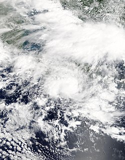
Climatologically, in the Australian basin, most tropical cyclones develop between November and April, or as early as October and as late as May. However, there are some cases, like Typhoon Vamei and Cyclone Viyaru that affected the country, outside the basin. This article includes all tropical cyclone of any intensity that affected the island nation of Indonesia, on all available records and data.
Climatology

The region of Indonesia is not generally traversed by tropical cyclones although a lot of systems have historically formed there. [1] In an analysis of tropical cyclone data from the Bureau of Meteorology since 1907 to 2017 which was published after the dissipation of Cyclone Cempaka found that only around 0.62% of all cyclones in the Australian region during those years occurred north of the 10th parallel south. [2]

Statistics

Storms affecting Indonesia by month
MonthNumber of storms
January
6
February
3
March
15
April
21
May
6
June
0
July
0
August
0
September
0
October
1
November
8
December
18
Storms affecting Indonesia by period
PeriodNumber of storms
1970s
20
1980s
16
1990s
13
2000s
6
2010s
22
2020s
2

1970s

1980s

1990s

2000s

2010s

Cyclone Cempaka, just stalling offshore East Java at peak intensity on November 27, 2013. Cempaka 2017-11-27 0300Z.jpg
Cyclone Cempaka, just stalling offshore East Java at peak intensity on November 27, 2013.

2020s

Deadly storms

The following list is the recorded fatalities from the storms that impacted or affected the island country of Indonesia. The total number of deaths recorded is only from the country itself.

RankNameYearNumber of Deaths
1 1973 Flores cyclone 19731,653
2 Cyclone Seroja 2021183
3 Cyclone Inigo 200358
4 Cyclone Cempaka 201741
5 Cyclone Bonnie 200219
6 Cyclone Viyaru 201315
7 Cyclone Narelle 201314
8 Cyclone Savannah 201910

See also

Related Research Articles

<span class="mw-page-title-main">1999–2000 Australian region cyclone season</span>

The 1999–2000 Australian region cyclone season was a slightly above average tropical cyclone season. It ran from 1 November 1999 to 30 April 2000. The regional tropical cyclone operational plan also defines a "tropical cyclone year" separately from a "tropical cyclone season", with the "tropical cyclone year" for this season lasting from 1 July 1999 to 30 June 2000.

<span class="mw-page-title-main">Meteorology, Climatology, and Geophysical Agency</span> Indonesian government agency

Meteorology, Climatology, and Geophysical Agency is an Indonesian non-departmental government agency for meteorology, climatology, and geophysics.

<span class="mw-page-title-main">2007–08 Australian region cyclone season</span> Tropical cyclone season

The 2007–08 Australian region cyclone season was a slightly below-average tropical cyclone season. The season began with an early start, with the formation of the first tropical cyclone on 29 July, which was only recognized as a tropical cyclone during post-season analysis. This was the second time that a tropical cyclone had formed during July. The other one was Cyclone Lindsay in the 1996–1997 season. The next tropical cyclone that formed was Cyclone Guba, which formed on 13 November with TCWC Port Moresby assigning the name Guba on 14 November, which was the first named storm within TCWC Port Moresby's area of responsibility since Cyclone Epi in June 2003. Guba was also the first cyclone to occur in the Queensland region in November since 1977.

An Australian region tropical cyclone is a non-frontal, low-pressure system that has developed within an environment of warm sea surface temperatures and little vertical wind shear aloft in either the Southern Indian Ocean or the South Pacific Ocean. Within the Southern Hemisphere there are officially three areas where tropical cyclones develop on a regular basis: the South-West Indian Ocean between Africa and 90°E, the Australian region between 90°E and 160°E, and the South Pacific basin between 160°E and 120°W. The Australian region between 90°E and 160°E is officially monitored by the Australian Bureau of Meteorology, the Indonesian Meteorology, Climatology, and Geophysical Agency, and the Papua New Guinea National Weather Service, while others like the Fiji Meteorological Service and the United States National Oceanic and Atmospheric Administration also monitor the basin. Each tropical cyclone year within this basin starts on 1 July and runs throughout the year, encompassing the tropical cyclone season, which runs from 1 November and lasts until 30 April each season. Within the basin, most tropical cyclones have their origins within the South Pacific convergence zone or within the Northern Australian monsoon trough, both of which form an extensive area of cloudiness and are dominant features of the season. Within this region a tropical disturbance is classified as a tropical cyclone when it has 10-minute sustained wind speeds of at least 65 km/h (40 mph) that wrap halfway around the low level circulation centre, while a severe tropical cyclone is classified when the maximum 10-minute sustained wind speeds are greater than 120 km/h (75 mph).

<span class="mw-page-title-main">Cyclone Inigo</span> Category 5 Australian region cyclone in 2003

Severe Tropical Cyclone Inigo is tied with Cyclone Gwenda for being the most intense recorded cyclone in the Australian region in terms of pressure, with the possible exception of Cyclone Mahina. Inigo developed from a tropical low that crossed eastern Indonesia in late March 2003. Becoming a named tropical cyclone on 1 April, Inigo rapidly intensified as it tracked southwestward, reaching a minimum central pressure of 900 hPa on 4 April with maximum 1 minute sustained winds of 170 mph. An approaching trough weakened the cyclone and turned it to the southeast, and on 8 April, Inigo dissipated after making landfall on Western Australia, as a minimal tropical storm.

<span class="mw-page-title-main">2008–09 Australian region cyclone season</span> Tropical cyclone season

The 2008–09 Australian region cyclone season was a near average tropical cyclone season. It officially started on 1 November 2008, and officially ended on 30 April 2009. This season was also the first time that the BoM implemented a "tropical cyclone year." The regional tropical cyclone operational plan defines a "tropical cyclone year" separately from a "tropical cyclone season"; the "tropical cyclone year" began on 1 July 2008 and ended on 30 June 2009.

<span class="mw-page-title-main">2011–12 Australian region cyclone season</span> Tropical cyclone season

The 2011–12 Australian region cyclone season was a below average tropical cyclone season, with 7 cyclones forming rather than the usual 11. It began on 1 November 2011, and ended on 14 May 2012. The regional tropical cyclone operational plan defines a "tropical cyclone year" separately from a "tropical cyclone season"; the "tropical cyclone year" began on 1 July 2011 and ended on 30 June 2012.

<span class="mw-page-title-main">2012–13 Australian region cyclone season</span> Tropical cyclone season

The 2012–13 Australian region cyclone season was a slightly below average tropical cyclone season event in the ongoing cycle of tropical cyclone formation. It officially started on 1 November 2012, and officially ended on 30 April 2013, despite Cyclone Zane being an active system at the time. The regional tropical cyclone operational plan defines a "tropical cyclone year" separately from a "tropical cyclone season"; the "tropical cyclone year" began on 1 July 2012 and ended on 30 June 2013.

<span class="mw-page-title-main">2013–14 Australian region cyclone season</span> Tropical cyclone season

The 2013–14 Australian region cyclone season was a slightly below-average tropical cyclone season, with 10 tropical cyclones occurring within the Australian region. It officially started on 1 November 2013, and ended on 30 April 2014. The regional tropical cyclone operational plan defines a "tropical cyclone year" separately from a "tropical cyclone season"; the "tropical cyclone year" began on 1 July 2013 and ended on 30 June 2014.

<span class="mw-page-title-main">2014–15 Australian region cyclone season</span> Tropical cyclone season

The 2014–15 Australian region cyclone season was a slightly below average tropical cyclone season, though it featured numerous intense cyclones. The season officially ran from 1 November 2014, to 30 April 2015, however, a tropical cyclone could form at any time between 1 July 2014, and 30 June 2015, and would count towards the season total. During the season, tropical cyclones were officially monitored, by one of the five Tropical Cyclone Warning Centres (TCWCs) that are operated in this region.

<span class="mw-page-title-main">2017–18 Australian region cyclone season</span> Tropical cyclone season

The 2017–18 Australian region cyclone season was an average period of tropical cyclone formation in the Southern Indian Ocean and South Pacific Ocean, between 90°E and 160°E, with 11 named storms, which 3 intensified into severe tropical cyclones. Another two tropical cyclones, Cempaka and Flamboyan occurred outside the Australian region but are included in the descriptions below. The season officially began 1 November 2017 and ended on 30 April 2018; however, tropical cyclones can form at any time of the year, as demonstrated by the first tropical low of the season in early August. Any tropical system that forms between 1 July 2017 and 30 June 2018 will count towards the season total. During the season, tropical cyclones will be officially monitored by one of the five tropical cyclone warning centres (TCWCs) that operate in this region. Three of the five centres are operated by the Australian Bureau of Meteorology (BOM) in Perth, Darwin and Brisbane, while the other two are operated by the National Weather Service of Papua New Guinea in Port Moresby and the Indonesian Agency for Meteorology, Climatology and Geophysics in Jakarta. The Joint Typhoon Warning Center (JTWC) of the United States and other national meteorological services, including Météo-France at Réunion, also monitored the basin during the season.

<span class="mw-page-title-main">2018–19 Australian region cyclone season</span> Tropical cyclone season

The 2018–19 Australian region cyclone season was an average season that saw the formation of 11 tropical cyclones, six of which intensified further to become severe tropical cyclones. The season officially began on 1 November 2018 and concluded on 30 April 2019; however, as evidenced by Tropical Low Liua in September 2018 and Tropical Cyclones Lili and Ann in May 2019, tropical cyclones can form at any time of the year. As such, any system existing between 1 July 2018 and 30 June 2019 would count towards the season total. During the season, tropical cyclones were officially monitored by the Bureau of Meteorology (BOM), the Indonesian Agency for Meteorology, Climatology and Geophysics (BMKG) in Jakarta, Indonesia, and the National Weather Service of Papua New Guinea in Port Moresby. The United States' Joint Typhoon Warning Center (JTWC) in Hawaii, and other national meteorological services such as MetService in New Zealand, Météo-France at La Réunion, and the Fiji Meteorological Service (FMS), also monitored parts of the basin during the season in an unofficial capacity.

<span class="mw-page-title-main">2019–20 Australian region cyclone season</span> Tropical cyclone season

The 2019–20 Australian region cyclone season was a below average tropical cyclone season for the waters surrounding Australia between longitudes 90°E and 160°E. The season officially began on 1 November 2019 and ended on 30 April 2020; however, tropical cyclones can form at any time of year, as evidenced by Tropical Cyclone Mangga during May 2020. As such, any system existing between 1 July 2019 and 30 June 2020 would count towards the season total. The season featured the region's second-latest start on record, with the formation of the first tropical low only occurring on 4 January 2020. A total of eight tropical cyclones formed during the season, which represents the region's least active season since the 2016–17 season. Three systems intensified further into severe tropical cyclones, and three systems made landfall within the region at tropical cyclone intensity. A total of 28 fatalities were caused, either directly or indirectly, as a result of impacts from the season's systems. Cyclone Ferdinand was the strongest of the season reaching Category 4 in late February 2020. However, it was the second-strongest storm, Cyclone Damien, that was the most damaging. Damien was the strongest tropical cyclone to strike Western Australia's Pilbara Region since Cyclone Christine in 2013, making landfall directly over the town of Dampier.

<span class="mw-page-title-main">2020–21 Australian region cyclone season</span> Tropical cyclone season

The 2020–21 Australian region cyclone season was a below average but very deadly season when most tropical cyclones formed in the Southern Indian Ocean and Pacific Oceans between 90°E and 160°E. It produced 8 tropical cyclones with 3 strengthening into severe tropical cyclones. However, it featured the region's third-deadliest cyclone on record—Cyclone Seroja, which brought severe floods and landslides to southern Indonesia and East Timor. The season officially began on 1 November 2020 and started with the formation of Tropical Low 01U on 24 November within the basin, which would later become Tropical Storm Bongoyo in the South-West Indian Ocean, and ended with the dissipation of a tropical low on 24 April, 6 days before the season ended on 30 April. However, a tropical cyclone could form at any time between 1 July 2020 and 30 June 2021 and would count towards the season total. During the season, tropical cyclones were officially monitored by one of the three tropical cyclone warning centres (TCWCs) for the region which are operated by the Australian Bureau of Meteorology, National Weather Service of Papua New Guinea and the Indonesian Agency for Meteorology, Climatology and Geophysics. The United States Joint Typhoon Warning Center (JTWC) and other national meteorological services including Météo-France also monitored the basin during the season.

<span class="mw-page-title-main">Cyclone Narelle</span> Category 4 Australian region cyclone in 2013

Severe Tropical Cyclone Narelle was a powerful Category 4 tropical cyclone in early January 2013 that brought light rains to areas in South Australia suffering from a drought and heat wave. On 4 January, a tropical low pressure developed within a monsoon trough over the Timor Sea. Over the following several days, the system gradually tracked westward and intensified, being classified Tropical Cyclone Narelle on 8 January. Turning southward into a region of low wind shear, Narelle intensified into a severe tropical cyclone on 9 January. Over the following two days, the cyclone's structure fluctuated, temporarily featuring an eye, before it maintained its organisation and intensified further on 11 January. The storm attained its peak intensity later on 11 January as a Category 4 cyclone with winds of 195 km/h (121 mph). The following day, Narelle passed approximately 330 km (205 mi) northwest of Exmouth as it moved on a south-southwesterly course. The system steadily weakened and ultimately fell below tropical cyclone strength on 15 January well to the west of Geraldton.

<span class="mw-page-title-main">Cyclone Gillian</span> Category 5 Australian region tropical cyclone in 2014

Severe Tropical Cyclone Gillian was the second most powerful of the 2013–14 Australian region cyclone season and the strongest in the basin in four years. It developed on 8 March, 2014, in the Gulf of Carpentaria offshore northern Australia. It drifted southeastward, moving over northwestern Queensland on 10 March as a weak tropical cyclone, and subsequently turned to the southwest and later to the west. Unfavourable wind shear, land interaction, and dry air prevented much restrengthening, and for several days Gillian was a weak tropical low. The storm moved northward and curved westward around the Top End of northwestern Australia, and subsequently moved across several islands in Indonesia, first Timor on 18 March. On 21 March, Gillian again became a tropical cyclone as it moved away from Indonesia. On the next day, it passed just southeast of Christmas Island as an intensifying storm, and subsequently Gillian underwent rapid deepening. On 23 March, the Bureau of Meteorology (BoM) estimated peak 10-minute sustained winds of 220 km/h (140 mph). On the same day, the Joint Typhoon Warning Center (JTWC) estimated peak 1-minute sustained winds of 260 km/h (160 mph), making it a Category 5 on the Saffir–Simpson hurricane wind scale. Increased wind shear caused the cyclone to rapidly weaken, and both BoM and JTWC discontinued advisories on Gillian on 26 March.

<span class="mw-page-title-main">Cyclone Cempaka</span> Category 1 Australian region cyclone in 2017

Tropical Cyclone Cempaka was a tropical cyclone that impacted the island of Java and Bali, Indonesia in November 2017. Although it did not make landfall, Cempaka managed to cause 41 deaths, with more than 20,000 people evacuated and causing around US$83.6 million in damages. Cempaka was the fourth cyclone to be registered in Indonesia by the Tropical Cyclone Warning Center of the Indonesian Meteorology, Climatology, and Geophysical Agency (BMKG) since 2008 and the first since Cyclone Bakung in 2014. It also came closer to making landfall in that country than any other cyclone on record.

<span class="mw-page-title-main">Cyclone Lili (2019)</span> Category 1 tropical cyclone in 2019

Tropical Cyclone Lili was a small and relatively weak off-season tropical cyclone that brought moderate impacts to the Maluku Islands and East Timor, and mild impacts to other parts of eastern Indonesia and far-northern Australia. It was the latest tropical cyclone to exist in the Australian Bureau of Meteorology's northern tropical cyclone region on record, surpassing Severe Tropical Cyclone Verna of 1977. Lili was the tenth tropical cyclone of the 2018–19 Australian region cyclone season, and the second of which to be named by the Indonesian Agency for Meteorology, Climatology and Geophysics. Lili originated from a tropical low that formed over the Banda Sea on 4 May 2019. The system gradually organised as it tracked slowly southwards, and strengthened into a Category 1 tropical cyclone on the Australian scale on 9 May. Lili reached peak intensity later that day, with ten-minute sustained winds of 75 km/h (47 mph) and a central barometric pressure of 997 hPa (29.44 inHg). The Joint Typhoon Warning Center estimated one-minute mean winds at this time to be at 100 km/h (62 mph). Weakening commenced soon thereafter, and the system fell below cyclone intensity on 10 May after turning to the west. Lili made landfall in northern East Timor the following day as a weak tropical low, and dissipated shortly afterwards.

<span class="mw-page-title-main">Cyclone Savannah</span> Australian region tropical cyclone

Severe Tropical Cyclone Savannah was a strong tropical cyclone that brought significant impacts to Java and Bali and minor impacts to Christmas Island and the Cocos (Keeling) Islands during March 2019. It was the sixteenth tropical low, sixth tropical cyclone and third severe tropical cyclone of the 2018–19 Australian region cyclone season. Savannah developed from a tropical low that formed well to the east of Christmas Island on 8 March. The system was slow to develop initially, but reached tropical cyclone intensity on 13 March after adopting a southwesterly track. Savannah underwent rapid intensification and reached peak intensity on 17 March as a Category 4 severe tropical cyclone on the Australian scale. Ten-minute sustained winds were estimated as 175 kilometres per hour (109 mph), with a central barometric pressure of 951 hPa (28.08 inHg). One-minute sustained winds reached 185 kilometres per hour (115 mph) at this time, equivalent to a Category 3 major hurricane on the Saffir–Simpson hurricane wind scale. Weakening commenced soon afterwards, and responsibility for the system passed from the Australian Bureau of Meteorology to Météo-France. As it moved into the new region, Savannah became the eighth of a record-breaking ten intense tropical cyclones in the 2018–19 South-West Indian Ocean cyclone season. Savannah was downgraded to a tropical depression on 20 March, and its remnants dissipated in the central Indian Ocean on 24 March.

<span class="mw-page-title-main">Cyclone Seroja</span> Category 3 Australian region cyclone in 2021

Severe Tropical Cyclone Seroja was the third-deadliest tropical cyclone on record in the Australian region, behind Cyclone Mahina in 1899 and the Flores cyclone in 1973. Seroja brought historic flooding and landslides to portions of southern Indonesia and East Timor and later went on to make landfall in Western Australia's Mid West region, becoming the first to do so since Cyclone Elaine in 1999. The twenty-second tropical low, seventh tropical cyclone, and third severe tropical cyclone of the 2020–21 Australian region cyclone season, the precursor of Seroja formed off the south coast of Timor island as Tropical Low 22U at 18:00 UTC on 3 April 2021; its genesis was related to convectively coupled equatorial waves. The tropical low moved very slowly near the island, while the system's thunderstorms increased in organization. The low intensified into Tropical Cyclone Seroja by 4 April, while it was passing north of Rote Island, while continuing its slow strengthening trend.

References

  1. "Musim Siklon di Sekitar Indonesia" (in Indonesian). Badan Meteorologi Klimatologi dan Geofisika. Retrieved 15 January 2019.
  2. "Cempaka dan Dahlia, anomali siklon tropis Indonesia" (in Indonesian). Beritagar.id. 3 December 2017. Archived from the original on 15 January 2019. Retrieved 15 January 2019.
  3. RSMC Tokyo — Typhoon Center. "Typhoon Vamei Best Track for the 2001 Pacific typhoon season" (PDF) (in Japanese). Japan Meteorological Agency. Retrieved 2012-12-06.
  4. 1 2 Gary Padgett (November 2001). "Monthly Global Tropical Cyclone Summary November 2001" . Retrieved 21 July 2007.
  5. Joint Typhoon Warning Center (2002). "Best Track for Cyclone 03S" . Retrieved 19 July 2008.
  6. "Climate of 2002 - April - Global Regional Analysis: Australia and Indonesia". National Climatic Data Center . Retrieved 11 May 2008.
  7. Gary Padgett (2003). "April 2003 Worldwide Tropical Weather Summary" . Retrieved 5 January 2008.
  8. 1 2 3 United Nations Office for the Coordination of Humanitarian Affairs (3 April 2003). "Indonesia – Landslides OCHA Situation Report No. 1". ReliefWeb. Retrieved 6 January 2008.
  9. 1 2 Bureau of Meteorology Special Services Unit (2003). "Tropical Cyclone Inigo (30 March – 8 April)". Government of Australia. Archived from the original on 27 August 2006. Retrieved 5 January 2008.
  10. United Nations Office for the Coordination of Humanitarian Affairs (4 November 2003). "Indonesia: OCHA Consolidated Situation Report No. 123". ReliefWeb. Retrieved 8 January 2008.
  11. RA V Tropical Cyclone Committee for the South Pacific and South-East Indian Ocean (2004). "Final Report for the Tenth Tropical Cyclone Committee Session" (PDF). World Meteorological Organization. p. 7. Retrieved 6 January 2008.[ permanent dead link ]
  12. 1 2 Jakarta Tropical Cyclone Warning Centre (6 July 2010). Tropical Cyclone Kirrily (PDF) (After Event Report) (in Indonesian). Badan Meteorologi, Klimatologi, dan Geofisika. Archived (PDF) from the original on 18 May 2015.
  13. 1 2 Darwin Regional Specialised Meteorological Centre (2009). "April 2009" (PDF). Darwin Tropical Diagnostic Statement. 28 (4). Australian: Bureau of Meteorology: 2. ISSN   1321-4233 . Retrieved 11 January 2012.
  14. Western Australian Regional Office. Tropical Cyclone Errol (Report). Australian Bureau of Meteorology. Retrieved 3 January 2015.
  15. Joint Typhoon Warning Center. "Significant tropical weather advisory for the Indian Ocean 2012-05-05 06z". United States Navy, United States Airforce. Archived from the original on 26 January 2012. Retrieved 10 May 2012.
  16. 1 2 Andi Hajramurni and Panca Nugraha (11 January 2013). "Two missing after cargo vessel sinks off Sulawesi". The Jakarta Port. Archived from the original on 12 January 2013. Retrieved 16 January 2013.
  17. Andi Hajramurni (16 January 2013). "Sunken ship search called off as bad weather continues". The Jakarta Post. Archived from the original on 18 January 2013. Retrieved 16 January 2013.
  18. Luh De Suriyani (10 January 2013). "Narelle tropical cyclone batters Bali with strong winds". The Jakarta Post. Archived from the original on 21 May 2024. Retrieved 16 January 2013.
  19. Novia D. Rulistia and Multa Fidrus (12 January 2013). "BNPB urges caution amid stormy weather". The Jakarta Post. Archived from the original on 13 January 2013. Retrieved 16 January 2013.
  20. Multa Fidrus (11 January 2013). "Flood cuts off toll road, kills 4 in Banten". The Jakarta Post. Archived from the original on 12 January 2013. Retrieved 16 January 2013.
  21. "14 People Killed, 6 Missing in Natural Disasters in Indonesia This Year". Bernama. 10 January 2013. Archived from the original on 13 March 2013. Retrieved 16 January 2013.
  22. Jeff Masters (May 10, 2013). "Double Trouble: twin tropical cyclones spin up in the Indian Ocean". Weather Underground. Archived from the original on May 16, 2013. Retrieved May 15, 2013.
  23. 1 2 "Thousands homeless from floods in Indonesia's Aceh district". United Press International. Jakarta, Indonesia. May 11, 2013. Retrieved May 16, 2013.
  24. 1 2 Nurdin Hasan; Aris Cahyadi (May 13, 2013). "A Dozen Fishermen Feared Dead After Aceh Winds". Jakarta Globe. Retrieved May 19, 2013.
  25. 1 2 Aris Cahyadi (May 13, 2013). "Aceh Landslide Kills 3 Bus Passengers". Jakarta Globe. Archived from the original on June 26, 2013. Retrieved May 16, 2013.
  26. "Siklon tropis Gillian sebabkan hujan di Jakarta" (in Indonesian). Antara News. 23 March 2014. Retrieved 24 March 2014.
  27. "Cyclone may fan fires in Riau". The Jakarta Post. 23 March 2014. Archived from the original on 25 March 2014. Retrieved 24 March 2014.
  28. "Severe Tropical Cyclone Frances, Northern Territory Regional Office".
  29. 1 2 "Banjir di Pacitan dan Yogyakarta, dampak 'keserakahan pada alam' dengan kerugian triliunan rupiah" (in Indonesian). BBC News Indonesia. 30 November 2017. Retrieved 14 January 2019.
  30. "Belasan Ribu Orang Mengungsi Akibat Siklon Cempaka" (in Indonesian). CNN Indonesia. 30 November 2017. Retrieved 15 January 2019.
  31. "2.341 Kejadian Bencana, 377 Tewas dan 3,5 Juta Jiwa Mengungsi dan Menderita Akibat Bencana Tahun 2017" (in Indonesian). Badan Nasional Penanggulangan Bencana. 29 December 2017. Archived from the original on 15 January 2019. Retrieved 15 January 2019.
  32. "Cyclone Cempaka leaves at least 41 dead". The Jakarta Post. 6 December 2017. Retrieved 14 January 2019.
  33. "Siklon Tropis "CEMPAKA" Lahir, Siaga Cuaca Ekstrem 3 Hari Ke Depan" (in Indonesian). Retrieved March 18, 2021.
  34. Tropical Cyclone Technical Bulletin at 1430 UTC 15/03/2018 (Report). Australian Bureau of Meteorology. Archived from the original on 22 May 2024. Retrieved 22 March 2018.
  35. "Northern Territory Tropical Cyclone Outlook". Bureau of Meteorology. 19 March 2018. Archived from the original on 1 March 2018.
  36. "Weekly Tropical Climate Note". Bureau of Meteorology. 12 March 2019. Archived from the original on 22 May 2019. Retrieved 21 May 2019.{{cite web}}: CS1 maint: bot: original URL status unknown (link)
  37. "South East Asia Gradient Level Wind Analysis (00Z)". Bureau of Meteorology. 8 March 2019. Archived from the original on 1 June 2019. Retrieved 21 May 2019.{{cite web}}: CS1 maint: bot: original URL status unknown (link)
  38. Bagus, Rahadian (7 March 2019). "Kecelakaan Mobil di Jalan Tol Madiun-Surabaya, Bocah 5 Tahun Tewas" (in Indonesian). Tribunnews. Retrieved 17 March 2019.
  39. Muryanto, Bambang (18 March 2019). "Five dead, one missing after flooding, landslides in Yogyakarta". The Jakarta Post. Retrieved 18 March 2019.
  40. Muhlis, Al Alawi (10 March 2019). "Kapolres: Kabar 2 Orang Tewas akibat Banjir di Madiun Hoaks" (in Indonesian). Regional Kompas. Retrieved 18 March 2019.
  41. Mustofa, Ali (6 March 2019). "Kerugian Akibat Banjir Madiun Capai Rp54 Miliar!" (in Indonesian). Madiunpos. Archived from the original on 27 March 2019. Retrieved 18 March 2019.
  42. "Empat Wisatawan Tewas Terseret Banjir Bandang" (in Indonesian). Tribun Bali. 13 March 2019. Retrieved 18 March 2019.
  43. "38 Desa di Bojonegoro Tergenang Banjir, Kerugian Capai Rp 4 Miliar" (in Indonesian). Kumparan. 8 March 2019. Retrieved 18 March 2019.
  44. "Banjir di Ngawi, Petani Merugi hingga Rp 33 Miliar" (in Indonesian). Jawa Pos News Network. 11 March 2019. Retrieved 18 March 2019.
  45. Pebrianti, Charoline (15 March 2019). "Banjir 2 Hari Rugikan Ponorogo Rp 9 Miliar" (in Indonesian). detikNews. Retrieved 18 March 2019.
  46. "Banjir timbulkan kerugian Rp5 miliar lebih di Tulungagung" (in Indonesian). Antara Aceh. 11 March 2019. Retrieved 18 March 2019.
  47. Iswinarno, Chandra (11 March 2019). "BPBD Magetan: Kerugian Akibat Banjir Hampir Rp 1 Miliar" (in Indonesian). Suara. Retrieved 18 March 2019.
  48. Prakoso, Taufik (13 March 2019). "32,75 Ha Sawah Puso Karena Banjir, Petani Klaten Rugi Ratusan Juta Rupiah" (in Indonesian). Soloraya. Retrieved 18 March 2019.
  49. Perdana (8 March 2019). "Banjir Sukoharjo, Kerugian Capai Rp 300 Juta, Sawah Terendam 379 Ha" (in Indonesian). Radar Solo. Archived from the original on 24 May 2019. Retrieved 18 March 2019.
  50. Mustofa, Ali (11 March 2019). "Disapu Air Bah, Rumah Subsidi Seharga Rp 150 Juta Diterjang Banjir" (in Indonesian). Radar Solo. Retrieved 18 March 2019.
  51. "12 UTC Tropical Cyclone Information Bulletin (Wallace)". Indonesian Meteorology, Climatology and Geophysical Agency (BMKG) (in Indonesian). 5 April 2019. Archived from the original on 5 April 2019. Retrieved 5 April 2019.
  52. "00 UTC Tropical Cyclone Information Bulletin". Indonesian Meteorology, Climatology and Geophysical Agency (BMKG) (in Indonesian). 6 April 2019. Archived from the original on 6 April 2019. Retrieved 6 April 2019.
  53. 1 2 3 Arbi, Ivani Atina (10 May 2019). "Cyclone Lili causes floods, strong winds in Maluku". The Jakarta Post. Archived from the original on 11 May 2019. Retrieved 11 May 2019.
  54. "Indonesia, Timor-Leste - Tropical Cyclone LILI (GDACS, JTWC, BMKG, BNPB, NOAA, media) (ECHO Daily Flash of 10 May 2019)". Relief Web. 10 May 2019. Archived from the original on 10 May 2019. Retrieved 11 May 2019.
  55. "Tropical Cyclone Ann Forecast Track Map #12 (03Z)". Bureau of Meteorology. 14 May 2019. Archived from the original on 14 May 2019. Retrieved 14 May 2019.
  56. "Northern Region Tropical Cyclone Outlook". Australian Bureau of Meteorology. 4 January 2020. Archived from the original on 4 January 2020. Retrieved 4 January 2020.
  57. "BMKG warns of tropical cyclone Claudia in East Nusa Tenggara". 2020-01-12. Retrieved 2021-03-16.
  58. "Potential Tropical Cyclone Claudia expected to form on Saturday". ABC News. 2020-01-09. Retrieved 2021-03-16.
  59. "Tropical Depression 96S Forecast Track Map (06Z)". Indonesian Agency for Meteorology, Climatology and Geophysics. 5 May 2020. Archived from the original on 5 May 2020. Retrieved 5 May 2020.
  60. "Tropical Depression 96S Information Bulletin (06Z)". Indonesian Agency for Meteorology, Climatology and Geophysics (in Indonesian). 5 May 2020. Archived from the original on 5 May 2020. Retrieved 5 May 2020.
  61. "Tropical Low 17U Technical Bulletin (00Z)". Indonesian Agency for Meteorology, Climatology and Geophysics (in Indonesian). 21 May 2020. Archived from the original on 21 May 2020. Retrieved 21 May 2020.
  62. 1 2 "Tropical Low 17U Track and Impact Map (00Z)". Indonesian Agency for Meteorology, Climatology and Geophysics. 21 May 2020. Archived from the original on 21 May 2020. Retrieved 21 May 2020.
  63. Laila Afifa (2020-05-22). "Tropical Cyclone Mangga May Cause Extreme Weather Patterns". TEMPO.CO. Retrieved 2021-03-15.
  64. "Tropical Low 02U 5 – 12 December 2020". Bureau of Meteorology. 2021-05-12. Retrieved 2021-03-15.
  65. Wawo, Ricko; Karmini, Niniek. "Rescuers hampered by damaged roads, more rain in Indonesia". The Washington Post. Retrieved 5 April 2021.
  66. "Floods and landslides in Indonesia and East Timor kill more than 100". BBC News. 5 April 2021. Retrieved 5 April 2021.
  67. Yos Seran; Agustinus Beo Da Costa (5 April 2021). "Tropical cyclone kills at least 97 in Indonesia, East Timor". Reuters. Retrieved 5 April 2021.
  68. Cruz, Agustinus Beo Da Costa, Nelson Da (5 April 2021). "Tropical cyclone kills at least 76 in Indonesia, East Timor". Reuters. Retrieved 5 April 2021.{{cite news}}: CS1 maint: multiple names: authors list (link)
  69. "Tropical Cyclone Seroja hits Indonesia and East Timor: At least 76 people killed and thousands displaced by flash floods and landslides". Sky News. 5 April 2021. Retrieved 5 April 2021.