Hong Kong, officially the Hong Kong Special Administrative Region of the People's Republic of China, is a city and a special administrative region in China. With 7.4 million residents of various nationalities in a 1,104-square-kilometre (426 sq mi) territory, Hong Kong is one of the most densely populated territories in the world.

The Hong Kong Special Administrative Region (HKSAR), can be divided into three geographical regions: Hong Kong Island, Kowloon, and the New Territories. Hong Kong is a coastal city and major port in Southern China, bordering Guangdong Province through the city of Shenzhen to the north and the South China Sea to the east, south, and west. Hong Kong and its 260 nearby islands and peninsulas are located at the mouth of the Pearl River Delta. The area of Hong Kong is distinct from Mainland China, but is considered a part of "Greater China".

Hong Kong has a highly developed transport network, encompassing both public and private transport. Based on Hong Kong Government's Travel Characteristics Survey, over 90% of daily journeys are on public transport, the highest rate in the world. However, in 2014 the Transport Advisory Committee, which advises the Government on transportation issues, issued a report on the much-worsened congestion problem in Hong Kong and pointed at the excessive growth of private cars during the past 10–15 years.

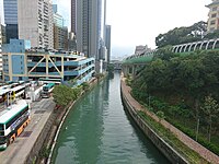
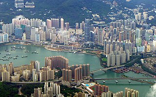
Hong Kong Island is an island in the southern part of Hong Kong. Known colloquially and on road signs simply as Hong Kong, the island had a population of 1,289,500 and a population density of 16,390 per square kilometre (42,400/sq mi), as of 2008. The island had a population of about 3,000 inhabitants scattered in a dozen fishing villages when it was occupied by the United Kingdom in the First Opium War (1839–1842). In 1842, the island was formally ceded in perpetuity to the UK under the Treaty of Nanking and the City of Victoria was then established on the island by the British Force in honour of Queen Victoria. The Central area on the island is the historical, political and economic centre of Hong Kong. The northern coast of the island forms the southern shore of the Victoria Harbour, which is largely responsible for the development of Hong Kong due to its deep waters favoured by large trade ships.

Lantau Island is the largest island in Hong Kong, located West of Hong Kong Island and the Kowloon Peninsula, and is part of the New Territories. Administratively, most of Lantau Island is part of the Islands District of Hong Kong. A small northeastern portion of the island is located in the Tsuen Wan District.

The New Territories is one of the three main regions of Hong Kong, alongside Hong Kong Island and the Kowloon Peninsula. It makes up 86.2% of Hong Kong's territory, and contains around half of the population of Hong Kong. Historically, it is the region described in the Convention for the Extension of Hong Kong Territory. According to that treaty, the territories comprise the mainland area north of Boundary Street on the Kowloon Peninsula and south of the Sham Chun River, as well as over 200 outlying islands, including Lantau Island, Lamma Island, Cheung Chau, and Peng Chau in the territory of Hong Kong.

Yuen Long District is one of the districts of Hong Kong. Located in the northwest of the New Territories, it had a population of 662,000 in 2021
Tsuen Wan District is one of the 18 districts of Hong Kong. It is located in the New Territories and is served by the Tsuen Wan line of the MTR metro system. Its area is 60,7 km². Its residents, who mostly live in Tsuen Wan Town, enjoy the highest income in the New Territories.

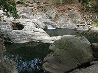
Sai Kung District is one of the 18 districts of Hong Kong. The district comprises the southern half of the Sai Kung Peninsula, the Clear Water Bay Peninsula in the New Territories and a strip of land to the east of Kowloon. Areas in the district include Sai Kung Town, Hong Kong UNESCO Global Geopark, Tseung Kwan O and over 70 islands of different sizes. The administrative centre had been located in Sai Kung Town until the Sai Kung District Office was relocated to Tseung Kwan O recently. The district's population is concentrated in Tseung Kwan O, as of 2011. In 2011, the district was the third youngest district, with a median age of 39.3. Known as the "back garden of Hong Kong", Sai Kung has been able to retain its natural scenery. Many traditional customs and cultures are still retained in the rural villages.
Lo Wu is an area in North District, New Territories, Hong Kong. It lies on the border between Hong Kong and mainland China, specifically the Luohu District of Shenzhen in mainland China. The area is most notable as the location of the most heavily used immigration control point for passengers travelling to and from mainland China. It is where the Lo Wu station is located.

Chek Lap Kok is an island in the western waters of Hong Kong's New Territories. Unlike the smaller Lam Chau, it was only partially leveled when it was assimilated via land reclamation into the 12.48 square kilometres (4.82 sq mi) island for the current Hong Kong International Airport, which opened for commercial aviation in 1998. The airport is popularly referred to as Chek Lap Kok Airport to distinguish it from the former Hong Kong International Airport, now commonly known as Kai Tak Airport (啟德機場).

Xinhui, alternately romanized as Sunwui and also known as Kuixiang, is an urban district of Jiangmen in Guangdong, China. It grew from a separate city founded at the confluence of the Tan and West Rivers. It has a population of about 735,500, 98% of whom are Han Chinese but many of whom speak a dialect of Cantonese as their first language. Xinhui is best known in China for its chenpi, a kind of dried Mandarin orange peel.

Zhaoqing, alternately romanized as Shiuhing, is a prefecture-level city in Guangdong Province, China. As of the 2020 census, its population was 4,113,594, with 1,553,109 living in the built-up area made of Duanzhou, Dinghu and Gaoyao. The prefectural seat—except the Seven Star Crags—is fairly flat, but thickly forested mountains lie just outside its limits. Numerous rice paddies and aquaculture ponds are found on the outskirts of the city. Sihui and the southern districts of the prefecture are considered part of the Pearl River Delta.

Cantonese is a language within the Chinese (Sinitic) branch of the Sino-Tibetan languages originating from the city of Guangzhou and its surrounding Pearl River Delta. It is the traditional prestige variety of the Yue Chinese group, which has over 82.4 million native speakers. While the term Cantonese specifically refers to the prestige variety, it is often used to refer to the entire Yue subgroup of Chinese, including related but partially mutually intelligible varieties like Taishanese.

Tai Po is an area in the New Territories of Hong Kong. It refers to the vicinity of the traditional market towns in the area presently known as Tai Po Old Market or Tai Po Kau Hui (大埔舊墟) on the north of Lam Tsuen River and the Tai Po Hui on Fu Shin Street on the south of the Lam Tsuen River, near the old Tai Po Market railway station of the Kowloon-Canton Railway. Both market towns became part of the Tai Po New Town in the late 1970s and early 1980s. In present-day usage, "Tai Po" may refer to the area around the original market towns, the Tai Po New Town, or the entire Tai Po District.

Chung Ying Street is a street on the border between Hong Kong and Shenzhen, within the border town of Sha Tau Kok and Shatoujiao (Shenzhen). One side of the street belongs to Hong Kong and the other belongs to mainland China.

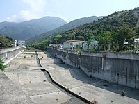
Shek Pik is an area located along the southwestern coast of Lantau Island, Hong Kong. When the Shek Pik Reservoir was built, villages at Shek Pik were demolished and the villagers were relocated to other parts of Lantau Island and to Tsuen Wan. Below the dam of the reservoir is Shek Pik Prison.

Ma On Shan is a saddle-shaped peak in east of Tolo Harbour in the New Territories of Hong Kong. With a height of 702 metres (2,303 ft), it stands among the ten highest mountains in Hong Kong. The mountain borders Sha Tin and Tai Po districts.

Ping Che is a village in Ta Kwu Ling, North District, Hong Kong.

The Boundaries of Hong Kong, officially the Boundary of the Administrative Division of the Hong Kong Special Administrative Region of the People's Republic of China, is a regulated administrative border with border control in force under the One country, two systems constitutional principle, which separates the Hong Kong Special Administrative Region from mainland China, by land border fence of 30 km (19 mi) and maritime boundary of 733 km (455 mi), enforcing a separate immigration and customs-controlled jurisdiction from mainland China.