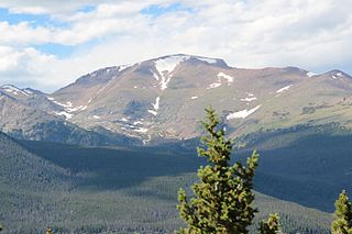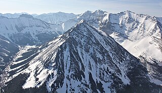
The Rocky Mountains, also known as the Rockies, are a major mountain range and the largest mountain system in North America. The Rocky Mountains stretch 3,000 miles in straight-line distance from the northernmost part of Western Canada, to New Mexico in the Southwestern United States. Depending on differing definitions between Canada and the U.S., its northern terminus is located either in northern British Columbia's Terminal Range south of the Liard River and east of the Trench, or in the northeastern foothills of the Brooks Range/British Mountains that face the Beaufort Sea coasts between the Canning River and the Firth River across the Alaska-Yukon border. Its southernmost point is near the Albuquerque area adjacent to the Rio Grande rift and north of the Sandia–Manzano Mountain Range. Being the easternmost portion of the North American Cordillera, the Rockies are distinct from the tectonically younger Cascade Range and Sierra Nevada, which both lie farther to its west.

The term "United States," when used in the geographic sense, refers to the contiguous United States, Alaska, Hawaii, the five insular territories of Puerto Rico, Northern Mariana Islands, U.S. Virgin Islands, Guam, American Samoa, and minor outlying possessions. The United States shares land borders with Canada and Mexico and maritime borders with Russia, Cuba, the Bahamas, and many other countries, mainly in the Caribbeanin addition to Canada and Mexico. The northern border of the United States with Canada is the world's longest bi-national land border.

The Canadian Rockies or Canadian Rocky Mountains, comprising both the Alberta Rockies and the British Columbian Rockies, is the Canadian segment of the North American Rocky Mountains. It is the easternmost part of the Canadian Cordillera, which is the northern segment of the North American Cordillera, the expansive system of interconnected mountain ranges between the Interior Plains and the Pacific Coast that runs northwest–southeast from central Alaska to the Isthmus of Tehuantepec in Mexico.
Lewis and Clark National Forest is located in west central Montana, United States. Spanning 2,912 square miles (7,500 km2). The region was inhabited by various cultures of Native Americans for a period of at least 8,000–10,000 years. When the Lewis and Clark Expedition came to this area, different areas of the large forest territory were used by members of the Blackfeet, Sioux, Cheyenne, Flathead and Crow nations for hunting and as an area for their seasonal winter camps. The forests provided shelter from the winter.

Little Bear Peak is a high mountain summit in the Sangre de Cristo Range of the Rocky Mountains of North America. The 14,043-foot (4,280 m) fourteener is located on the Sierra Blanca Massif, 8.8 miles (14.2 km) north by east of the Town of Blanca, Colorado, United States, on the drainage divide separating Rio Grande National Forest and Alamosa County from the Sangre de Cristo Land Grant and Costilla County. Little Bear lies 0.96 miles (1.54 km) southwest of Blanca Peak, the ultra prominent fourteener that is the highest point of the massif.

Beaver Meadows Visitor Center, also known as Rocky Mountain National Park Administration Building, is the park headquarters and principal visitors center of Rocky Mountain National Park in central northern Colorado. Completed in 1967, it was designed by Taliesin Associated Architects, and was one of the most significant commissions for that firm in the years immediately following the death of founder Frank Lloyd Wright. It was also one of the last major projects completed under the Park Service Mission 66 project. It was declared a National Historic Landmark in 2001.

James Peak is a high mountain summit in the Front Range of the Rocky Mountains of North America. The 13,271 foot thirteener is located on the Continental Divide in the James Peak Wilderness of Arapaho National Forest and Roosevelt National Forest, 5.2 miles (8.4 km) east-southeast of the Town of Winter Park, Colorado, United States. The summit is the tripoint of Clear Creek, Gilpin, and Grand counties. The peak is the highest point in Gilpin County and the second-highest in the James Peak Wilderness.

Mount Julian is a mountain summit in the northern Front Range of the Rocky Mountains of North America. The 12,933-foot (3,942 m) peak is located in the Rocky Mountain National Park Wilderness, 12.2 miles (19.7 km) west of the Town of Estes Park in Larimer County, Colorado, United States. The mountain was named in honor of Julian Hayden, a civil engineer who lived in Estes Park.

The Little Rocky Mountains, also known as the Little Rockies, are a group of buttes, roughly 765 km2 in area, located towards the southern end of the Fort Belknap Indian Reservation in Blaine County and Phillips County in north-central Montana. Their highest summit is Antoine Butte.

Mount Richthofen is the highest summit of the Never Summer Mountains range of the Rocky Mountains of North America. The prominent 12,945-foot (3,946 m) peak is located 5.6 miles (9.0 km) northwest by west of Milner Pass, Colorado, United States, on the Continental Divide separating the Rocky Mountain National Park Wilderness in Rocky Mountain National Park and Grand County from Routt National Forest and Jackson County. The mountain was named in honor of pioneering German geologist Baron Ferdinand von Richthofen, apparently by Clarence King's 1870 survey team.

Mount Alice is a high mountain summit in the northern Front Range of the Rocky Mountains of North America. The 13,315-foot (4,058 m) thirteener is located in the Rocky Mountain National Park Wilderness, 12.0 miles (19.3 km) southwest by south of the Town of Estes Park, Colorado, United States, immediately east of the Continental Divide between Boulder and Grand counties. Just who the namesake Alice was is unclear, but according to one source she was likely a "woman of ill repute".

The Mountain states form one of the nine geographic divisions of the United States that are officially recognized by the United States Census Bureau. It is a subregion of the Western United States.

Fairchild Mountain is a high mountain summit in the Mummy Range of the Rocky Mountains of North America. The 13,508-foot (4,117 m) thirteener is located in the Rocky Mountain National Park Wilderness, 9.6 miles (15.5 km) northwest of the Town of Estes Park in Larimer County, Colorado, United States.

Lead Mountain is a summit in Grand County, Colorado, in the United States. With an elevation of 12,546 feet (3,824 m), Lead Mountain is the 970th-highest summit in the state of Colorado. Lead Mountain was named in 1879 on account of its lead deposits.

Mount Ida is a mountain summit in the northern Front Range of the Rocky Mountains of North America. The 12,874-foot (3,924 m) peak is located in the Rocky Mountain National Park Wilderness, 13.4 miles (21.6 km) west of the Town of Estes Park, Colorado, United States, on the Continental Divide between Grand and Larimer counties. The mountain was probably named after Mount Ida on Crete.

Chief Cheley Peak is a mountain summit in the northern Front Range of the Rocky Mountains of North America. The 12,815-foot (3,906 m) peak is located in the Rocky Mountain National Park Wilderness, 13.1 miles (21.1 km) west of the Town of Estes Park, Colorado, United States, on the Continental Divide between Grand and Larimer counties.

Powell Peak is a summit in Grand County, Colorado, in the United States. With an elevation of 13,176 feet (4,016 m), Powell Peak is the 493rd-highest summit in the state of Colorado.

Horseshoe Park is a flat at 8,524 feet (2,598 m) in elevation in Larimer County, Colorado. It is within the Rocky Mountain National Park, which lies between Estes Park to the east and Grand Lake, Colorado on the west. Horseshoe Park is home to bighorn sheep, elk and other wildlife, and it is a wetland sanctuary for a wide variety of birds. Recreational activities include picnicking, hiking, cross-country skiing and snowshoeing. Roaring River, Lawn Lake and Crystal Lake are located here.
Little Rocky is a mountain located in the Catskill Mountains of New York. It is part of a massif that includes Ashokan High Point, Mombaccus Mountain and South Mountain in West Shokan. Hanover Mountain is located north, Breath Hill is located northwest, and Big Rosy Bone Knob is located southwest of Little Rocky.

Little Regret Peak is an 11,090-foot elevation (3,380 m) mountain summit located in Custer County, Idaho, United States.


