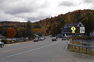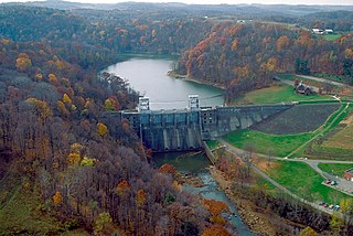
Arietta is a town in Hamilton County, New York, United States. The population was 292 at the 2020 census. The town was named after the mother of one of the first settlers, Rensselaer Van Rennslaer.

Indian Lake is a town in Hamilton County, New York, United States. The population was 1,352 at the 2010 census. The name is from a lake of the same name that is largely inside the town. There are no permanent stop lights in the town. Law enforcement is provided by New York State Troopers and Hamilton County Sheriff's Office.

Long Lake is a town in Hamilton County, New York, United States. The population was 791 at the 2020 census.

Walton is a town in Delaware County, New York, United States. The population was 5,270 at the 2020 census. The town is in the west-central part of the county and contains the village of Walton. The town claims to be the "Scarecrow Capital of the World."

Loyalhanna Creek is a 50-mile (80 km) long tributary of the Kiskiminetas River in Westmoreland County in the U.S. state of Pennsylvania. The stream is a popular destination for canoeing and recreational trout fishing.
Pines Lake is an unincorporated community and census-designated place (CDP) located on a lake in Wayne, in Passaic County, in the U.S. state of New Jersey. Pines Lake was started in the 1920s as a vacation community around a man-made lake approximately 1.5 miles (2.4 km) long and 0.5 miles (0.80 km) wide. Many of the original homes were modified log cabins. A large number of these log cabins, built of American chestnut in the 1930s, are still occupied as year-round homes. Gradually the neighborhood became approximately 500 high end to moderate suburban homes. It has a grammar school, Pines Lake School and its residents send their high-school-aged children to Wayne Hills High School.

Kittatinny Mountain is a long ridge traversing primarily across Sussex County in northwestern New Jersey, running in a northeast-southwest axis, a continuation across the Delaware Water Gap of Pennsylvania's Blue Mountain. It is the first major ridge in the far northeastern extension of the Ridge and Valley province of the Appalachian Mountains, and reaches its highest elevation, 1,803 feet, at High Point in Montague Township. Kittatinny Mountain forms the eastern side of Wallpack Valley; the western side comprises the Wallpack Ridge (highest elevation: 928 feet above sea level.

Lake Chaubunagungamaug, also known as Webster Lake, is a lake in the town of Webster, Massachusetts. It is located near the Connecticut border and has a surface area of 1,442 acres. Since 1921, the lake has also been known by a much longer name having 45 letters comprising fourteen syllables: Lake Chargoggagoggmanchauggagoggchaubunagungamaugg. The lake has become famous beyond Central Massachusetts for having the longest name of any geographic feature in all of the United States.

The 9th congressional district of Illinois covers parts of Cook, Lake, and McHenry counties as of the 2021 redistricting which followed the 2020 census. It includes all or parts of Chicago, Evanston, Glenview, Skokie, Morton Grove, Niles, Northfield, Prospect Heights, Wilmette, Buffalo Grove, Hawthorn Woods, Wauconda, Island Lake, Long Grove, Lake Barrington, Algonquin Township, Cary, Crystal Lake, Lake in the Hills, Lakewood, Oakwood Hills, Trout Valley, Algonquin, Port Barrington, Barrington Hills, and Fox River Grove. It is anchored in Chicago's North Side, along Lake Michigan, and covers many of Chicago's northern suburbs. Democrat Jan Schakowsky has represented the district since January 1999.

Oak Ridge is an unincorporated community and census-designated place (CDP) located in West Milford Township in Passaic County and Jefferson Township in Morris County, in the U.S. state of New Jersey. The area is served as United States Postal Service ZIP Code 07438.

Kinsman Mountain is a mountain located in Grafton County, New Hampshire. It is named after Nathan Kinsman, an early resident of Easton, New Hampshire, and is part of the Kinsman Range of the White Mountains. To the northeast, Kinsman is connected by The Cannon Balls ridge to Cannon Mountain.

Signal Mountain is an isolated summit standing 7,720 feet (2,350 m) above sea level. The mountain is located in Grand Teton National Park in the U.S. state of Wyoming. The next closest higher summit is more than 10 miles (16 km) distant, and this isolation provides sweeping views of the Teton Range, much of the northern Jackson Hole area as well as the Snake River. Though located adjacent to the Tetons, Signal Mountain was not formed in the same manner or period. The mountain originally was formed by volcanic ashfall from one of the eruptions of the Yellowstone hotspot. The peak is also partially a glacial moraine formed by a receding glacier that came south out of the Yellowstone icecap. This same glacier also created neighboring Jackson Lake.

The Tiger Bay State Forest is in the U.S. state of Florida. The 27,330-acre (11,060 ha) forest is located in Volusia County, Florida, between Daytona Beach and DeLand.
Salt Pond Mountain is a mountain located in Giles County, Virginia. The mountain, which is part of the Ridge-and-valley province of the Appalachian Mountains, extends about seven miles (12 km) from southwest to northeast. The highest peak is Bald Knob, at the southeast end, south of Mountain Lake. Salt Pond Mtn. joins Johns Creek Mountain at the southwest end, and the Big Mountain – Potts Mountain ridge at the northeast end, just south of West Virginia.

Besek Mountain also known as Black Mountain, est. 840 feet (260 m), is a traprock mountain ridge located 4.75 miles (7.6 km) southeast of Meriden, Connecticut. It is part of the narrow, linear Metacomet Ridge that extends from Long Island Sound near New Haven, Connecticut, north through the Connecticut River Valley of Massachusetts to the Vermont border. Besek Mountain is known for its 3-mile (4.8 km) long line of open cliffs, unique microclimate ecosystems, and rare plant communities. The mountain is traversed by the 51-mile (82 km) Mattabesett Trail, and is home to the Powder Ridge Ski Area.

Saltonstall Mountain, also known as Saltonstall Ridge, with a high point of (est.) 320 feet (98 m) above sea level, is a traprock mountain ridge located 3 miles (5 km) east of New Haven, Connecticut and 1.75 miles (2.8 km) north of Long Island Sound. It is part of the Metacomet Ridge that extends from Long Island Sound near New Haven, Connecticut, north through the Connecticut River Valley of Massachusetts to the Vermont border. Saltonstall Mountain is known for its 100 foot (30 m) scenic cliff faces and sharp ridgeline, unique microclimate ecosystems, rare plant communities, and for Lake Saltonstall, a 3 miles (5 km) long by 0.3 miles (400 m) wide municipal reservoir nearly enclosed by the mountain. Saltonstall Mountain is traversed by a number of hiking trails managed by the South Central Connecticut Regional Water Authority (SCCRWA) and Branford Land Trust.

Taylor Valley77°37′S163°00′E is an ice-free valley about 18 nautical miles long, once occupied by the receding Taylor Glacier. It lies north of the Kukri Hills between the Taylor Glacier and New Harbour in Victoria Land, Antarctica. Taylor Valley is the southernmost of the three large McMurdo Dry Valleys in the Transantarctic Mountains, located west of McMurdo Sound.

The Dunns Pond Mound is a historic Native American mound in northwestern Logan County, Ohio, United States. Located near Huntsville, it lies along the southeastern corner of Indian Lake in Washington Township. In 1974, the mound was listed on the National Register of Historic Places as a potential archeological site, with much of its significance deriving from its use as a burial site for as much as nine centuries.

The Lake Ridge Island Mounds are a group of small hills in Logan County, Ohio, United States that have been thought to be Native American mounds. Located in an area of about 5 acres (2.0 ha) at the northern end on Lake Ridge Island in Indian Lake, the mounds are near the village of Russells Point in the southeastern corner of Stokes Township. State Route 368 passes a short distance to the east of the mounds, even weaving at one point to avoid them. The four mounds on the island are small, not reaching a height greater than 3 feet (0.91 m) or a diameter greater than 40 feet (12 m); they are small enough that they appear to be natural knolls. A report produced in the 1970s observed that the mounds were in "excellent" condition at the time, never having been disturbed by artifact seekers.

Moose Mountain is an 8-mile (13 km)-long ridge located in the eastern part of the town of Hanover in Grafton County, New Hampshire. The mountain is flanked to the north by Holts Ledge, at 2,110 feet (640 m), and to the south by Shaker Mountain, at 1,690 feet (520 m). It is traversed by the Appalachian Trail, a 2,170-mile (3,490 km) National Scenic Trail from Georgia to Maine. Moose Mountain is outside the White Mountain National Forest, but the trail runs through a narrow corridor along the ridge which is administered by the U.S. Forest Service. The trail can be accessed from the south along Three Mile Road in Hanover, and from the north along Goose Pond Road in Lyme, New Hampshire.


