
Lyon County is a county in the U.S. state of Nevada. As of the 2020 census, the population was 59,235. Lyon County comprises the Fernley, NV Micropolitan Statistical Area which is part of the Reno-Carson City-Fernley, NV Combined Statistical Area.

Allenspark is an unincorporated town, a post office, and a census-designated place (CDP) located in and governed by Boulder County, Colorado, United States. The CDP is a part of the Boulder, CO Metropolitan Statistical Area. The Allenspark post office has the ZIP code 80510. At the United States Census 2020, the population of the Allenspark CDP was 568.

Lyons is a Statutory Town in Boulder County, Colorado, United States. The town population was 2,209 at the 2020 United States Census, up from 2,033 at the 2010 United States Census. Lyons is located at the confluence of North St. Vrain Creek and South St. Vrain Creek, 20 miles (32 km) east of Rocky Mountain National Park. Due to its location at the intersection of State Highway 7 and U.S. Highway 36 which lead to Rocky Mountain National Park, it is sometimes referred to as "The Double Gateway to the Rockies".

Lyon Mountain is a hamlet and census-designated place located in the town of Dannemora in Clinton County, New York, United States. The population was 423 at the 2010 census.

Richmond Township is a township in Berks County, Pennsylvania, United States. The population was 3,397 at the 2010 census.

The Humboldt–Toiyabe National Forest (HTNF) is the principal U.S. National Forest in the U.S. state of Nevada, and has a smaller portion further west in Eastern California in the state of California. With an area of 6,289,821 acres (25,454.00 km2), it is the largest U.S. National Forest reservation outside of Alaska, further northwest on the North American continent.

Dannemora is a town in Clinton County, New York, United States. The population was 4,037 at the 2020 census, down from 4,898 in 2010. The town is named after Dannemora, Sweden, an important iron-mining region.
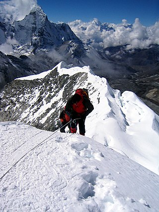
A summit is a point on a surface that is higher in elevation than all points immediately adjacent to it. The topographic terms acme, apex, peak, and zenith are synonymous.

State Highway 7 (SH 7) is an 81.64-mile (131.39 km) state highway in Colorado, United States. It is located in the north-central portion of the state, traversing the mountains on the east of the continental divide south of Estes Park as well as portions of the Colorado Piedmont north of Denver. The northwestern segment of the highway is part of the Peak to Peak Scenic Byway and furnishes an access route to Estes Park, Colorado and Rocky Mountain National Park. In its southeast portion it skirts the northern end of the Denver Metropolitan Area, providing an access route connecting Boulder, Lafayette and Brighton with Interstate 25 (I-25) and Interstate 76 (I-76).

The Beaverhead–Deerlodge National Forest is the largest of the National Forests in Montana, United States. Covering 3.36 million acres (13,600 km2), the forest is broken into nine separate sections and stretches across eight counties in the southwestern area of the state. President Theodore Roosevelt named the two forests in 1908 and they were merged in 1996. Forest headquarters are located in Dillon, Montana. In Roosevelt's original legislation, the Deerlodge National Forest was called the Big Hole Forest Reserve. He created this reserve because the Anaconda Copper Mining Company, based in Butte, Montana, had begun to clearcut the upper Big Hole River watershed. The subsequent erosion, exacerbated by smoke pollution from the Anaconda smelter, was devastating the region. Ranchers and conservationists alike complained to Roosevelt, who made several trips to the area. (Munday 2001)
Mount Cardigan is a prominent bare-rock summit in the towns of Orange and Alexandria in western New Hampshire, USA. While its peak is only 3,155 feet (962 m) above sea level, it has extensive areas of bare granite ledges and alpine scrub, giving it the feel to hikers of a much higher mountain. Most of the summit area was denuded by devastating forest fires in 1855.

Seneca Creek is a 19.6-mile-long (31.5 km) tributary of the North Fork of the South Branch of the Potomac River located entirely within Pendleton County, West Virginia, USA.
Gila is a census-designated place in Grant County, New Mexico, United States. It is 48 kilometres northwest of the county seat, Silver City. Its population was 314 as of the 2010 census. The community is located in the irrigated valley of the Gila River in the midst of hilly and mountainous semi-arid terrain. The townsite was sporadically populated by the Apache, Spanish and Mexican colonists, and American mountain men prior to the rise to prominence of the million-acre Lyons & Campbell Ranch. The ranch established its headquarters in Gila in 1890 and was one of the largest ranches in the United States. The headquarters building is on the National Register of Historic Places.

Lyon Mountain is a 3,820 ft (1,160 m) mountain located in Clinton County, New York, the county’s high point. It is named for Nathaniel Lyon, an early settler of the area who moved from Vermont in 1803 and died circa 1850. The mountain is within New York's Adirondack Park.
Dryville is a census-designated place in Rockland Township, Berks County, Pennsylvania, United States. It is located one mile south of Lyons, and is located in the South Mountains and is drained by Bieber Creek into Manatawny Creek, a tributary of the Schuylkill River. It is split between the Fleetwood zip code of 19522 and the Mertztown Zip Code of 19539. As of the 2010 census, the population was 398 residents.

The Front Range Urban Corridor is an oblong region of urban population located along the eastern face of the Southern Rocky Mountains, encompassing 18 counties in the US states of Colorado and Wyoming. The corridor derives its name from the Front Range, the mountain range that defines the western boundary of the corridor which serves as a gateway to the Rocky Mountains. The region comprises the northern portion of the Southern Rocky Mountain Front geographic area, which in turn comprises the southern portion of the Rocky Mountain Front geographic area of Canada and the United States. The Front Range Urban Corridor had a population of 5,055,344 at the 2020 census, an increase of +16.65% since the 2010 census.
Bald Mountain is the highest mountain in the Pine Grove Hills of Lyon County in Nevada, United States. It is the most topographically prominent peak in Lyon County and ranks eighty-second among the most topographically prominent peaks in Nevada. The peak is located within the Humboldt-Toiyabe National Forest.
The Wovoka Wilderness is a wilderness area in Lyon County in the state of Nevada in the United States. Part of Humboldt–Toiyabe National Forest, Wovoka Wilderness was designated part of the National Wilderness Preservation System in December 2014. Totaling 49,018 acres (19,837 ha), it is the largest remaining tract of wilderness in Lyon County. Named after Wovoka, was Wovoka Wilderness' total acreage includes 23,000 acres (9,308 ha) that are protected from leasing and mining.

Tower Mountain is a mountain located in the Catskill Mountains of New York state, east-northeast of Deposit in Delaware County. Speedwell Mountain is located west-southwest of Tower Mountain, Walton Mountain is located north-northeast of it, and Crane Hill is located northeast of Tower Mountain. In 1934, the Civilian Conservation Corps built what was known as the Rock Rift Fire Observation Tower on the mountain. The tower ceased fire lookout operations at the end of the 1988 season and was officially closed in early 1989. Currently, the tower is not safe to climb. The first set of steps has been removed to prevent injury. Restoration of the tower is planned by the Town of Tompkins.

Lyon Peak is an 8,891-foot-elevation (2,710 meter) mountain summit in Placer County, California, United States.

