Malham

Last updated

Malham
North Yorkshire UK location map (2023).svg
Red pog.svg
Malham
Location within North Yorkshire
Population238 (2011 census) [1]
OS grid reference SD900629
Unitary authority
Ceremonial county
Region
Country England
Sovereign state United Kingdom
Post town SKIPTON
Postcode district BD23
Dialling code 01729
Police North Yorkshire
Fire North Yorkshire
Ambulance Yorkshire
UK Parliament
List of places
UK
England
Yorkshire
54°03′40″N2°09′11″W / 54.061°N 2.153°W / 54.061; -2.153

Malham is a village and civil parish in the Craven district of North Yorkshire, England. Before 20th century boundary changes, the village was part of the Settle Rural District, in the historic West Riding of Yorkshire. In the Domesday Book , the name is given as Malgun, meaning "settlement by the gravelly places". [2] In 2001 the parish had a population of approximately 150. [3] Malham parish increased in size geographically (to include Malham Moor) and so at the 2011 Census had a population of 238. [1]

Contents

Malham lies at the upper end of the valley of the River Aire, known above Airton as Malhamdale, in the Yorkshire Dales. [4] The surrounding countryside is well known for its limestone pavements and other examples of limestone scenery. Tourist attractions include Malham Tarn, Malham Cove, Gordale Scar, Janet's Foss and the Dry Valley.

In the 1950s the village gave its name to a Ham class minesweeper, HMS Malham.

Governance

Malham has a joint parish council, Kirkby Malhamdale Parish Council, with the parishes of Malham Moor, Kirkby Malham and Hanlith. [5]

Tourism

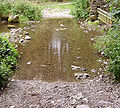
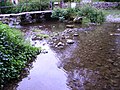
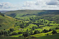
Malham is a popular walkers' destination. The rise in tourism over Malham's history has led to some deterioration of the area's surrounding paths as tourists wander off the paths and cause pockets of erosion, a process often called "footpath erosion". The footpaths in the area are maintained by the Yorkshire Dales National Park Authority.

In the village there is a National Park Information Centre and a large car park. The Pennine Way long-distance path passes through the village. Nearby natural landmarks include Malham Cove, Malham Tarn, Gordale Scar and Janet's Foss. The Malham Show Fell Race course runs over the nearby 301-metre (988 ft) Cawden.

In May 2006, it was reported that a covert listening device was discovered hidden in the local parish hall, leaving the villagers baffled. The electronic transmitter was found in a wall socket during a safety inspection at Malham village hall. [6]

Part of Harry Potter and the Deathly Hallows – Part 1 was filmed around the Malham Cove limestone pavement. [7]

All Creatures Great and Small TV series was largely filmed within the Dales, including some scenes shot in and around Malham Lings and at Janet's Foss waterfall on the Malham Landscape Trail. [8] [9]

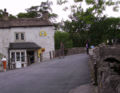
Beck Hall in the village is England's first vegan hotel, after making over its menu and room amenities to be free of animal products in 2023. [10]

Climate

Malham has an Oceanic climate, but is generally colder and wetter than most settlements in Britain. [11] It has a relatively low altitude of around 200 metres, but is partly surrounded by fells. This exposed position[ citation needed ] means the temperature range is limited, due to little pooling of cold air. Extremes of temperature (since 1960) range from 28.2 °C (82.8 °F) during August 1990, [12] down to −13.5 °C (7.7 °F) during March 2001. [13]

Climate data for Malham Tarn, elevation: 391 m (1,283 ft), 1991–2020 normals, extremes 1960–present
MonthJanFebMarAprMayJunJulAugSepOctNovDecYear
Record high °C (°F)12.5
(54.5)
15.3
(59.5)
19.1
(66.4)
21.0
(69.8)
24.0
(75.2)
27.2
(81.0)
28.6
(83.5)
28.2
(82.8)
24.4
(75.9)
20.1
(68.2)
15.2
(59.4)
12.9
(55.2)
28.6
(83.5)
Average high °C (°F)4.8
(40.6)
5.2
(41.4)
7.2
(45.0)
10.0
(50.0)
13.2
(55.8)
15.6
(60.1)
17.4
(63.3)
17.0
(62.6)
14.7
(58.5)
11.1
(52.0)
7.6
(45.7)
5.3
(41.5)
10.8
(51.4)
Daily mean °C (°F)2.5
(36.5)
2.7
(36.9)
4.1
(39.4)
6.4
(43.5)
9.4
(48.9)
12.0
(53.6)
13.8
(56.8)
13.6
(56.5)
11.5
(52.7)
8.4
(47.1)
5.2
(41.4)
2.9
(37.2)
7.7
(45.9)
Average low °C (°F)0.2
(32.4)
0.1
(32.2)
1.0
(33.8)
2.8
(37.0)
5.5
(41.9)
8.4
(47.1)
10.3
(50.5)
10.2
(50.4)
8.2
(46.8)
5.6
(42.1)
2.8
(37.0)
0.5
(32.9)
4.7
(40.5)
Record low °C (°F)−11.5
(11.3)
−13.0
(8.6)
−13.5
(7.7)
−7.5
(18.5)
−4.2
(24.4)
−1.1
(30.0)
1.7
(35.1)
2.1
(35.8)
−1.0
(30.2)
−4.9
(23.2)
−9.2
(15.4)
−14.1
(6.6)
−14.1
(6.6)
Average precipitation mm (inches)164.9
(6.49)
137.9
(5.43)
117.6
(4.63)
91.9
(3.62)
90.9
(3.58)
99.8
(3.93)
118.3
(4.66)
134.2
(5.28)
128.6
(5.06)
156.6
(6.17)
165.6
(6.52)
181.3
(7.14)
1,587.4
(62.50)
Average precipitation days (≥ 1.0 mm)17.915.414.512.812.613.514.315.713.916.818.818.3184.5
Mean monthly sunshine hours 34.658.290.5134.5162.9137.3141.3135.9106.175.443.034.21,153.9
Source 1: Met Office [14]
Source 2: KNMI [15]

Village events

The village hosts an annual agricultural and horticultural show on the Saturday before the August Bank Holiday. Known as the Malham Show, it has competitions for everything from Lego models to fell running. Another major annual event is the Malham Safari, [16] when the villagers and particularly the local school build sculptures around the village. This event attracts many tourists and stalls are put up on the green.

Places of worship

Malham Methodist Church is located in Chapel Gate and is part of the Skipton and Grassington Circuit of the Methodist Church. [17] St Helen's Chapel was an ancient religious foundation mentioned in monastic charters from the twelfth century. It was demolished during the reformation. [18] Archaeological digs at the site have been supported by the Ingleborough Archaeology Group. [19]

See also

Related Research Articles

<span class="mw-page-title-main">Malham Cove</span> Rock formation in North Yorkshire, England

Malham Cove is a large curved limestone formation 0.6 miles (1 km) north of the village of Malham, North Yorkshire, England. It was formed by a waterfall carrying meltwater from glaciers at the end of the last Ice Age more than 12,000 years ago. Today it is a well-known beauty spot and rock climbing crag within the Yorkshire Dales National Park. A large limestone pavement lies above the cove.

<span class="mw-page-title-main">Airedale</span>

Airedale is a valley, or dale, in North Yorkshire and West Yorkshire, England. It is named after the River Aire, which flows through it. The upper valley, from Malham Cove to Airton, is known as Malhamdale, named after the village of Malham. At Airton the valley widens and becomes Airedale proper. The river flows past Skipton on to Keighley, Bingley, Shipley, and Leeds.

<span class="mw-page-title-main">Yorkshire Dales</span> Upland area of the Pennines in Northern England

The Yorkshire Dales are an upland area of the Pennines in England. Most of the area is in the county of North Yorkshire, but it extends into Cumbria and a small part of Lancashire. It was historically entirely within Yorkshire. The majority of the Dales are part of the Yorkshire Dales National Park, created in 1954. The exception is the area around Nidderdale, which forms the separate Nidderdale Area of Outstanding Natural Beauty.

<span class="mw-page-title-main">Craven District</span> Former local government district in England

Craven was a non-metropolitan district in the west of North Yorkshire, centred on the market town of Skipton.

<span class="mw-page-title-main">Yorkshire Dales National Park</span> National park in England

The Yorkshire Dales National Park is a 2,178 km2 (841 sq mi) national park in England covering most of the Yorkshire Dales, with the notable exception of Nidderdale. Most of the park is in North Yorkshire, with a sizeable area in Cumbria and a small part in Lancashire. The park was designated in 1954, and extended in 2016. Over 95% of the land in the Park is under private ownership; there are over 1,000 farms in this area.

<span class="mw-page-title-main">Grassington</span> Village and civil parish in North Yorkshire, England

Grassington is a village and civil parish in North Yorkshire, England. The population of the parish at the 2011 Census was 1,126. Historically part of the West Riding of Yorkshire, the village is situated in Wharfedale, about 8 miles (10 km) north-west from Bolton Abbey, and is surrounded by limestone scenery. Nearby villages include Linton, Threshfield, Hebden, Conistone and Kilnsey.

<span class="mw-page-title-main">Kilnsey</span> Village in North Yorkshire, England

Kilnsey is a small village in Wharfedale, North Yorkshire, England. It lies on the B6160 road, between the villages of Grassington and Kettlewell, near Arncliffe and just across the River Wharfe from Conistone. The village is 12 miles (19 km) north of Skipton and 3 miles (5 km) south of Kettlewell.

<span class="mw-page-title-main">Janet's Foss</span> Waterfall in North Yorkshire, England

Janet's Foss is a small waterfall in the vicinity of the village of Malham, North Yorkshire, England. It carries Gordale Beck over a limestone outcrop topped by tufa into a deep pool below. The pool was traditionally used for sheep dipping, an event which drew in local village inhabitants for the social occasion.

<span class="mw-page-title-main">Malham Tarn</span> Natural upland lake in North Yorkshire, England

Malham Tarn is a glacial lake near the village of Malham in the Yorkshire Dales, England. The lake is one of only eight upland alkaline lakes in Europe. At an altitude of 377 metres (1,237 ft) above sea level it is the highest marl lake in the United Kingdom. Its geology, flora and fauna have led to it being listed under a number of conservation designations. The site is currently owned by the National Trust, who used to lease part of the site to the Field Studies Council but this closed as a field centre in 2022. The site was the inspiration for Charles Kingsley's 1863 novel The Water-Babies, A Fairy Tale for a Land Baby.

<span class="mw-page-title-main">Airton</span> Village and civil parish in North Yorkshire, England

Airton is a small village and civil parish in the Craven district of North Yorkshire, England, situated 10 miles (16 km) north-west of Skipton. The village had a population of 175 according to the 2001 Census, 228 at the 2011 Census, decreasing to 227 at the 2021 Census.

<span class="mw-page-title-main">Calton, North Yorkshire</span> Village and civil parish in North Yorkshire, England

Calton is a village and civil parish in the Craven district of North Yorkshire, England, on the River Aire in Airedale. In both the 2001 and 2011 Censuses the population was less than 100, so details were included in the civil parish of Flasby with Winterburn. In 2015, North Yorkshire County Council estimated the population of the village to be 60.

<span class="mw-page-title-main">Hebden, North Yorkshire</span> Village and civil parish in North Yorkshire, England

Hebden is a village and civil parish in the Craven District of North Yorkshire, England, and one of four villages in the ecclesiastical parish of Linton. It lies near Grimwith Reservoir and Grassington, in Wharfedale in the Yorkshire Dales National Park. In 2011 it had a population of 246.

<span class="mw-page-title-main">Kirkby Malham</span> Village and civil parish in North Yorkshire, England

Kirkby Malham is a small village and civil parish in the Craven district of North Yorkshire, England. Situated in the Yorkshire Dales it lies 5 miles (8 km) east of Settle. The population of the civil parish as taken in the 2011 Census was 202. Nearby settlements include Hanlith, Malham, Airton and Calton.

<span class="mw-page-title-main">Malham Tarn Field Studies Centre</span> Field studies centre in North Yorkshire, England

<span class="mw-page-title-main">Hanlith</span> Village and civil parish in North Yorkshire, England

Hanlith is a small village and civil parish in the Craven district of North Yorkshire, England. It is situated near Kirkby Malham and the tourist attraction of Malham Cove. It is about 10 miles (16 km) north west of Skipton, and consists of only 13 houses. Its population was estimated at 40 in 2015.

<span class="mw-page-title-main">Malham Moor</span> Civil parish in North Yorkshire, England

Malham Moor is a civil parish in the Craven district of North Yorkshire, England. Its population was estimated at 70 in 2015.

<span class="mw-page-title-main">St Michael's Church, Kirkby Malham</span> Anglican church in North Yorkshire, England

St Michael's Church is in the village of Kirkby Malham, North Yorkshire, England. It is an active Anglican parish church in the deanery of Bowland and Ewecross, the archdeaconry of Craven, and the Diocese of Leeds. It is recorded in the National Heritage List for England as a designated Grade I listed building.

<span class="mw-page-title-main">Dales High Way</span>

A Dales High Way is a long-distance footpath in northern England. It is 90 miles (140 km) long and runs from Saltaire in West Yorkshire to Appleby-in-Westmorland, Cumbria, roughly parallel to the line of the Settle and Carlisle Railway.

<span class="mw-page-title-main">Bell Busk</span> Hamlet in North Yorkshire, England

Bell Busk is a hamlet situated in the Craven district of North Yorkshire, England. The hamlet is located at the southern end of Malhamdale where the nascent River Aire meets Otterburn Beck. The village is 7 miles (11 km) north west of Skipton and used to have a railway station on the line linking Skipton and Hellifield.

References

  1. 1 2 UK Census (2011). "Local Area Report – Malham Parish (1170216772)". Nomis. Office for National Statistics . Retrieved 10 April 2018.
  2. "Surname Database: Malham Last Name Origin". The Internet Surname Database. Retrieved 1 October 2020.
  3. "2001 census". Neighbourhood Statistics. Office for National Statistics.
  4. "Yorkshire Dales National Park: Malhamdale". Archived from the original on 17 May 2013. Retrieved 1 October 2020.
  5. "Kirkby Malhamdale Parish Council". malhamdale.com. Retrieved 4 February 2016.
  6. "Mystery surrounds parish hall bug". BBC News. 27 May 2006. Retrieved 8 November 2008.
  7. "Malham Cove Tourist Website". Malham Tourism. 12 June 2011. Retrieved 7 February 2011.
  8. "Insider's Guide to the Yorkshire Dales Filming Locations". PBS Masterpiece. 24 January 2021. Retrieved 27 February 2021.
  9. "New All Creatures Great and Small brings a huge increase in Yorkshire tourism". Examiner. 24 September 2020. Retrieved 27 February 2021.
  10. "Yorkshire Hotel To Become England's First Fully Vegan Hotel". The Yorkshireman. 24 October 2023. Retrieved 24 October 2023.
  11. "UK climate averages". Met Office. Retrieved 1 October 2020.
  12. "1990 temperature". KNMI.
  13. "2001 temperature". KNMI.
  14. "Malham Tarn (North Yorkshire) UK climate averages". Met Office. Retrieved 1 January 2022.
  15. "KNMI - Malham Tarn maximum temperature time series". KNMI . Retrieved 22 August 2021.
  16. "Malham Safari website". malhamdale.com. Retrieved 9 November 2018.
  17. "Skipton & Grassington Methodist Circuit". Skipton and Grassington Circuit. Retrieved 1 October 2020.
  18. "St Helen's Chapel, Malham" . Retrieved 1 October 2020.
  19. Kingsbury, H. (3 August 2017). "Excavations at St Helen's Chapel, Malham" . Retrieved 1 October 2020.