Mamuju (city)

Last updated

Mamuju
Mamuju port.jpeg
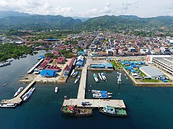
Aerial view of the port of Mamuju
Mamuju (city)
Interactive map of Mamuju
Sulawesi location map plain.svg
Red pog.svg
Mamuju
Location in Sulawesi and Indonesia
Indonesia location map.svg
Red pog.svg
Mamuju
Mamuju (Indonesia)
Coordinates: 2°40′07″S118°51′44″E / 2.66861°S 118.86222°E / -2.66861; 118.86222
Country Flag of Indonesia.svg Indonesia
Province Flag of West Sulawesi.svg West Sulawesi
Regency Mamuju Regency
Founded14 July 1540
Area
  Total
206.64 km2 (79.78 sq mi)
Elevation
390 m (1,280 ft)
Population
 (2010)
  Total
107,864
  Density521.99/km2 (1,351.9/sq mi)
Time zone UTC+8 (Indonesia Central Time)
Area code (+62) 426

Mamuju is the capital of the Indonesian province of West Sulawesi. The town was formerly part of South Sulawesi province.

Contents

Education

Education in Mamuju extends up to SMA class III (Year 12) and people from surrounding areas (especially the area of Kalumpang) will travel to Mamuju to further their education.[ citation needed ] Students who wish to pursue a tertiary education must travel to larger towns like Makassar.[ citation needed ]

Agriculture

Agriculture in this area includes jackfruit, rambutan, durian, rice, and bananas.[ citation needed ]

Demographics

Like many places in West Sulawesi, Mamuju is a predominantly Muslim town, with many mosques. However, Christianity has established a presence with several churches in this town, in addition to a small contingent of Buddhists.

Climate

Mamuju has a tropical rainforest climate (Köppen Af) with heavy rainfall year-round.

Climate data for Mamuju (Tampa Padang Airport) (1991–2020 normals, extremes 2005–2023)
MonthJanFebMarAprMayJunJulAugSepOctNovDecYear
Record high °C (°F)35.5
(95.9)
35.0
(95.0)
35.4
(95.7)
35.0
(95.0)
34.3
(93.7)
35.0
(95.0)
34.0
(93.2)
34.4
(93.9)
34.8
(94.6)
35.6
(96.1)
34.6
(94.3)
35.0
(95.0)
35.6
(96.1)
Mean daily maximum °C (°F)31.7
(89.1)
31.9
(89.4)
32.1
(89.8)
32.0
(89.6)
31.7
(89.1)
31.1
(88.0)
30.7
(87.3)
31.3
(88.3)
32.2
(90.0)
32.6
(90.7)
32.3
(90.1)
31.8
(89.2)
31.8
(89.2)
Daily mean °C (°F)27.7
(81.9)
27.8
(82.0)
27.9
(82.2)
27.9
(82.2)
28.1
(82.6)
27.7
(81.9)
27.4
(81.3)
27.6
(81.7)
28.1
(82.6)
28.4
(83.1)
28.2
(82.8)
27.7
(81.9)
27.9
(82.2)
Mean daily minimum °C (°F)24.4
(75.9)
24.4
(75.9)
24.6
(76.3)
24.9
(76.8)
25.3
(77.5)
25.0
(77.0)
24.7
(76.5)
24.7
(76.5)
24.7
(76.5)
25.0
(77.0)
25.0
(77.0)
24.6
(76.3)
24.8
(76.6)
Record low °C (°F)20.6
(69.1)
20.4
(68.7)
21.4
(70.5)
20.0
(68.0)
22.6
(72.7)
22.2
(72.0)
20.4
(68.7)
21.6
(70.9)
21.0
(69.8)
21.0
(69.8)
21.8
(71.2)
20.2
(68.4)
20.0
(68.0)
Average precipitation mm (inches)219.9
(8.66)
117.4
(4.62)
100.2
(3.94)
144.5
(5.69)
117.1
(4.61)
108.1
(4.26)
67.8
(2.67)
37.2
(1.46)
54.8
(2.16)
146.8
(5.78)
147.8
(5.82)
234.7
(9.24)
1,496.3
(58.91)
Average precipitation days12.99.69.69.69.49.55.93.74.710.611.013.4109.9
Mean monthly sunshine hours 170.3173.7192.0202.8218.8200.5208.2242.8226.8239.4218.6171.82,465.7
Source: Starlings Roost Weather [1]

Culture

An annual sandeq race takes place every August from Mamuju to Makassar.

Twin towns – sister cities

Mamuju is twinned with:

References

  1. "MAJENE Climate: 1991–2020". Starlings Roost Weather. Retrieved 25 December 2024.

2°41′S118°54′E / 2.683°S 118.900°E / -2.683; 118.900