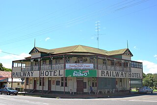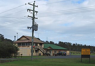
Kandanga is a town and a locality in the Gympie Region, Queensland, Australia. In the 2016 census, Kandanga had a population of 665 people.

Kandanga Creek is a rural locality in the Gympie Region, Queensland, Australia. In the 2016 census, Kandanga Creek had a population of 118 people.

Coes Creek is a rural locality in the Sunshine Coast Region, Queensland, Australia. In the 2016 census, Coes Creek had a population of 1,392 people.

Tin Can Bay is a coastal town and locality in the Wide Bay–Burnett region in Queensland, Australia. The locality is split between the Fraser Coast Region and the Gympie Region, but the town itself is within Gympie Region. In the 2016 census, Tin Can Bay had a population of 2,242 people.

Jones Hill is a rural locality in the Gympie Region, Queensland, Australia. In the 2016 census, Jones Hill had a population of 898 people.

Glanmire is an urban industrial locality in Gympie in the Gympie Region, Queensland, Australia. In the 2016 census, Glanmire had a population of 20 people.

Kybong is a rural locality in the Gympie Region, Queensland, Australia. In the 2016 census, Kybong had a population of 333 people.

Imbil is a rural town and locality in the Gympie Region, Queensland, Australia. In the 2016 census, Imbil had a population of 924 people.

Amamoor is a rural town and locality in the Gympie Region, Queensland, Australia. In the 2016 census, Amamoor had a population of 636 people.

Dagun is a rural town and locality in the Gympie Region, Queensland, Australia. In the 2016 census, Dagun had a population of 150 people.

Curra is a locality in the Gympie Region, Queensland, Australia. At the 2016 census, Curra had a population of 1,920.

Tinana is a town and a locality in the Fraser Coast Region, Queensland, Australia.

Pie Creek is a rural locality in the Gympie Region, Queensland, Australia. In the 2016 census, Pie Creek had a population of 1,013 people.

Amamoor Creek is a locality in the Gympie Region, Queensland, Australia. In the 2016 census, Amamoor Creek had a population of 56 people.

Black Snake is a locality in the Gympie Region, Queensland, Australia. In the 2016 census, Black Snake had a population of 75 people.

Bella Creek is a rural locality in the Gympie Region, Queensland, Australia. In the 2016 census, Bella Creek had a population of 43 people.

Bollier is a rural locality in the Gympie Region, Queensland, Australia. In the 2016 census, Bollier had a population of 200 people.

Coles Creek is a rural locality in the Gympie Region, Queensland, Australia. In the 2016 census, Coles Creek had a population of 44 people.

East Deep Creek is a rural locality in the Gympie Region, Queensland, Australia. In the 2016 census, East Deep Creek had a population of 645 people.

Ross Creek is a rural locality in the Gympie Region, Queensland, Australia. In the 2016 census, Ross Creek had a population of 58 people.


