The term "United States," when used in the geographic sense, refers to the contiguous United States, Alaska, Hawaii, the five insular territories of Puerto Rico, Northern Mariana Islands, U.S. Virgin Islands, Guam, American Samoa, and minor outlying possessions. The United States shares land borders with Canada and Mexico and maritime borders with Russia, Cuba, the Bahamas, and many other countries, mainly in the Caribbeanin addition to Canada and Mexico. The northern border of the United States with Canada is the world's longest bi-national land border.

The Humboldt–Toiyabe National Forest (HTNF) is the principal U.S. National Forest in the U.S. state of Nevada, and has a smaller portion further west in Eastern California in the state of California. With an area of 6,289,821 acres (25,454.00 km2), it is the largest U.S. National Forest reservation outside of Alaska, further northwest on the North American continent.

The United States Range is one of the northernmost mountain ranges of the Arctic Cordillera and in the world, surpassed only by the Challenger Mountains to the northwest. The range is located in the northeastern region of Ellesmere Island in Nunavut, Canada, and is part of the Innuitian Mountains. The highest mountain in the range is Mount Eugene with an elevation of 1,860 metres (6,100 ft). The British Empire Range is immediately to the west of the United States Range.

The Sangre de Cristo Mountains are the southernmost subrange of the Rocky Mountains. They are located in southern Colorado and northern New Mexico in the United States. The mountains run from Poncha Pass in South-Central Colorado, trending southeast and south, ending at Glorieta Pass, southeast of Santa Fe, New Mexico. The mountains contain a number of fourteen thousand foot peaks in the Colorado portion, as well as several peaks in New Mexico which are over thirteen thousand feet.

The Medicine Bow Mountains are a mountain range in the Rocky Mountains that extend 100 miles (160 km) from northern Colorado into southern Wyoming. The northern extent of this range is the sub-range the Snowy Range. From the northern end of Colorado's Never Summer Mountains, the Medicine Bow mountains extend north from Cameron Pass along the border between Larimer and Jackson counties in Colorado and northward into south central Wyoming. In Wyoming, the range sits west of Laramie, in Albany and Carbon counties to the route of the Union Pacific Railroad and U.S. Interstate 80. The mountains often serve as a symbol for the city of Laramie. The range is home to Snowy Range Ski Area.

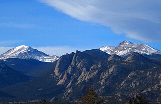
The Mummy Range is a mountain range in the Rocky Mountains of northern Colorado in the United States. The range is a short subrange of the Front Range located in southwestern Larimer County northwest of the town of Estes Park. It is located largely within Rocky Mountain National Park, extending north from Trail Ridge Road approximately 15 mi (24 km). The Arapaho name is "nooku-bee3ei-no," which translates to "White Owls."

The Virgin Mountains are a mountain range of the northeastern Mojave Desert, located in Clark County, southeastern Nevada and Mohave County, northwestern Arizona.

The King Range is a mountain range of the Outer Northern California Coast Ranges system, located entirely within Humboldt County on the North Coast of California.

The Chemehuevi Mountains are a mountain range that are found at the southeast border of San Bernardino County in southeastern California and are adjacent the Colorado River. Located south of Needles, California and northwest of the Whipple Mountains, the mountains are oriented in a north–south direction, and stretch for approximately 15 miles (24 km) in length.

The Blackhead Mountains range is located near the northern end of the Catskill Mountains, in Greene County, New York, United States, where it divides the towns of Windham and Jewett. The three named peaks in the range — Thomas Cole Mountain, Black Dome, and Blackhead Mountain — are the fourth-, third-, and fifth-highest peaks in the Catskills, respectively. The gap between Thomas Cole and Black Dome is, at 3,700 feet, the highest in the Catskills.

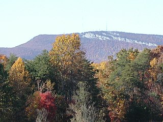
The Sauratown Mountains, which are sometimes called "the mountains away from the mountains", are an isolated mountain range located within Stokes and Surry counties in the U.S. state of North Carolina. The vast majority of the range is located in Stokes County. Although the range occupies only 5% of Stokes County's area, it dominates the county's scenery from almost every direction. The Sauras rise sharply 800 to 1,700 feet above the surrounding terrain.

The Wapack Range, sometimes referred to as the Pack Monadnock Range, is a 20-mile-long (32 km) range of mountains in south-central New Hampshire and adjacent Massachusetts, in the northeastern United States. The range is considered very scenic and rugged with many bare summits and ledges ranging from 1,800 to 2,290 feet. The 22-mile (35 km) Wapack Trail, one of the oldest interstate hiking trails in the United States, traverses it. The Wapack Range is also the northern terminus of the 90-mile (140 km) Midstate Trail.

Plateau Mountain is located in the town of Hunter in Greene County, New York, United States. It is part of the Devil's Path range of the Catskill Mountains. Plateau has a two-mile-long (3.2 km) summit ridge above 3,500 feet (1,100 m). The highest point, at least 3,840 feet (1,170 m), is at the southeast end, facing Sugarloaf Mountain to the east across Mink Hollow Notch. It is the 12th-highest peak in the range Devils Tombstone is located west of Plateau Mountain. The northwest end faces Hunter Mountain to the west across 1,400-foot deep (430 m) Stony Clove Notch.

Cornell Mountain is a mountain located in Ulster County, New York. The mountain is part of the Burroughs Range of the Catskill Mountains. Cornell Mountain is flanked to the northeast by Wittenberg Mountain, to the southwest by Friday Mountain, and to the west by 4,180-foot (1,270 m) Slide Mountain — the highest peak in the Catskills.
The Rampart Range is a mountain range in the western United States in Colorado, located in Douglas, El Paso, and Teller counties. Part of the Front Range of the Rocky Mountains, the range is almost entirely public land within the Pike National Forest.
John Taylor More (1771-1857) was an American politician in the Catskill region of the state of New York. He served in several political capacities in the Township of Roxbury, NY and in the State of New York.

The Mountain states form one of the nine geographic divisions of the United States that are officially recognized by the United States Census Bureau. It is a subregion of the Western United States.
McGregor Mountain is a mountain located in the Catskill Mountains of New York south of Stamford. Utsayantha Mountain is located northwest of McGregor Mountain, Moresville Range is located southeast and Churchill Mountain is located west.
Irish Mountain is a mountain located in the Catskill Mountains of New York southwest of Grand Gorge. Irish Mountain is located southeast of Moresville Range and north of Schultice Mountain.


