McGregor is a city in Clayton County, Iowa, United States. The population was 742 at the time of the 2020 census. McGregor is located on the Mississippi River across from Prairie du Chien, Wisconsin. Pike's Peak State Park is located just south of the city. Just to the north of McGregor is the city of Marquette. The community of McGregor Heights lies in the southern parts of the city limits.

Wilton is a town in Saratoga County, New York, United States. The population was 17,361 at the 2020 census.

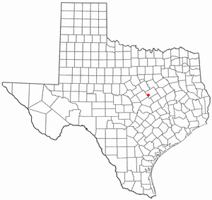
McGregor is a city in McLennan and Coryell counties in the U.S. state of Texas. The population is estimated to be 5,823 by the Texas Demographic Center.

The Canadian Rockies or Canadian Rocky Mountains, comprising both the Alberta Rockies and the British Columbian Rockies, is the Canadian segment of the North American Rocky Mountains. It is the easternmost part of the Canadian Cordillera, which is the northern segment of the North American Cordillera, the expansive system of interconnected mountain ranges between the Interior Plains and the Pacific Coast that runs northwest–southeast from central Alaska to the Isthmus of Tehuantepec in Mexico.

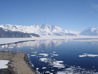
The Admiralty Mountains is a large group of high mountains and individually named ranges and ridges in northeastern Victoria Land, Antarctica. This mountain group is bounded by the sea, and by the Dennistoun Glacier, Ebbe Glacier, and Tucker Glacier.
Tucker Glacier is a major valley glacier of Victoria Land, Antarctica, about 90 nautical miles long, flowing southeast between the Admiralty Mountains and the Victory Mountains to the Ross Sea. There is a snow saddle at the glacier's head, just west of Homerun Range, from which the Ebbe Glacier flows northwestward.

On March 12, 1948, Northwest Airlines Flight 4422 (NC95422) crashed into Mount Sanford, Alaska, with a crew of six and 24 passengers. The flight was a C-54 charter flying back to the United States from Shanghai. The aircraft refueled at Anchorage and took off at 8:12 P.M. to continue on to its destination, New York City. Instead of following the published airway, which detoured around Mount Sanford, the aircraft flew a direct line, crashing into the mountain. After the initial impact the wreckage slid down for about 3000 feet before coming to rest. There were no survivors. The passengers were American merchant mariners, crew members of the tanker SS Sunset, being ferried back home.

Abe McGregor Goff was an attorney and Republican politician from the U.S. state of Idaho, most notably as a one-term congressman from 1947 to 1949. He served in the U.S. Army in both world wars.

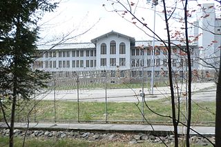
Mount McGregor Correctional Facility was a medium security prison for male inmates in the Town of Moreau, Saratoga County, New York, United States. It was served by the Wilton, New York, post office and included 100 structures on over 1,000 acres. Before updating security, it was called "Camp Walkaway" due to the number of breakouts. It became a prison in 1976, housing a maximum of 540 inmates, and eventually closed 38 years later, on July 26, 2014.

Grant Cottage State Historic Site is an Adirondack mountain cottage on the slope of Mount McGregor in the town of Moreau, New York. Ulysses S. Grant, the 18th President of the United States, died of throat cancer at the cottage on July 23, 1885. The house was maintained as a shrine to U.S. Grant following his death by the Mount McGregor Memorial Association and a series of live-in caretakers. The building became a New York State Historic Site in 1957 and was added to the National Register of Historic Places in 1971. The Historic Site was designated a National Historic Landmark by the National Park Service in 2021.
McGregor Pass, 1,555 metres (5,102 ft), is a mountain pass located on the Continental Divide in the Canadian Rockies and near the head of the McGregor River, to the north of Wishaw Mountain and to the west of Kakwa Pass, which is in the same vicinity. McGregor Pass forms the division between the Hart Ranges of the Rockies, which begin at Mount Sir Alexander just to the northwest and extend to the Peace Reach of Lake Williston, and the Continental Ranges, the largest and most well-known segment of the Canadian Rockies, which extend to Marias Pass, at the head of the North Fork Flathead River in Montana, United States.
Gough Glacier is an Antarctic glacier about 25 nautical miles (50 km) long, flowing from the northern slopes of the Prince Olav Mountains and the base of the Lillie Range and trending northward to the Ross Ice Shelf, between the Gabbro Hills and the Bravo Hills. It was named by the Southern Party of the New Zealand Geological Survey Antarctic Expedition (1963–64) for A.L. Gough, surveyor of the party.
Ball Bluff is an unincorporated community in Ball Bluff Township, Aitkin County, Minnesota, United States. The community is located between Jacobson and McGregor along State Highway 65. The Mississippi River flows nearby.
Libby is an unincorporated community in Libby Township, Aitkin County, Minnesota, United States. The community is located between McGregor and Jacobson along State Highway 65. The Mississippi River flows nearby. Libby is located immediately northwest of Big Sandy Lake.

Utsayantha Mountain is a 3,209-foot-tall (978 m) mountain in the Catskill Mountains of New York. It is located east-southeast of Stamford in Delaware County. Variant names include Utsayanthe Mountain, Utsayanthia Mountain, Utsayantho Mountain, and Utsyantha Mountain. McGregor Mountain is located southeast of Utsayantha Mountain and Churchill Mountain is located southwest. Utsayantha Mountain is named after Utsayantha, the daughter of Chief Ubiwacha, chief of the Lenape Indians.
Churchill Mountain is a mountain located in the Catskill Mountains of New York east-southeast of Stamford. Utsayantha Mountain is located northeast, Cowan Mountain is located southwest, and McGregor Mountain is located east of Churchill Mountain.
Moresville Range is a range located in the Catskill Mountains of New York west of Grand Gorge. Irish Mountain is located southeast of Moresville Range and McGregor Mountain is located northwest.

McGregor Mountain is an 8,143-foot (2,482-metre) elevation massif located in the Stehekin Valley of the North Cascades, in Chelan County of Washington state. McGregor Mountain is situated northwest of Lake Chelan in the northern Methow Mountains, on the shared border of North Cascades National Park and Lake Chelan National Recreation Area. The closest community is Stehekin, and the nearest higher neighbor is Goode Mountain, 7.3 miles (11.7 km) to the northwest. Precipitation runoff from the mountain drains into tributaries of the Stehekin River. Topographic relief is significant since the southern aspect of the mountain rises 6,600 feet above this river in approximately two miles. The famous Pacific Crest Trail traverses the western base of this mountain, and the strenuous 7.7-mile (12.4 km) McGregor Mountain Trail gains 6,400 feet of elevation to take hikers within a half-mile of the summit. Reaching the summit requires exposed scrambling the final 1,100 feet, and an ice axe is needed if the trail remains covered by snowpack. The summit was the site of an old fire lookout cabin from 1923 until 1955, but now has a radio repeater for the National Park Service. The views from the top include Glacier Peak, Black Peak, Corteo Peak, Frisco Mountain, Tupshin Peak, Dome Peak, Glory Mountain, and many others. This mountain was named for Billy McGregor, a Stehekin Valley resident who had a cabin and homestead at the base of this mountain during the 1890s. In May 1901, Billy disappeared overnight from a boat docked in Lake Chelan, and was never seen or heard from again.

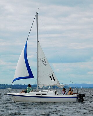
The MacGregor 22 is an American trailerable sailboat that was designed by Roger MacGregor as a cruiser and first built in 1967.


