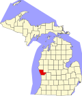
Muskegon Heights, Michigan | |
---|---|
Coordinates: 43°12′04″N86°14′20″W / 43.20111°N 86.23889°W | |
Country | United States |
State | Michigan |
County | Muskegon |
Government | |
• City manager | Melvin Burns (Interim) |
Area | |
• Total | 3.19 sq mi (8.25 km2) |
• Land | 3.19 sq mi (8.25 km2) |
• Water | 0.00 sq mi (0.00 km2) |
Elevation | 623 ft (190 m) |
Population | |
• Total | 9,917 |
• Density | 3,113.66/sq mi (1,202.05/km2) |
Time zone | UTC-5 (Eastern (EST)) |
• Summer (DST) | UTC-4 (EDT) |
ZIP code | 49444 |
Area code | 231 |
FIPS code | 26-56360 [3] |
GNIS feature ID | 0633165 [4] |
Website | www |
Muskegon Heights is a city in Muskegon County in the U.S. state of Michigan. The population was 9,985 at the 2020 census. [2]
The city is in southwestern Muskegon County, bordered to the north by Muskegon and to the south by the city of Norton Shores, with a small area of unincorporated Muskegon Township on the east side. The city of Roosevelt Park is a very short distance to the west. [5] U.S. Route 31 runs along the western border of the city as Seaway Drive. The highway leads north into downtown Muskegon and south 31 miles (50 km) to Holland. Grand Rapids is 38 miles (61 km) to the southeast.
According to the U.S. Census Bureau, Muskegon Heights has a total area of 3.19 square miles (8.26 km2), all land. [1]
Census | Pop. | Note | %± |
---|---|---|---|
1900 | 1,012 | — | |
1910 | 1,690 | 67.0% | |
1920 | 9,514 | 463.0% | |
1930 | 15,584 | 63.8% | |
1940 | 16,047 | 3.0% | |
1950 | 18,828 | 17.3% | |
1960 | 19,552 | 3.8% | |
1970 | 17,304 | −11.5% | |
1980 | 14,611 | −15.6% | |
1990 | 13,176 | −9.8% | |
2000 | 12,049 | −8.6% | |
2010 | 10,856 | −9.9% | |
2020 | 9,917 | −8.6% | |
U.S. Decennial Census [6] |
Race / Ethnicity (NH = Non-Hispanic) | Pop 2000 [7] | Pop 2010 [8] | Pop 2020 [9] | % 2000 | % 2010 | % 2020 |
---|---|---|---|---|---|---|
White alone (NH) | 1,982 | 1,564 | 1,571 | 16.45% | 14.41% | 15.84% |
Black or African American alone (NH) | 9,315 | 8,434 | 7,238 | 77.31% | 77.69% | 72.99% |
Native American or Alaska Native alone (NH) | 47 | 29 | 41 | 0.39% | 0.27% | 0.41% |
Asian alone (NH) | 29 | 13 | 28 | 0.24% | 0.12% | 0.28% |
Pacific Islander alone (NH) | 2 | 0 | 4 | 0.02% | 0.00% | 0.04% |
Some Other Race alone (NH) | 14 | 11 | 23 | 0.12% | 0.10% | 0.23% |
Mixed Race or Multi-Racial (NH) | 236 | 354 | 548 | 1.96% | 3.26% | 5.53% |
Hispanic or Latino (any race) | 424 | 451 | 464 | 3.52% | 4.15% | 4.68% |
Total | 12,049 | 10,856 | 9,917 | 100.00% | 100.00% | 100.00% |
As of the census [10] of 2010, there were 10,856 people, 3,996 households, and 2,682 families living in the city. The population density was 3,403.1 inhabitants per square mile (1,313.9/km2). There were 4,842 housing units at an average density of 1,517.9 per square mile (586.1/km2). The racial makeup of the city was 16.0% White, 78.3% African American, 0.3% Native American, 0.1% Asian, 1.4% from other races, and 3.8% from two or more races. Hispanic or Latino residents of any race were 4.2% of the population.
There were 3,996 households, of which 42.2% had children under the age of 18 living with them, 20.2% were married couples living together, 40.0% had a female householder with no husband present, 7.0% had a male householder with no wife present, and 32.9% were non-families. 28.4% of all households were made up of individuals, and 8.2% had someone living alone who was 65 years of age or older. The average household size was 2.66 and the average family size was 3.23.
The median age in the city was 30.3 years. 32.3% of residents were under the age of 18; 10.3% were between the ages of 18 and 24; 25.4% were from 25 to 44; 22.6% were from 45 to 64; and 9.6% were 65 years of age or older. The gender makeup of the city was 46.3% male and 53.7% female.
As of the census [3] of 2000, there were 12,049 people, 4,507 households, and 2,970 families living in the city. The population density was 3,804.2 inhabitants per square mile (1,468.8/km2). There were 5,108 housing units at an average density of 1,612.7/sq. mi. (622.1/km2). The racial makeup of the city was 17.69% White, 77.77% African American, 0.45% Native American, 0.25% Asian, 0.02% Pacific Islander, 1.63% from other races, and 2.19% from two or more races. Hispanic or Latino of any race were 3.52% of the population.
There were 4,507 households, out of which 36.9% had children under the age of 18 living with them, 25.0% were married couples living together, 35.2% had a female householder with no husband present, and 34.1% were non-families. 28.8% of all households were made up of individuals, and 9.7% had someone living alone who was 65 years of age or older. The average household size was 2.66 and the average family size was 3.28.
In the city, 35.2% were under the age of 18, 9.3% from 18 to 24, 27.0% from 25 to 44, 17.8% from 45 to 64, and 10.6% were 65 years of age or older. The median age was 29 years. For every 100 females, there were 82.6 males. For every 100 females age 18 and over, there were 74.5 males.
The median income for a household in the city was $21,778, and the median income for a family was $26,144. Males had a median income of $30,027 versus $22,768 for females. The per capita income for the city was $12,456. About 25.7% of families and 29.6% of the population were below the poverty line, including 41.8% of those under age 18 and 17.0% of those age 65 or over.
Benton Heights is an unincorporated community in Berrien County in the U.S. state of Michigan. It is also a census-designated place (CDP) for statistical purposes without any legal status as an incorporated municipality. Per the 2020 Census, the population was 3,652. The community is a part of Benton Charter Township and is adjacent to the city of Benton Harbor.
Mecosta is a village in Mecosta County in the U.S. state of Michigan. The population was 386 at the 2020 census, down from 457 in 2010. The village is within Morton Township. Mecosta Township, which is also in Mecosta County, is located several miles to the west.
Egelston Township is a general law township of Muskegon County in the U.S. state of Michigan. As of the 2020 census, the township population was 11,128, up from 9,909 in 2010.
Fruitland Township is a civil township of Muskegon County in the U.S. state of Michigan. The population was 5,793 at the 2020 census.
Fruitport is a village in Muskegon County in the U.S. state of Michigan. The population was 1,103 at the 2020 census. The community is located within Fruitport Charter Township.
Laketon Township is a civil township of Muskegon County in the U.S. state of Michigan. The population was 7,626 at the 2020 census.
Lakewood Club is a village in Dalton Township of Muskegon County in the U.S. state of Michigan. The population was 1,340 at the 2020 census.
Montague Township is a civil township of Muskegon County in the U.S. state of Michigan. The population was 1,555 at the 2020 census. It is adjacent to the city of Montague.
Moorland Township is a civil township of Muskegon County in the U.S. state of Michigan. The population was 1,627 at the 2020 census.
Muskegon Charter Township is a charter township of Muskegon County in the U.S. state of Michigan. The population was 17,596 at the 2020 census. The city of Muskegon borders the township to the southwest and is administratively autonomous.
North Muskegon is a city in Muskegon County in the U.S. state of Michigan. The population was 4,093 at the 2020 census, up from 3,786 in 2010.
Ravenna is a village in Muskegon County in the U.S. state of Michigan. The population was 1,308 at the 2020 census. The village is located in Ravenna Township.
Ravenna Township is a civil township of Muskegon County in the U.S. state of Michigan. As of the 2020 census, the population was 2,962, up from 2,905 in 2010. The village of Ravenna is located within the township.
Roosevelt Park is a city in Muskegon County in the U.S. state of Michigan. The population was 4,172 at the 2020 census, up from 3,831 in 2010.
White River Township is a civil township of Muskegon County in the U.S. state of Michigan. The population was 1,383 at the 2020 census.
Whitehall Township is a civil township of Muskegon County in the U.S. state of Michigan. The population was 1,768 at the 2020 census.
Croton Township is a civil township of Newaygo County in the U.S. state of Michigan. The population was 3,368 at the 2020 census.
Newaygo is a rural city in Newaygo County in the U.S. state of Michigan. The population was 2,471 at the 2020 census.
Casnovia is a village in the U.S. state of Michigan. It is situated on the boundary between Muskegon and Kent counties and lies partially within each. The population was 316 at the 2020 census.
Cedar Creek Township is a civil township of Muskegon County in the U.S. state of Michigan. The population was 3,192 at the 2020 census.