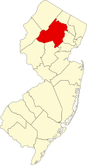
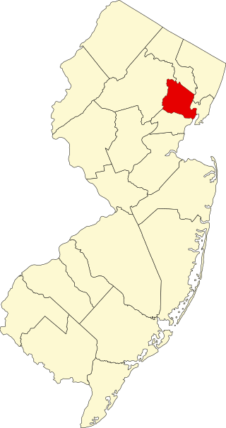
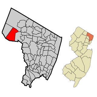
[3] Name on the Register [4] Image Date listed [5] Location City or town Description 1 Acorn Hall Acorn Hall April 3, 1973 (# 73001124 68 Morris Ave. 40°47′48″N 74°27′38″W / 40.796667°N 74.460556°W / 40.796667; -74.460556 (Acorn Hall ) Morristown 2 Alnwick Hall Alnwick Hall April 11, 1985 (# 85000783 355 Madison Ave. 40°46′51″N 74°27′03″W / 40.780833°N 74.450833°W / 40.780833; -74.450833 (Alnwick Hall ) Morris Township 3 Anthony–Corwin Farm Anthony–Corwin Farm May 1, 1992 (# 92000371 244 West Mill Road 40°46′14″N 74°48′17″W / 40.770556°N 74.804722°W / 40.770556; -74.804722 (Anthony–Corwin Farm ) Washington Township part of the Stone Houses and Outbuildings in Washington Township Multiple Property Submission (MPS) 4 Arch Bridge from the Boonton Ironworks Arch Bridge from the Boonton Ironworks September 1, 2022 (# 100008042 Grace Lord Park 40°54′23″N 74°24′58″W / 40.9065°N 74.4160°W / 40.9065; -74.4160 (Arch Bridge from the Boonton Ironworks ) Boonton Known as the Stone Arch Bridge over the Rockaway River 5 Ayres' Farm Ayres' Farm May 29, 1998 (# 98000598 25 Cooper Rd. 40°52′02″N 74°30′15″W / 40.867222°N 74.504167°W / 40.867222; -74.504167 (Ayres' Farm ) Denville 6 Baker Building Baker Building July 1, 1981 (# 81000396 16 W. Blackwell St. S4703 40°53′02″N 74°33′35″W / 40.883889°N 74.559722°W / 40.883889; -74.559722 (Baker Building ) Dover 7 Martin Berry House Martin Berry House June 19, 1973 (# 73001129 581 NJ 23 at Jackson Ave. 40°58′09″N 74°17′12″W / 40.969167°N 74.286667°W / 40.969167; -74.286667 (Martin Berry House ) Pompton Plains 8 Beverwyck Site Beverwyck Site May 14, 2004 (# 04000430 Southeast of the junction of US 46 and S. Beverwyck Rd. 40°51′41″N 74°23′03″W / 40.861389°N 74.384167°W / 40.861389; -74.384167 (Beverwyck Site ) Parsippany-Troy Hills 9 Blackwell Street Historic District Blackwell Street Historic District May 21, 1982 (# 82003287 Blackwell and Sussex Streets 40°53′04″N 74°33′34″W / 40.884444°N 74.559444°W / 40.884444; -74.559444 (Blackwell Street Historic District ) Dover 10 Boisaubin Manor Boisaubin Manor October 22, 1976 (# 76001175 Southeast of Morristown on Treadwell Avenue 40°46′03″N 74°26′37″W / 40.7675°N 74.443611°W / 40.7675; -74.443611 (Boisaubin Manor ) Chatham Township 11 Boonton Historic District Boonton Historic District September 29, 1980 (# 80002509 Main, Church, Birch, Cornelia, and Cedar Streets 40°54′22″N 74°24′37″W / 40.906111°N 74.410278°W / 40.906111; -74.410278 (Boonton Historic District ) Boonton 12 Boonton Ironworks Historic District Boonton Ironworks Historic District July 14, 2023 (# 100009115 Plane Street, Grace Lord Park 40°54′18″N 74°24′48″W / 40.905°N 74.4133°W / 40.905; -74.4133 (Boonton Ironworks Historic District ) Boonton Includes the Arch Bridge from the Boonton Ironworks 13 Boonton Public Library Boonton Public Library November 13, 1972 (# 72000804 619 Main Street 40°54′19″N 74°24′39″W / 40.905278°N 74.410833°W / 40.905278; -74.410833 (Boonton Public Library ) Boonton Known as Boonton Holmes Public Library 14 Bottle Hill Historic District Bottle Hill Historic District June 16, 2005 (# 05000614 James Park, 1-105 Ridgedale ave. 40°45′57″N 74°24′54″W / 40.765833°N 74.415°W / 40.765833; -74.415 (Bottle Hill Historic District ) Madison 15 David S. Bower House Upload image November 30, 1982 (# 82001045 427 Main St. 40°44′33″N 74°23′26″W / 40.7425°N 74.390556°W / 40.7425; -74.390556 (David S. Bower House ) Chatham Probably demolished. 16 Bowers–Livingston–Osborn House Bowers–Livingston–Osborn House June 19, 1973 (# 73001128 25 Parsippany Road 40°51′53″N 74°25′36″W / 40.864722°N 74.426667°W / 40.864722; -74.426667 (Bowers–Livingston–Osborn House ) Parsippany 17 Bowlsby-Degelleke House Bowlsby-Degelleke House December 15, 1978 (# 78001784 Northwest of Parsippany at 320 Baldwin Rd. 40°52′07″N 74°23′46″W / 40.868611°N 74.396111°W / 40.868611; -74.396111 (Bowlsby-Degelleke House ) Parsippany 18 Boyle/Hudspeth-Benson House Boyle/Hudspeth-Benson House February 10, 1975 (# 75001151 100 Basking Ridge Rd. 40°40′45″N 74°31′22″W / 40.679281°N 74.522722°W / 40.679281; -74.522722 (Boyle/Hudspeth-Benson House ) Millington 19 Brookside Historic District Brookside Historic District February 16, 1996 (# 96000041 Bounded by Tingley Road, E. and W. Main Streets, Cold Hill Road and Cherry Lane 40°47′39″N 74°34′07″W / 40.794167°N 74.568611°W / 40.794167; -74.568611 (Brookside Historic District ) Brookside 20 Dr. Jabez Campfield House Dr. Jabez Campfield House September 4, 2008 (# 08000837 5 Olyphant Pl. 40°47′50″N 74°28′21″W / 40.797108°N 74.472506°W / 40.797108; -74.472506 (Dr. Jabez Campfield House ) Morristown 21 Lewis Carey Farmhouse Lewis Carey Farmhouse July 20, 1977 (# 77000893 208 Emmans Rd. 40°51′38″N 74°40′48″W / 40.860556°N 74.68°W / 40.860556; -74.68 (Lewis Carey Farmhouse ) Flanders 22 Cary Station Cary Station September 5, 1985 (# 85002005 239 Emmans Rd. 40°51′25″N 74°41′25″W / 40.856944°N 74.690278°W / 40.856944; -74.690278 (Cary Station ) Ledgewood 23 Stephen Cary House Stephen Cary House July 27, 1989 (# 89000995 Mountainside Rd. 40°47′26″N 74°35′56″W / 40.790556°N 74.598889°W / 40.790556; -74.598889 (Stephen Cary House ) Mendham 24 George Chamberlain House George Chamberlain House December 2, 2009 (# 09000973 315 Dover-Milton Rd. 41°01′12″N 74°31′40″W / 41.020097°N 74.527797°W / 41.020097; -74.527797 (George Chamberlain House ) Jefferson Township 25 Chester House Inn Chester House Inn July 18, 1974 (# 74001183 Main Street and Hillside Road 40°47′10″N 74°41′41″W / 40.786111°N 74.694861°W / 40.786111; -74.694861 (Chester House Inn ) Chester 26 The Church in the Glen The Church in the Glen January 2, 2013 (# 12001127 2 Ledgewood Ave. 40°54′05″N 74°42′19″W / 40.901389°N 74.705278°W / 40.901389; -74.705278 (The Church in the Glen ) Netcong Known as Stanhope United Methodist Church 27 Combs Hollow Historic District Combs Hollow Historic District February 16, 1996 (# 96000042 Junction of Combs Avenue and Combs Hollow Road, south of Doby Road 40°48′40″N 74°36′35″W / 40.811111°N 74.609722°W / 40.811111; -74.609722 (Combs Hollow Historic District ) Randolph Extends into Mendham Township 28 Community of St John Baptist Community of St John Baptist April 24, 2007 (# 07000356 82 W. Main St. 40°46′26″N 74°36′54″W / 40.773814°N 74.614872°W / 40.773814; -74.614872 (Community of St John Baptist ) Mendham 29 Dr. Lewis Condict House Dr. Lewis Condict House April 3, 1973 (# 73001125 51 South Street 40°47′23″N 74°28′50″W / 40.789722°N 74.480556°W / 40.789722; -74.480556 (Dr. Lewis Condict House ) Morristown Headquarters of the Woman's Club of Morristown 30 Stephen Condit House Stephen Condit House February 15, 1974 (# 74001187 Northeast of Parsippany on Beverwyck Rd. off U.S. 46 40°51′51″N 74°23′04″W / 40.864167°N 74.384444°W / 40.864167; -74.384444 (Stephen Condit House ) Parsippany 31 Ellis Cook House Ellis Cook House May 12, 1975 (# 75001149 174 Mount Pleasant Ave. 40°48′06″N 74°21′52″W / 40.801667°N 74.364444°W / 40.801667; -74.364444 (Ellis Cook House ) East Hanover 32 General Nathan Cooper Mansion General Nathan Cooper Mansion December 29, 1978 (# 78001781 West of Mendham on NJ 24 40°46′45″N 74°40′04″W / 40.779167°N 74.667778°W / 40.779167; -74.667778 (General Nathan Cooper Mansion ) Chester Township 33 Nathan Cooper Gristmill Nathan Cooper Gristmill November 21, 1976 (# 76001174 West of Chester at Hacklebarney Road and NJ 24 40°46′44″N 74°43′16″W / 40.778889°N 74.721111°W / 40.778889; -74.721111 (Nathan Cooper Gristmill ) Chester Township 34 Craft–Clausen House Craft–Clausen House May 1, 1992 (# 92000372 170 Fairmont Road 40°46′06″N 74°46′07″W / 40.768333°N 74.768611°W / 40.768333; -74.768611 (Craft–Clausen House ) Washington Township part of the Stone Houses and Outbuildings in Washington Township MPS 35 Craftsman Farms Craftsman Farms April 10, 1989 (# 85003730 Junction of NJ 10 and Manor Ln. 40°51′22″N 74°28′52″W / 40.856111°N 74.481111°W / 40.856111; -74.481111 (Craftsman Farms ) Parsippany Home to Gustav Stickley and other artists and artisans of the Arts and Crafts Movement in the early 20th century 36 Cutler Homestead Cutler Homestead March 10, 1975 (# 75001152 21 Cutler St. 40°48′28″N 74°29′04″W / 40.807778°N 74.484444°W / 40.807778; -74.484444 (Cutler Homestead ) Morristown 37 Davenport–Demarest House Davenport–Demarest House January 17, 1992 (# 91001934 140 Changebridge Road 40°53′38″N 74°22′00″W / 40.893889°N 74.366667°W / 40.893889; -74.366667 (Davenport–Demarest House ) Montville part of the Dutch Stone Houses in Montville MPS 38 Decker-Kincaid Homestead Decker-Kincaid Homestead March 9, 2005 (# 05000126 591 Powerville Road 40°57′26″N 74°24′38″W / 40.957222°N 74.410556°W / 40.957222; -74.410556 (Decker-Kincaid Homestead ) Boonton Township 39 Delaware, Lackawanna and Western Railroad Station Delaware, Lackawanna and Western Railroad Station March 11, 1980 (# 80002514 132 Morris St. 40°47′50″N 74°28′29″W / 40.797222°N 74.474722°W / 40.797222; -74.474722 (Delaware, Lackawanna and Western Railroad Station ) Morristown 1913 Renaissance Revival station in use ever since. Some scenese from Cyndi Lauper 's "Time After Time " video shot here. 40 Delaware, Lackawanna and Western Railroad Station Delaware, Lackawanna and Western Railroad Station July 13, 1977 (# 77000889 Myrtle Ave., Main, and Division Sts. 40°54′14″N 74°24′23″W / 40.903889°N 74.406389°W / 40.903889; -74.406389 (Delaware, Lackawanna and Western Railroad Station ) Boonton 41 Delaware, Lackawanna and Western Railroad Station Delaware, Lackawanna and Western Railroad Station May 23, 1980 (# 80002511 N. Dickerson St. 40°53′01″N 74°33′20″W / 40.883611°N 74.555556°W / 40.883611; -74.555556 (Delaware, Lackawanna and Western Railroad Station ) Dover 42 James Dixon Farm James Dixon Farm August 29, 1977 (# 77000890 Northwest of Boonton on Rockaway Valley Road 40°55′58″N 74°26′22″W / 40.932778°N 74.439444°W / 40.932778; -74.439444 (James Dixon Farm ) Boonton Township 43 John Dods House and Tavern John Dods House and Tavern August 12, 1977 (# 77000895 11 Highland Street and 8 Chapel Hill Road 40°55′04″N 74°18′07″W / 40.917778°N 74.301944°W / 40.917778; -74.301944 (John Dods House and Tavern ) Lincoln Park 44 Henry Doremus House Henry Doremus House October 31, 1972 (# 72000805 490 Main Road, Towaco 40°55′06″N 74°21′15″W / 40.918333°N 74.354167°W / 40.918333; -74.354167 (Henry Doremus House ) Montville part of the Dutch Stone Houses in Montville MPS 45 Dusenberry House Dusenberry House November 1, 1979 (# 79001515 186 Main St 40°44′23″N 74°22′50″W / 40.739722°N 74.380556°W / 40.739722; -74.380556 (Dusenberry House ) Chatham Mid-19th century home of local pastor 46 Fairmount Historic District Fairmount Historic District December 20, 1996 (# 96001470 NJ 517 from the Morris-Hunterdon County line to NJ 512 and NJ 517 from Fox Hill to Wildwood Roads, Fairmount 40°43′08″N 74°46′30″W / 40.718889°N 74.775000°W / 40.718889; -74.775000 (Fairmount Historic District ) Washington Township Primarily in Tewksbury Township, Hunterdon County 47 First Congregational Church First Congregational Church August 10, 1977 (# 77000892 30 Hillside Road 40°47′14″N 74°41′45″W / 40.787222°N 74.695833°W / 40.787222; -74.695833 (First Congregational Church ) Chester 48 First Presbyterian Church of Hanover First Presbyterian Church of Hanover November 10, 1977 (# 77000896 Mount Pleasant and Hanover Aves. 40°48′13″N 74°22′07″W / 40.803611°N 74.368611°W / 40.803611; -74.368611 (First Presbyterian Church of Hanover ) East Hanover 49 First Reformed Church of Pompton Plains First Reformed Church of Pompton Plains December 12, 2012 (# 12001034 529 Newark-Pompton Turnpike 40°57′52″N 74°17′44″W / 40.96445°N 74.29552°W / 40.96445; -74.29552 (First Reformed Church of Pompton Plains ) Pompton Plains 50 Flock-Stephens Farmstead Flock-Stephens Farmstead May 1, 1992 (# 92000373 244 Flocktown Rd., Washington Township 40°49′16″N 74°46′47″W / 40.821111°N 74.779722°W / 40.821111; -74.779722 (Flock-Stephens Farmstead ) Long Valley part of the Stone Houses and Outbuildings in Washington Township MPS 51 Flocktown Schoolhouse Flocktown Schoolhouse November 30, 1982 (# 82001046 Flocktown and Naughright Roads 40°48′57″N 74°47′13″W / 40.815833°N 74.786944°W / 40.815833; -74.786944 (Flocktown Schoolhouse ) Washington Township 52 Samuel Ford, Jr.'s, Hammock Farm Samuel Ford, Jr.'s, Hammock Farm December 23, 1974 (# 74001185 310 Columbia Turnpike 40°47′26″N 74°24′36″W / 40.790556°N 74.41°W / 40.790556; -74.41 (Samuel Ford, Jr.'s, Hammock Farm ) Florham Park 53 Ford-Faesch House Ford-Faesch House February 12, 1974 (# 74001184 629 Mount Hope Road (N. of Mall) 40°55′42″N 74°32′36″W / 40.928333°N 74.543333°W / 40.928333; -74.543333 (Ford-Faesch House ) Rockaway Township 54 Fordville Fordville November 2, 1978 (# 78001782 East of Morristown at 30 Ford Hill Rd. 40°48′18″N 74°26′05″W / 40.805°N 74.434722°W / 40.805; -74.434722 (Fordville ) Morristown 55 Fredericks House Fredericks House October 18, 1979 (# 79003254 6 Duchess Dr. 40°58′27″N 74°22′03″W / 40.974167°N 74.3675°W / 40.974167; -74.3675 (Fredericks House ) Kinnelon 56 Friends Meetinghouse Friends Meetinghouse June 4, 1973 (# 73001121 South of Dover at Quaker Ave. and Quaker Church Rd., near NJ 10 40°51′54″N 74°34′11″W / 40.865°N 74.569722°W / 40.865; -74.569722 (Friends Meetinghouse ) Dover 57 German Valley Historic District German Valley Historic District July 14, 1983 (# 83001606 NJ 24, Fairmount and Fairview Roads 40°47′05″N 74°46′48″W / 40.784722°N 74.780000°W / 40.784722; -74.780000 (German Valley Historic District ) Long Valley 58 Gibbons Mansion Gibbons Mansion August 10, 1977 (# 77000897 36 Madison Ave. 40°45′44″N 74°25′31″W / 40.762222°N 74.425278°W / 40.762222; -74.425278 (Gibbons Mansion ) Madison 59 William Gibbons Stable and Farm William Gibbons Stable and Farm March 30, 2005 (# 05000222 Loantaka Way 40°44′55″N 74°26′42″W / 40.748611°N 74.445°W / 40.748611; -74.445 (William Gibbons Stable and Farm ) Chatham Township 60 Glanville Blacksmith Shop Glanville Blacksmith Shop March 25, 1987 (# 86003112 47 Bank St. 40°47′43″N 74°29′01″W / 40.795278°N 74.483611°W / 40.795278; -74.483611 (Glanville Blacksmith Shop ) Morristown part of the Morristown Multiple Resource Area (MRA) 61 Glynallen Glynallen March 9, 1987 (# 87000354 Canfield Rd. 40°46′26″N 74°26′48″W / 40.773889°N 74.446667°W / 40.773889; -74.446667 (Glynallen ) Morris Township 62 Grimes Homestead Grimes Homestead April 1, 1977 (# 77000900 45 Bloomfield Ave. 40°52′32″N 74°26′15″W / 40.875556°N 74.4375°W / 40.875556; -74.4375 (Grimes Homestead ) Mountain Lakes 63 Rev. John Hancock House, Cider Mill and Cemetery Rev. John Hancock House, Cider Mill and Cemetery August 30, 1984 (# 84002761 45 Ridgedale Ave. 40°46′29″N 74°24′07″W / 40.774722°N 74.401944°W / 40.774722; -74.401944 (Rev. John Hancock House, Cider Mill and Cemetery ) Florham Park 64 Hanover Village Historic District Hanover Village Historic District September 13, 1993 (# 93000901 Area surrounding Hanover Rd. and Mount Pleasant Ave., East Hanover Township 40°48′00″N 74°21′59″W / 40.8°N 74.366389°W / 40.8; -74.366389 (Hanover Village Historic District ) East Hanover 65 Hartley Farms Hartley Farms July 19, 1991 (# 91000888 Junction of Spring Valley and Blue Mill Rds., Harding Township 40°45′16″N 74°27′38″W / 40.754444°N 74.460556°W / 40.754444; -74.460556 (Hartley Farms ) Harding Township 66 Benjamin Howell Homestead Benjamin Howell Homestead October 19, 1978 (# 78001786 709 S. Beverwyck Rd. 40°50′49″N 74°23′33″W / 40.846944°N 74.3925°W / 40.846944; -74.3925 (Benjamin Howell Homestead ) Parsippany 67 Illumination Gas Plant of the New Jersey State Asylum for the Insane at Morris Plains Illumination Gas Plant of the New Jersey State Asylum for the Insane at Morris Plains June 9, 2000 (# 00000653 Old Dover Rd. 40°50′10″N 74°30′03″W / 40.836111°N 74.500833°W / 40.836111; -74.500833 (Illumination Gas Plant of the New Jersey State Asylum for the Insane at Morris Plains ) Parsippany 68 Joseph Jackson House Joseph Jackson House March 4, 1975 (# 75001155 82 E. Main Street 40°53′55″N 74°30′33″W / 40.898611°N 74.509167°W / 40.898611; -74.509167 (Joseph Jackson House ) Rockaway Rockaway Borough Public Library 69 Jenkins-Mead House Jenkins-Mead House March 10, 1997 (# 97000106 14 Revere Rd. 40°47′23″N 74°28′10″W / 40.789664°N 74.469572°W / 40.789664; -74.469572 (Jenkins-Mead House ) Morristown 70 Peter Kemble House Peter Kemble House August 26, 1980 (# 80002510 Mount Kemble Avenue at Old Camp Road 40°45′30″N 74°31′27″W / 40.758333°N 74.524167°W / 40.758333; -74.524167 (Peter Kemble House ) Harding Township Relocated in 1840 71 King Store and Homestead King Store and Homestead April 29, 1994 (# 94000393 211 Main Street, Roxbury Township 40°52′42″N 74°39′07″W / 40.878333°N 74.651944°W / 40.878333; -74.651944 (King Store and Homestead ) Ledgewood 72 Lafayette School Lafayette School September 1, 2022 (# 100008044 79 Mill Road 40°54′46″N 74°36′29″W / 40.9128°N 74.6081°W / 40.9128; -74.6081 (Lafayette School ) Roxbury Township Known as Lower Berkshire Valley School 73 Lake Hopatcong Yacht Club Lake Hopatcong Yacht Club August 12, 1999 (# 99000904 N. Bertrand Rd. and Willow St. 40°55′43″N 74°38′59″W / 40.928475°N 74.649722°W / 40.928475; -74.649722 (Lake Hopatcong Yacht Club ) Mount Arlington 74 Ledgewood Historic District Ledgewood Historic District April 18, 2013 (# 13000202 Main and Canal Streets, Circle Drive, and Emmans and Mountain Roads 40°52′47″N 74°39′15″W / 40.879722°N 74.654167°W / 40.879722; -74.654167 (Ledgewood Historic District ) Ledgewood Includes King Store and Homestead , Silas Riggs House 75 Lindenwold Lindenwold November 13, 1986 (# 86003113 247 South Street 40°47′40″N 74°29′04″W / 40.794444°N 74.484444°W / 40.794444; -74.484444 (Lindenwold ) Morristown part of the Morristown MRA, on the campus of the Peck School 76 Little Red Schoolhouse Little Red Schoolhouse June 6, 1986 (# 73001122 203 Ridgedale Avenue 40°47′17″N 74°23′26″W / 40.788056°N 74.390556°W / 40.788056; -74.390556 (Little Red Schoolhouse ) Florham Park 77 Effingham Low House Effingham Low House January 17, 1992 (# 91001930 102 Hook Mountain Road, Pine Brook 40°52′37″N 74°20′18″W / 40.876944°N 74.338333°W / 40.876944; -74.338333 (Effingham Low House ) Montville part of the Dutch Stone Houses in Montville MPS 78 Madison Civic Commercial District Madison Civic Commercial District October 18, 1991 (# 89002115 Roughly Main St., Waverly Pl., Lincoln Pl., Prospect St., Kings Rd., Green Ave., Wilmer St., and Green Village Rd. 40°45′29″N 74°25′00″W / 40.758056°N 74.416667°W / 40.758056; -74.416667 (Madison Civic Commercial District ) Madison Downtown core of Madison from late 19th century 79 Madison Masonic Lodge Madison Masonic Lodge January 17, 2008 (# 07001405 170 Main St. 40°45′25″N 74°24′31″W / 40.756944°N 74.408611°W / 40.756944; -74.408611 (Madison Masonic Lodge ) Madison 80 Madison Public Library and the James Building Madison Public Library and the James Building February 8, 1980 (# 80002512 Main St. and Green Village Rd. 40°45′35″N 74°25′03″W / 40.759722°N 74.4175°W / 40.759722; -74.4175 (Madison Public Library and the James Building ) Madison 81 Madison Station Madison Station June 22, 1984 (# 84002764 Kings Rd. 40°45′25″N 74°24′58″W / 40.756944°N 74.416111°W / 40.756944; -74.416111 (Madison Station ) Madison 1916 stone Gothic Revival building; part of the Operating Passenger Railroad Stations TR 82 Mendham Historic District Mendham Historic District April 18, 1985 (# 85000865 Roughly bounded by Halstead St. and Country Ln. on W. and E. Main St., Mountain Ave., Hilltop Rd. and Prospect St.; also E. & W. Main Sts., Peacock Ln., Hampton St., Hilltop & Talmage Rds. 40°46′33″N 74°36′03″W / 40.7758°N 74.6008°W / 40.7758; -74.6008 (Mendham Historic District ) Mendham second address listing represents a boundary increase 11/19/14. 83 Merchiston Farm Merchiston Farm November 13, 1989 (# 89001946 170 Longview Road 40°43′53″N 74°42′26″W / 40.731389°N 74.707222°W / 40.731389; -74.707222 (Merchiston Farm ) Chester Township Home to landscape architect Martha Brookes Hutcheson , now the Bamboo Brook Outdoor Education Center 84 Methodist Episcopal Church Methodist Episcopal Church May 2, 2008 (# 08000364 24 Madison Ave. 40°45′48″N 74°25′22″W / 40.763333°N 74.422778°W / 40.763333; -74.422778 (Methodist Episcopal Church ) Madison 85 Methodist Episcopal Church of Hibernia Methodist Episcopal Church of Hibernia July 14, 2011 (# 11000448 419 Green Pond Road 40°56′44″N 74°29′40″W / 40.945556°N 74.494444°W / 40.945556; -74.494444 (Methodist Episcopal Church of Hibernia ) Hibernia 86 Middle Valley Historic District Middle Valley Historic District September 25, 1990 (# 89002353 Along West Mill Road and Middle Valley Road south of Beacon Road 40°45′30″N 74°49′15″W / 40.758333°N 74.820833°W / 40.758333; -74.820833 (Middle Valley Historic District ) Middle Valley 87 Miller-Rinehard Farmstead Miller-Rinehard Farmstead February 1, 2006 (# 05001569 72 Hacklebarney Rd. 40°45′18″N 74°44′40″W / 40.755°N 74.744444°W / 40.755; -74.744444 (Miller-Rinehard Farmstead ) Washington Township 88 Miller-Kingsland House Miller-Kingsland House July 24, 1973 (# 73001120 Vreeland Ave., 900 feet (270 m) west of Montville Township boundary 40°54′02″N 74°23′13″W / 40.900556°N 74.386944°W / 40.900556; -74.386944 (Miller-Kingsland House ) Boonton 89 Millington Schoolhouse Millington Schoolhouse March 12, 2012 (# 12000109 1802 Long Hill Rd. (Long Hill Township) 40°40′38″N 74°31′05″W / 40.677099°N 74.518023°W / 40.677099; -74.518023 (Millington Schoolhouse ) Millington 90 Millington Station Millington Station June 22, 1984 (# 84002767 Long Hill Rd. 40°40′24″N 74°31′26″W / 40.673333°N 74.523889°W / 40.673333; -74.523889 (Millington Station ) Millington part of the Operating Passenger Railroad Stations TR 91 Timothy Mills House Timothy Mills House February 24, 1975 (# 75001153 27 Mills Street 40°48′05″N 74°29′24″W / 40.801389°N 74.49°W / 40.801389; -74.49 (Timothy Mills House ) Morristown 92 Montville Schoolhouse Montville Schoolhouse December 11, 2009 (# 09001075 6 Taylortown Rd. 40°54′57″N 74°23′03″W / 40.915739°N 74.384239°W / 40.915739; -74.384239 (Montville Schoolhouse ) Montville 93 Morris Canal Morris Canal October 1, 1974 (# 74002228 Irregular line beginning at Phillipsburg and ending at Jersey City 40°41′08″N 75°09′49″W / 40.685556°N 75.163611°W / 40.685556; -75.163611 (Morris Canal ) Not Applicable 94 Morris County Courthouse Morris County Courthouse August 19, 1977 (# 77000898 Washington Street between Court Street and Western Avenue 40°47′51″N 74°29′05″W / 40.7975°N 74.484722°W / 40.7975; -74.484722 (Morris County Courthouse ) Morristown 95 Morris Plains Station Morris Plains Station June 22, 1984 (# 84002780 Speedwell Ave. 40°49′42″N 74°28′44″W / 40.828333°N 74.478889°W / 40.828333; -74.478889 (Morris Plains Station ) Morris Plains part of the Operating Passenger Railroad Stations TR 96 Morristown and Erie Railroad Whippany Water Tank Morristown and Erie Railroad Whippany Water Tank September 6, 2006 (# 06000762 1 RR Plaza, NJ 10 W and Whippany Rd. 40°49′31″N 74°24′46″W / 40.825278°N 74.412778°W / 40.825278; -74.412778 (Morristown and Erie Railroad Whippany Water Tank ) Hanover Township 97 Morristown District Morristown District October 30, 1973 (# 73001126 Roughly bounded by the cemetery, King Pl., Madison and Colles Aves., DeHart St., and N. Park Pl.; Morristown Historic District boundary increase: Irregularly bounded by Lackawanna, Franklin Pl., James, Ogden Pl., Doughty, Mt. Kemble, Western, and Speedwell 40°47′38″N 74°28′51″W / 40.793889°N 74.480833°W / 40.793889; -74.480833 (Morristown District ) Morristown part of the Morristown MRA, includes the Dr. Lewis Condict House , Morris County Courthouse , Morristown station , and Thomas Nast Home 98 Morristown National Historical Park Morristown National Historical Park October 15, 1966 (# 66000053 At junction of U.S. 202 and NJ 24 40°47′47″N 74°28′00″W / 40.796389°N 74.466667°W / 40.796389; -74.466667 (Morristown National Historical Park ) Morristown Includes the Ford Mansion , Fort Nonsense , Jockey Hollow and New Jersey Brigade Encampment Site 99 Morristown School Morristown School February 28, 1996 (# 96000047 East of Morristown at junction of Whippany Road and Hanover Avenue 40°48′13″N 74°26′58″W / 40.803611°N 74.449444°W / 40.803611; -74.449444 (Morristown School ) Morris Township 100 Mott Hollow Mott Hollow August 31, 1992 (# 92001085 Roughly, Gristmill Rd. from Millbrook Ave. to Zandep Ln. and adjacent area along Millbrook, Randolph Township 40°51′43″N 74°33′07″W / 40.861944°N 74.551944°W / 40.861944; -74.551944 (Mott Hollow ) Randolph 101 Mount Arlington Historic District Mount Arlington Historic District August 26, 1983 (# 83001607 Howard Blvd., Edgemere and Windemere Aves. 40°55′56″N 74°37′58″W / 40.932222°N 74.632778°W / 40.932222; -74.632778 (Mount Arlington Historic District ) Mount Arlington 102 Mount Freedom Presbyterian Church Mount Freedom Presbyterian Church October 11, 1991 (# 91001484 Junction of Sussex Turnpike and Church Rd., Randolph Township 40°49′38″N 74°34′56″W / 40.827222°N 74.582222°W / 40.827222; -74.582222 (Mount Freedom Presbyterian Church ) Mount Freedom 103 Mount Hope Miners' Church Mount Hope Miners' Church August 20, 2012 (# 12000530 Mount Hope Road 40°55′42″N 74°32′39″W / 40.92834°N 74.544174°W / 40.92834; -74.544174 (Mount Hope Miners' Church ) Mount Hope 104 Mount Kemble Home Mount Kemble Home November 13, 1986 (# 86003115 1 Mt. Kemble Ave. 40°47′40″N 74°29′04″W / 40.794444°N 74.484444°W / 40.794444; -74.484444 (Mount Kemble Home ) Morristown part of the Morristown MRA 105 Mount Olive Village Historic District Mount Olive Village Historic District August 3, 2015 (# 15000490 Mount Olive Road and Flanders-Drakestown Road 40°51′04″N 74°44′00″W / 40.851111°N 74.733333°W / 40.851111; -74.733333 (Mount Olive Village Historic District ) Mount Olive Township 106 Mount Tabor Historic District Mount Tabor Historic District March 3, 2015 (# 15000051 Roughly bounded by Tabor & Dickerson Rds., Simpson & Ridgewood Aves. & Mount Tabor Golf Course 40°52′21″N 74°28′42″W / 40.8724°N 74.4782°W / 40.8724; -74.4782 (Mount Tabor Historic District ) Parsippany-Troy Hills 107 Mount Vernon School Mount Vernon School July 7, 2022 (# 100007872 24 Southern Boulevard 40°43′19″N 74°24′13″W / 40.7219°N 74.4036°W / 40.7219; -74.4036 (Mount Vernon School ) Chatham Township Known as Chatham Red Brick Schoolhouse 108 Mountain Lakes Historic District Mountain Lakes Historic District September 7, 2005 (# 05000963 Roughly bounded by Pocono Rd., Denville Township line, Fanny Rd., and RR Tracks 40°53′41″N 74°26′22″W / 40.894722°N 74.439444°W / 40.894722; -74.439444 (Mountain Lakes Historic District ) Mountain Lakes 109 Thomas Nast Home Thomas Nast Home October 15, 1966 (# 66000470 MacCulloch Avenue and Miller Road 40°47′30″N 74°28′52″W / 40.791667°N 74.481111°W / 40.791667; -74.481111 (Thomas Nast Home ) Morristown Home of influential political cartoonist Thomas Nast for much of his career 110 Jacob Wise Neighbor House Jacob Wise Neighbor House February 22, 1991 (# 91000111 143 West Mill Road 40°46′42″N 74°47′26″W / 40.778333°N 74.790556°W / 40.778333; -74.790556 (Jacob Wise Neighbor House ) Washington Township 111 Leonard Neighbor Farmstead Leonard Neighbor Farmstead May 1, 1992 (# 92000374 177 West Mill Road 40°46′24″N 74°47′37″W / 40.773333°N 74.793611°W / 40.773333; -74.793611 (Leonard Neighbor Farmstead ) Washington Township part of the Stone Houses and Outbuildings in Washington Township MPS 112 New Vernon Historic District New Vernon Historic District July 8, 1982 (# 82003288 Lee's Hill, Village, Mill Brook and Glen Alpin Roads 40°44′36″N 74°29′57″W / 40.743333°N 74.499167°W / 40.743333; -74.499167 (New Vernon Historic District ) Harding Township 113 New York Susquehanna & Western Railroad Station New York Susquehanna & Western Railroad Station January 24, 2002 (# 01001492 Main St. 41°00′14″N 74°20′33″W / 41.003889°N 74.3425°W / 41.003889; -74.3425 (New York Susquehanna & Western Railroad Station ) Butler 114 Normandy Park Historic District Normandy Park Historic District December 6, 1996 (# 96001469 Normandy Parkway, between Columbia Turnpike and Madison Avenue 40°47′31″N 74°27′10″W / 40.791944°N 74.452778°W / 40.791944; -74.452778 (Normandy Park Historic District ) Morris Township 115 Oak Dell Oak Dell November 13, 1986 (# 86003114 Franklin St. and Madison Ave. 40°47′20″N 74°27′37″W / 40.788889°N 74.460278°W / 40.788889; -74.460278 (Oak Dell ) Morristown part of the Morristown MRA 116 Our Lady of Mercy Chapel Our Lady of Mercy Chapel September 18, 1978 (# 78001785 100 Whippany Rd. 40°49′11″N 74°25′01″W / 40.819722°N 74.416944°W / 40.819722; -74.416944 (Our Lady of Mercy Chapel ) Whippany 117 Palace Theatre Palace Theatre May 24, 1996 (# 96000536 7 Ledgewood Ave. 40°54′02″N 74°42′17″W / 40.900556°N 74.704722°W / 40.900556; -74.704722 (Palace Theatre ) Netcong 118 Johannes Parlaman House Johannes Parlaman House January 17, 1992 (# 91001933 15 Vreeland Avenue 40°54′03″N 74°22′50″W / 40.900833°N 74.380556°W / 40.900833; -74.380556 (Johannes Parlaman House ) Montville part of the Dutch Stone Houses in Montville MPS 119 Parsonage of the Montville Reformed Dutch Church Parsonage of the Montville Reformed Dutch Church January 17, 1992 (# 91001931 107 Changebridge Rd. 40°54′00″N 74°21′54″W / 40.9°N 74.365°W / 40.9; -74.365 (Parsonage of the Montville Reformed Dutch Church ) Montville part of the Dutch Stone Houses in Montville MPS 120 Pompton Plains Railroad Station Pompton Plains Railroad Station March 5, 2008 (# 08000136 33 Evans Place 40°58′14″N 74°17′36″W / 40.970556°N 74.293333°W / 40.970556; -74.293333 (Pompton Plains Railroad Station ) Pequannock 121 Pottersville Village Historic District Pottersville Village Historic District September 18, 1990 (# 90001475 Properties fronting on Black River, Pottersville, McCann Mill and Hacklebarney Roads, Fairmount Road East and High Street 40°42′52″N 74°43′15″W / 40.714444°N 74.720833°W / 40.714444; -74.720833 (Pottersville Village Historic District ) Pottersville Extends into Hunterdon and Somerset Counties 122 Pruddentown Historic District Pruddentown Historic District February 12, 2003 (# 03000011 Mount Kemble Ave. 40°46′47″N 74°29′56″W / 40.779722°N 74.498889°W / 40.779722; -74.498889 (Pruddentown Historic District ) Morris Township 123 Ralston Historic District Ralston Historic District February 20, 1975 (# 75001150 1 mile (1.6 km) west of Mendham at NJ 24 and Roxiticus RoadFebruary 22, 1999 , refnum 99000085): NJ 24 and Roxiticus Rd. 40°46′16″N 74°37′31″W / 40.771111°N 74.625278°W / 40.771111; -74.625278 (Ralston Historic District ) Mendham Township 124 Rarick-Kellihan House Rarick-Kellihan House May 1, 1992 (# 92000375 358 Fairview Ave., Washington Township 40°48′56″N 74°45′08″W / 40.815556°N 74.752222°W / 40.815556; -74.752222 (Rarick-Kellihan House ) Long Valley part of the Stone Houses and Outbuildings in Washington Township MPS 125 Joseph W. Revere House Joseph W. Revere House September 20, 1973 (# 73001127 Junction of Mendham and Kahdena RoadsOctober 9, 1991 , refnum 91000478) 40°48′06″N 74°30′16″W / 40.801667°N 74.504444°W / 40.801667; -74.504444 (Joseph W. Revere House ) Morris Township Known as Fosterfields 126 Silas Riggs House Silas Riggs House November 11, 1977 (# 77000894 213 Main Street 40°52′44″N 74°39′08″W / 40.878750°N 74.652222°W / 40.878750; -74.652222 (Silas Riggs House ) Ledgewood 127 Alfred T. Ringling Manor Alfred T. Ringling Manor June 3, 1976 (# 76001177 South of Oak Ridge on Berkshire Valley Rd. 41°00′33″N 74°31′00″W / 41.009167°N 74.516667°W / 41.009167; -74.516667 (Alfred T. Ringling Manor ) Oak Ridge 128 Rockaway Valley Methodist Church Rockaway Valley Methodist Church November 11, 1977 (# 77000891 Valley Road, northwest of Boonton 40°55′42″N 74°26′12″W / 40.928333°N 74.436667°W / 40.928333; -74.436667 (Rockaway Valley Methodist Church ) Boonton Township 129 St. Mary's Church Historic District St. Mary's Church Historic District April 3, 2023 (# 100008766 South Main Street bounded by US 46 and St. Mary's Street 40°53′13″N 74°34′47″W / 40.8869°N 74.5797°W / 40.8869; -74.5797 (St. Mary's Church Historic District ) Wharton St. Mary's Church serves Wharton , Dover , and Mine Hill Township 130 Sayre House Sayre House February 12, 1980 (# 80002513 31 Ridgedale Ave. 40°45′44″N 74°24′58″W / 40.762222°N 74.416111°W / 40.762222; -74.416111 (Sayre House ) Madison 131 Schooley's Mountain Historic District Schooley's Mountain Historic District June 14, 1991 (# 91000677 Schooley's Mountain, Pleasant Grove, and Flocktown Roads, and Heath Lane, Schooley's Mountain 40°48′07″N 74°48′53″W / 40.801944°N 74.814722°W / 40.801944; -74.814722 (Schooley's Mountain Historic District ) Washington Township 132 Seward House Seward House December 24, 2013 (# 13000977 30 Flanders Road (Turkey Brook Park) 40°52′00″N 74°43′33″W / 40.866667°N 74.725833°W / 40.866667; -74.725833 (Seward House ) Mount Olive Township Known as Seward Mansion 133 Sharpenstine Farmstead Sharpenstine Farmstead May 1, 1992 (# 92000376 98 East Mill Road 40°47′11″N 74°45′50″W / 40.786389°N 74.763889°W / 40.786389; -74.763889 (Sharpenstine Farmstead ) Washington Township part of the Stone Houses and Outbuildings in Washington Township MPS 134 Silver Lake Historic District Silver Lake Historic District March 5, 1999 (# 99000270 Roughly along Blue Mill Rd., Dickson's Mill Rd., Beuren Rd., Red Gate Rd., and James St. 40°45′08″N 74°28′22″W / 40.752222°N 74.472778°W / 40.752222; -74.472778 (Silver Lake Historic District ) Harding Township 135 Slater's Mill Slater's Mill June 18, 1975 (# 75001154 96 Paterson-Hamburg Turnpike 40°59′55″N 74°18′22″W / 40.998611°N 74.306111°W / 40.998611; -74.306111 (Slater's Mill ) Riverdale 136 Bridget Smith House Bridget Smith House February 27, 1998 (# 98000099 124 Randolph Ave. 40°52′25″N 74°35′49″W / 40.873611°N 74.596944°W / 40.873611; -74.596944 (Bridget Smith House ) Mine Hill Township 137 John Smith House John Smith House January 1, 1976 (# 76001176 124 Washington Valley Road 40°48′20″N 74°31′37″W / 40.805556°N 74.526944°W / 40.805556; -74.526944 (John Smith House ) Washington Valley 138 Speedwell Village-The Factory Speedwell Village-The Factory September 13, 1974 (# 74001186 333 Speedwell Ave. 40°47′50″N 74°28′51″W / 40.797222°N 74.480833°W / 40.797222; -74.480833 (Speedwell Village-The Factory ) Morristown 139 Split Rock Furnace Split Rock Furnace November 6, 1974 (# 74001182 Northwest of Boonton 40°57′33″N 74°27′43″W / 40.959167°N 74.461944°W / 40.959167; -74.461944 (Split Rock Furnace ) Rockaway Township 140 Spring Brook House Spring Brook House November 13, 1986 (# 86003111 161 James Street 40°46′56″N 74°28′59″W / 40.782222°N 74.483056°W / 40.782222; -74.483056 (Spring Brook House ) Morristown part of the Morristown MRA 141 Stephens Homestead Stephens Homestead January 14, 2013 (# 12001178 800 Willow Grove Road, Stephens State Park 40°52′19″N 74°48′24″W / 40.871944°N 74.806528°W / 40.871944; -74.806528 (Stephens Homestead ) Mount Olive Township 142 Tempe Wick Road–Washington Corners Historic District Tempe Wick Road–Washington Corners Historic District August 25, 2000 (# 00000959 Corey Lane, Cemetery, Tempe Wick, Kennaday, Leddell, and Jockey Hollow Roads 40°45′56″N 74°33′30″W / 40.765556°N 74.558333°W / 40.765556; -74.558333 (Tempe Wick Road–Washington Corners Historic District ) Harding Township , Mendham Township Includes the Peter Kemble House 143 David Thompson House David Thompson House July 24, 1973 (# 73001123 56 W. Main St. 40°46′26″N 74°36′45″W / 40.773889°N 74.6125°W / 40.773889; -74.6125 (David Thompson House ) Mendham 144 Thorne and Eddy Estates Thorne and Eddy Estates December 14, 1978 (# 78001783 East of Morristown on Normandy Heights Road 40°47′42″N 74°26′40″W / 40.795°N 74.444444°W / 40.795; -74.444444 (Thorne and Eddy Estates ) Morris Township 145 Trimmer-Dufford Farmstead Trimmer-Dufford Farmstead May 1, 1992 (# 92000377 186 W. Mill Rd., Washington Township 40°46′24″N 74°47′48″W / 40.773333°N 74.796667°W / 40.773333; -74.796667 (Trimmer-Dufford Farmstead ) Long Valley part of the Stone Houses and Outbuildings in Washington Township MPS 146 Tuttle House Tuttle House October 5, 1977 (# 77000901 341 NJ 10 40°49′12″N 74°24′26″W / 40.82°N 74.407222°W / 40.82; -74.407222 (Tuttle House ) Whippany 147 David Tuttle Cooperage David Tuttle Cooperage June 19, 1979 (# 79001516 83 Gristmill Rd. 40°51′35″N 74°33′21″W / 40.859722°N 74.555833°W / 40.859722; -74.555833 (David Tuttle Cooperage ) Dover 148 United States Army Steam Locomotive No. 4039 United States Army Steam Locomotive No. 4039 March 4, 2002 (# 02000108 1 Railroad Plaza, 10 West and Whippany Rd. 40°49′23″N 74°24′41″W / 40.823056°N 74.411389°W / 40.823056; -74.411389 (United States Army Steam Locomotive No. 4039 ) Hanover Township 149 James Van Duyne Farmhouse James Van Duyne Farmhouse April 15, 1982 (# 82003289 32 Waughaw Road, Towaco 40°55′32″N 74°20′54″W / 40.925556°N 74.348333°W / 40.925556; -74.348333 (James Van Duyne Farmhouse ) Montville 150 Martin Van Duyne House Martin Van Duyne House January 17, 1992 (# 91001935 292 Main Road 40°54′59″N 74°22′15″W / 40.916389°N 74.370833°W / 40.916389; -74.370833 (Martin Van Duyne House ) Montville part of the Dutch Stone Houses in Montville MPS 151 Simon Van Duyne House Simon Van Duyne House January 17, 1992 (# 91001932 58 Maple Avenue, Pine Brook 40°51′55″N 74°20′22″W / 40.865278°N 74.339444°W / 40.865278; -74.339444 (Simon Van Duyne House ) Montville part of the Dutch Stone Houses in Montville MPS 152 Van Duyne–Jacobus House Van Duyne–Jacobus House January 17, 1992 (# 91001929 29 Changebridge Road 40°54′39″N 74°21′50″W / 40.910833°N 74.363889°W / 40.910833; -74.363889 (Van Duyne–Jacobus House ) Montville part of the Dutch Stone Houses in Montville MPS 153 Vanness – Linen House Vanness – Linen House July 14, 2011 (# 11000449 211 Hamburg Turnpike 41°00′03″N 74°18′54″W / 41.000833°N 74.315°W / 41.000833; -74.315 (Vanness – Linen House ) Riverdale 154 Nicholas Vreeland Outkitchen Nicholas Vreeland Outkitchen December 11, 2009 (# 09001076 52 Jacksonville Road, Towaco 40°55′59″N 74°20′33″W / 40.933161°N 74.342494°W / 40.933161; -74.342494 (Nicholas Vreeland Outkitchen ) Montville 155 Washington Valley Historic District Washington Valley Historic District November 12, 1992 (# 92001583 Roughly bounded by Schoolhouse Lane, Gaston Road, Sussex Avenue, Kahdena Road, Mendham Avenue, Tingley and Washington Valley Roads 40°48′00″N 74°31′48″W / 40.8000°N 74.5300°W / 40.8000; -74.5300 (Washington Valley Historic District ) Morris Township , Mendham Township Includes Joseph W. Revere House , John Smith House , and Washington Valley Schoolhouse 156 Washington Valley Schoolhouse Washington Valley Schoolhouse October 15, 1973 (# 73001130 Washington Valley Road and Schoolhouse Lane 40°48′22″N 74°31′52″W / 40.806111°N 74.531111°W / 40.806111; -74.531111 (Washington Valley Schoolhouse ) Washington Valley 157 Whippany Burying Yard Whippany Burying Yard December 11, 2009 (# 09001077 New Jersey Route 10 40°49′09″N 74°24′22″W / 40.819167°N 74.406111°W / 40.819167; -74.406111 (Whippany Burying Yard ) Hanover 158 Whippany Farm Whippany Farm September 22, 1977 (# 77000899 53 E. Hanover Ave. 40°48′05″N 74°27′10″W / 40.801389°N 74.452778°W / 40.801389; -74.452778 (Whippany Farm ) Morristown 159 Willow Hall Willow Hall January 18, 2011 (# 10001146 330 Speedwell Avenue 40°48′51″N 74°29′00″W / 40.814167°N 74.483333°W / 40.814167; -74.483333 (Willow Hall ) Morristown