Coimbatore, sometimes shortened as Kovai, is one of the major metropolitan cities in the Indian state of Tamil Nadu. It is located on the banks of the Noyyal River and surrounded by the Western Ghats. Coimbatore is the second largest city in Tamil Nadu after Chennai in terms of population and the 16th largest urban agglomeration in India as per the census 2011. It is the administrative capital of Coimbatore District and is administered by the Coimbatore Municipal Corporation which was established in 1981.

Kollegala is the Major taluk in the Chamarajanagara District of Karnataka State in the south of India. Kollegala is well known for its silk industry which attracts traders from all over the state.
Karumathampatti is a Municipality in the Coimbatore district in the state of Tamil Nadu, India. It is one of the prominent developing suburb in Coimbatore metropolitan area, about 25 km away from the city centre. It is situated in between NH544 which connects the city of Coimbatore with Salem – Erode – Tirupur and also in between the State Highway 165 connects Annur – Kamanaikenpalayam. Nearby places are Somanur-3 km, Avinashi-10 km, Tirupur-20 km, Sulur-15 km, Annur-16 km. Coimbatore -27,Mettupalayam-38,Palladam-19. Karumathampatti lies near the junction of two major roads, NH544(Coimbatore – Salem) and Karumathampatti – Annur road.
Mettupalayam is a municipality town and taluk headquarters of Mettupalayam Taluk in the Coimbatore district of the Indian state of Tamil Nadu, a suburb of Coimbatore. It is the third largest town in the Coimbatore district after Coimbatore and Pollachi. It's located to the North of the Coimbatore city on the way to Ooty in the foothills of Nilgiri hills. As of 2011, the town had a population of 66,595. Mettupalayam railway station is the starting point of Nilgiri Mountain Railway and it operates the only rack railway in India connecting Ooty and Mettupalayam.

Muthur is a panchayat town in Kangeyam taluk in Tirupur district, Tamil Nadu, India.

Sulur is a town located in the Coimbatore district of Tamil Nadu, India. It is a suburb of Coimbatore. It is the headquarters of Sulur Taluk of Coimbatore district. There are many market places and many big retail and wholesale shops are available and also taluk office, police station, and a famous RVS institutions consisting of medical college, arts college is there in Sulur. And also two big famous temples are there. It is also a taluk and legislative constituency which comes under the Coimbatore parliamentary constituency.
Vedapatti is a suburb of Coimbatore in the Indian state of Tamil Nadu. It is the western suburb of Coimbatore, which was included with the Coimbatore Corporation limits in 2011.

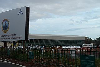
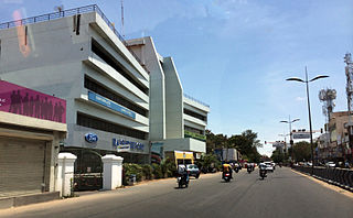
Peelamedu is a major commercial centre and residential locality in the Eastern part of the city of Coimbatore in Tamil Nadu, India. It is governed by Coimbatore City Municipal Corporation since 1981. The growth of Peelamedu during the last decade can be cited due to the growth of the IT sector in Coimbatore. The rapid growth of Peelamedu as a commercial and residential hub could be attributed to its geographical advantage in terms of the connectivity to other parts of the city. It acts as an important hub connecting the rapidly growing business class Information Technology corridor. The Peelamedu area stretches from Nava India to the Coimbatore International Airport near SITRA, encompassing major educational institutions, hospitals, and Industries.
The Coimbatore Diocese is one of the 24 dioceses of the Anglican Church of South India (CSI).
Economy of Coimbatore is heavily influenced by information technology, engineering and textiles. Coimbatore is called the Manchester of South India due to its extensive textile industry, and IT industry, small and medium scale enterprise gdp(gross domestic product) of Coimbatore city is around $20 billion in 2021.It is second largest city by GDP in Tamil Nadu. The city has four special economic zones [SEZ], ELCOT SEZ, KGISL SEZ, SPAN Venture SEZ, Aspen SEZ and at least five more SEZs are in the pipeline. In 2010, Coimbatore ranked 15th in the list of most competitive Indian cities.

Coimbatore is a city in the state of Tamil Nadu, India. Most transportation in the city and suburbs is by road. Coimbatore is well-connected to most cities and towns in India by road, rail, and air, but not through waterways. The city has successful transport infrastructure compared to other Indian cities, though road infrastructures are not well maintained and developed according to the growing needs of transport, making traffic congestion a major problem in the city. A comprehensive transport development plan has been made to address many traffic problems.

The Coimbatore Bypass Road refers to a series of bypasses connecting the various National Highways and State Highways passing through and originating in the South Indian city of Coimbatore.
Mettupalayam Road, (NH 181) is a major arterial road in city of Coimbatore, Tamil Nadu, India. This NH runs for about 10 kilometers starting exactly from Rangai Gownder street up to the northern Thudiyalur within the corporation limits.Beyond that the road continues northwards for a distance of 26 kilometres till Mettupalayam. It is six metres (20 ft) wide in most stretches. The road narrows at the stretches between Edayar street, RG street and Flower Market areas. Green Corridor system is under implementation between Chintamani and Thudiyalur to synchronise traffic signals, as it is one of the most congested stretches in the city. This road connects the city with Saibaba Colony Bus Terminus and the northern suburbs in the Coimbatore Metropolitan Area.

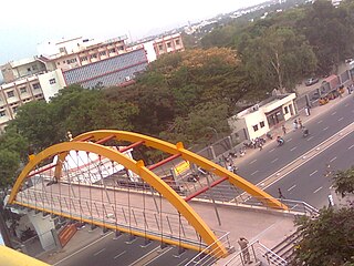
Avinashi Road, is an arterial road in Coimbatore, India. Running from east to west, the road starts at Uppilipalayam flyover and ends at Neelambur by-pass junction where it joins NH 544, Beyond Neelambur Junction, the road branches into two, with one traversing southwards to Madukarai to form the Coimbatore bypass while the other continues westwards to Avinashi and beyond to form the National Highway 544. This road connects Coimbatore to its airport and the east and north-east suburbs. The road was an indicator of development as the city of Coimbatore grew up mostly along its eastern and western sides.

Kathir College of Engineering is an engineering college located in Neelambur Avinashi Road, Coimbatore in Tamil Nadu, India. It is eight kilometres (5.0 mi) from Coimbatore Junction railway station. The college has been approved by the All India Council for Technical Education and is affiliated to Anna University, Chennai.

Trichy Road is an arterial road in Coimbatore, India. This road connects the city to Singanallur Bus Terminus and Sulur Air Force Station and the east and south-east suburbs in the Coimbatore metropolitan area. This road, along with Avinashi Road reveals Coimbatore's development, mostly along the eastern and western sides of these roads. It is considered to be one of the arterial roads with lesser traffic congestion.
Palakkad Road, is an arterial road in Coimbatore, India. This road connects the city to Palakkad and the state of Kerala and the south-west suburbs in the Coimbatore metropolitan area.


