Kinathukadavu, meaning Pass of the Well, is a town panchayat suburb of Coimbatore city and taluk in Coimbatore district in the Indian state of Tamil Nadu. It is along the National Highway 209 and is 23 kilometres (14 mi) from Gandhipuram heart of Coimbatore city and 20.5 kilometres (13 mi) from Pollachi town.
Saravanampatti is a neighborhood of the Coimbatore city. It lies on the north-eastern part of the city. Saravanampatti is one of the fast-growing neighbourhoods of Coimbatore, because of the proliferation of IT companies in areas such as Saravanampatti, Peelamedu, Keeranatham, Vilankurichi, Kalapatti. Saravanampatti has been part of Coimbatore Corporation since 2011.
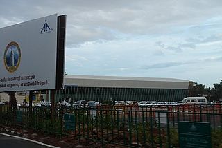
Peelamedu is a major commercial centre and residential locality in the Eastern part of the city of Coimbatore in Tamil Nadu, India. It is governed by Coimbatore City Municipal Corporation since 1981. The growth of Peelamedu during the last decade can be cited due to the growth of the IT sector in Coimbatore. The rapid growth of Peelamedu as a commercial and residential hub could be attributed to its geographical advantage in terms of the connectivity to other parts of the city. It acts as an important hub connecting the rapidly growing business class Information Technology corridor. The Peelamedu area stretches from Nava India to the Coimbatore International Airport near SITRA, encompassing major educational institutions, hospitals, and Industries.
Ondipudur is a major residential neighbourhood of the city of Coimbatore in Tamil Nadu, India. It is situated in the south-eastern part of the city. It is one of the well developed neighborhoods in the city and has been part of Coimbatore Corporation since 1981.
Ramanathapuram is a locality in Coimbatore city on the south eastern part of the city. It is one of the well developed neighborhoods in the city and has been part of Coimbatore Corporation since 1882.
Coimbatore is a city in the state of Tamil Nadu, India. Most transportation in the city and suburbs is by road. Coimbatore is well-connected to most cities and towns in India by road, rail, and air, but not through waterways. The city has successful transport infrastructure compared to other Indian cities, though road infrastructures are not well maintained and developed according to the growing needs of transport, making traffic congestion a major problem in the city. A comprehensive transport development plan has been made to address many traffic problems.
Coimbatore Metro, also known as Kovai Metro, is a proposed rapid transit system for Coimbatore, Tamil Nadu.

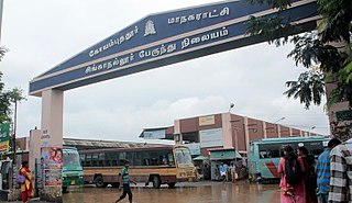
Ukkadam Bus Terminus, popularly known as Ukkadam Bus Stand, is one of the bus terminus of Coimbatore City. It was opened in 1991 to ease congestion in the central bus stand at Gandhipuram.The bus stand was planned to accommodate town buses and buses to Pollachi and nearby places and Palakkad.
Townhall is the core part of the city of Coimbatore in Tamil Nadu, India. It is the largest and the major commercial hub in the city with locations such as Oppanakara Street, Raja Street, Ukkadam, VH Road and NH Road. The locality derives its name from the Victoria Town Hall, Coimbatore. It is centrally located in the city.
The Coimbatore Integrated Bus Terminus, commonly known as the CIBT, is the integrated bus terminus under construction in Podanur on Chettipalayam Road, Coimbatore, Tamil Nadu, India, to serve both intercity and intracity buses. Upon completion, it would be the largest bus station in the world with an area of 249,400 square metres.
Chettipalayam Road, SH 162 is an arterial road in the city of Coimbatore, Tamil Nadu, India. This road connects the city with the Coimbatore Integrated Bus Terminus and Podanur Junction. It is a four lane road from Podanur to Chettipalayam.

Trichy Road is an arterial road in Coimbatore, India. This road connects the city to Singanallur Bus Terminus and Sulur Air Force Station and the east and south-east suburbs in the Coimbatore metropolitan area. This road, along with Avinashi Road reveals Coimbatore's development, mostly along the eastern and western sides of these roads. It is considered to be one of the arterial roads with lesser traffic congestion.
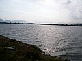
Singanallur is a major residential locality of the city of Coimbatore in Tamil Nadu, India. It is located on the banks of Noyyal river, which runs to the southern boundary of the locality. It is situated in the eastern part of the city, and is a major hub for the inter-city bus services towards Southern and Central districts of Tamilnadu from the city. It is one of the well developed neighborhoods in the city and has been part of Coimbatore Corporation since 1981. The East Zone Office of Coimbatore City Municipal Corporation is located at Singanallur.
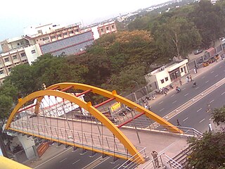
Trichy road Flyover also known as Ramanathapuram-Sungam flyover is a 3.15 km long flyover in the city of Coimbatore. It is designed for vehicles to bypass the Sungam and Ramanathapuram Junctions to move towards Ukkadam, Townhall in the west and Singanallur and Coimbatore International Airport in the east. It was opened on 11 June 2022.
Eachanari is a suburb of Coimbatore city in Tamil Nadu, India. The suburb and its environs are also home to the Eachanari Vinayagar Temple. It exists within the Coimbatore City Municipal Corporation jurisdiction.
Coimbatore is the second largest city in the state of Tamilnadu in India. The major arterial roads in the city are Avinashi Road, Trichy Road, Pollachi Road, Sathy Road, Palakkad Road, Mettupalayam Road and Thadagam Road. Coimbatore city is served by many flyovers. Avinashi road flyover in Coimbatore was built in 1974 and was the second flyover to be opened in Tamil Nadu after the Anna flyover in Chennai. It was also the first grade separator in India to have a roundabout.
Ukkadam Flyover also known as Ukkadam-Aathupalam flyover is a 2.5 km long flyover under construction in the city of Coimbatore.
Karanampettai is a town located in the Tiruppur district of Tamil Nadu, India. It is a suburb of Coimbatore.It lies on the National Highway 81. It is a part of Palladam taluk and Palladam which comes under the Coimbatore Parliament Constituency.
Nanjundapuram is a residential neighbourhood of the city of Coimbatore in Tamil Nadu, India. It is one of the well developed neighborhoods in the city and has been part of Coimbatore Corporation since 1981. The name "Nanjundapuram" is derived from the Nanjundeshwarar Temple located on the banks of Noyyal river.
Selvapuram is a major residential locality of the city of Coimbatore in Tamil Nadu, India. It is located on the banks of Noyyal river, which runs to the northwestern boundary of the locality. It is situated in the northwestern part of the city, and is a major resedenial and industrial locality in the city. It is one of the well developed neighborhoods in the city and has been part of Coimbatore Corporation since 1866.