Northern Connector

Last updated

North–South Motorway (known as Northern Connector during construction)

Coordinates
General information
Type Freeway  (Under construction)
Length15 km (9.3 mi)
Route number(s) AUS Alphanumeric Route M2.svg M2 (proposed)
Major junctions
North end
 
South end
Location(s)
Major suburbs / towns Dry Creek, Globe Derby Park, Bolivar, St Kilda
Highway system

The Northern Connector (part of route M2) is a 15 kilometre long expressway in Adelaide, South Australia. It is the northern-most part of the North-South Motorway (National Highway M2) and extends it from Wingfield to the Northern Expressway (also M2 and also known as the Max Fatchen Expressway). It is part of an ongoing plan to develop a continuous freeway grade road between Old Noarlunga and Nuriootpa known as the North–South Corridor. The road is three lanes in each direction and provides a faster, safer and less congested route over the section of the North-South Corridor between the Port River Expressway and the Northern Expressway. [1] Construction began in January 2016 and it opened to traffic on 7 March 2020. [2]

Contents

The project involved the construction of a complex interchange at the Port River Expressway / North-South Motorway intersection. [3] The original plan also included a major diversion in the main ARTC interstate rail line, which would use the same corridor between Dry Creek, South Australia and Taylors Road at Waterloo Corner, however the railway was not built with the road.

The entire Northern Connector permits heavy vehicles up to 36.5 metres (120 ft) road trains and 35.0 metres (114.8 ft) B-triples. They are permitted to continue only as far south as the off ramp to Grand Junction Road. [4]

Planning

2008 plans

In early 2008, the South Australian Government announced plans for the Northern Connector, as an eight lane connector roadway, linking the Northern Expressway and South Road, with three intermediate interchanges. [5] This would have involved the construction of a four-way cloverstack interchange at the Port River Expressway / South Road intersection. The project was proposed to also include a major diversion in the main ARTC interstate rail line, which would run down the middle of the new connector freeway between Dry Creek, South Australia and Taylors Road at Waterloo Corner. [3]

The federal government proposed that it could be the state's first toll road. [6]

September 2015 announcement

On 14 September 2015, the Premier of South Australia, Jay Weatherill and Prime Minister of Australia Tony Abbott announced that the road component of the project would start construction in early 2016. The federal government would provide A$788M towards an expected total cost of A$985M. The project was reduced to three lanes each way (four in the 2008 announcement), and two intermediate interchanges (a proposed Globe Derby Park interchange was not in the 2015 plans). The road is not subject to direct tolls, but South Australia will become a testing ground for a "network fee" which involves charging trucks based on road use and impact in place of high registration fees. [7] This construction includes the road and shared path, but not the rail component. [8] The rail corridor would now be reserved on the western side of the road, rather than down the median strip.

Preliminary works

Part of the early work for the project involved realigning the intersection at Kings Road and Bolivar Road. Kings Road is a significant cross-suburban route (State Route A18) feeding from McIntyre Road past Parafield Airport. It previously terminated at a T-junction with Bolivar Road only 300 metres (980 ft) from the Bolivar Road and Port Wakefield Road intersection. Prior to the main Northern Connector construction, the intersection was realigned so that Kings and Bolivar Roads meet at a new two-lane roundabout on previously vacant land south of the former intersection. [9] The western end of Bolivar Road was later moved slightly south and extended across a new intersection at Port Wakefield Road to the Northern Connector interchange and access to the Bolivar Waste Water Treatment Plant.

Prime contractors for the main road design and construction were shortlisted to Lend Lease and a consortium of Leighton Contractors and York Civil. These two bidders were invited to tender for the complete works in December 2015 after having responded to an open call for expressions of interest in October. It was expected that the contract would be awarded to one of these bidders before major construction began in May 2016 with completion anticipated in December 2019. [10]

In January 2016, work commenced carting earth and brine mud to build embankments across the former salt flats. This was required to allow it to settle properly before the road could be built on top. [11]

Construction

Lend Lease Engineering was awarded the contract. The announcement included support for other sectors of the South Australian economy, with a requirement that 7500 tonnes of steel would be sourced from Arrium and at least half of the workers hired from the northern suburbs of Adelaide where other industries were reducing workforce - notably Holden ceased local production of cars in 2017. [12]

In November 2016, it was announced that the majority of the road surface would be concrete, rather than asphalt as used on most roads in South Australia. This was expected to have a slightly higher up-front cost, but significantly lower maintenance costs over 30 years. [13]

Major construction was announced to have started on 6 December 2016, with completion anticipated in December 2019. [14] There were a total of nine bridges required to be constructed. The Southern Interchange required three bridges; The Bolivar and Waterloo Corner Interchanges each required a bridge over the expressway; the northern interchange required a new bridge for the northbound carriageway of Port Wakefield Road to cross the southbound on-ramp; the motorway crosses North Arm Creek, Dry Creek and the Little Para River. [15]

The project was divided into six zones. Zone 1 containing the northern interchange was let to McMahon Services. Zone 2 contained the Waterloo Corner interchange, and was let to LR&M Constructions. Zone 3 contained the Bolivar interchange and bridge over the Little Para River and was subcontracted to Catcon. Zone 4 was the Bolivar intersection with Port Wakefield Road, let to S.E.M. Group. Zone 5 crossed Dry Creek and the salt pans. Zone six was the southern interchange. Zones 5 and 6 were both managed directly by Lendlease. The shared use path along the eastern side of the road was constructed by Intract Indigenous Contractors [15] :47 and is named Tapa Martinthi Yala. [16]

The raw materials to make the concrete for the road were be supplied by Adelaide Brighton Cement, and mixed on-site. The road was reinforced with steel from Liberty OneSteel and asphalt was supplied by Boral. [17]

The first new bridge to open to traffic was the bridge over the new motorway at the Waterloo Corner interchange. This bridge was opened on 26 March 2019 to provide the new access route into St Kilda, replacing several roads that had been cut by the motorway. The last road to be closed in the area was St Kilda Road, three days after the new bridge opened. [18] The next new bridges were the twin bridges over the Port River Expressway at the southern interchange. They replaced the original Craig Gilbert Bridge which was closed and demolished in May 2019. [19] A temporary off ramp from South Road to Salisbury Highway was provided which used the new southbound bridge and the future Port River Expressway to South Road on ramp. In July 2019, the bridge for the end-state off ramp opened to traffic, carrying north->east traffic over the Northern Connector. [20] The bridge over the expressway at Bolivar Road opened for access into the Bolivar Waste Water Treatment Plant about a week before Christmas 2019. The final alignment of the northbound carriageway of Port Wakefield Road at the northern interchange opened at about the same time, over a new bridge that passes over the southbound on-ramp from Port Wakefield Road. The whole road opened to traffic on 7 March 2020. [2]

Interchanges

LGALocationkmmiNameDestinations [21] Notes
Playford Waterloo Corner 00.0Port Wakefield RoadAUS Alphanumeric Route M2.svgAustralian national highway A1.svg Northern Expressway (National Highway M2) north-east / Port Wakefield Road (National Highway A1) north  Elizabeth, Gawler, Adelaide, Dry Creek Northern extent, no connection from northbound Port Wakefield Road to Northern Expressway or Northern Connector
Salisbury Waterloo Corner Interchange / Kawanta Wama Bridge [16] Waterloo Corner Road (extended west of its previous terminus at Port Wakefield Road)  Salisbury, St Kilda
Bolivar Bolivar Interchange / Harry Taylor Warritja Bridge [16] AUS Alphanumeric Route A18.svg Bolivar Road (A18, extended southwest of the previous terminus at Port Wakefield Road)  Parafield Gardens, Paralowie Bolivar and Kings roads realigned to the east
Port Adelaide Enfield Dry CreekWingfield boundary159.3Port River Expressway Interchange / Craig Gilbert Bridge [22] AUS Alphanumeric Route M2.svgAUS Alphanumeric Route A9.svg North-South Motorway (M2) south / Port River Expressway (A9) west / Salisbury Highway (A9) east  Regency Park, Adelaide, Port Adelaide, Dry Creek Continues to the South Road Superway segment

See also

Related Research Articles

Southern Expressway (South Australia) expressway in Adelaide, South Australia

The Southern Expressway is an 18.5 km (11.5 mi) freeway in the southern suburbs of Adelaide, South Australia, between Bedford Park and Old Noarlunga. It is the southern part of the North–South Corridor which extends the full length of Adelaide and is being built to urban freeway standard.

Port Wakefield Road is an important Australian highway. It connects Adelaide, the South Australian capital, to the Yorke Peninsula, Port Augusta, northern and western South Australia, the Northern Territory and Western Australia. It is designated National Highway A1 and a part of the National Highway. It is named after Port Wakefield, the first government town north of Adelaide.

Stoney Trail Freeway in Calgary, Alberta

Stoney Trail is a 69-kilometre (43 mi) freeway in Calgary, Alberta. Signed as Highway 201, it is a ring road that is approximately 70% complete, serving as an important bypass around the city and an alternate route to the congested Highway 1 and Highway 2. Stoney Trail begins in the city's northwest at Highway 1 near Canada Olympic Park, running north across the Bow River and Crowchild Trail. It winds through neighbourhoods of northwest Calgary to Deerfoot Trail and the Queen Elizabeth II Highway. Turning south, the freeway again intersects Highway 1, crosses Glenmore Trail, and curves west at the neighbourhood of Mahogany. Beyond a second major interchange with Deerfoot Trail, it descends across the Bow River and ends at Macleod Trail in the city's southeast.

South Road, Adelaide road in Adelaide, South Australia

South Road, also known as Main South Road, is a major north–south conduit in Adelaide and Fleurieu Peninsula in South Australia. It is one of Adelaide's most important arterial and bypass roads.

The Port River Expressway is a 5.5-kilometre (3.4 mi) freeway-grade road. The expressway links Port Adelaide and the LeFevre Peninsula to the northern suburbs of Adelaide and major interstate routes via Salisbury Highway (A9) to Port Wakefield Road (A1) and the Max Fatchen Northern Expressway (M2) to Perth, Darwin and Sydney.

M2 Hills Motorway motorway in Sydney

The Hills Motorway is a tollway in north-western Sydney, Australia, owned by toll road operator Transurban. It forms part of Sydney's M2 route and the 110 km Sydney Orbital Network. West of Pennant Hills Road, the M2 is also part of the National Highway.

M4 Motorway (Sydney) Motorway in Sydney

The M4 Motorway is a 51.5-kilometre-long (32.0 mi) dual carriageway motorway in Sydney, New South Wales, Australia that is designated with the M4 route. The M4 designation is part of the wider A4 and M4 route designation. It runs parallel to the Great Western Highway and Parramatta Road.

Northern Expressway freeway in Adelaide, South Australia

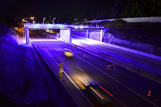
The Northern Expressway, also known as the Fatchen Northern Expressway, is a 23 kilometre long controlled-access highway in Adelaide, South Australia. It travels from Gawler to Port Wakefield Road. The road has been built to four-lane standard and provides a faster route between Adelaide and Gawler, whilst reducing the amount of traffic on Main North Road, which passes through the heart of the northern suburbs and is interspersed with frequent traffic lights. It also allows freight vehicles to avoid residential areas and go straight to Port Wakefield Road and onto the Port River Expressway (A9) to reach the harbour at Port Adelaide.

Auckland Northern Motorway road in New Zealand

The Auckland Northern Motorway in the Auckland Region of New Zealand links central Auckland City and Puhoi in the former Rodney District via the Hibiscus Coast and North Shore. It is part of State Highway 1.

Auckland Southern Motorway road in New Zealand

The Auckland Southern Motorway is the major route south out of the Auckland Region of New Zealand. It is part of State Highway 1.

The Salisbury Highway is a 12 kilometre major connecting road in the northern suburbs of the Adelaide metropolitan area.

Hunter Expressway freeway in New South Wales

The Hunter Expressway is a 39.5-kilometre (24.5 mi) long dual carriageway freeway in New South Wales, Australia. It was previously known as the F3 to Branxton link or Kurri Kurri Corridor during the planning stage. It has two lanes in each direction, running generally north west from the Pacific Motorway at the Newcastle Link Road interchange to the eastern end of the Belford Bends Deviation on the New England Highway north of Branxton. The road allows traffic to bypass the Maitland area, Lochinvar, Greta and Branxton. The expressway opened on 22 March 2014.

New Zealand State Highway 2 Road in New Zealand

State Highway 2 runs north–south through eastern parts of the North Island of New Zealand from the outskirts of Auckland to Wellington. It runs via Tauranga in the Bay of Plenty, Gisborne, and Napier and Hastings in Hawke's Bay. It is the second-longest highway in the North Island, after State Highway 1, which runs the length of both of the country's main islands.

Highways in Croatia Wikimedia list article

Highways in Croatia are the main transport network in Croatia. The Croatian classification includes several classes of highways:

This is a list of freeways in Australia, sorted by states and territories and their corresponding routes. This list includes tollways / toll roads such as the CityLink freeway system in Melbourne. This list has over 70 entries. The only jurisdiction in Australia without freeways is the Northern Territory. Victoria has the largest and densest freeway network in Australia.

Bundesautobahn 100 federal motorway in Germany

Bundesautobahn 100 is an Autobahn in Germany.

State Highway 74 is a state highway in New Zealand servicing the eastern suburbs of Christchurch. Mostly two-lane, it is composed of limited-access expressways, with part of the highway as the Christchurch-Lyttelton Motorway, and connects the city to its port town of Lyttelton.

North–South Motorway elevated freeway in Adelaide, South Australia

The North–South Motorway is an incomplete planned motorway traversing the inner western suburbs of Adelaide from Wingfield in the north to Bedford Park in the south. It is planned to be a non-stop north–south route overlaying the same motor traffic corridor as South Road by grade separation. The motorway is to be the central section of Adelaide's North–South Corridor, being flanked north and south by the Northern Expressway and Southern Expressway, respectively.

North–South Corridor, Adelaide road route in and beyond Adelaide, South Australia

The North–South Corridor is a series of road projects currently under construction or planning which travel through Adelaide, South Australia that will eventually form a continuous link from Old Noarlunga in the outer southern metropolitan Adelaide suburbs through to Nuriootpa in the inner northern rural area around the Barossa Valley, a distance of over 100 km, aiming to be without a single stop by 2030.

McIntyre Road and Kings Road are arterial roads crossing the northern and northeastern suburbs of Adelaide in South Australia. They are together denoted as route A18.

References

  1. "Northern Connector". Infrastructure S.A. 15 August 2014. Archived from the original on 8 June 2010. Retrieved 5 July 2015.
  2. 1 2 Smith, Matt (3 March 2020). "Adelaide's biggest road project, the Northern Connector, set to open this weekend". The Advertiser. Retrieved 3 March 2020.
  3. 1 2 "northern connector" (PDF). Infrastructure S.A. Archived from the original (PDF) on 15 October 2009. Retrieved 12 June 2010.
  4. "RAVnet". Department of Planning, Transport and Infrastructure, Government of South Australia . Retrieved 7 March 2020.
  5. "Northern Connector". Infrastructure S.A. Archived from the original on 8 June 2010. Retrieved 12 June 2010.
  6. Schultz, Duane (13 August 2013). "Federal Government push to make $1.1bn Northern Connector South Australia's first toll road". News Review Messenger. Retrieved 5 July 2015.
  7. Jean, Peter; Starick, Paul (14 September 2015). "Northern Connector Work to Start on Crucial $985 Million Adelaide Road Link". The Advertiser. News Corp. Retrieved 14 September 2015.
  8. "Northern Connector Project". Department of Planning, Transport and Infrastructure South Australia. Retrieved 14 September 2015.
  9. "Kings/Bolivar Intersection Realignment". Department of Planning, Transport and Infrastructure, Government of South Australia. Archived from the original on 29 February 2016. Retrieved 15 January 2016.
  10. "Northern Connector contract shortlisted to two tenderers". Government of South Australia. Retrieved 2 May 2016 via AEOL. [Minister Stephen Mullighan said] "The contract will be awarded ahead of the start of major works in May 2016 and the project is scheduled for completion in December 2019."
  11. Paul Fletcher MP, Minister for Territories, Local Government and Major Projects (6 January 2016). "Closing the gap with North-South Corridor jobs" (Press release). Retrieved 3 February 2016.CS1 maint: multiple names: authors list (link)
  12. Novak, Lauren (31 May 2016). "Lendlease Engineering chosen to build and construct Northern Connector, work to start next month". The Advertiser . Retrieved 2 June 2016.
  13. Starick, Paul (16 November 2016). "$985 million Northern Connector to be South Australia's first major concrete road, creating more jobs". The Advertiser . News Corp (published 17 November 2016). Retrieved 17 November 2016.
  14. Paul Fletcher, Federal Minister for Urban Infrastructure; Jay Weatherill, Premier of South Australia; Stephen Mullighan, SA Transport and Infrastructure Minister (6 December 2016). "Major construction begins on Northern Connector project" (PDF) (Press release). Retrieved 7 December 2016.CS1 maint: multiple names: authors list (link)
  15. 1 2 "Northern Connector Project Breakfast". Industry Capability Network. 23 June 2016. Retrieved 7 December 2016.
  16. 1 2 3 "Notice to Assign a Names to Bridges and Shared-Use Path" (PDF). South Australian Government Gazette . Government of South Australia. 2 January 2020. p. 10. Retrieved 13 January 2020.
  17. "Three contracts awarded on $885M Northern Connector". Trailer Magazine. 16 November 2017. Retrieved 18 November 2017.
  18. "Finally! New overpass at Waterloo corner has opened". Cruise 1323. 26 March 2019. Retrieved 27 March 2019.
  19. "Port River Expressway weekend closure and detours, 24-27May" (PDF). Northern Connector Project. Department of Planning, Transport and Infrastructure. May 2019. Retrieved 19 May 2019. This closure will allow for the demolition of the Craig Gilbert Bridge over PREXY as part of the construction of the Southern Interchange.
  20. "New South Road Superway off-ramp opening" (PDF). North-South Corridor Northern Connector Project. 8 July 2019. Retrieved 23 July 2019.
  21. Department of Planning, Transport and Infrastructure. "The Northern Connector proposed road and rail route". Government of South Australia. Archived from the original on 15 May 2013. Retrieved 26 February 2015. Additional archives: 26 February 2015.
  22. "Craig Gilbert Bridge retains dedication". Tonkin. Archived from the original on 29 February 2020. Retrieved 29 February 2020.