P Street (Washington, D.C.)

Last updated
P Street NW in the Georgetown neighborhood in February 2006 Georgetown p street.jpg
P Street NW in the Georgetown neighborhood in February 2006

P Street refers to four different streets within the city of Washington, D.C. The streets were named by President George Washington in 1791 as part of a general street naming program, in which east-west running streets were named alphabetically and north-south running streets numerically. [1]

Washington, D.C. Capital of the United States

Washington, D.C., formally the District of Columbia and commonly referred to as Washington or D.C., is the capital of the United States. Founded after the American Revolution as the seat of government of the newly independent country, Washington was named after George Washington, the first President of the United States and a Founding Father. As the seat of the United States federal government and several international organizations, Washington is an important world political capital. The city is also one of the most visited cities in the world, with more than 20 million tourists annually.

George Washington 1st president of the United States

George Washington was an American political leader, military general, statesman, and Founding Father who also served as the first president of the United States from 1789 to 1797. He led Patriot forces to victory in the nation's War of Independence, and he presided at the Constitutional Convention of 1787 which established the new federal government. He has been called the "Father of His Country" for his manifold leadership in the formative days of the new nation.

Contents

NW

P Street NW runs in an easterly direction from North Capitol Street to the eastern boundary of Georgetown University (at 37th Street NW), with an additional block-long section running from the western edge of Glover-Archbold Park to Foxhall Road NW. P Street NW crosses Rock Creek and the Rock Creek and Potomac Parkway via the P Street Bridge. P Street NW also crosses Dupont Circle and Logan Circle. P Street NW is the most historic of the four streets, having been the first P Street plotted in the city's history. The northern boundary of the City of Washington in the District of Columbia, as surveyed in July 1795, listed the P Street ford at Rock Creek as the starting point of the city's original northern boundary. [2] The first bridge to carry P Street over the creek was Paper Mill Bridge. [2] [3]

North Capitol Street

North Capitol Street is a street in Washington, D.C. that separates the Northwest and Northeast quadrants of the city.

Georgetown University Private university in Washington, D.C., United States

Georgetown University is a private research university in the Georgetown neighborhood of Washington, D.C. Founded in 1789 as Georgetown College, the university has grown to comprise nine undergraduate and graduate schools, among which are the School of Foreign Service, School of Business, Medical School, and Law School. Located on a hill above the Potomac River, the school's main campus is identifiable by its flagship Healy Hall, a National Historic Landmark. Georgetown offers degree programs in forty-eight disciplines, enrolling an average of 7,500 undergraduate and 10,000 post-graduate students from more than 130 countries.

Glover-Archbold Park

Glover Archbold Park is a 183-acre, frequently-used, quasi-natural, stream-valley park in Northwest, Washington, D.C., on the western edge of Georgetown University and the Burleith-Hillandale, Glover Park, Mclean Gardens, and Westchester neighborhoods. It is a welcome change from the general urban landscape and includes Foundry Branch from Van Ness Street, to Canal Road, along the Potomac River. Several temporary streams, some originating from springs, flow into Foundry Branch. This park is one of the "finger parks" of Rock Creek Park, administered by the National Park Service (NPS). It prohibits removal of anything from the natural areas of the park. Also, to help preserve it, the NPS prohibits off-leash dogs, bicycles, and motorized vehicles in the park. Dog walkers, hikers, and joggers are often in the park. The park contains a historical Victory Garden adjacent to W Street, N.W. Nature, Gardens, and Georgetown (2006) includes a chapter on the park.

The 2000 and 2100 blocks of P Street NW in 2012 P Street NW - looking east at 2000 and 2100 blocks - 2012.jpg
The 2000 and 2100 blocks of P Street NW in 2012

P Street NW was important both commercially and topographically. The P Street ford marked the farthest point at which ocean-going ships could travel up Rock Creek. [4] Slash Run, a major tributary of Rock Creek, began at 1700 P Street. [5] P Street NW was also home to the city's earliest free African American residents. One of the first free blacks to buy property in the city was Lethe Hill, who purchased a lot at P and 30th Streets in 1819. Another free black, William Becraft, bought a home a block away. [6] In time, a large neighborhood of free blacks formed in a 10-block area bounded by P Street NW, Constitution Avenue NW, 16th Street NW, and 6th Street NW. [7] In the 1890s, Riggs Market—one of the city's important (if smaller) markets—was located on P Street NW between 14th and 15th Streets NW. [8]

In 1885, Major General John A. Logan purchased the "Stone Mansion" on Iowa Circle and P Street NW. Three-time presidential candidate William J. Bryan later leased it from the Logans. [9] Congress changed the circle's name to "Logan Circle" in December 1930 in Logan's honor. [10] The Dupont Circle Citizens Association was founded in 1922 in a townhouse at 1767 P Street. [11]

John A. Logan American soldier and political leader

John Alexander Logan was an American soldier and political leader. He served in the Mexican–American War and was a general in the Union Army in the American Civil War. He served the state of Illinois as a State Senator, a Congressman, and a U.S. Senator and was an unsuccessful candidate for Vice President of the United States with James G. Blaine in the election of 1884. As the 3rd Commander-in-Chief of the Grand Army of the Republic, he is regarded as the most important figure in the movement to recognize Memorial Day as an official holiday.

NE

P Street NE runs westerly for a single block from North Capitol Street to Florida Avenue NE. Areas further east are occupied by the Amtrak railroad tracks, Gallaudet University, Mount Olivet Cemetery, the United States National Arboretum, Anacostia Park, and the Anacostia River. It does not extend into the Deanwood neighborhood.

Florida Avenue

Florida Avenue is a major street in Washington, D.C. It was originally named Boundary Street, because it formed the northern boundary of the Federal City under the 1791 L'Enfant Plan. With the growth of the city beyond its original borders, Boundary Street was renamed Florida Avenue in 1890.

Amtrak Intercity rail operator in the United States

The National Railroad Passenger Corporation, doing business as Amtrak, is a passenger railroad service that provides medium- and long-distance intercity service in the contiguous United States and to nine Canadian cities.

Gallaudet University university providing education for deaf and hard of hearing students

Gallaudet University is a federally chartered private university for the education of the deaf and hard of hearing. It is located in Washington, D.C. on a 99-acre (0.40 km2) campus.

SW

Looking east down P Street SW (the 300 block is in the foreground) P Street SW 01 - looking east - Washington DC.jpg
Looking east down P Street SW (the 300 block is in the foreground)

P Street SW runs westerly from South Capitol Street to Southwest Waterfront Park, where it intersects with 4th Street SW. Along about half its length, on the south side of the street, is Fort Lesley J. McNair. The main entrance to the defense facility is on P Street SW. P Street SW lies within an area originally deeded to Charles Carroll the Settler in 1688, who sold it to Notley Young in 1770. [12] Around 1792, Young sold the property to developer James Greenleaf, who platted it in 1794. Greenleaf built large residential townhomes along P Street SW in 1794-1795, but sold the property shortly afterward. The area bordering P Street passed through several hands, with the property becoming more and more fragmented over time. Benjamin G. Orr, the fourth mayor of the city, owned property on P Street SW between 4 and 4-1/2 Streets. He later sold some of it to Reverend Luther Rice and some to Secretary of the Treasury William H. Crawford. Two of the houses on this block of P Street were owned by Columbia College. [13]

South Capitol Street

South Capitol Street is a major street dividing the southeast and southwest quadrants of Washington, D.C., in the United States. It runs south from the United States Capitol to the D.C.-Maryland line, intersecting with Southern Avenue. After it enters Maryland, the street becomes Indian Head Highway at the Eastover Shopping Center, a terminal or transfer point of many bus routes.

Fort Lesley J. McNair

Fort Lesley J. McNair is a United States Army post located on the tip of Greenleaf Point, the peninsula that lies at the confluence of the Potomac River and the Anacostia River in Washington, D.C. To the peninsula's west is the Washington Channel, while the Anacostia River is on its south side. Originally named Washington Arsenal, the fort has been an army post for more than 200 years, third in length of service, after the United States Military Academy at West Point and the Carlisle Barracks. The fort is currently named for Lesley J. McNair, a U.S. Army General who was killed in action in World War II.

Charles Carroll the Settler American lawyer and planter

Charles Carroll (1661–1720), sometimes called Charles Carroll the Settler to differentiate him from his son and grandson, was a wealthy lawyer and planter in colonial Maryland. Carroll, a Catholic, is best known because his efforts to hold office in the Protestant-dominated colony resulted in the disfranchisement of the colony's Catholics.

Navy Commodore John Rodgers purchased two of the homes on the far western end of P Street SW between 4th and 4-1/2 Streets SW, and connected the homes into a single dwelling. Rodgers' property extended to the Potomac River. [14] This block became known as "Rodgers Row". [13] In the early 1870s, the homes here were purchased and demolished by the Metropolitan Railroad to build its 4-1/2 Street Car Barn and Shop. [15]

This streetcar barn was torn down in 1962 to allow for the construction of the Riverside Condominiums. [16]

SE

P Street SE is fragmented and truncated due to the topography of the eastern side of the Anacostia River. It runs westerly for two blocks between 18th Street NE and Naylor Road SE, and for approximately three blocks between Pennsylvania Avenue SE and Branch Avenue SE.

Related Research Articles

Dupont Circle neighborhood in Washington, D.C.

Dupont Circle is a traffic circle, park, neighborhood, and historic district in Northwest Washington, D.C.. The Dupont Circle neighborhood is bounded approximately by 16th Street NW to the east, 22nd Street NW to the west, M Street NW to the south, and Florida Avenue NW to the north. Much of the neighborhood is listed on the National Register of Historic Places. However, the local government Advisory Neighborhood Commission and the Dupont Circle Historic District have slightly different boundaries.

Southeast (Washington, D.C.) Place in the United States

Southeast is the southeastern quadrant of Washington, D.C., the capital of the United States, and is located south of East Capitol Street and east of South Capitol Street. It includes the Capitol Hill and Anacostia neighborhoods, the Navy Yard, the Joint Base Anacostia-Bolling (JBAB), the U.S. Marine Barracks, the Anacostia River waterfront, Eastern Market, the remains of several Civil War-era forts, historic St. Elizabeths Hospital, RFK Stadium, Nationals Park, and the Congressional Cemetery. It is also contains a landmark known as "The Big Chair," located on Martin Luther King Avenue. The quadrant is split by the Anacostia River, with the portion that is west of the river sometimes referred to as "Near Southeast".

Northwest (Washington, D.C.) Place in the United States

Northwest is the northwestern quadrant of Washington, D.C., the capital of the United States, and is located north of the National Mall and west of North Capitol Street. It is the largest of the four quadrants of the city, and it includes the central business district, the Federal Triangle, and the museums along the northern side of the National Mall, as well as many of the District's historic neighborhoods.

14th Street (Washington, D.C.) street in northwest and southwest quadrants of Washington, D.C., USA

14th Street NW/SW is a street in Northwest and Southwest quadrants of Washington, D.C., located 1.25 miles (2.01 km) west of the U.S. Capitol. It runs from the 14th Street Bridge north to Eastern Avenue.

Outdoor sculpture in Washington, D.C. Wikimedia list article

There are many outdoor sculptures in Washington, D.C. In addition to the capital's most famous monuments and memorials, many figures recognized as national heroes have been posthumously awarded with his or her own statue in a park or public square. Some figures appear on several statues: Abraham Lincoln, for example, has at least three likenesses, including those at the Lincoln Memorial, in Lincoln Park, and the old Superior Court of the District of Columbia. A number of international figures, such as Mohandas Gandhi, have also been immortalized with statues. The Statue of Freedom is a 19½-foot tall allegorical statue that rests atop the United States Capitol dome.

Massachusetts Avenue (Washington, D.C.) major diagonal transverse road in Washington, D.C.

Massachusetts Avenue is a major diagonal transverse road in Washington, D.C., and the Massachusetts Avenue Historic District is a historic district that includes part of it.

Dumbarton Bridge (Washington, D.C.)

The Dumbarton Bridge, also known as the Q Street Bridge and the Buffalo Bridge, is a historic masonry arch bridge in Washington, D.C.

Streetcars in Washington, D.C.

For just under 100 years, between 1862 and 1962, streetcars in Washington, D.C. transported people across the city and region.

The name "M Street" refers to two major roads in the United States capital of Washington, D.C. Because of the Cartesian coordinate system used to name streets in Washington, the name "M Street" can be used to refer to any east-west street located twelve blocks north or south of the dome of the United States Capitol. Thus, in all four quadrants of the city there are streets called "M Street", which are disambiguated by quadrant designations, namely, M Street NW, NE, SW, and SE.

The Inner Loop was two planned freeways around downtown Washington, D.C. The innermost loop would have formed an oval centered on the White House, with a central freeway connecting the southern segment to the northern segment and then continuing on to Interstate 95. Interstate 95 would have met Interstate 66, Interstate 295, Interstate 695, and US 50 while traversing the Inner Loop. A second loop was an arc across the northern section of the city, beginning at East Capitol Street at the Anacostia River and using the Missouri Avenue NW and Nebraska Avenue NW commercial corridors to terminate in Georgetown.

Barney Circle Neighborhood in the United States

Barney Circle is a small residential neighborhood located on the west bank of the Anacostia River in southeast Washington, D.C., in the United States. The neighborhood's name refers to the traffic circle which exists at Pennsylvania Avenue SE just before it crosses the John Philip Sousa Bridge over the Anacostia. The Barney Circle traffic circle is named for Commodore Joshua Barney, commander of the Chesapeake Bay Flotilla in the War of 1812.

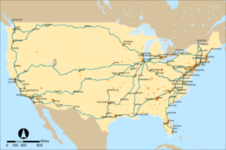
The streets and highways of Washington, D.C., form the core of the city's surface transportation infrastructure. Given that it is a planned city, streets in the capital of the United States follow a distinctive layout and addressing scheme. There are 1,500 miles (2,400 km) of public roads in the city, of which 1,392 miles (2,240 km) are owned and maintained by the District government.

Metropolitan Railroad street car company in the US

The Metropolitan Railroad was the second streetcar company to operate in Washington, D.C., United States. It was incorporated and started operations in 1864, running from the Capitol to the War Department and along H Street NW in downtown. It added lines on 9th Street NW, on 4th Street SW/SE, along Connecticut Avenue to Dupont Circle, to Georgetown, to Mt. Pleasant and north along Georgia Avenue. In the late 19th Century it was purchased by the Washington Traction and Electric Company and on February 4, 1902, became a part of the Washington Railway and Electric Company.

The Anacostia and Potomac River Railroad Company was the fourth streetcar company to operate in Washington, D.C. and the first to cross the Anacostia River. It was chartered in 1870, authorized by Congress in 1875 and built later that year. The line ran from the Arsenal to Union Town. It expanded, adding lines to Congressional Cemetery, Central Market and to the Government Hospital for the Insane; and in the late 1890s it purchased two other companies and expanded their lines. It was reluctant to change its operations, but in 1900 it relented to pressure and became the last company to switch from horse cars to electric streetcars. It was one of the few companies not to be swept up by the two major streetcar companies at the turn of the 20th century, but it could not hold out forever and on August 31, 1912, it was purchased by the Washington Railway and Electric Company and ceased to operate as a unique entity.

Capitol, North O Street and South Washington Railway

The Capitol, North O Street and South Washington Railway was a street railway company in Washington, D.C. from 1875 to 1898. It was the sixth and final company to start during the horse car era. It operated on a loop, or "belt," around downtown and the National Mall. For that reason, and because of its long name, it was known colloquially as the Belt Railway. It changed its name to the Belt Railway in 1893. It expanded north and south on 11th street west to the boundaries of the city. In 1896 it attempted to use compressed air motors instead of electricity, a decision that sent them into receivership. In 1898, the company was purchased by the Anacostia and Potomac River Railroad and the company ceased to exist.

Quadrants of Washington, D.C. geographical quadrant

Washington, D.C., is administratively divided into four geographical quadrants of unequal size, each delineated by their ordinal directions from the medallion located in the Crypt under the Rotunda of the Capitol. Street and number addressing, centered on the Capitol, radiates out into each of the quadrants, producing a number of intersections of identically named cross-streets in each quadrant. Originally, the District of Columbia was a near-perfect square. However, even then the Capitol was never located at the geographic center of the territory. As a result, the quadrants are of greatly varying size. Northwest is quite large, encompassing over a third of the city's geographical area, while Southwest is little more than a neighborhood and military base.

Western Avenue (Washington, D.C.) one of three boundary streets between Washington, D.C., and the state of Maryland, United States

Western Avenue is one of three boundary streets between Washington, D.C., and the state of Maryland. It follows a southwest-to-northeast line, beginning at Westmoreland Circle in the south and ending at Oregon Avenue NW in the north. It is roughly 3.5 miles (5.6 km) in length. First proposed in 1893, it was constructed somewhat fitfully from about 1900 to 1931.

Holmead's Burying Ground, also known as Holmead's Cemetery and the Western Burial Ground, was a historic 2.94-acre (11,900 m2) cemetery located in the Dupont Circle neighborhood of Washington, D.C., in the United States. It was founded by Anthony Holmead in 1794 as a privately owned secular cemetery open to the public. The city of Washington, D.C., constructed the Western Burial Ground on the remainder of the city block in 1798, and the two burial grounds became synonymous. The city took ownership of the private Holmead cemetery in 1820. The unified cemetery went into steep decline around 1850, and it was closed on March 6, 1874. Removal of remains, most of which were reinterred at Graceland Cemetery or Rock Creek Cemetery, continued until 1885.

References

  1. Hagner, Alexander. "Street Nomenclature of Washington City." Records of the Columbia Historical Society. 7 (1904), pp. 237-261, 240.
  2. 1 2 Hagner, Alexander. "Street Nomenclature of Washington City." Records of the Columbia Historical Society. 7 (1904), pp. 237-261, 257.
  3. Hawkins, Don Alexandr. "The Landscape of the Federal City: A 1792 Walking Tour." Washington History. 3:1 (Spring/Summer 1991), p. 10-33, 16.
  4. Hawkins, Don Alexandr. "The Landscape of the Federal City: A 1792 Walking Tour." Washington History. 3:1 (Spring/Summer 1991), p. 10-33, 17.
  5. The "run", or creek, got its name from "slashes", or stands, or silver maples which stood near its headwaters. See: Hawkins, Don Alexandr. "The Landscape of the Federal City: A 1792 Walking Tour." Washington History. 3:1 (Spring/Summer 1991), p. 10-33, 21.
  6. Brown, Letitia. "Residence Patterns of Negroes in the District of Columbia, 1800-1860." Records of the Columbia Historical Society. 69/70 (1969/1970), pp. 66-79, 74.
  7. Half of all property in this area was owned by African Americans. See: Brown, Letitia. "Residence Patterns of Negroes in the District of Columbia, 1800-1860." Records of the Columbia Historical Society. 69/70 (1969/1970), pp. 66-79, 76.
  8. McArdle, Walter F. "The Development of the Business Sector in Washington, D. C., 1800-1973." Records of the Columbia Historical Society. 49 (1973/1974), p. 556-594, 567.
  9. Emery, Fred A. "Mount Pleasant and Meridian Hill." Records of the Columbia Historical Society. 33/34 (1932), p. 187-223, 202.
  10. Proctor, John Claggett. "Chronicler's Report for 1930." Records of the Columbia Historical Society. 33/34 (1932), p. 352-356, 356.
  11. Dupont Circle Citizens Association. No date. Accessed 2012-10-20.
  12. Henning, George C. "The Mansion and Family of Notley Young." Records of the Columbia Historical Society. 16 (1913), p. 1-24, 4-5, 9-10.
  13. 1 2 Croggon, James. "Named Rodgers' Row." The Evening Star. March 30, 1907, p. 9.
  14. Paullin, Charles O. "Washington City and the Old Navy." Records of the Columbia Historical Society. 33/34 (1932), p. 163-177, 176.
  15. "Streetcar and Bus Resources of Washington, D.C., 1862-1962." Multiple Property Documentation Form. National Register of Historic Places. National Park Service. United States Department of the Interior. May 10, 2006. Accessed 2012-10-20.
  16. Levey, Jane Freundel. SW Heritage Trail Brochure. Washington, D.C.: Cultural Tourism DC, 2004. Archival URL. Accessed 2012-10-20.