| Playford | |
|---|---|
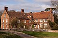
 The Village Hall | |
 Playford Location within Suffolk | |
| Population | 215 (2011) |
| OS grid reference | TM217480 |
| Civil parish |
|
| District | |
| Shire county | |
| Region | |
| Country | England |
| Sovereign state | United Kingdom |
| Post town | Ipswich |
| Postcode district | IP6 |
| Dialling code | 01473 |
| Police | Suffolk |
| Fire | Suffolk |
| Ambulance | East of England |
| UK Parliament | |
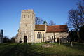
Playford is a village and civil parish in the East Suffolk district, in Suffolk, England, on the outskirts of Ipswich. It has about 215 residents in 90 households. [1] [2] The name comes from the Old English plega meaning play, sport; used of a place for games, or a courtship or mating-place for animals, and the Old English ford meaning a place where a stream or river can be crossed. [3] Villages nearby include Rushmere, Little Bealings, Great Bealings, Culpho and Grundisburgh. There are no pubs or shops in Playford, although it has a church (St Mary's) and a village hall.