Related Research Articles

Montgomery County, colloquially referred to as Montco, is a county in the Commonwealth of Pennsylvania. As of the 2020 census, the population of the county was 856,553, making it the third-most populous county in Pennsylvania after Philadelphia and Allegheny counties.
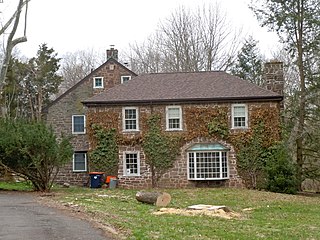
Collegeville is a borough in Montgomery County, Pennsylvania, a suburb outside of Philadelphia on Perkiomen Creek. Collegeville was incorporated in 1896. It is the location of Ursinus College, which opened in 1869. The population was 5,089 at the 2010 census.

Lower Providence Township is a township in Montgomery County, Pennsylvania, United States. The township is located approximately 17 miles northwest of Philadelphia. The population was 25,625 at the 2020 census.

Perkiomen Township is a township in Montgomery County, Pennsylvania, United States. As of the 2010 census, the township population was 9,139, which represents a 28.8% increase from the 2000 total of 7,093 residents. Governmentally, it is a township of the second class, governed by a board of supervisors. It is part of the Perkiomen Valley School District. Perkiomen Township includes an abundance of history that goes as far back as to the first tribes who inhabited the area. This township started with the inhabitants of the Lenni-Lenape Tribe and progressed in many ways into what it is today.
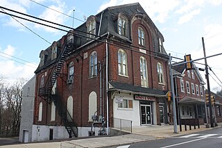
Schwenksville is a borough in Montgomery County, Pennsylvania, United States. The population was 1,431 at the 2020 census. It is notable for being located near the site of the Philadelphia Folk Festival. The borough was founded in 1684, when the Lenni-Lenape Indians ceded to William Penn the land along the Perkiomen Creek; it was incorporated in 1903. The borough was named for George Schwenk, whose son, Jacob Schwenk, served in George Washington's army.

Skippack, originally named "Van Bebber's Township", is a census-designated place (CDP) in Skippack Township, Montgomery County, Pennsylvania, United States. The population was 3,758 at the 2010 census.

Towamencin Township is a home rule township in Montgomery County, Pennsylvania, United States. The population was 17,578 at the 2010 census. It is part of the North Penn School District and the North Penn Valley region that is centered around the borough of Lansdale. Towamencin has residential neighborhoods, historic farmhouses, recreational facilities, many schools, and open spaces. The community is a mix of residential, commercial and rural development. The Township is centrally located within Montgomery County with easy access to the Pennsylvania Turnpike’s Northeast Extension.

Upper Providence Township is a township in Montgomery County, Pennsylvania, United States. As of the 2010 census, the township population was 21,219.
Shimerville is an unincorporated community, located on Pennsylvania Route 100 and Pennsylvania Route 29 South in Upper Milford Township in Lehigh County, Pennsylvania. The community is located outside and to the south of Macungie and to the west of Vera Cruz. It is part of the Lehigh Valley, which has a population of 861,899 and is the 68th-most populous metropolitan area in the U.S. as of the 2020 census.

The Cradle of Liberty Council (#525) is a Boy Scouts of America council created in 1996 with the merger of the former Philadelphia Council and the former Valley Forge Council.

Pennsylvania Route 29 is a 118-mile-long (190 km) north–south state highway that runs through most of eastern Pennsylvania.
Graterford is an unincorporated community in Perkiomen Township, Montgomery County, Pennsylvania, United States.
Moreland Township was a township that was located in Philadelphia County, Pennsylvania, United States.

Perkiomen Creek is a 37.7-mile-long (60.7 km) tributary of the Schuylkill River in Berks, Lehigh and Montgomery counties, Pennsylvania. The water course was also named Perquaminck Creek, on Thomas Holme's 1687 map.

Swamp Creek is an 18.8-mile-long (30.3 km) tributary of Perkiomen Creek in Berks and Montgomery counties, Pennsylvania in the United States.
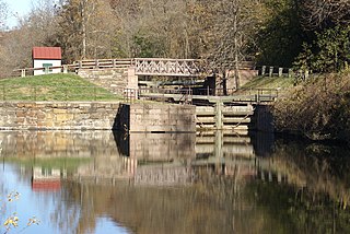
Mont Clare is a village in Upper Providence Township, Montgomery County, Pennsylvania. The village is located on the left bank of the Schuylkill River opposite Phoenixville and Chester County. Mont Clare is at the site of the former Jacobs' ford. Mont Clare hosts the only functional lock and one of only two remaining watered stretches of the Schuylkill Canal. Mont Clare was the birthplace of the infamous outlaw Sundance Kid. As of the 2020 United States census the population was 1,852.
Barto is an unincorporated community situated between the boroughs of Bally and Bechtelsville in Washington Township, Berks County, Pennsylvania, United States. Barto is part of the Delaware Valley, located near the border with Montgomery County. Its Zip Code is 19504 and the West Branch Perkiomen Creek flows southeast through it to join the Perkiomen Creek in the Green Lane Reservoir.

Chapel is a village located on Pennsylvania Route 29 and the Perkiomen Creek in Hereford Township, Berks County and Upper Hanover Township, Montgomery County in the U.S. state of Pennsylvania. It uses the 18070 zip code of Palm, which is located just to the southeast. It is served by the Upper Perkiomen School District and uses the area code of 215.
The Manor of Gilberts was one of the areas of land that William Penn set aside for himself as the Proprietor of the Province of Pennsylvania. The Manor was located on the along the left (northeastern) bank of the Schuylkill River, extending above and below the Perkiomen Creek. The Manor was created on 8 October 1683 when Penn wrote a warrant assigning the Manor to himself. The tract was named after his paternal grandmother Joanne (Gilbert) Penn's family.
Germantown Pike is a historic road in Pennsylvania that opened in 1687, running from Philadelphia northwest to Collegeville. The road is particularly notable for the "imposing mansions" that existed in the Germantown neighborhood in Philadelphia. The road was left in ruins after the British destroyed it in the Revolutionary War during the 1777 Battle of Germantown, and was not rebuilt until 1809. Portions of Germantown Pike were signed as U.S. Route 422 (US 422) before the latter was rerouted along a freeway alignment to King of Prussia.
References
- ↑ "HOW PENN DIVIDED HIS VAST HOLDINGS OF LAND". The Reading Eagle. Reading, Pennsylvania. July 21, 1932. p. 6. Retrieved March 3, 2010.
- ↑ Bean, Theodore W., ed. (1884). HISTORY OF MONTGOMERY COUNTY PENNSYLVANIA, ILLUSTRATED, 1884. Philadelphia: Everts & Peck. p. 1044.
- ↑ Bean, p. 1049
- ↑ House Resolution 374

40°07′29″N75°28′09″W / 40.12481°N 75.46920°W
| | This Montgomery County, Pennsylvania state location article is a stub. You can help Wikipedia by expanding it. |