Redgranite, Wisconsin

Last updated

Redgranite, Wisconsin
RedGraniteWisconsinDowntownWIS21.jpg
Downtown Redgranite, Wisconsin
Waushara County Wisconsin Incorporated and Unincorporated areas Redgranite Highlighted.svg
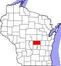
Location of Redgranite in Waushara County, Wisconsin.
Coordinates: 44°2′40″N89°6′7″W / 44.04444°N 89.10194°W / 44.04444; -89.10194
Country Flag of the United States.svg  United States
State Flag of Wisconsin.svg  Wisconsin
County Waushara
Area
[1]
  Total2.37 sq mi (6.15 km2)
  Land2.36 sq mi (6.12 km2)
  Water0.01 sq mi (0.03 km2)
Elevation
[2]
791 ft (241 m)
Population
 (2010) [3]
  Total2,149
  Estimate 
(2019) [4]
2,128
  Density900.55/sq mi (347.70/km2)
Time zone UTC-6 (Central (CST))
  Summer (DST) UTC-5 (CDT)
Area code 920
FIPS code 55-66625 [5]
GNIS feature ID1572163 [2]
Website Official website

Redgranite is a village in Waushara County, Wisconsin, United States. The population was 2,149 at the 2010 census.

Contents

History

A post office called Redgranite has been in operation since 1897. [6] The village was named after deposits of red granite in the area. [7]

Geography

Redgranite is located at 44°2′40″N89°6′7″W / 44.04444°N 89.10194°W / 44.04444; -89.10194 (44.044550, -89.101993). [8]

According to the United States Census Bureau, the village has a total area of 2.29 square miles (5.93 km2), of which, 2.28 square miles (5.91 km2) of it is land and 0.01 square miles (0.03 km2) is water. [9]

Demographics

Historical population
CensusPop.Note
1910 1,521
1920 1,012−33.5%
1930 977−3.5%
1940 857−12.3%
1950 648−24.4%
1960 588−9.3%
1970 6459.7%
1980 97651.3%
1990 1,0093.4%
2000 1,0403.1%
2010 2,149106.6%
2019 (est.)2,128 [4] −1.0%
U.S. Decennial Census [10]

2010 census

As of the census [3] of 2010, there were 2,149 people, 509 households, and 275 families living in the village. The population density was 942.5 inhabitants per square mile (363.9/km2). There were 583 housing units at an average density of 255.7 per square mile (98.7/km2). The racial makeup of the village was 77.4% White, 17.8% African American, 1.9% Native American, 0.1% Asian, 0.3% Pacific Islander, 1.4% from other races, and 1.2% from two or more races. Hispanic or Latino of any race were 3.0% of the population.

There were 509 households, of which 24.4% had children under the age of 18 living with them, 36.9% were married couples living together, 12.0% had a female householder with no husband present, 5.1% had a male householder with no wife present, and 46.0% were non-families. 39.7% of all households were made up of individuals, and 22.4% had someone living alone who was 65 years of age or older. The average household size was 2.17 and the average family size was 2.89.

The median age in the village was 39.3 years. 11.6% of residents were under the age of 18; 9% were between the ages of 18 and 24; 40.5% were from 25 to 44; 26.2% were from 45 to 64; and 12.9% were 65 years of age or older. The gender makeup of the village was 72.8% male and 27.2% female.

2000 census

As of the census [5] of 2000, there were 1,040 people, 440 households, and 268 families living in the village. The population density was 468.6 people per square mile (180.9/km2). There were 493 housing units at an average density of 222.1 per square mile (85.7/km2). The racial makeup of the village was 94.90% White, 0.87% African American, 1.15% Native American, 0.67% from other races, and 2.40% from two or more races. Hispanic or Latino of any race were 3.08% of the population.

There were 440 households, out of which 29.5% had children under the age of 18 living with them, 46.6% were married couples living together, 11.6% had a female householder with no husband present, and 38.9% were non-families. 32.5% of all households were made up of individuals, and 17.7% had someone living alone who was 65 years of age or older. The average household size was 2.30 and the average family size was 2.91.

In the village, the population was spread out, with 24.9% under the age of 18, 7.8% from 18 to 24, 24.6% from 25 to 44, 20.7% from 45 to 64, and 22.0% who were 65 years of age or older. The median age was 39 years. For every 100 females, there were 88.7 males. For every 100 females age 18 and over, there were 86.8 males.

The median income for a household in the village was $26,726, and the median income for a family was $34,875. Males had a median income of $27,109 versus $22,361 for females. The per capita income for the village was $13,994. About 6.2% of families and 11.1% of the population were below the poverty line, including 8.0% of those under age 18 and 10.0% of those age 65 or over.

Notable people

Related Research Articles

<span class="mw-page-title-main">Waushara County, Wisconsin</span> County in Wisconsin, United States

Waushara County is a county located in the U.S. state of Wisconsin. As of the 2020 census, the population was 24,520. Its county seat is Wautoma.

<span class="mw-page-title-main">Davis Junction, Illinois</span> Village in Illinois, United States

Davis Junction is a village in Ogle County, Illinois, United States. The population was 2,512 at the 2020 census. Named for Jeremiah Davis, it is located where the Illinois Railway Rockford Line and the Canadian Pacific Railway Chicago Subdivision intersect along Illinois Route 72. It is the site of the Orchard Hills Landfill - one of the largest in the United States.

<span class="mw-page-title-main">Big Falls, Waupaca County, Wisconsin</span> Village in Wisconsin, United States

Big Falls is a village in Waupaca County, Wisconsin, United States. The population was 61 at the 2010 census.

<span class="mw-page-title-main">Aurora, Waushara County, Wisconsin</span> Town in Wisconsin, United States

Aurora is a town in Waushara County, Wisconsin, United States. The population was 971 at the 2000 census. The unincorporated community of Auroraville is located in the town, and the city of Berlin is adjacent to the town.

<span class="mw-page-title-main">Dakota, Wisconsin</span> Town in Wisconsin, United States

Dakota is a town, as well as an unincorporated community in Waushara County, Wisconsin, United States. The town took its name from the community of the same name, which was platted for the community's first postmaster, Chapin M. Seeley, in 1853. It was likely named for the Dakota Territory which was in the news at the time. The unincorporated community of Bannerman is also located in the town. Bannerman was originally named Bannerman Junction in 1901 as a stop on the Chicago & Northwestern Railroad. It was named for William and John Bannerman, two Scottish men who owned the area's granite company.

<span class="mw-page-title-main">Deerfield, Waushara County, Wisconsin</span> Town in Wisconsin, United States

Deerfield is a town in Waushara County, Wisconsin, United States. The population was 629 at the 2000 census.

<span class="mw-page-title-main">Leon, Waushara County, Wisconsin</span> Town in Wisconsin, United States

Leon is a town in Waushara County, Wisconsin, United States. The population was 1,281 at the 2000 census. The census-designated place of Pine River is located in the town. The village of Redgranite is located adjacent to the town.

<span class="mw-page-title-main">Richford, Wisconsin</span> Town in Wisconsin, United States

Richford is a town in Waushara County, Wisconsin, United States. The population was 588 at the 2000 census.

<span class="mw-page-title-main">Warren, Waushara County, Wisconsin</span> Town in Wisconsin, United States

Warren is a town in Waushara County, Wisconsin, United States. The population was 675 at the 2000 census. The ghost town of Rodney was located partially in the town.

<span class="mw-page-title-main">Wild Rose, Wisconsin</span> Village in Wisconsin, United States

Wild Rose is a village in Waushara County, Wisconsin, United States. The population was 725 at the 2010 census.

<span class="mw-page-title-main">Scandinavia, Wisconsin</span> Village in Wisconsin, United States

Scandinavia is a village in the Town of Scandinavia in Waupaca County, Wisconsin, United States. The population was 328 at the 2010 census.

<span class="mw-page-title-main">Coloma, Wisconsin</span> Village in Wisconsin, United States

Coloma is a village in Waushara County, Wisconsin, United States. The population was 450 at the 2010 census. The village is located within the Town of Coloma. Coloma is home of the annual Coloma Chicken Chew, held at the end of June.

<span class="mw-page-title-main">Hancock, Wisconsin</span> Village in Wisconsin, United States

Hancock is a village in Waushara County, Wisconsin, United States. The population was 417 at the 2010 census. The village is located within the Town of Hancock.

Hancock founded in 1850 is a town in Waushara County, Wisconsin, United States. The population was 531 at the 2000 census. The Village of Hancock is located within the town.

Plainfield is a town in Waushara County, Wisconsin, United States. The population was 533 at the 2000 census. The village of Plainfield is surrounded by the town. The ghost town of West Plainfield is located in the town.

<span class="mw-page-title-main">Plainfield, Wisconsin</span> Village in Wisconsin, United States

Plainfield is a village in Waushara County, Wisconsin, United States. The village is located almost entirely within the Town of Plainfield. A tiny portion extends into adjacent Town of Oasis. The population was 897 at the 2010 census.

<span class="mw-page-title-main">Wautoma, Wisconsin</span> City in Wisconsin, United States

Wautoma is a city and the county seat of Waushara County, Wisconsin, United States. The population was 2,218 at the 2010 census.

<span class="mw-page-title-main">Berlin, Wisconsin</span> City in Wisconsin, United States

Berlin is a city in Green Lake and Waushara counties in the U.S. state of Wisconsin. The population was 5,571 at the 2020 census. Of this, 5,435 were in Green Lake County, and only 89 were in Waushara County. The city is located mostly within the Town of Berlin in Green Lake County, with a small portion extending into the Town of Aurora in Waushara County.

<span class="mw-page-title-main">Bloomer, Wisconsin</span> City in Wisconsin, United States

Bloomer is a city in Chippewa County, Wisconsin, United States. As of the 2010 census, the population of the city of Bloomer was 3,539.

<span class="mw-page-title-main">Lohrville, Wisconsin</span> Village in Wisconsin, United States

Lohrville is a village in Waushara County, Wisconsin, United States. The population was 402 at the 2010 census.

References

  1. "2019 U.S. Gazetteer Files". United States Census Bureau. Retrieved August 7, 2020.
  2. 1 2 U.S. Geological Survey Geographic Names Information System: Redgranite, Wisconsin
  3. 1 2 "U.S. Census website". United States Census Bureau . Retrieved November 18, 2012.
  4. 1 2 "Population and Housing Unit Estimates". United States Census Bureau. May 24, 2020. Retrieved May 27, 2020.
  5. 1 2 "U.S. Census website". United States Census Bureau . Retrieved January 31, 2008.
  6. "Waushara County". Jim Forte Postal History. Retrieved March 26, 2015.
  7. Chicago and North Western Railway Company (1908). A History of the Origin of the Place Names Connected with the Chicago & North Western and Chicago, St. Paul, Minneapolis & Omaha Railways. p. 117.
  8. "US Gazetteer files: 2010, 2000, and 1990". United States Census Bureau. February 12, 2011. Retrieved April 23, 2011.
  9. "US Gazetteer files 2010". United States Census Bureau. Archived from the original on January 25, 2012. Retrieved November 18, 2012.
  10. "Census of Population and Housing". Census.gov. Retrieved June 4, 2015.
  11. 'Wisconsin Blue Book 1946,' Biographical Sketch of Harley M. Jacklin, pg. 32