
Adair County is a county located in the northeastern part of the U.S. state of Missouri. As of the 2010 Census, the population was 25,607. Its county seat is Kirksville. The county was first settled by immigrants from Kentucky and organized on January 29, 1841.
Rocheport is a city in Boone County, Missouri, United States. It is part of the Columbia, Missouri Metropolitan Statistical Area. The population was 239 at the 2010 census. Rocheport includes the Rocheport Historic District, an area with buildings dating from 1830 and which is listed on the National Register of Historic Places.

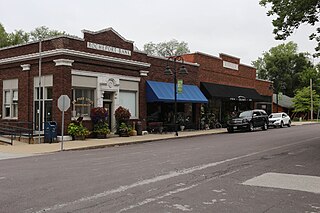
Kahoka is a city in and the county seat of Clark County, in the northeast tip of Missouri, United States. The population was 2,078 at the 2010 census.

Yankton is a city in and the county seat of Yankton County, South Dakota, United States.

Mark Twain National Forest (MTNF) is a U.S. National Forest located in the southern half of Missouri. MTNF was established on September 11, 1939. It is named for author Mark Twain, a Missouri native. The MTNF covers 3,068,800 acres (12,419 km2) of which 1,506,100 acres (6,095 km2) is public owned, 78,000 acres (320 km2) of which are Wilderness, and National Scenic River area. MTNF spans 29 counties and represents 11% of all forested land in Missouri. MTNF is divided into six distinct ranger districts: Ava-Cassville-Willow Springs, Eleven Point, Houston-Rolla, Cedar Creek, Poplar Bluff, Potosi-Fredericktown, and the Salem. The six ranger districts actually comprise nine overall unique tracts of forests. Its headquarters are in Rolla, Missouri.

This is a list of properties and historic districts in Arkansas that are listed on the National Register of Historic Places. There are more than 2,600 listings in the state, including at least 8 listings in each of Arkansas's 75 counties.

Fort Osage was an early 19th-century factory trading post system run by the United States Government, on the American frontier being located in present-day Sibley, Missouri. The Treaty of Fort Clark was signed with certain members of the Osage Nation in 1808 calling for the creation of Fort Osage. It was one of three forts established by the U.S. Army to establish control over the newly acquired Louisiana Purchase territories. Fort Madison in SE Iowa was built to control trade and pacify Native Americans in the Upper Mississippi River region. Fort Belle Fontaine near St. Louis controlled the mouth of the Missouri. The fort ceased operations in the 1820s as the Osage in subsequent treaties ceded the rest of their land in Missouri. A replica of the fort was rebuilt on the site between 1948 and 1961. The Fort Osage school district, which serves northeast Independence and the surrounding area, was named after it.

Cabanne's Trading Post was established in 1822 by the American Fur Company as Fort Robidoux near present-day Dodge Park in North Omaha, Nebraska, United States. It was named for the influential fur trapper Joseph Robidoux. Soon after it was opened, the post was called the French Company or Cabanné's Post, for the ancestry and name of its operator, Jean Pierre Cabanné, who was born and raised among the French community of St. Louis, Missouri.

The Clarksville Historic District in Austin, Texas, is an area located west of downtown Austin near Lady Bird Lake and just northeast of the intersection of the Missouri Pacific Railroad and West Tenth Street. Many historic homes and structures are located within the Clarksville Historic District. While Clarksville is geographically part of the Old West Austin Historic District, it is distinct from the two historic neighborhoods of Old Enfield which lies immediately to the north on the eastern side of Texas State Highway Loop 1 and Tarrytown which is situated to the west and northwest on the western side of Mopac.

Fort Clark Trading Post State Historic Site was once the home to a Mandan and later an Arikara settlement. Over the course of its history it also had two factories. Today only archeological remains survive at the site located eight miles west of Washburn, North Dakota, United States.
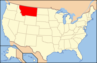
The following is an alphabetical list of articles related to the U.S. state of Montana.

Ste. Genevieve Historic District is a historic district encompassing much of the built environment of Ste. Genevieve, Missouri. The city was in the late 18th century the capital of Spanish Louisiana, and, at its original location a few miles south, capital of French Louisiana as well. A large area of the city, including fields along the Mississippi River, is a National Historic Landmark District designated in 1960, for its historically French architecture and land-use patterns, while a smaller area, encompassing the parts of the city historically important between about 1790 and 1950, was named separately to the National Register of Historic Places in 2002.
Fort Pierre Chouteau, also just Fort Pierre, was a major trading post and military outpost in the mid-19th century on the west bank of the Missouri River in what is now central South Dakota. Established in 1832 by Pierre Chouteau, Jr. of St. Louis, Missouri, whose family were major fur traders, this facility operated through the 1850s.

The following outline is provided as an overview of and topical guide to the U.S. state of Missouri:
The Moses U. Payne House, also known as Lynn Bluffs and Roby River Bed and Breakfast, is a historic home near the Missouri River in Rocheport, Missouri. It was constructed in 1856–1857, and is a large frame central hall plan I-house. It is five bays wide and features an ornamental ironwork front porch.

This is a list of the National Register of Historic Places listings in Clark County, Missouri.

The St. Charles Historic District is a national historic district located at St. Charles, St. Charles County, Missouri. It is the site of the first permanent European settlement on the Missouri River and of the embarkation of Lewis and Clark's journey of exploration along the Missouri. The first state capital of Missouri and over one hundred other historic buildings are located in the district.
The Boonslick, or Boone's Lick Country, is a cultural region of Missouri along the Missouri River that played an important role in the westward expansion of the United States and the development of Missouri's statehood in the early 19th century. The Boone's Lick Road, a route paralleling the north bank of the river between St. Charles and Franklin, Missouri, was the primary thoroughfare for settlers moving westward from St. Louis in the early 19th century. Its terminus in Franklin marked the beginning of the Santa Fe Trail, which eventually became a major conduit for Spanish trade in the Southwestern United States. Later it connected to the large emigrant trails, including the Oregon and California Trails, used by pioneers, gold-seekers and other early settlers of the West. The region takes its name from a salt spring or "lick" in western Howard County, used by Nathan and Daniel Morgan Boone, sons of famed frontiersman Daniel Boone.

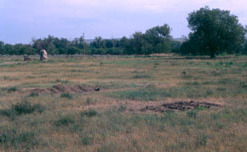
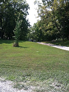
Cabins Historic District is a national historic district located near Novinger, Adair County, Missouri. The district encompasses nine contributing buildings, three contributing sites, four contributing structures, and one contributing object in a relatively isolated area near Novinger. It developed between about 1829 and 1865 and was one of the earliest settlements in the interior of northeast Missouri. It includes five antebellum structures surrounded by forests and farm land. They are the John B. Cain House, the Asa King Collett House, the Ira R. Collett House and its poultry house and summer kitchen. Other notable contributing resources include the Conner Tannery site, the Collett Spring, the site of Fort Clark, the site of Camp Collett, the Collett Cemetery, and Native American burial mounds.


