Related Research Articles
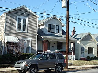
St. Joseph is a neighborhood two miles south of downtown Louisville, Kentucky, United States, and immediately east of the University of Louisville. It borders the Meriwether neighborhood to the north and Schnitzelburg to the east. The area was named after the St. Joseph's Infirmary hospital, which was established by the Sisters of Charity of Nazareth. The building, once located at the corner of Preston Street and Eastern Parkway, was razed in 1980.
Clifton is a neighborhood east of downtown Louisville, Kentucky USA. Clifton was named because of its hilly location on the Ohio River valley escarpment. Clifton is bounded by I-64, N Ewing Ave, Brownsboro Road, and Mellwood Ave.
Irish Hill is a neighborhood east of downtown Louisville, Kentucky USA. It is bounded by Baxter Avenue to the west, Lexington Road to the north, the middle fork of Beargrass Creek and I-64 to the east. Cave Hill Cemetery is located directly south of Irish Hill. It is in the inner Highlands area of Louisville.

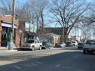
Crescent Hill is a neighborhood four miles (6 km) east of downtown Louisville, Kentucky USA. This area was originally called "Beargrass" because it sits on a ridge between two forks of Beargrass Creek. The boundaries of Crescent Hill are N Ewing Ave to the St. Matthews city limit by Brownsboro Road to Lexington Road. Frankfort Avenue generally bisects the neighborhood.
Cherokee Gardens is a residential area six miles east of downtown Louisville, Kentucky USA. The area is a collection of small, unconnected subdivisions along Lexington Road and large estates built just outside Cherokee Park.

Auburndale is a neighborhood in Louisville, Kentucky, United States. Its boundaries are Palatka Road to the north, and New Cut Road and Third Street to the east.

Kenwood Hill is a hill and neighborhood on the south side of Louisville, Kentucky, United States. Its boundaries are New Cut Road, Kenwood Drive, Southside Drive and Palatka Road. The hill, earlier known as Sunshine Hill and then Cox's Knob, was used by Native Americans to spot buffalo. By 1868 Benoni Figg owned the area as a part of his charcoal business. His family oversaw development on the land until it was sold in 1890 to a development company which named the area Kenwood Hill. Southern Parkway was opened soon after in 1893.
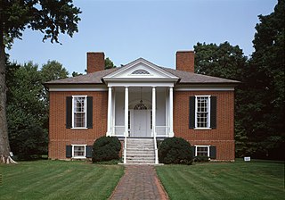
Hawthorne is a neighborhood in eastern Louisville, Kentucky, United States. Its boundaries are Taylorsville Road, Hawthorne Avenue, Bardstown Road and I-264. The land was once part of John Speed's Farmington estate, known for its plantation house built around 1815–16. The neighborhood is primarily residential and was first subdivided in 1909, but saw its fastest grown in the 1920s. It takes its name from Hawthorne Avenue, and most of the other streets are named after writers or poets. Sullivan University is located in the neighborhood.
Cloverleaf is a neighborhood in southwest Louisville, Kentucky. Its boundaries are I-264 to the north, Manslick Road to the east, Gagel Avenue to the south, and the Illinois Central railroad tracks to the west. It takes its name from Cloverleaf Acres, a development in the area. It is residential, and was annexed by Louisville in 1958.
The Point was a thriving 19th century neighborhood in Louisville, Kentucky, east of Downtown Louisville and opposite Towhead Island along the Ohio River. It was also located north of the present day Butchertown area.
Greenwood is a neighborhood of Louisville, Kentucky located along Cane Run Road and Greenwood Road. It is sometimes referred to by its large industrial park and shipping facility, Riverport.

Riverside Gardens is a neighborhood of Louisville, Kentucky centered along Campground Road and Lees Lane. In 2007, the first stretch of the proposed 110-mile Louisville Loop bike and pedestrian trail was completed to Lees Lane in Riverside Gardens from Riverview Park. The project included a $2 million bridge over Mill Creek. The concrete trail is expected to be connected to Shawnee Park by spring of 2008. In the future, a wharf and riverfront park is planned for Riverside Gardens.
Valley Gardens is a neighborhood of Louisville, Kentucky, in the United States. It is centered along Johnsontown Road and Terry Road.
Valley Downs is a neighborhood of Louisville, Kentucky, USA located along Omar Khayyam Boulevard south of Johnsontown Road.

California's 45th congressional district is a congressional district in the U.S. state of California currently represented by Republican Michelle Steel. It was one of 18 districts that would have voted for Joe Biden in the 2020 presidential election had they existed in their current configuration while being won or held by a Republican in 2022.

Fort Nelson, built in 1781 by troops under George Rogers Clark including Captain Richard Chenoweth, was the second on-shore fort on the Ohio River in the area of what is now downtown Louisville, Kentucky. Fort-on-Shore, the downriver and first on-shore fort, had proved to be insufficient barely three years after it was established. In response to continuing attacks from Native Americans and the threat of British attacks during the Revolutionary War, Fort Nelson was constructed between what is currently Main Street and the river, with its main gate near Seventh Street. It was named after Thomas Nelson Jr., then the governor of Virginia.
Springhurst is a large, unincorporated area in Northeast Louisville, Kentucky, United States. Developed heavily in the 1990s, it is now considered an edge city of Louisville, and is home to one of the largest shopping areas in the city, with the largest concentration of shops along the Gene Snyder Freeway from Westport Road to Ballardsville Road. The Shopping Center was purchased in December 2023 by Kaden Companies and Marquee Capitol. Large residential areas also exist on either side of the shopping areas.
The Louisville Astronomical Society (LAS) was founded in 1931 in Louisville, Kentucky, United States, by a group of amateur astronomers, including James Gilbert Baker. The society holds regular observing sessions and star parties.

The Palace Theatre is a music venue in downtown Louisville, Kentucky, located in the city's theater district, on the east side of Fourth Street, between Broadway and Chestnut Street. It has a seating capacity of 2,800 people and is owned by Live Nation. The historic landmark opened on September 1, 1928, and was designed by architect John Eberson. It was originally known as the Loew's and United Artists State theatre.
Warwick Village is a neighborhood located in Louisville, Kentucky. Warwick Village is just outside the Watterson Expressway and part of the City of St. Matthews, Its boundaries are roughly New La Grange Rd, Washburn Ave, and Columbia Ave. Many of Warwick Village's streets are surrounded by Warwick Park also known as Warwick-Villa Park Playground.
References
- "Rockcreek-Lexington Road". The Encyclopedia of Louisville (1 ed.). 2001.
