Anchorage, Kentucky

Last updated

Anchorage
Anchorageposummer.jpg
Anchorage Post Office
Jefferson County Kentucky Incorporated and Unincorporated areas Anchorage Highlighted 2101504.svg
Location of Anchorage in Jefferson County, Kentucky
USA Kentucky location map.svg
Red pog.svg
Anchorage
Location within the state of Kentucky
Usa edcp location map.svg
Red pog.svg
Anchorage
Anchorage (the United States)
Coordinates: 38°16′08″N85°32′11″W / 38.26889°N 85.53639°W / 38.26889; -85.53639
Country United States
State Kentucky
County Jefferson
Area
[1]
  Total2.97 sq mi (7.69 km2)
  Land2.96 sq mi (7.66 km2)
  Water0.01 sq mi (0.03 km2)
Elevation
[2]
728 ft (222 m)
Population
 (2020)
  Total2,500
  Density844.88/sq mi (326.22/km2)
Time zone UTC-5 (Eastern (EST))
  Summer (DST) UTC-4 (EDT)
ZIP code
40223
Area code 502
FIPS code 21-01504
GNIS feature ID2403096 [2]
Website www.cityofanchorage.org

Anchorage is a home rule-class city [3] in eastern Jefferson County, Kentucky, United States. The population was 2,500 as of the 2020 census, up from 2,348 at the 2010 census [4] and an estimated 2,432 in 2018. [5] It is a suburb of Louisville.

Contents

History

Anchorage Presbyterian Church, est. 1799 AnchChurch 053.jpg
Anchorage Presbyterian Church, est. 1799

The land that is now Anchorage was a part of Isaac Hite's 1773 land grant, which awarded most of the land in today's Jefferson County to officers in the Virginia militia, in exchange for their service in the French and Indian War. Early maps refer to the area as "Hite's Mill",[ citation needed ] and it has also been known as "Hobbs Station". [6] Part of Hite's original grant now makes up the grounds of Central State Hospital and E. P. "Tom" Sawyer State Park.

The nautical name is a bit odd, considering the city is over 12 miles (19 km) from the Ohio River. The origin is The Anchorage, the estate of riverboat captain and early resident James W. Goslee, and was chosen to honor him when the city incorporated in 1878, three years after his death. Tradition says that an anchor hanging inside the rim of a locomotive wheel at the center of town was taken by Goslee from his ship, the Matamora.

The Louisville and Frankfort Railroad (later purchased by the Louisville & Nashville Railroad) was built through the area in 1849. The development of an interurban rail line in 1901 allowed faster travel between Anchorage and Louisville, as well as other towns in the area.

The heavily shaded city, with temperatures often noticeably cooler than in Downtown Louisville, became a popular location for summer homes for wealthy Louisvillians. One such resident was brewing magnate Isaac Wolfe Bernheim, still remembered locally for his philanthropy. In 1914, Bernheim commissioned the firm of Frederick Law Olmsted to design a plan for Anchorage, which would incorporate stone bridges and triangle intersections, similar to Olmsted's plans for Louisville's park system.

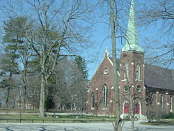
The city has long been known as home of some of the area's wealthiest citizens, though the large old estates have mostly been divided up and many new, still upscale, houses have been built in the area, especially since 1977. Part of the city is designated as the Anchorage Historic District, which was listed on the National Register of Historic Places in 1982.

Papa John's Pizza founder John Schnatter is a resident and owns about 6% of the land in Anchorage, including much of the city center. He restored an interurban rail station, three historic buildings and built a fourth in a similar style in the city's center, with plans to build a bank, an upscale restaurant, and a hiking trail, which opened as the Anchorage Trail in June 2008. In an interview, he told the Courier-Journal that his goal was purely to "preserve the city's character". [7]

Geography

Anchorage is located in northeastern Jefferson County. It is bordered to the south by Middletown. Downtown Louisville is 15 miles (24 km) to the west. Interstate 265 passes north and east of Anchorage, with access from Exits 29 (Old Henry Road) and 30 (Kentucky Route 146).

According to the United States Census Bureau, the city has a total area of 3.0 square miles (7.7 km2), of which 0.01 square miles (0.03 km2), or 0.38%, are water. [4]

Government and public safety

Anchorage is managed by a mayor and six councilmen. Public safety is provided by the Anchorage Police Department, an on duty 24/7 police agency with 10 full-time, sworn officers certified by the Commonwealth of Kentucky.

Demographics

Historical population
CensusPop.Note
1880 967
1900 421
1910 384−8.8%
1920 44716.4%
1930 56426.2%
1940 69022.3%
1950 88328.0%
1960 1,17032.5%
1970 1,47726.2%
1980 1,72616.9%
1990 2,08220.6%
2000 2,2648.7%
2010 2,3483.7%
2020 2,5006.5%
U.S. Decennial Census [8]

As of the census [9] of 2000, there were 2,264 people, 729 households, and 643 families residing in the city. The population density was 744.0 inhabitants per square mile (287.3/km2). There were 750 housing units at an average density of 246.5 per square mile (95.2/km2). The racial makeup of the city was 97.13% White, 0.84% Black or African American, 1.33% Asian, 0.27% from other races, and 0.44% from two or more races. Hispanic or Latino of any race were 0.75% of the population.

There were 729 households, out of which 52.4% had children under the age of 18 living with them, 81.9% were married couples living together, 3.7% had a female householder with no husband present, and 11.7% were non-families. 10.6% of all households were made up of individuals, and 4.8% had someone living alone who was 65 years of age or older. The average household size was 3.09 and the average family size was 3.33.

In the city, the population was spread out, with 35.0% under the age of 18, 4.0% from 18 to 24, 20.8% from 25 to 44, 32.2% from 45 to 64, and 8.0% who were 65 years of age or older. The median age was 40 years. For every 100 females, there were 99.1 males. For every 100 females age 18 and over, there were 95.5 males.

The median income for a household in the city was $133,969, and the median income for a family was $147,050. Males had a median income of $100,000 versus $47,188 for females. The per capita income for the city was $63,988. About 1.1% of families and 1.87% of the population were below the poverty line, including 1.2% of those under age 18 and 2.5% of those age 65 or over.

Education

Evergreen Road in Anchorage AnchRdPicture 049.jpg
Evergreen Road in Anchorage

Almost all of Anchorage is zoned to Anchorage Public School (K–8), a part of Anchorage Independent Schools. [10] For high school, Anchorage district residents may attend Jefferson County Public Schools (JCPS) or Oldham County Schools. [11] A very small portion is zoned to JCPS for grades K-12. [10]

As of 2015 Kelley Ransdell is the Superintendent of Schools. [12]

Notable people

Climate

The climate in this area is characterized by hot, humid summers and generally mild to cool winters. According to the Köppen Climate Classification system, Anchorage has a humid subtropical climate, abbreviated "Cfa" on climate maps. [13]

See also

Related Research Articles

<span class="mw-page-title-main">Frankfort, Kentucky</span> Capital city of Kentucky, United States

Frankfort is the capital city of the U.S. state of Kentucky and the seat of Franklin County. It is a home rule-class city. The population was 28,602 at the 2020 United States census. Located along the Kentucky River, Frankfort is the principal city of the Frankfort, Kentucky Micropolitan Statistical Area, which includes all of Franklin and Anderson counties. It is the 4th least populous state capital in the United States by population, and the 13th most populous city in Kentucky.

<span class="mw-page-title-main">Oldham County, Kentucky</span> County in Kentucky, United States

Oldham County is a county located in the north central part of the U.S. state and commonwealth of Kentucky. As of the 2020 census, the population was 67,607. Its county seat is La Grange. The county is named for Colonel William Oldham.

<span class="mw-page-title-main">Nelson County, Kentucky</span> County in Kentucky, United States

Nelson County is a county located in the U.S. state of Kentucky. As of the 2020 census, the population was 48,065. Its county seat is Bardstown. Nelson County comprises the Bardstown, KY Micropolitan Statistical Area, which is also included in the Louisville/Jefferson County-Elizabethtown-Madison, KY-IN Combined Statistical Area.

<span class="mw-page-title-main">Jefferson County, Kentucky</span> County in Kentucky, United States

Jefferson County is located in the north central portion of the U.S. state of Kentucky. As of the 2020 census, the population was 782,969. It is the most populous county in the commonwealth.

<span class="mw-page-title-main">Henry County, Kentucky</span> County in Kentucky, United States

Henry County is a county located in the north central portion of the U.S. state of Kentucky bordering the Kentucky River. As of the 2020 census, the population was 15,678. Its county seat is New Castle, but its largest city is Eminence. The county was founded in 1798 from portions of Shelby County. It was named for the statesman and governor of Virginia Patrick Henry. Henry County is included in the Louisville/Jefferson County, KY-IN Metropolitan Statistical Area. Since the 1990s, it has become an increasingly important exurb, especially as land prices have become higher in neighboring Oldham County. With regard to the sale of alcohol, it is classified as a wet county.

<span class="mw-page-title-main">Franklin County, Kentucky</span> County in Kentucky, United States

Franklin County is a county located in the U.S. state of Kentucky. As of the 2020 census, the population was 51,541, making it the 2nd least populous capital county in the United States after Hughes County, South Dakota. Its county seat is Frankfort, the state capital. The county was formed in 1795 from parts of Woodford, Mercer and Shelby counties, and was named after the American inventor and statesman Benjamin Franklin. Franklin County is part of the Frankfort, Kentucky Micropolitan Statistical Area. It shares a name with Franklin County in Ohio, where Columbus is located. This makes it one of two pairs of capital cities in counties of the same name, along with Marion Counties in Oregon and Indiana.

<span class="mw-page-title-main">Bullitt County, Kentucky</span> County in Kentucky, United States

Bullitt County is a county located in the north central portion of the U.S. state of Kentucky. As of the 2020 census, the population was 82,217. Its county seat is Shepherdsville. The county was founded in 1796. Located just south of the city of Louisville, Bullitt County is included in the Louisville/Jefferson County, KY-IN Metropolitan Statistical Area, commonly known as Kentuckiana. The western fifth of the county is part of the United States Army post of Fort Knox and is reserved for military training.

<span class="mw-page-title-main">Jeffersonville, Indiana</span> City in Indiana, United States

Jeffersonville is a city and the county seat of Clark County, Indiana, United States, situated along the Ohio River. Locally, the city is often referred to by the abbreviated name Jeff. It lies directly across the Ohio River to the north of Louisville, Kentucky, along I-65. The population was 49,447 at the 2020 census.

<span class="mw-page-title-main">Scottsburg, Indiana</span> City in Indiana, United States

Scottsburg is a city within Vienna Township and the county seat of Scott County, in the U.S. state of Indiana, about 30 miles (48 km) north of Louisville, Kentucky. The population of Scottsburg was 7,345 at the 2020 census.

<span class="mw-page-title-main">Shepherdsville, Kentucky</span> City in Kentucky, United States

Shepherdsville is a home rule-class city on the Salt River in Bullitt County, Kentucky, in the United States. It is the second largest city and seat of its county, located just south of Louisville. The population was 14,201 during the 2020 U.S. Census.

<span class="mw-page-title-main">Audubon Park, Kentucky</span> City in Kentucky, United States

Audubon Park is a home rule-class city in central Jefferson County, Kentucky, United States. The population was 1,433 as of the 2020 census, down from 1,473 at the 2010 census. It is located about 5 miles (8 km) south of downtown Louisville and is surrounded on all sides by the city of Louisville.

Fairdale is a former census-designated place in southern Jefferson County, Kentucky, United States. The population was 7,658 at the 2000 census. In 2003, the area was annexed to the city of Louisville due to a merger between the city and Jefferson County's unincorporated community. Fairdale is now a neighborhood within the city limits of Louisville. The ZIP Code for Fairdale is 40118.

<span class="mw-page-title-main">Forest Hills, Kentucky</span> City in Kentucky, United States

Forest Hills is a home rule-class city in Jefferson County, Kentucky, United States. It was formally incorporated by the state assembly in 1959. The population was 444 at the 2010 census.

<span class="mw-page-title-main">Glenview, Kentucky</span> City in Kentucky, United States

Glenview is a 6th-class city along the southern bank of the Ohio River in northeastern Jefferson County, Kentucky, United States The population was 531 at the 2010 census.

<span class="mw-page-title-main">Jeffersontown, Kentucky</span> City in Kentucky, United States

Jeffersontown is a home rule-class city in Jefferson County, Kentucky, United States. The population was 26,595 at the 2010 U.S. census.

<span class="mw-page-title-main">Middletown, Kentucky</span> City in Kentucky, United States

Middletown is an independent, home rule-class city in Jefferson County, Kentucky, United States, and a former neighborhood of Louisville. The population was 7,218 at the 2010 census.

<span class="mw-page-title-main">Mockingbird Valley, Kentucky</span> City in Kentucky, United States

Mockingbird Valley is a home rule-class city in Jefferson County, Kentucky, United States. Since incorporation, there has been some interest in making it a historic preservation district, largely to prevent unwanted development. The population was 167 at the 2010 census. It has the highest per capita income of any location in Kentucky and the tenth-highest of any location in the United States.

<span class="mw-page-title-main">Shively, Kentucky</span> City in Kentucky, United States

Shively is a home rule-class city in Jefferson County, Kentucky, United States, and a suburb of Louisville within the Louisville Metro government. As of the 2010 census, the city's population was 15,264, reflecting an increase of 107 (+0.7%) from 15,157 in 2000.

<span class="mw-page-title-main">South Park View, Kentucky</span> City in Kentucky, United States

South Park View is a home rule-class city in Jefferson County, Kentucky, United States. The population was 0 at the 2020 census. The community was named for its location near South Park Hill, elevation 902 feet (275 m), the highest point in Jefferson County. It is the smallest incorporated city in the commonwealth of Kentucky and one of nine incorporated places in the U.S. that have no recorded population.

<span class="mw-page-title-main">Shelbyville, Kentucky</span> City in Kentucky, United States

Shelbyville is a home rule-class city in and the county seat of Shelby County, Kentucky, United States. The population was 17,282 at the 2020 census.

References

  1. "2020 U.S. Gazetteer Files". United States Census Bureau. Retrieved March 18, 2022.
  2. 1 2 U.S. Geological Survey Geographic Names Information System: Anchorage, Kentucky
  3. "Summary and Reference Guide to House Bill 331 City Classification Reform" (PDF). Kentucky League of Cities. Retrieved December 30, 2014.
  4. 1 2 "Geographic Identifiers: 2010 Census Summary File 1 (G001): Anchorage city, Kentucky". American Factfinder. U.S. Census Bureau. Archived from the original on February 13, 2020. Retrieved May 22, 2018.
  5. "Population and Housing Unit Estimates" . Retrieved December 18, 2019.
  6. Commonwealth of Kentucky. Office of the Secretary of State. Land Office. "Anchorage, Kentucky". Accessed 15 July 2013.
  7. Otts, Chris (September 9, 2007). "Anchorage warms up to pizza magnate". Courier-Journal .
  8. "Census of Population and Housing". Census.gov. Retrieved June 4, 2015.
  9. "U.S. Census website". United States Census Bureau . Retrieved January 31, 2008.
  10. 1 2 "Appendix B: Maps Of Independent School Districts In Operation In FY 2014-FY 2015 Using 2005 Tax District Boundaries – Anchorage ISD" (PDF). Research Report No. 415 – Kentucky's Independent School Districts: A Primer. Frankfort, KY: Office of Education Accountability, Legislative Research Commission. September 15, 2015. p. 86 (PDF p. 100/174). Retrieved April 26, 2022.
  11. "Chapter 3, Exchange of Nonresident Students with Other Districts: Districts Without High Schools" (PDF). Research Report No. 415 – Kentucky's Independent School Districts: A Primer. Frankfort, KY: Office of Education Accountability, Legislative Research Commission. September 15, 2015. pp. 49–50 (PDF p. 63–64/17). Retrieved April 26, 2022.
  12. "Kentucky Department of Education Anchorage Independent". Kentucky Department of Education. Archived from the original on September 6, 2015. Retrieved May 1, 2015.
  13. Climate Summary for Anchorage, Kentucky